|
Hiking Log
Hiking Locations
Data Analyses
Pictures
Recent Changes
|
2014 | |
Up to 2014 hiking log.
|
20131228 5.6mi, 830m | Tiger Mt: Nook, Section Line, Bus Trail |
I've been rather ill for the past three weeks, having at least a good solid (common) cold for ten days followed by some sore throats and what might be a sinus infection. I decided I'd get some exercise anyway, hoping that some light exercise would help get over the cold. Tiger Mountain beind a pretty easy ascent, I headed up the Nook and Section Line over the top of WT3 and down the other side. After making WT2, and having a tough time getting there even with the minimal uphill, I started coughing and decided that I probably should not continue, so I went back via WT3 and down the usual return loop.
WTA Trip Report
|
20131128 12.8mi, 1165m | Rattlesnake Ledge, East Peak, Grand Prospect |
The original plan was to take someone to Rattlesnake Ledge, but I arrived at their place to find the windows dark and their phone non-responsive to voice or text. After waiting a while, I decided to head toward the hill myself. Fortunately, the LGI was able to stablize shortly after arrival, and I found myself bolting up the hill a little later than I would typically prefer. By that time, about 20-30min after sunrise, there were already several groups on the trail, and some morning runners coming back down, presumably from the ledge.
I passed a good many people on the ascent. Most were dressed in hats, gloves, and some fluffy jackets or rain pants atop on unknown number of layers. Indeed it was a tad humid, and about 38F outside. I was wearing shorts and a tshirt. :D I had the hat in place for the first half mile, but it came off soon thereafter. The chill was worth it, presumably, as my ascent was rather aggressive. It appears I was at the (first) ledge in 39 minutes, and reached Grand Prospect (6.5mi and 925m up) in 2.25 hours. My trip average was nearly 3mph, similar to my performance on the west half 11/12. It's too bad that speed wasn't visible last weekend.
WTA Trip Report
|
20131123 12.2mi, 1185m | Hall Point, Change Lake, Great Wall, Mt Washington |
I had about 2.65mi of snowshoeing here, but nothing was particularly deep. I was too tired to try for Change Peak, but it was a nice hike nonetheless. I saw one solo hiker at the summit and a group coming up from the lake (below Mt Wa), but saw no others until near the OWL.
WTA Trip Report
|
20131112 11.8mi, 1010m | Snoqualmie Point, Grand Prospect, East Peak |
The last few weekends have been something of a tragedy for hiking. One weekend saw 40kt winds, which would have prevent safe driving on the return journey, not to mention some interesting weather for hiking. The digestion was messed up for ten days. One weekend I went climbing instead. Finally, luck had me taking a full day off for an afternoon event --- I realized too late that I just could have driven to work and left 'a tad' early --- so I bolted for the hills in the morning.
Let's be clear about one thing. IT RAINED. \o/ It didn't quite rain buckets, nor cats, nor dogs, but it rained. Fortunately, it was in the 50s, so I wore my goretex jacket and shorts. :] There was a 45 minute break in precipitation around 0830, and everything died down a bit around 1000. The afternoon was supposed to be punctuated by showers, but I was gone by then.
I chose this hike, not having gone hiking in a while, because it is one of my "flat hikes" averaging only 90m/mi ascent, and a maximum (windowed) ascent of 150m over a single kilometer. This hike was, therefore, a balance between the "ease of a flat hike" coupled with the complications of "being out of shape".
Despite all the potential troubles and conditions, and it being a bit warm for a jacket, I was able to plod the mountain under foot in four hours, giving an average speed of 3mph. I still have to check the data more thoroughly, but I find that to be rather amazing. I don't know if I could still maintain my climbing speed of a few months ago, or how this will translate to snowshoeing this winter, but it does make me a bit happy.
On the return journey, having yet to see anyone the entire day, I decided that a pine branch was in need of attention. It was lying on the ground and just the right size to attach to my backpack, so I did. Of course, no less than five minutes later, I encountered my first group for the day. "Do you know you have a branch stuck on your backpack?" The other two people I saw --- the last two of five for the day --- asked no questions about it. May it stay green and happy on the back of my Jeep.
WTA Trip Report
|
20131019 14.7mi, 1295m | Pratt Mountain, Pratt Lake, Little Tuscohatchie |
Having only been on Pratt Mountain once, it seemed time to give it another try. This was a fairly warm and sunny day at elevation, but starting early from Talapus was sufficient to stay in the shade and cool. Having been up the final bouldering section of Pratt previously, I was more willing and courageous getting up those rocks in a hurry, if nothing else to beat the sun coming over the saddle, which is shining right in your face if you aren't careful.
Spending a few minutes for food and pictures on the top, I decided to depart. As usual, the descent from the summit was a different route than I've ever taken before, but with some route checking it was fairly direct. Also as usual, the various slide crossings were confusing, so I had to stop and stare for a bit on the edge of each set of vegetation. I rebuilt at least one of the cairns to make it more visible.
On the return, I felt so good at the saddle that I decided I could head down to Pratt Lake. As I stopped at the talus slope to grab some food, I checked the GPS and saw that I was 700m from the northwest corner of that trail, and that it was only 700m from there to Talapus, so it seemed reasonable to continue onward. I made Tuscohatchie in good time, but, as usual, there was a great deal of water on the outflow so I didn't cross beyond that point.
I kept close track of time on the way back from Tuscohatchie, having a good time tracking my paces and doing mental arithmetic. :] I passed a few people who were interested in the weather and the trails and most were pretty shocked to hear the route I had taken. Downhill from the saddle was running at times as possible.
In general, a beautiful day despite some periods of heat, and a nice distance for a jaunt at 2mph average over a seven-hour period.
WTA Trip Report
|
20131005 10.5mi, 1250m | McClellan Butte |
WTA Trip Report
...
|
20130921 8.9mi, 1170m | Dirty Harry's Peak & Balcony |
WTA Trip Report
...
|
20130901 5.5mi, 715m | Mt Pilchuck |
WTA Trip Report
...
|
20130818 5.2mi, 1020m | Putrid Pete's Peak |
WTA Trip Report
...
|
20130805 5.56mi, 1250m | Mailbox Peak |
...
Note: This is NOT as steep as Teneriffe. (Data forthcoming... but is available on the data page.)
WTA Trip Report
|
20130728 5.3mi, 685m | Tinkham Peak |
WTA Trip Report
...
|
20130711 7.74mi, 1205m | Granite Mt |
WTA Trip Report
...
|
20130623 6.9mi, 950m | Bandera Mt |
As most of the trip reports indicated, the trail is clear to the west summit, though snow is still retained on the north faces. We made fairly good time --- I was about 10% faster the last time I was here --- but Will did not want to go to Mason Lake after we had descended Bandera, so it was a short trip. One day I must attempt the route to the proper summit.
WTA Trip Report
|
20130607 6mi, 525m | Natapoc Mountain Approach |
(This ascent and RT distance are to the ridge, not the summit.)
Myself, Stephen B, and Ulysses K, decided to take this jaunt while at the Bluebox company retreat. We were not moving fast enough to add the four miles RT and elevation needed to get to the Natapoc summit, but views from the powerline ridge were sufficient to make our morning exercise worthwhile.
WTA Trip Report
|
20130602 8.9mi, 1080m | Zig Zag Trail |
...
WTA Trip Report
|
20130520 >12.5mi, >1230m | Bessemer Mountain |
As with many of my "first approaches", this trip achieved only the goal of "a hike", not the goal of "on the summit". Despite being late spring, there was enough snow near the top to slow me down, significantly negatively impact my lower gastrointestinals, and ultimately led to the decision to turn back. Nevertheless, this was a lengthy hike, which was part of the intent, there were several good views, and snow!
Bessemer Mountain is hidden away from most of the weekend hikers because of its driving distance from Seattle, limited parking, an access road that is punctuated by potholes and covered with mud, and a significant hike merely to get past the old forest service road and quarry facilities. The hike offers views, but it is not for the faint of heart, primarily because of the endurance and time required. Likewise, this is no stroll on a sidewalk or paved path, it is an active road (presumably during the week), has what appears to be a quarry station that may be monitored or manned during the week, and gives the impression that traffic may appear at any time, certainly at the lower elevations.
Above the quarry and a borrow pit, the road turns into a Jeep path, so some of the rocks are larger in places. Higher up, I began to encounter patches of snow, so it was difficult to gauge the road surface. Today, the snow started around 3200ft, which was somewhat unexpected. Having no snowshoes nor any spikes, I was not able to progress very quickly past that point. The views from the saddle were good, but the snow had been melting over the trail/road, so there were a number of treacherous spots where a fall would have led to a slide. Around the eastern arm, the views opened spectacularly, but the sun was enough to make the snow fluffy. Looking further up, after having ascended a great snow chute --- no worries, it was not an avalanche chute --- it became apparent that the higher reach would either be too treacherous or take too long, so I turned around. As the snow was somewhat fluffy, and several feet deep, it was easy to glissade on that portion of the descent. The snow-angled road still required walking, but the descent was fairly uneventful past that point.
Bessemer Mountain would be an excellent hike in early autumn, when the trail is still mostly dry, but the temperature is cool enough to permit an eight hour hike. Of course, it must be early enough in the season for the sun to be up that long. A mountain bike would likely be very helpful here as well, as the trail up to the quarry station is relatively flat, at least enough so for a bike, and that would save a good deal of time. Walking the bike further up the road might also cut time off the descent.
WTA Trip Report
|
20130505 8.0mi, 1250m | Mt Teneriffe |
...
Having gotten his preview six weeks ago, it was time to have Will attack the full summit of Tenerife. The conditions on the lower portion of the trail were, of course, much improved in terms of footing, as was the ascent from the falls, and we managed to start early enough to avoid much traffic on the way up and unnecessary heating from the afternoon sun. Indeed, we encountered snow about half a mile from the summit, which was crusty on the way up, making the steepest slide very interesting, and becoming slushy on the way down.
I had hoped to attempt the Teneriffe Road route for the descent, but that would have required snowshoes due to the depth of the snow on the saddle to the north. Moreover, the road appeared to be fully covered at elevation, so it would have been a great many miles of trudging or postholing, which would have been a bit too exhausting overall for the day.
Things became considerably warmer towards the end of the hike, and we used a few of the uphill shortcut trails below the falls to bypass the crowds on the way down. Based on some of the following groups, that probably saved us nearly fifteen minutes.
WTA Trip Report
|
20130428 9.5mi, 1220m | Tiger Mountain |
Cable Line, WT3, WT2, WT1, Bootpath, Poo Top Trail, One View Trail, Poo Poo Point, West Tiger Railroad Grade, Cable Line
Being terribly out of practice, I decided to traipse over something easier for April. Indeed, I was at least 20% slower on the Cable Line ascent, but had enough energy for the full route overall. This was the first return I made via the WT Railroad Grade; being rather early in the year, there were still some muddy spots along the way. The junction with Cable Line is low enough that your knees get a workout without sharding, and you don't have to worry about the extra mileage from the Bus or WT3 trail loops.
WTA Trip Report
|
20130325 8.76mi, 725m | Middle/South Tiger |
A short explanation of this hike would be that it was a disappointment. I admit to a few hikes that don't provide expected views, or some where the weather isn't quite up to par with my mood (which, at times, requires rain or snow), but South Tiger was not really in the mood to be hiked this season.
First, the only reasonably accessible parking and facilities are at the east summit, but even those were gated off at this time. I ended up parking at that lot and walking the mile round trip to visit the restrooms. Afterwards, I drove back down the hill looking for the trailhead where I wanted to start my hike (as you may have guessed, I missed it in the dark, and the only way to try again requires three miles of going around in circles). Alas, this area has room for about two cars, parked in the mud and up against the weeds; if you arrive first, you'll have a chance. Nevertheless, this is the most direct route to the southern trails on Tiger of which I know, though there may be access from the housing development just south-west of South Tiger proper.
The initial portions of this hike, in any case, either by this trail or from East Summit, are several miles of plodding before one arrives at the interesting spots. This, coupled with some of the later finds, suggests it as a reasonable bike trail, but for hiking it's a bit lengthy for the profits. Indeed, the trail eventually dumps onto the Tiger Mountain trail, and one can find the railroad wreck site, but then the trail diverges sharply from the (older) maps. There is no route from the railroad wreck northwest, with the trail swinging entirely around to the south to reconnect, presumably, with the westward trail a couple miles away.
Myself, I climbed up the logged surface of the adjacent hill, took some pictures, and then took the logging road away to the northwest. Having no GPS track of the northwest trail, I was unable to connect with it across country, and ended up following the logging road back to the main (south tiger) road. It was on that return trek that I encountered the actual trail. Indeed, the entire region was undergoing active logging, so all the trails have been ripped apart. I didn't even find the main northward trail from the road to the railroad wreck until I was coming back; it was invisible from the south-side connector.
Having returned, dejected, I aimed for the South Tiger summit proper. The picnic area just north was terribly overgrown, and seem primarily of use to horses. The road around the north-and-east side of South Tiger terminated, so I again had to attack the snow-covered scrub, underbrush, and logging detritus, to reach the top of the hill. A trail did come in from the southwest corner, but it was little more than a muddy bootpath.
Well, now I know. I don't know if I'll be back here for a good many years, but getting an up to date map seems essential. This is not a good route to access Middle Tiger proper; attempt an approach from the East Summit upper parking lot, which is only open in non-winter months, or from the Grand Canyon trail.
WTA Trip Report
|
20130317 5.5mi, 670m | Kamikaze Falls |
Having been on several hikes, it was time to give Will a taste of the Cascades, namely that they are steep. The approach to Kamikaze Falls is a good starter hike as it provides a preview of thee full measure of Mt Tenerife without the sheer distance and elevation requirements (not to mention the time required). It also provides for some variation in terrain, namely rocks and pebbles, challenging footing, and some steeper loose slopes above the falls.
The falls were in fine shape this time of year, with some ice crystals visibly blowing off the water, and also serving as a keen reminder that it was still winter up on the mountain proper. The slope above the falls was still a bit slippery in places, but was mostly just frozen or loose mud, and was thawing during the day.
As a starter hike on this mountain, this was a good distance and ascent. Minimal ground snow before the falls, but, Yay, it snowed!
WTA Trip Report
|
20130304 9.25mi, 1510m | Blowdown Mt via Old Mt Si Trail |
This is a non-trivial route, particularly in these conditions, and there are very few people out on a Monday.
The ascent via the Old Mt Si trail affords a relatively isolated approach at the cost of extra steepness (maximum 288m/km versus 233m/km on the new trail, which is 0.3mi longer one way). As I did not foot the new trail today, I cannot comment on the actual conditions thereon, but Microspikes were added on the old trail around 2600ft elevation, though they would have been useful several hundred feet lower. :) The trail was icy from that point onward, until cresting the entrance boulders on the peak. Solid snow covered the trail as it curved through the lower trees, and the wind went from zero to fifty just as the trees opened up to the view of the haystack. I hid in the trees and added snowshoes and fortitude, and bolted off to the east.
As there was no visible trail, I ended up approaching the eastern ridge of Si by bolting directly up a hill, and generally just tried "going basically the right direction". The ridge opened to an actual trail over the first bump, and that continued around on the old roads to the east. There were about two sets of prints along the trail to Blowdown, but conditions were very, very powdery requiring a great deal of effort to get things moving.
I had intended to continue east off Blowdown, the ridge to the next summit seemed rather treacherous and started with something like a 50ft dropoff down through the snow. As I was concerned about sliding down the saddle, and was otherwise too tired with the earlier work snowshoeing, I turned back.
I met a single hiker at Mt Si proper, who had a picture or two taken and then was descending directly to get out of the wind. Despite the wind, we had clear skies and about 250mi visibility. :D
WTA Trip Report
|
20130228 4.3mi, 680m | Zig Zag Trail |
This was my first attempt on the Zig Zag trail, and, as most first approaches go, I did not make it to the 'peak'. The switchback ascent was muddy and then turned to sloppy snow, and continued that way to the FS road. While it was a bit more fluffy on the rise to the road, there was a good deal of divoting and areas where the snow was starting to collapse or fall through just at the road. Having never been here before, the intersection of the roads was large and flat enough that it appeared to be a lake.
I continued up the road but was very tired, going several hundred meters at a time before taking each water break and looking around. Though I searched for the trail cutting to the south then back west, I never saw it. Eventually, when I saw the road rising again, I decided I had enough and turned back. While I was not keen on that much continuing ascent, I did travel around on the road west of the summit. There are some good views about 500m south on that trail, particularly views of the surrounding mountains (Hall Pk and that ridge) and some nice rock features.
The combination of clutter and soft snow slop made both directions interesting, particularly as the trail contains a number of tree stumps and fallen logs, in places. The first forested hill and associated "steps" are awful for footing in these conditions.
WTA Trip Report
|
20130210 9.0mi, 825m | McDonald Mt Radio Tower |
This was the first hike where Will and I caught a view of Mt Rainier, which is slightly amusing considering how overcast it was today. We took the standard northern approach trail to the radio tower. There were a good number of animal tracks on the trail, which made for lots of stops on the ascent, and a few pictures to the south from the tower. We did walk a tad on the continuation of the trail to the east, but were ultimately tired enough to turn back before the first major descent.
The view of Mt Rainier was luck. Having descended to an FS road intersection (long past the snow and back on regular rock), we decided to go see what was around the south side of that arm of the mountain. Indeed, a short rise later show Rainier. I continued onward and upward while Will took pictures, but turned back as the trail seemed to continue for a good distance up the road (it may have terminated at the old gravel pit, in fact).
WTA Trip Report
|
20130120 7.4mi, 610m | Talapus and Olallie Lakes |
Needing another round of snowshoeing, Will and I headed up the road in the Jeep until steering was gone and then began adding chains. As it was my first time putting on the new chains, it took a bit of time, but helped us get a bit further up the road. Certainly it's nothing we couldn't have walked up, but we were aiming for Olallie Lake and wanted as much starting elevation as possible. The solid ice surface turned to snow, then started to collapse in places. The soft snow slop started us spinning our wheels in places, as neither low nor higher RPM were providing any grip; that, coupled with a narrow bridge, had us backing down the road, as I was unwilling to climb the road in 4L, reserving it for emergencies. We parked on a hill (40-45deg slope, nose out) which received positive feedback from several hikers later in the day. Will was impressed it could climb backwards up the hill.
There was a good deal of checking the GPS and searching for a route in the snow. It was rather warm at the start, but at least the surface stayed solid enough to support human weight for a while. I managed a mile with spikes (going up the road and the first part of the trail), but the trees had insulated the softer snow so the snowshoes were needed. Wind blowing snow off the trees, coupled with overnight snow, hid the trail in places, but we followed our noses and made a few turns as needed.
Tracks led across Talapus Lake, presumably heading for a winter route to Pratt, but we stayed on the edge. Olallie Lake was also well frozen over but much more open and beautiful. The snow at that point was also considerably more powdery, and would have made for an entirely peaceful lunch spot were it not for some rather aggressively-grubbing birds. They were almost taking to food from our mouths. We did well moving around to shoo them away while staying warm.
The descent was mostly non-eventful. We did cut our own trail in places descending to Talapus, though the switchbacks past Talapus were more troublesome for me. We passed quite a few people coming up the trail and the road.
We took our time cleaning up for, indeed, as several hikers at Talapus had mentioned, some kids had their car stuck on the road about 0.25mi down from where we parked. (Indeed, I drove down in 4L, which was probably not needed, but a good last bit of testosterone.) It seemed they were planning to drive the whole way to the parking lot and then, possibly, hike somewhere and set up camp. When we arrived, in the heavy-duty chained, mud-and-snow tired, 4WD Jeep Wrangler, they had the front tire of a Jetta Golf fallen off the road bed. It seems they had borrowed their mother's car, made it partially up the road, and then decided to "turn around". Big mistake. With the arrival of several other hikers, including some men willing to push against the bumper, we set to abusing their rubber floor mats and some of the local fallen branches to get them some traction, and then forced them to back down the road. Indeed, the road was so slick at that lower spot, where they parked, that I fell down (as I was no longer wearing boots and such).
WTA Trip Report
|
20130113 9.5mi, 535m | Gold Creek Lake Basin |
Will's fourth hike and, sadly, a day of false starts: As the road to the lake was closed, a Northwest Forest Pass was insufficient for parking purposes. We went in search of a SnoPark pass which was nowhere to be found in Alpental Village. They pointed us to a pay kiosk, which we eventually found on the south side of the highway in the parking lot for the Snoqualmie Train Tunnel. A day pass was $20! It also had to be coupled with a Discover Pass.
Having finally arrived at the parking area, I instructed Will to stuff our expensive day pass and the Northwest Forest Pass in the window, and we bolted up the trail, starting in snowshoes. After about thirty minutes, having started a discussion about parking passes and the like, I came to the realization that the kiosk and SnoPark pass, in rather fine print, had noted that it must be paired with a Discover Pass. I was expecting to park with a Northwest Forest Pass all morning, so that's what I had Will stuff in the window. Deciding that a $100 fine was stupid, and that it was still early enough in the morning to perhaps avoid the parking attendants, I left Will and ran back to the Jeep... wearing snowshoes... wearing my pack. In hindsight, wearing the pack was silly; I could have stashed it with Will. Of course, as he was heading back walking, I met up with him again sooner on my return.
I arrived in time. I placed every pass I owned in the windshield, turned around, took a deep breath, and bolted back up the trail.
Meeting Will, I was finally ready to fetch a drink of water, only to realize that the twenty minutes of running had been sufficient to aide atmospheric cooling to the point of freezing my line. Will also found that he could get no water from his new Camelback pack. I issued the 'experienced hiker' recommendation of stuffing the tubes close in to our necks to help them thaw, as having no water would have been unacceptable for the rest of the trip. Indeed, Will's was merely a frozen mouthpiece. Mine required a great deal of work, starting with a slight trickle of water, blowing back the tube so it wouldn't refreeze, and so forth. After ten or fifteen minutes of concentrated work, all the while walking, we were running smooth, and they didn't freeze for the rest of the trip once we remind ourselves that constant sipping was better. Still, a nice demonstration of physics: My line was full of water and froze more rapidly because I was moving more quickly 'through the air'.
There are houses along the main road past Gold Creek Lake, and there is a clear parking area at the lake (where I had hoped to park). After the houses, the road turns into a trail, eventually crossing a small branch of the river on an interesting log bridge, and then proceeds up the hill. We were following what appeared to be the only set of footprints available. Eventually the started up the side of the slope and we had to slow down considerably as the snow was collapsing in places. We found that the two leaders for the day were, in fact, on skis, giving them much better footing on the sideslopes of those ascents.
Having eventually given up with the notion of going further along the slope, we decided to try our luck descending into the trees to make our way back. Had our wits been more about us, we would have realized that continuing north from that point would have been much easier. Instead, we were content to wiggle our way back through the forest to get in some extra mileage as needed. The GPS track shows that we departed from our incoming trail, and even crossed it several times. This was to our benefit, as we found some other roads that permitted easy travel, while avoiding the incoming crowds, of which there were quite a few. We also explored some of the arms of the slopes, the mini-chutes for runoff (not large enough for avalanche chutes) and so on. Will was generally ecstatic, this being his first time in snowshoes.
WTA Trip Report
|
20121231 7.9mi, 740m | Snoqualmie Point, Grand Prospect |
Coming off a cold, I didn't really feel particularly well, but I decided to attempt something 'flat' to get in more prospects for the new snowshoes. Indeed, the gate to official parking was not opened until nearly 8AM --- in the future, park along the road and take the footpath in --- so I got a later start than expected (and likely had already lost some of my energy by that point). The ascent from the second road crossing to Stan's Overlook was somewhat icy; traction devices helped quite a great deal here on the descent, and would have made things faster on the way up. After the overlook, snowshoes could have been worn, but they were not required (I stuck with the Microspikes). The surface was sufficiently solid to permit walking without extra flotation, though it seemed that the Grand Prospect to East Peak route would have had more drifts.
Given the stupid LGI starting in at Stan's, I dragged myself to Prospect and decided that I wasn't going to bother with East Peak. The descent was much more comfortable, and there were a fair number of groups coming up the trail around the overlook area.
WTA Trip Report
|
20121209 11.8mi, 1490m | Double summit! Kamikaze Falls to Mt Teneriffe, Blowdown Mt |
This trek was solid snowshoeing starting after the ascent above Kamikaze Falls, and, with no apparent recent travellers, I was breaking trail most of the way, particularly past the Teneriffe summit, across the saddle, and on the way to Blowdown Mountain. As a first attempt up Blowdown, I was fairly impressed with the views on the western arm; while the summit is not as high as Teneriffe, the open area prior to the main upward run is amazing for southbound and northbound views. The Blowdown summit is encased in trees, though there may be some views if one continues to the west, or if one escapes the trees to the east.
This was a long haul given the elevation, and it was not helped by my continued pattern of not eating enough food nor often enough. Approximately five miles of snowshoeing in total, with 650m ascent, over a 4.5 hour period. I didn't set any records, and almost gave up looking at the main rise up Blowdown.
The route off Blowdown to the next mountain north is non-obvious, or it doesn't exist. While it was part of my agenda for today, another route may be necessary to attain it given the sheer distance required here.
WTA Trip Report
|
20121125 5.3mi, 510m | Snow Lake (snowshoeing) |
This journey to the saddle above Snow Lake was the first round with the new snowshoes, but conditions prevented the setting of any type of record whatsoever. I started early enough to hit the ascent to the saddle while the surface was still frozen, but the trail at the top disappeared or otherwise went in some rather insane directions (one path led to the top of a 50ft dropoff). Having attempted a few of the trails at the saddle, I set off with my new snowshoes in the direction of the summer trail, planning to break trail to the usual switchbacks down the northeast slope. Unfortunately, even at that time of day, the snow was so well drifted and fluffy that I was in knee-deep or more even with snowshoes (the surface was a 1" soft crust covering a few feet of powder). Worried about being able to return via that route, and the potential issues with the sun hitting the southwest slope later in the day, it seemed appropriate to abort.
The trees were melting rapidly during the descent, particularly on the upper portions of the slope, but I saw no snow sliding beyond a few chunks here and there. Having ample time, I started up the Source Lake trail and took a few pictures.
|
20121111 9.9mi, 1022m | Rattlesnake Ledge, East Peak |
Will's third hike, gaining elevation and distance both, and doing quite a good job of improving at that. Since he's still been in the mood to get some manner of pictures of the Cascades (other than the constant fog and rain), we opted for a location with some reasonable views.
I carried the new snowshoes for extra weight and was questioned by everyone we passed above the ledges. The question, "Did you need snowshoes?" was consistently answered with, "No, just exercise". Flurries started during our time at East Peak (the picture is us trying to sneak up on an animal that was making lots of noise but didn't appear).
|
20121104 5.1mi, 1340m | Double summit! Snoqualmie Mountain, Cake Ridge, Guye Peak |
One of the slowest-going hikes I've had in a considerable while, probably due to the fact that I've never been here before, was generally looking for the sign to Guye Peak, and was concerned with footing on the initial ascent due to the about of water on the ground, this was, nevertheless, a pretty fun hike. The initial ascent was likely the slowest portion of the hike all around, being a mess of climbing up streams, looking around for the trail, and trying not to trip on all the underbrush and small trees. It was definitely drizzling heavily, and I was fairly well wet within the first hour or two; that did not change throughout the hike.
I was willing to go a bit slower than normal on this hike because of how out of shape I am, but also because it was a bit early, and it was supposed to warm up later in the day. Snoqualmie Mountain affords several false summits as well, but I had hoped for a better opportunity to navigate based on the nearby peaks. Indeed, with the fog cutting visibility to about 4000 yards, I generally couldn't see anything beyond the fact that the trail continued upwards. Up and up and Up it went, but at least it was a clearly defined trail. Several portions of the arm/ridge approach were exposed to a 15kt west wind, which was a bit on the cool side given the moisture but, fortunately, the bulk was warm enough while moving to avoid getting cold. Snow appeared at one point on the trail, which was easily bypassed, but there was no other snow visible except in the SE bowl. Given the weather, no pictures were attempted at the summit. I hid out of the wind on the north side, having no further trail to attempt (there are dropoffs to get to various mini-peakies at the top), ate a bit of food, restocked the accessible pockets, and descended.
My descent found a group of four about 500m (vertical) from the top. They were pacing like snails, getting in about 20-50 vertical feet between each break period, but had noticed the sign to Guye and suggested it was in the lower boulder field. This saddened me a bit as I had hoped the turnoff to be closer to the 4800ft mark (indeed, it's about 1000ft lower). I encountered another ascending couple just above the falls, trekking poles well in hand, that suggested a similar location for the turnoff. After making the boulder field, I started to turn around (yay slowness) and eventually found the trail.
Slogging up another hill for the day, still in the constant rain, I discovered that the approach to Guye is more of a wide goat path. There is considerable bouldering involved, and many places that one must carefully consider the route and the availability of a cairn (difficult to see in this weather and light). There is at least one portion that I can only describe as a "mud slide" before making the ridge.
The ascent on Guye proper is listed as a Class 3-4. The route I took was likely a solid 4 or beyond, particularly in one or two spots where the round-about trail is steeper and requires more climbing. There are (surprise!) three false summits on Guye before reaching the true (north) summit. Several spots require proper foot and hand placement (all the more exciting when it's raining). The south summit is presumably a low Class 5 and, having no partner nor rope, was not attempted in this weather. The descent was, generally, much faster and easier, except for the few spots that require actual climbing descents. There are few, if any, dropoffs, depending on the approach, so the primary concern is minor injury from slipping. I saw a father/son pair back at the ridge, but no other people on or approaching Guye peak.
I was fully expecting to get passed on the final descent, but beat both the couple and the group of four back to the parking lot (but about five and fifteen minutes, respectively). They were in much more of a hurry to leave, but we did get in some minimal conversation regarding the trail and Guye peak.
A further item regarding speed on this trip is that I avoided the use of the trekking poles entirely. They would have helped with the speed on the descent quite a bit, in fact, but I opted for the exercise instead. Given the days required for quad recovery, that may have been a slight mistake, but it was not fatal to either my person or my performance compared to others on the trail that day. Also of note is that I was carrying the ice axe and the new snowshoes throughout the entire trip; that extra weight (5-7lb) is the cause for some of the slowness.
|
20121021 7.3mi, 650m | Snow Lake |
The second hike with Will, who was keeping a reasonable clip during the primary run on the approach to the Snow Lake ridge line. The ascent to the ridge was, naturally, more heart-rate increasing, but he seemed to be doing so well that we continued around the lake. Snow appeared --- that's the white stuff, not the lake --- and complicated a few sections around the western rise, but traction was sufficient to arrive at the log bridge without major incident.
Our 'lunch' was troubled by wanting to wait for the fog to clear so we could see beyond the northern shore (portions of Kaleetan and Chair were visible), and noting that the temperature in the lake basin was about 10F cooler than elsewhere. We continued our exercise and managed to find a bit of clear sky on the western rise on the return, noting portions of Middle Fork and discussing Mt Price. I pointed out Snoqualmie Mountain as a potential future pursuit (for myself, the 'team' isn't ready yet) and Will told me "It looked like a cold, lonely mountain", to which I replied, "Yay". I'll need to start printing out USGS sections prior to these trips as I often lack the necessary answers to Will's questions. In particular, note the small lake ESE of Snow that the trail crosses: I knew the water was constant and came from somewhere, but it's amazing how much water is available there.
The weather held with minimal fog, some dripping here and there, but did warm considerably after leaving the basin (big shocker). A good number of people were finally seen coming down into the basin, but I was shocked that we were almost at the ridge line before we met our first group for the day. The first pair seemed to be heading for Gem or beyond, so we had to discuss traction requirements. Two forest rangers were ascending to the ridge; they typically only attack when there are plenty of people around in need to 'reminders', so it was nice to talk with them.
Will was very happy with our scheduling. We started early, the weather was approvable (enough), and the traffic on the descent was just enough to know that we didn't want to come through any later.
Having a bit of remaining energy, and having recently discovered that the Snoqualmie Train Tunnel has been repaired and is open for public travel!!! we decided to add on the Snoqualmie Train Tunnel... 2.3mi one way, generally flat. We did the east to west with no lights whatsoever, but examined the structure on the return.
|
20120930 12.34mi, 1630m | Two summits: Bandera, Mt Defiance |
My goal today was to summit Bandera. Noting the proximity of the two summits (yes, I've seen that before on the map, and have been to the saddle enough to know the inter-summit distance approximately), I decided it would be reasonable to at least attempt a second summit. Previous attempts at this failed because I didn't know the route up Bandera which, being quite steep and unclear in places, was difficult to ascend while wet or covered with snow.
I found the Ira Spring trail to feel a bit flatter than in the past, which is a good sign for the coming winter months, as this suggests potential snowshoeing, perhaps to the lake or Bandera itself (the trail to Defiance could be more difficult without a winter route due to the length). The ascent up the southern arm of Bandera was as confusing and steep as I recalled, namely being a collection of grasses and boulders strewn about. Having dry weather definitely helped.
Bandera is a Cascades Peak: There are about fourteen false summits --- yeah, that's an exaggeration --- and you generally crest one to find two more in view... hoping that, eventually, the ratio will drop and you'll start making some progress. The summit itself was considerably further from the trail divide (Bandera versus Mason Lake) than I had expected based on the map. There are also two prime summits of Bandera itself, and though I had heard references to these, it's still unclear which is the true summit. Feeling well enough to attempt the rise to Defiance, I decided to forego 'Bandera East', which, given the general lack of a trail, would have taken a bit of time to discover. (Hikers at Defiance indicated that the trail along the ridge is there, but that they had gotten lost in the fog a day or two earlier on that trail. It would seem that the approach is little more than a boot path. It was also not clear to me that they had ascended the same trail I used, but may have come from the southeast instead.)
The approach to Defiance met with an intra-hike failure when I attempted to use a side path prior to the Mason/Defiance/Pratt cutoff. While it did go the entire way to Little Mason Lake, there was no clear approach from there to the actual trail, nor did a quick search of my GPS reveal the other trail (I need to get a better GPS, ultimately, that will store more tracks and permit easier searching). There was a bit of bushwacking to be had on this offshoot trail, but it did waste a good hour of my energy and required the GPS in order to return (everything started to look like a trail; a common occurrence, I find, when one is wearing hiking boots).
Having returned to the main trail, dejected, I started my attack on Defiance proper. The lower portion of the ascent revealed that I was rather tired, and likely not eating enough. I was unable to catch up with some older hikers ahead of me on the lower portion of the southeastern arm, but I was not passed. The southern trail on Defiance looks as confusing as ever, and I lost some time considering an approach up a runoff stream that, just like last time, was not the trail. Finding the proper trail again gave me a reason to stop and catch my breath a few times.
This was also the second time in recent weeks that I started going numb on the descent. I had stopped for about fifteen minutes at the summit to attend to some food, and was saddened that I had to mess with that offshoot trail as I would likely have had the summit to myself had I not been an hour behind. I descended last, behind the other two pairs that we at the top, and they were still going faster than me off the summit. I stopped after making the main southern trail to attend to more food, again exercising the arms to try to get some blood circulating, and made use of the trekking poles.
The descent saw many crowds on their ascents, most going rather slowly. I was impressed to see what appeared to be a group of one or two families, including some people that were well out of shape and should have been on the trail to Snow Lake. :S These sorts of approaches give out heart attacks, you know. Many people I passed on the return were shocked to hear that I had done both. I passed one of the summit groups before reaching the mail trail junction, and was significantly better after stopping at Mason Lake to consider more food. The remainder of the descent was uneventful, except to note that some foolish person parked way too close in the parking lot (so driver's side access was almost impossible). It was also terribly hot in the parking lot, so I went off into the woods to stretch. Some people were still starting the trail this late in the day. I do not know what their intended destinations were.
|
20120916 5.2mi, 705m | Little Si, Boulder Loop |
Introducing Will: Will and his wife, Ada, just moved to Seattle from Tennessee. Having seen the mountains for the last few weeks, Will has indicated a desire to go hiking, at least to see what the hills of this region offer in terms of the outdoor experience.
Digging deep into my memory banks about the geography of the midwest, and knowing that I was planning a simple exercise hike this weekend, I asked in an online forum that I frequent if anyone had an interest in an early morning hike. Will, still being on eastern time, and still employeed with an EDT schedule, showed interest. This trail offered some options in the way of length, in that the Boulder Garden Loop could be skipped if necessary, but offered some reasonable views compared to other 'flat' hikes in this region. Since Will was willing to leave at an early enough hour of the day, it made for a good plan.
We arrived just about the perfect time and, by some further stroke of fortune, Will had no need to talk constantly during the ascent. Since the Little Si trail ascends quickly at the beginning, any such need for chatter was quickly replaced by huffing and puffing, which I always do on that trail to as I try to find my pace. The center section was, conveniently, flat, and views of the climbing areas made him happy. Somehow we managed to save a sock that would have been lost far from the dryer. :P The final ascent was the primary cause of death on this "first hike", but the day was just opening and permitted some reasonable views of the valley, despite the fog, as the sun rose.
Being a good sport, he permitted the climb to the Boulder Garden. We saw absolutely no traffic here whatsoever, and, both being somewhat dead, the pause at the Old Mt Si trail in the garden was the perfect time to absorb the peacefulness of nature. Descent from the boulders was the final run of the day's heating, it being a good 15F warmer than necessary, but pausing as we did permitted the discovery of another rock outcropping from which to get reasonable valley pictures.
|
20120909 10.7mi, 1262m | McClellan Butte |
Avalanche concerns are an understatement on this beast, and no approach should be attempted above about a level 2.2 avalanche warning. The fundamental issue I saw was that the upper avalanche chute narrows to a weir-shaped overhang, and this dumps into the lower portion of the main chute. In conditions with full snow buildup, the lower portion of the chute may look rather empty and stable, whereas the upper chute, which is ultimately out of sight, may destabilize due to morning heating and sunshine. Given the rate at which snow moves in an avalanche, it seems likely that a break in the upper chute could result in a near-instantaneous washout of the lower portion of the trail.
All the snow has disappeared in the last three months, however, so that was not a concern. The trail is quite steep, offering quite a workout, and the views from the top should be pretty good. Unfortunately, the weather had not cleared for the day and the summit was still in the clouds, enough so that I couldn't even see the top from the lower portion of the final scramble. Considering the wind direction and mist, I decided to forego the (Class 4) scramble, having no climbing rope, belay partner, etcetera. I'll come back some other year when it's dry.
|
20120812 11.3mi, 1150m | Pratt Mountain |
Finally summitted Pratt Mountain, and early enough in the day to avoid the major heat on the descent. From the bolders, the final climb (solid Class 2) is around 500ft, probably, and mostly a great deal of bouldering (see pictures) up a 35 degree slope. The ascent could be quite tragic when wet, though it should be reasonable with a good layer of snow, and it seems there should be a pretty low chance of avalanches near and around the summit. I'm still not certain what 'winter route' people use, but an approach up the gully towards Rainbow Lake might make some sense, though some snow slides seem more likely there. I seriously considered heading up toward Granite Mountain today as well, but my energy cut off in the last two miles, so I decided it was time to go home.
|
20120722 12.7mi, 1234m | Hall Point, Change Peak, Mt Washington |
Good fortune resulted in a fully-overcast day instead of the predicted 80F sun-baking scorcher, so it was easy to keep the energy and attitude high throughout the hike. It was a day to visit Hall Point --- which I generally just go past only because I'm in the mood to keep moving --- an outcropping before the rise to Change Lake, but sufficient for me to call this a "2.5 summit day". It's at least a "2 summit" day, despite the general proximity of Change Peak to Mt Washington, but perhaps future research will report that those types of days only occur when on descends whole-heartedly only to have to ascend another 1000m again. Of course, if that was the definition, than Mt Si and Teneriffe, being on the same ridge line, would be a single summit (which seems wrong).
Moving on, today was the day to find Change Peak. The northern approach was chosen based on satellite images, which seemed to suggest that the old road started at the north and approached the western rise, which is less steep than the scree-slide eastern face. Unfortunately, a significant amount of overgrowth, after the first major turning after the turnoff to the Great Wall trail, was sufficient to prevent passage even to the connector trail that descends to the new trail. Indeed, I attempted a circuitous route to find the road, but turned back after realizing that it was going to take too many hours.
Dejected, I return via the Great Wall route to make my approach to Mt Washington, only to realize that there is a forest service road on the southeast side of Change Peak about three-quarters of the way as you pass it from north to south. I honestly have no idea how this road never appeared before today: It may be that it's always snow covered and blends in because of drifting, the angle of approach makes it ultimately invisible, or I've been too focused on the western approach that I've never paid sufficient attention. It's possible that the trail appeared July 22 and disappeared after I left (a bit of empiricism, my gentle reader).
In fact, it appears to be an old forest service road and, despite some standard growth, it can be ascended the first third of the way up Change Peak. After that it is a narrow path ascending through the forest (Evil Dead, anyone), and it drops to a bootpath in places. Several sections require forcing one's way through the trees. Anyone attempting this route would do well to take a back-sight every 20-50m and/or carry GPS to avoid bewilderment on the return.
Change Peak was ascended! The trail does approach the top, and while the clouds were in preventing any great views, there should be a few available. Like Mt Washington, with its rather uni-directional viewing angle, Change Peak is topped with some trees (to the north and south, primarily), but a clever person with a camera would be able to find appropriate places to obtain pictures. The summit is broken rock and small growth (plus the trees).
It should be noted that a northern approach on Change Peak may not be possible. I may have missed the descent trail (leading from the old road down to the "Great Wall" signpost on the (new) Mt Washington trail) based on the GPS track, but I did purposefully aim for a portion of the old road that should have led to Change Peak (based on satellite images and road locations). Checking the view again, there are three approaches to the peak based on the roads. The north-eastern road is impassable when it reaches the bowl, it would seem. A check on the north-western approach may still show a viable route (though I saw no such route at the summit). The southern approach is open through the forest. As this has now become complicated, I advise you check a map. :D
|
20120624 6.2mi, 1100m | Old Mt Si Trail | In lieu of some forthcoming plans regarding the trail system connecting the Mt Sis and Mt Teneriffe, I was curious as to the connection coordinates between the old and new trails on Mt Si. I had hiked up a portion of the old trail, which is above the Little Si "boulder garden", in the past, but had only done so for some additional exercise and hiking time. This was the first ascent to the summit via that trail; impressively, the trails do not join until just about 500m before the (lower) summit is reached. In the past, I had assumed that they connected much further down, around the 3-4mi mark, which is why I did not find this trail 20120408.
This is the way to go on a drizzly, overcast day if you want to minimize your human contact. I saw a grand total of three people ascending via this route, but some of that may be attributed to my 10AM conclusion of the hike. The Little Si trail and associated boulder loop will be significantly more populated, but the trail is well-traveled enough that one can typically get around the slower crowds with a quick request. For a good loop, ascend this trail and descend via the Mt Si Talus Loop trail; I haven't done this loop, nor do I know the distance via the road from the Mt Si to Little Si trailheads (but that could be a boring return route on a hot summer day). With a team and two cars, it would be perfect.
Postscript: I'm shocked that this route is so short. I was fully expecting, giving the base distance between the trailheads, that this route would be a good mile longer than the new trail. Apparently the summit is a bit closer to the Little Si trailhead. As comparison, the new trail is 5.6km and the old 5.0km, both with a 1060m ascent; the old trail is, therefore, 12% steeper (ft/mi).
|
20120609 5.1mi, 530m | Mountain Springs | This jaunt through the woods took place while I was at the company retreat. While several people admitted that they might want to partake in the hiking, very few people were in fact awake early enough in the morning to even know that I had gone (most were still hung over; haha). I had discussed trails with the resort staff Friday on arrival, planned an early Saturday hike while it was still cool, hence went to bed early Friday night, unlike most of our team. Arriving rather early, there were a few audience members in the main lodge, so I was able to announce my departure to one member of the company, indicating a potential return time and when to get worried.
I covered pretty much every single trail the place had to offer, including those that hadn't been walked for so long that they functionally terminated into a bunch of trees and didn't come out the other side. Some nice pictures can be found on the western slopes above the river, including the interesting runoff irrigation system and the weirs, and it was easiest to get the legs moving on that western ridge line. Crossing the irrigation system is not so easy, however, as it cannot generally be approached from the ridge (too steep of a descent) and there is no location from which to get a running start to attempt to jump it (and it's likely a bit too wide anyway). I finally found an exit around to the north that dumps back onto the resort property.
My hike included the hilll to the east, from which there was a reasonable view of the mountains, and was steep enough to get a bit of a cardio workout. The return from the main trail not being enough, I opted for the steeper trail, which had no payoff beyond the exercise, being a trail that disappeared into nothingness before emerging on the northeast corner of the ridge. Returning from that, I visited the horses at the barn (one was interested in my presence) and followed the horse trail across the north-eastern ridge line; here it was easy to get some speed. Returning from that, I crossed back over the resort grounds proper, across the access road, and bolted up the hill by the irrigation pipe. At the weir, head south to the exit weir, across the weir and along the north ridge for a mile. There is a footpath, which I eventually left to the north east to attempt to discover an exit, ending up a bit northwest of the barn. A resort maintenance road led back to the main weir, and I was down the hill and on my way home.
|
20120521 6.3mi, 660m | McClellan Butte Approach | Part of the notable `break' between hikes in this case had to do with the avalanche dangers recently, and the desire to avoid crowds on Sunday mornings. McClellan Butte has been on the list for a while, so I headed there this morning. I certainly avoided the crowds (no people nor evidence of people seen), but in lieu of avoiding the aforementioned avalanches, I did not make the summit.
The trail, in this case, could well be improved: Need it cross the main avalanche chute so many times?! To avoid crossing the chute yet again, I aimed straight up the hill, finding several other tracks later on had come to the same conclusion. At the upper treeline, after having kicked-stepped in places that were solid, and otherwise finding the bulk of the surface snow to be rather fluffy, it became somewhat apparent that several days of rain and nighttime temperatures in the 50s were starting to cast a rather dire outlook on snow stability. Hiding behind the last tree on the hill, I looked up at what appeared to be a five-foot wall of snow, rather just hanging in the air, and decided that I wanted nothing to do with it at that moment, or two hours later when it was going to be even less stable.
The machine must have been well-oiled today, because this hike felt relatively flat. Certainly there appeared to be more climbing towards the end (and the word is that reaching the actual summit requires actual climbing, as in hands gripping rock face) but over such a short distance I would not expect it to be much of a tragedy. The graph may reveal more truth regarding the trail, but it did not feel like that much ascent.
I suspect this route is awesome from mid-late July through about February or March. Indeed, it either needs to be entirely dry, or nothing but a huge snow hike with 20F nighttime temperatures, 40F daytime temperatures, and a good lack of avalanche warnings.
|
20120422 9.4mi, 1150m | Cable Line, Tig(g)er Mountain, WT3, WT2, WT1, Tig(g)er Mt Trail, Hidden Forest, One View Trail, Poo Poo Point, Bus Trail | Three-summit day! Second data collection for the new backpack. Nearly 70F weather is unnecessary, but at least the bugs haven't hit hard yet. Still a few spots with mud on the Cable Line, but no major puddles nor slippage...
|
20120408 10.3mi, 1155m | Teneriffe Rd, Mt Si | Having just obtained a new backpack, and wanting to give it something of a minimal break-in period, I opted for a rather small trek and a light load to see how well the thing would wear. My intent, therefore, was to not carry snowshoes and avoid significant snow. On the other hand, given the early sunrise and the choice of a weekend hike, I wanted to avoid the over-populated flat places (such as Tiger) or places that don't open early enough (Rattlesnake).
I hit snow, of course, but managed with the MicroSpikes, despite Teneriffe Road and the east slopes of Mt Si being rather deep and fluffy. The snowshoe trail was still somewhat solid, but with 60F weather and sun, there was significant undercutting by the runoff and several places for chimneys. Runners coming from Mt Si fouled the trail significantly. Wind was predicted near 35kt gusts closer to Snoqualmie Pass, and most of it started on the west side of Mt Si. Teneriffe road was rather protected, but the saddle near Si was a constant 30kt wind, and there were significant gusts down the west side of Si. Even on the saddle, however, the sun was enough to manage with just shorts and a tshirt.
Alas that I forgot my camera: There was an actual avalanche (not in progress) on Teneriffe road at about 3500ft. Avalanche conditions were high above 3000ft several weeks ago, and this is presumably evidence that their predictions were correct. A snow slide had occured down the slope of the road, from one switchback to the next, and a 5-10ft high mound of snow remained on the road. Snow was several feet deep on the road and east side of Si, but the west trail on Si was mostly ice, down to approximately the 3mi mark.
On the descent, I was searching for the Old Mt Si trail that descends via the Little Si Boulder Garden loop. While I have ascended a portion of that trail, I have never encountered the actual connection. Lacking that connection, I returned via the Talus Loop (to avoid the Mt Si crowds), to the Mt Si trailhead, and then returned via Mt Si road.
For a future hike, I see the potential here for a three-peak day: Take the Kamikaze run up Teneriffe, descend via Teneriffe Rd and the Mt Si approach, (ascend the Haystack?), to Mt Si, descend the Old Mt Si trail and the northern Boulder Loop trail, ascend Little Si, and return to the Little Si trailhead. (Then, sadly, walk the three miles or however far to get to the Teneriffe/DNR gate :( but having two people with cars would be nice). Checking mileage and ascent estimates first might be a good plan. ;)
|
| | Chirpy is in for a reshoeing. :[
|
20120311 6.7mi, 770m | Change Peak (approach) | Yep...
|
20120212 12.1mi, 1000m | Snoqualmie Point to East Peak | Checking the log, January was clearly not the hiking month in 2012. As a result of this time lapse, it seemed reasonable to start with something "easy", namely flat. After gauging any stamina or strength losses on such a hike, I can make the appropriate aims for the rest of the "winter".
The first part of this journey was dry and bare, with quite the exceptional clip (2.6-2.8mph+). There were some notable limitations from the heart rate, but I was not particularly out of breath nor energy. Things became tough about 0.5mi before Grand Prospect, and it was fouled slop thereon and back. About 4mi snowshoeing, some of which was sliding around, some falling over, and so forth. With near-50F weather, it was no surprise that the surface was so sloppy, but it was a severe annoyance that gobs of people had created significant postholes. Please people, go get some snowshoes!
I might add some more comments here after I get the GPS data.
|
20111222 11.5mi, 1150m | Raven's Roost, Hall Point, Change Lake, Great Wall, Mt Washington | (Section on wrens added after initial post.) Ice and surface snow to Raven's Roost and Hall Point, holding until Change Creek. Approach to Change Lake had increasing snow and drifts within the old road boundaries; small saplings and seedlings are really starting to attack the center columns of these roads --- I was thinking about stopping at the Snoqualmie ranger station to ask if it was okay in the summer months to machete some of these, but due to a late start and afternoon traffic, I opted against it; I'm all for conservation, but recent work on the lower portions of this trail suggests to me that they still want it to be a trail, and the Hall Point to Change Lake path will soon be impassable from overgrowth. Snowshoes were on at Change Lake (a little bit earlier would have been preferable), and the trail around the lake (instead of through the forest) required several springy jumps to get across active creeks from one mound of snow to the next. Snow was steady at 12-18 inches plus drifts past Change Peak and over the saddle, and increased slightly on the lower arm of Washington. Most places were 4-6" of fresh powder on crusted/medium-dense packed snow, but there were some places that were rather unconsolidated leading to difficulty in ascending certain hills (probably primarily due to drifting).
The ascent to the summit was non-eventful, and I used the ice axe during the descent along the summer trail. While the axe affords no particular advantage along the summer trail, microspikes would be beneficial at this point, and with incoming rain in the Seattle area, expect more snow build up and possible low avalanche conditions until further consolidation takes place. If you ascend the "winter route", particular the route directly west from the north side of the lake, it seems like an ice axe would be beneficial at this point.
The "snowy wrens" are getting around, as I have yet to see them this year on Rattlesnake, etc. There were two flapping around on the summit, however, as shown in the pictures. It is possible that enough foot traffic has been on Washington lately to lead to an increase of human detritis.
Descending from the lake onward was still easy, and there are no undercuts at this point that should lead to any notable collapses. A request, however: PLEASE, put on your snowshoes. "Mister Divot" had really gone through and torn up the trail, making things really hard on the ankles. It was easier to hike off to the side of the trail in places because at least it was flat, even though the increase resistance against the snowshoes required more energy. I did pass two women on approach to the lake; based on their speed, I would estimate they did not make the summit prior to 2PM, if that was their goal. They seemed to be hiking only with poles, but even the "new trail" ramp to the OWL spot had minimal snow and some ice. Get your microspikes out and use them! And your snowshoes as well!
This was about 6mi of snowshoeing all around, therefore, and a significant workout given my recent "heavy legs" thing. In closing, I'll note that the Great Wall approach to the summit still seems better and safer, despite the extra mileage, and if one is willing to slide down the hill with an ice axe on the descent, the very steep portions of the "winter trail" should cause no problems after another foot of snow appears.
|
20111213 5.5mi, 790m | Little Si, Boulder Loop, Old Mt Si Trail | This was an "off week", so I was only aiming for a little exercise. This worked out for the best because my legs felt pretty much like bricks most of the time (particularly going up the hills). On the return, I hit the boulder trail and decided, upon arriving at the Si cutoff, that I'd go that way for a while and see how long it took to intersect the new Si trail. Setting a time limit, however, and encountering a really steep section after 0.75mi, I decided I'd turn around, call it good, and check it on the map. Tried some larger bandaids on the tops of my feet; surprisingly, they mostly stayed in place. For the taping, an anchor plus a heel piece plus the final anchor seemed to work fine for both heels; on the other hand, this was a short trip.
|
20111208 12.7mi, 1200m | Rattlesnake Ridge, East Peak, Grand Prospect | I decided, due to various things going on here, that I needed what amounted to a "lazy" hike. Even the morning of, I was an hour late, and almost headed for something steeper like Mt Washington or Mason Lake instead, but I finally ended up at the correct hill and gave it a chance. I was somewhat skeptical of the digestion at the beginning (all was well until I stood up at the very end of the evening and then everything started rumbling), but there was only one or two moments on the trail that passed quickly, and nothing past about the first 90 minutes. It was notably empty; there was a group of about six men descending about 0930 from the ledge, and I passed a group of about six women on the way to the ledge. The women probably had about a twenty-thirty minute headstart on me, so they were taking their time. I saw no other people but did pass the women descending about 1mi down from East Peak, but I had been there for a good ten minutes, so they must have left twenty minutes prior.
|
20111126 8.3mi, 900m | Tiger Mountain, Poo Poo Point | Unfortunately, Cable Line was closed due to exposed wiring, so the route became: Nook, Section Line, WT3, WT2, Tiger Mt Trail, Seattle View Trail, West Tiger Railroad Grade, Poo Poo Trail, Poo Poo Point, Poo Poo Trail, Bus Trail, Lake Trail. It was to be clear at 45F; it was mostly foggy, drizzly, and about 38-40F, and with the general low usage of some of these trails, the lower half was fairly well wet after WT2. I had hoped to loop around to WT1 today, but the lack of trail markings yielded a path that avoided it. There were certainly very, very few people visible (as most were likely on the WT3 trail, which I avoid).
|
20111126 3.4mi, 400m | Mount Helena | Visiting Montana for Thanksgiving, my aunt became excited about hiking when I told her about my adventures, so she decided that my uncle and I could be taken to Mount Helena for a `walk in park'. Fortunately, they had two spare sets of YakTrax, for the compact snow would have caused problems otherwise. A nice little hill, and so conveniently located.
|
20111120 7.6mi, 740m | Snoqualmie Point, Grand Prospect | Due to the rather length, multi-summit two weeks ago, I opted for something a bit flatter. The plan was to hit East Peak as usual, but there was some snow starting halfway to Prospect, and with the LGI issues, I wasn't feeling as if snowshoeing through the usual East Peak drifting was going to work. Having arrived minutes before a writer for REI, as discovered by the second team to arrive after me, I had a chance to point out some hills to her that she had not yet hiked upon. They were heading back down, so I decided I'd follow instead of injuring myself going further up.
|
20111106 13.5mi, 1200m | McDonald Mountain (summit) | Finally made it to the true summit of McDonald Mountain, which has fewer views than a spot just south of the summit. The trail indeed proceeds east of the radio tower along the old jeep trail, which disappears into a 20-foot deep section of pine trees with a minimal path; shortly thereafter is completely clearcut downfall. The road is north and much easier for walking if one can cut around the downfall; stay relatively close to the cutting, however, as the forest has a relatively steep decline to obtain the road. As some sites point out, there is a section on approach to McDonald that is about 400ft down, which gets to be climbed on the departure, and the mountain does seem further away than it actually is. Moreover, there isn't as much of a climb at the end as there appears to be. The summit trail cuts to the right at the top, through new growth (twigs), and offers very little view. The main road terminates at the viewpoint used for the picture posted. One other note: I haven't the foggiest idea who is in charge of this area, but they seriously gouged up the lower portions of the northern exit. It contains serious divots and hills that must be traversed, and these will likely be huge washout regions and big mud piles by early Spring. But, what a pain! Up, down, up, down, mud slope, mud slide, very likely to fall on rear end... Why do you need to carve out a 20ft-tall triangular section of earth? Yes, it's a major watershed, but nothing compared to Washington and certainly not in need of water channels that flow 1Mgal/min.
|
20111018 10.6mi, 1355m | Snow Lake, Gem Lake, Wright Mountain | I don't know how I missed the Wright Mountain turnoff the last time I was here, but perhaps I had gone too far before starting to search for it. This was the first time on Wright Mountain, and I practically got blown off by the 40kt gusts. At least it was a generally clear, mostly warm type of day. The climb up to Wright is about a Class 2 scramble, and there were some regions with minimal frost or snow. Cairns to the campground are at approximately (47d38.67N,121d27.88W); Upper campground is at approximately (47d28.69N,121d27.85W). From there, the path is rather inevitable, and goes up the hill (of course). There were about eight dozen people on the trail, and about a dozen dogs, but only on the descent. I passed a few people on the way up, mostly before Snow.
|
20111002 8.0mi, 1190m | Kamikaze Falls, Teneriffe | I was amused to discover some WTA reports suggesting that this trail is worse than Mailbox --- which I likely won't get to visit until next year it being likely nothing more than a mudslope now --- and indeed I must say that it is still a major workout for the heart. I was the third to the summit today, being passed by two cheaters that were off trail on the approach to Kamikaze Falls; whereas I was following the switchbacks, they were bolting up the side of the stream. Indeed, there seems to be an actual trail there, but it has been relatively invisible in the past. My guess is that the summer crowd got wind of the Kamikaze trail "being finished" (the orange barrier is now completely gone) so everyone was going to the falls (and no further). The actual hikers needed a way to get around the people toting miniature poodles, so they created a forest route. This was definitely a workout hike, with a great deal of monitoring of the systems to ensure that I didn't pass out :[ or fall down a cliff, but indeed I was maintaining a good clip on the ascent. While conditions are apt to affect some of the actual comparison, it looks like the summit arrival was 20-30% sooner than past trips.
This was also the first time I returned via the Kamikaze trail instead of taking the road (which is longer), and also the first time that a descent took the same (or slightly longer) than the ascent. :[ The Kamikaze descent definitely requires trekking poles based on my current knee flexion strength; I was putting notable weight on the poles during the descent, and the quads hurt for a good day afterwards. I almost went past the falls trail off the ridge, but stopping to take a brief break helped identify the true return trail. The double rainbow in the picture was visible for less than two minutes; it disappeared between the first and last picture of the series. The right half of the rainbow was visible for some time, from the time I got to the summit to shortly before departure, but I suspect few people saw it during the day in any case. Lots of bugs in the "meadow"/underbrush near the summit; sufficient to cause bites that took a week or so to disappear. Other than the two guys that 'cheated', I saw about half a dozen people on the first mile of road during departure. I suspect few of them were going past the falls.
|
20110920 5.3mi, 725m | Pilchuck Lookout | Pico needed to go hiking, having been lazy lately (presumably for the last couple of years), having not gone hiking since moving from Idaho. My still being out of cardiovascular shape, being behind on the running, helped somewhat as it prevented a complete dusting 8) of my hiking partner, but it also reinforces one of the benefits of hiking in a group: I get to stay in the back and sorta just amble, meaning that I saw a few topographic and fauna details that I had missed in the past. The day was mostly clear, though some haze appeared shortly after getting to the summit (1000PDT), but it was enough for some reasonable pictures. Despite our late start, there were only a handful of people ahead of us, and less than a score on the descent --- and an interesting combination at that, with some people clearly working beyond their capacity to get to the top, and on a "work day" at that. For the next trip, I'll let pico start while I'm still dinking around at the vehicle putting on boots and checking the local facilities and such. That should even up the travel times a bit. ;)
|
20110831 12.3mi, 1125m | Raven's Roost, Change Lake, Mt Washington | It was time to go back and visit my old friend, Raven's Roost and Hall Point (which I think I've seen a grand total of one person even in the vicinity). Being the end of summer, this route was heavily overgrown, particularly from Hall Point to Change Lake. Both there and the top of MtWa were a combintaion of young trees and ferns, so the lower half ended up quite wet. It was a mellow day, fortunately, so with the sun hiding behind clouds, it was more cold and wet than hot and humid. This was the first time I actually went around the lake instead of using the forest bypass trail. The time requirements are likely about the same, assuming good footing and navigation within the forest (that could be a bad assumption most of the year). The lake surround is certainly more gradual, hence likely better footing in snow and ice. Approaching from the bactrian side, I decided to bolt from the saddle straight up to the summit instead of taking the road around to the switchbacks. There was a minor trail through the under-foliage; fortunately there were no snakes out. It would probably be a faster approach in the winter as the steepness and snowshoe requirements should be about the same. Pretty much no one around. If my memory is correct, precisely zero except in the last 500m of the exit, where I passed two couples ascending (about 1130PDT; sufficient time to ascend the steep approach and return).
|
20110710 7.6mi, 1190m | Granite Mountain | Boot happiness seems to have been achieved! I used an alternate lacing today, and anchored the athletic tape in a slightly different way, and saw no blisters (beyond some silly one that shows up because of the work boots). With all the climbing, I think the lacing was enough to hold the ankle firmly in place and prevent the chaffing that's been causing the problems, coupled with the boots being almost broken in (getting close to the 50mi mark). For the hike, I was digestively unhappy yesterday, and fear that I started this hike well dehydrated. I'm way behind on running, and it's being reflected in my heart rate whilst climbing. There were lots of little stops, and I know without checking that I wasn't near my 600m/hr. The snow started near 4500ft, and the winter trail up the ridge is still in heavy use, being rather thin in places, required some deviation to rocks for a while lest the trail falls out from under one's feet. There are huge cornices near the top just waiting to avalanche, and this is currently blocking the summer approach. With the sun blaring, and nearly 60F on top, coming down was getting slushy; microspikes helped on the ascent, trekking poles on the descent. Alas, I triply injured the left leg, once banging the knee against a rock, once tripping and scraping the knee and also cramping the calf. Fortunately the latter was 1000yd from the parking lot on the descent, and it seems that it will quickly heal. So, happy feet, out of shape heart. Despite all the troubles, I passed the one person in front of me and was the first on top. Many people had started their hike around 9:30 or so, whence I passed quite a few gaggles on the descent (but most were still an hour from the top at least). Most people seemed prepared (rare), some were not expecting snow, however, and some people were going to abort or take four hours to ascend.
|
20110621 7.5mi, 1120m | Grand ProspectMt Si | To further test the boots, I was planning a 'flat', lengthy hike, to see if the heels would get torn to shreds with less elevation. If I intend to hike to the tune of 20mi/day, a la Tuscohatchie or the full McDonald, I can't have blisters within three miles of starting. Alas, the main gate was closed for another 45min after my arrival, and I didn't want to wait around nor park on the road. Circumstances dumped me onto Mt Si, for which it is no secret that I have a loathing, but, having not hiked it since 2003, it seemed appropriate to do so for the sake of comparison and establishment of a baseline. Indeed, the descent was via the Talus Loop, hence not particularly comparable. The ascent (to the clearing) was 1hr45min with my 25lb pack (most online times are trail runners caring nothing whatsoever) and one heel was already notably concerned at mile two (but the other heel ended up with the blister). I'm only up to 32mi on the new boots, which, as they are of rather stiff material, I'm not yet ready to return them.
|
20110612 3.9mi, 660m | Tiger Mt | (Cable Line Trail, Section/Nook descent). 615m/hr up Cable Line (637m ascent). Still trying the single-sock boot thing, determining which socks are best, and so forth. Medium Smartwool seems good for keeping the feet dryer, but showed slightly higher potential for heel blisters. The heavy wool sock was starting some chafing around the tongue, and was having trouble keeping my feet dry. Passed three descents on CL, one group having started right before me (carrying nothing). Many runners/joggers/lighthikers ascending WT3 and quickly turning downhill, and a few on SL. Ascent rate could be difficult to maintain over 1mi, at this slope; calculate near 540m/hr.
|
20110608 4.6mi, 680m | Little Si, Boulder Garden Loop | Wanting to try fewer socks, hoping that more room for the feet would result in less rubbing in the new boots, I again opted for something short. Rained constantly; no people. The back approach to the boulder loop is surprisingly steep. Tried out the new handheld from the 'summit' and had good signal at 5W into the Cougar Mtn repeater (modulation a bit low at first).
|
20110528 6.7mi, 820m | Tiger Mt | (Nook, Section Line, WT3, WT2, WT3 Trail, Talus, Section Line, Bus Trail). Still breaking in the new boots; sigh. Had to add some athletic tape at WT3, and after Talus, and still got a blister. Only passed a couple dozen people despite there being a good 80 cars in the parking lot when I got back, likely due to the route I chose (only two other people on the way up, for instance). The starting ascent to WT3 registered at 720m climbing per hour, which is notably in excess of my usual 450-525m/hr expectation (but I need to check other recent data). That's still pretty good considering that I worked over 27 hours on Thursday and Friday.
|
20110516 5.6mi, 720m | Tiger Mt | Still breaking in the new boots and decided that this (also) 'new location' would be a good spot. I started off on the Nook trail but, not having a printed map with me, misremembered the Section Line trail as going miles out of the way. As such, I ended up taking the cut back to the main trail, meaning that the hike was about 1mi longer than I had originally intended. Had I shifted over to the Section Line trail, which was correct, I would have been at the top much sooner (albeit, via a steeper route). This was, and likely will be, the latest ever I've started a hike (finally decided to do it and left home about 1235). There were people on the main trail, but not the Nook. Boots aren't quite broken in yet.
|
20110509 3.7mi, 460m | Little Si | Breaking in new hiking boots, so I decided I would start with something rather tiny. Indeed, I have never been here before. It seems to be something of a highway, hence there is mud everywhere, but, as I was early and it was a Monday, I only saw two people on the trail on my descent (a good dozen appeared in the parking lot when I was leaving). An easy hike, certainly, definitely a "Si", however, and the boots are clearly not yet broken in.
|
20110502 8.8mi, 920m | Rattlesnake Ledge, East Peak | Points: -1 because there was a solid sheet of ice starting at 2600ft going up to the top. -2 because the afternoon weather was expected (dumping) rain and 30kt winds. -1 because some moron forgot his ice spikes. -1 because I somehow got a blister. -2 because the Cedar River Watershed Education Center was closed, so I couldn't go buy a stuffed animal. +1 because the trekking poles were enough to prevent slipping on the ice. +3 because there was snow on the ground. +5 because it started snowing on the way down, and I stopped under a nice pine tree for fifteen minutes to watch it. +2 because I had ample time to go get new boots at REI, and they had stuffed animals there.
|
20110404 8.2mi, 800m | Again with this thing? | I was planning to make the summit this time, but the conditions, ultimately, prevented it. The ground started to turn white sooner than expected --- which is always a good thing --- but the high temperatures were bad for footing. Flotation was acceptable for a good portion of the trail up to DNR #704, but things were rough on approach to the tower. The last 2mi stretch to the summit was going to require 12" plunge stepping, even with the snowshoes, and I was curiously out of energy already. Okay, the mountain will likely be there later, but ... negativity. No one else on the mountain.
|
20110321 11.7mi, 1020m | Snoqualmie Point to East Peak | Snow above about 2000ft, and snowshoeing for at least the middle half. There were several places where footprints diverged, so a couple of 500m sections were on the road, which shortened the overall trip. One such section is known to harbor some significant in-woods snow drifts which would have likely needed some multi-foot-deep plunge stepping even with snowshoes. There was certainly no one around, except for four people near the bottom on the descent. A bit warmer on top this time, and a pair of "snowy wrens" was quite interested in my food. Almost time to start taking the camera with me again.
|
20110307 7.4mi, 890m | Mt Washington Approach | The intent was to go to the top of Mt Washington, but the trail disappeared and snow conditions were questionable. Some surface whumpfing on the face of the rock slide coupled with an experiment suggested that human triggered events would be easy enough. The trail disappeared and I was too lazy to check the GPS for the next leg, and could not see how to ascend to where I thought the trail might be. Moreover, the return would have been very complicated given the above-freezing temperature for the day on some sun-exposed terrain. With up to five feet of powder underneath a thin crust, there were places where footprints had postholed to the ground. Ascent toward The Great Wall was met with drifts and four-foot plunge stepping whilst wearing snowshoes. Spikes were used on the early portion of the trail's ascent and descent, and about 3mi snowshoeing. No one else was on the trail.
|
20110220 10.4mi, 1320m | Kamikaze Falls, Teneriffe | Alas, I was actually slower here than last time, but this was not much of a shock considering conditions. Microspikes were required for the first time this season, and were necessary to make it up from the falls and toward the summit. Snowshoes donned just before the summit and used on the road descent for about 4mi total. Ice axe used on top and for some glissading on the peak descent. Very nice weather today.
|
20110131 8.9mi, 1030m | Rattlesnake Ledge, East Peak | Having been sick for a week, I opted for an easy mosey through the woods today. I did encounter several people on the return, but I saw no one on approach to the "peak", where it was 30F/30kt, and enough humidity to free skin (I had data that even a logical positivist would support). The sickness was of little disadvantage as the RT was 3.75 hours, including a 15-minute break at the top. In all, however, January was not a good month for hiking as such. :(
|
20110110 10.3mi, 890m | McDonald Mt West | About 5.6mi snowshoeing on the west peak of McDonald. Several of the east-bound trails were dead ends, including the one through-trail on the map. I did not follow the trail east from the radio tower very far, so it may go through to McDonald Mt. The location page will show the tracks (when I put up the data).
|
20101220 12.0mi, 1120m | Snoqualmie Point to East Peak | Snow! It was awfully windy as well. In many ways, the forecast was completely wrong. There was still "evening" snow falling when I started out in the morning, but it became intermittent. East Peak (~3300ft) had 30kt gusts and it was snowing, but it took trudging up through 18" of ground powder and up to 3ft drifts to get there (which I did for the sake of amusement). The descent was easier with the snowshoes, though floatation was little improved beyond feet except in the drifts, and the snowshoes became too wide for the trail as carved. The last footprints up from Grand Prospect disappeared (they probably got lost and turned around), so I was likely the first person up that way in a few days at least. 2.5mi snowshoeing; chimneys for the rest.
|
20101212 8.73mi, 790m | McDonald Mt to Radio Tower | Recent snow was melting due to heavy downpours today and yesterday. Variable rain conditions coupled with gusts to 25kt in unprotected areas yielded a slower rate than expected, which was also not aided by non-optimal bow wow conditions. Snow conditions on the upper service roads would have resulted in further delays and the final return was estimated beyond sunset by a possible 30-45 minutes, so I turned around for the day. This area seems excellent for snowshoeing.
|
20101127 8.78mi, 775m | Change Creek, Mt Washington approach | 95% snowshoeing, 3"-18" of fresh powder in places, approach near Hall Creek from the Iron Horse trail was a bit too steep, and too many drifts for good footing, had to abort and return to the Mt Wa new trail. Snow was much less and more crispy on the north-northwest face and didn't reach 1ft accumulation nor new powder until about 3200ft. About seven people on the way up around 1230.
|
20101106 10.26mi, 1267m | Kamikaze Falls, Mt Teneriffe | Mildly moist today but the rain pants did nothing but cause trouble. Departed the parking lot before sun-up. Took about 30 minutes of bumbling around the falls before, on the way down, I found the turnoff for Teneriffe. Saw one person on Teneriffe and no one else for the rest of the day.
|
20101023 5.5mi, 705m | Mount Pilchuck | A rather light and easy hike when there isn't three feet of snow on the ground. Two couples climbed up shortly after I arrived. One team had been on Granite on 10/16. Light rain started on the descent.
|
20101016 7.8mi, 1240m | Granite Mountain | Departed about 20 minutes before sun-up, but only needed the flashlight for five minutes. This hike was less technical than expected, and not that difficult. Second to the top (the first had left the parking lot at least 45 minutes before I did), and it was about 20F with the sun just clearing the clouds. Passed many people on the way down, several of which commented on my speed and the fact that I was wearing shorts and a t-shirt.
|
20100925 10.6mi, 1150m | Snow Lake, Gem Lake, Noname Peak | Couldn't find the official approach to Wright Mt, but Noname Peak was high enough for some okay pictures, though it was a tad muddy and falling could have been disasterous. Passed lots of people on the way back. The ranger had several groups stopped, blocking the trail, explaining the rules and filling out registrations.
|
20100823 9.56mi, 820m | Pratt Mt Trail | Talapus Lake approach to the Pratt Mt trail. I passed what is presumably the official boulder pile leading around the southwest corner of Pratt and aiming for the top but, lacking a trail on a map or a good description, I bumbled around a tad and called it a day. The winter approach from the Granite TH may be easier if snowshoeing up the arm/chute is possible.
|
20100816 2.05mi, 270m | Sugarloaf Peak | Ex-boyfriend recently returned to Seattle and was in the mood for some outdoors. We hiked Sugarloaf, drove up to the top of Mt Erie, and checked out Deception Pass. The "peak", such as it is, had about a dozen people on-board.
|
20100802 10.17mi, 1200m | Mt Defiance | Bugs. Defiance is very steep at the top; the trail is effectively dirt powder. It seems like it would be a treacherous approach in the rain or covered with snow.
|
20100719 9.42mi, 870m | Snow Lake, Gem Lake trail | Within about a quarter-mile of Gem Lake, but I hadn't been here in so long I couldn't remember the final approach in the talus bowl. It should be noted that there was still quite a bit of snow in places, big unmelted chunks, but the sun was causing good slush on 4" of the surface in places. I had to kickstep to get up one of the snowy hills... in July. Other things had me wanting to turn around as well. :D
|
20100621 14.18mi, 1160m | Lake Tuscohatchie | This was wonderful, if not a bit wet at times. Several bugs at Tuscohatchie, but no people past the Pratt Mt saddle except a few around Pratt Lake. I could not cross the Tuscohatchie mouth to examine the shelter marked on the map. Look, more snowy wrens.
The hike started from the Granite TH; this route exceeds the total distance compared to the Talapus TH route.
|
20100530 11.79mi, 1050m | Snoqualmie Point, Grand Prospect, East Peak |
|
20100509 11.45mi, 1130m | Mt Washington, Great Wall Trail | About 5mi of snowshoeing required, but, finally, I made the entire loop with this approach.
|
20100502 5.55mi, 550m | Olallie Lake |
|
20100418 12.95mi, 1425m | Mt Teneriffe | My descent off Teneriffe was 50m west of nominal --- this is not an infrequent mistake for Teneriffe hikers, as far as I know. Mildly scared, but keeping my wits about me, I reached for my GPS to check my track, put on my snowshoes, and proceeded to kick-step about 75m straight up to the ridgeline. One foot up, ten inches down; the snow was roughly hip-deep.
|
20100404 5.58mi, 550m | Olallie Lake |
|
20100321 9.87mi, 950m | Great Wall Trail |
|
20100311 8.17mi, 900m | Snoqualmie Point, Grand Prospect | I dub this day "Not more intestinal discomfort!"
|
20100303 10.55mi, 1240m | Mt Washington |
|
20100224 6.51mi, 705m | Mason Lake approach | I give up until the south face is entirely clear of snow. I dub thee "Thighburner to nowhere".
|
20100210 ?13.16mi?, 1175m | Rattlesnake Ledge, East Peak, Grand Prospect | "Snowy wrens are chasing me!"
|
20100127 2.84mi, 615m | Mason Lake approach | Terrible conditions and the snow is blowing over from the north side of the saddle and covering the south. Step; fall down alongside a rock.
|
20100120 7.9mi, 950m | Mason Lake | No snowshoes at present are preventing me from progressing around the lake. I made it to the primary turnoff for the through-trail, and did about 900m up the Defiance trail, but without snowshoes, there is no way I'll make the peak.
|
20100106 8.5mi, 1150m | Mt Washington | The main trail is really steep at the beginning. Twenty five steps, then... breathe! Some fool was off trail on the way down and, missing the turnoff myself, I went a good 700m along before it got really steep and dead-ended. This would be less of a problem is one of my step-downs didn't yield a completely cramped calf, which I could not attend to until I verified that I wasn't going to pitch over the side. I dub this "Injury mountain".
|
20091223 12.92mi, 1390m | Mt Teneriffe | Killer. I dub thee, "Please to be putting the gate 2mi closer to the hill because an extra 4mi of hiking is unnecessary on this trail".
|
20091208 | Source Lake, Snow Lake approach | Snow is shallow enough for an approach on the standard face up to Snow Lake, but evidence of minor avalanches and slick surfaces had me turning around. I went towards Source Lake, and started up the round-about to Snow, but it was a small snow chute and I was worried about the descent. I slid back down.
|
20091125 | Rattlesnake Ledge, East Peak | Saw a deer. I dub this mountain "Intestinal Trouble Peaks".
|
20091107 | Mt Pilchuck | Horizontal stalagmites of snow-covered ice off the boulders at the top, and about 10F inside the lookout. I literally spent six minutes in there before preparing for the descent. After the first 25m down, off the rocks, changed into the sports mittens because the hiking gloves were soaked and near freezing. Took a few more breaks down in the near-summit trees where, absent the 30kt ice storm, the temperature was a much more hospitable 30F.
|
20091024 | Snow Lake, Gem Lake | Took a great wakeful-nap on the bump south-by-east of Gem; listened to the people knocking over rocks on the talus slope. Just enough breeze to not completely bake in the sun, but the coverings were necessary to keep the legs from getting cold. Passed a ranger on the way down who asked about visibility of forest fires.
|
|
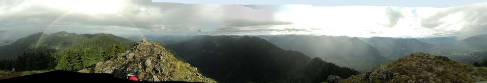
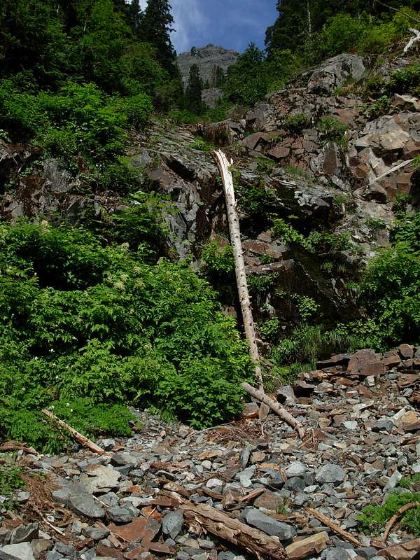