|
Hiking Log
Hiking Locations
Data Analyses
Pictures
Recent Changes
|
2015 | |
Up to 2015 hiking log.
|
20141212 8mi, 1050m | Bandera Mt, Mason Lake |
WTA Trip Report
|
20141127 12.1mi, 1260m | Rattlesnake Ledge, East Peak, Grand Prospect |
Found the shortcut. :D It's definitely steeper, more narrow, but appears to have some very old erosion bars. Presumably it was the old trail. It is a much better route in terms of scenery, as the forest opens up quite a bit and one gets to see more trees.
WTA Trip Report
|
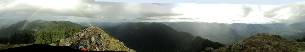
20141116 14.5mi, 1400m | Ravens Roost, Hall Point, Change Peak, Hall Peak (?), Mt Washington |
I saw absolutely everything today: Mt Si, Teneriffe, Green, Bessemer. Mailbox, Dirty Harrys, West Defiance, Putrid Pete's, Defiance, Bandera, and maybe a glimpse of Granite. Mt Baker? Yep. McClellan, everything in the direction of the Zig Zag trail and those unnamed peaks. Chester Morse Lake, Rainier (though it's south-east twin was not visible from this location). McDonald, Rattlesnake. North Bend, Issaquah, Bellevue, Seattle (in the smog). Even saw the big white building on the summit of the unnamed peak above Thompson Lake at the end of Granite Creek Road.
We're calling this "Hall Peak" because it's the accessible prominence on the ridge up from Hall Point. There is a slightly higher summit as the south side of this dromedary pair, but it was almost entirely covered with trees and there was no clear path except bushwhacking. There wasn't even a goat path, and even Change Peak has one of those.
WTA Trip Report
|
20141101 10.3mi, 1250m | McClellan Butte |
I was the fastest thing on this hill today, if I do say so myself.
I was the first on the top, but it was drizzly and cloudy today. While one gentleman ascended the cheese grater after me, most were turning around.
As the fastest thing on the hill, all those that had turned around early got passed on my way down.
WTA Trip Report
|
20141018 9.2mi, 1105m | Tiger Mountain, Cable Line, WT321, Poo Poo Point |
Yay rain.
WTA Trip Report
|
20141005 5.0mi, 1370m | Snoqualmie Mountain, Guye Peak |
Double summit!
WTA Trip Report
|
20140913 7.3mi, 1150m | Abiel Peak, Silver Peak, Snoqualmie Train Tunnel |
Double summit! I would have tripled with Tinkham, but circumstances earlier in the week left me wondering whether I'd be able to hike today or not; alas that I thus found myself going running Thursday night, whereafter my calves had not yet fully recovered for this Saturday morning hike. With the impending heat wave, and the general steepness of Tinkham near the top, I decided to skip it this time around; perhaps next year I'll have the right match of conditions to do the triple.
(In fact, in 2015 I didn't triple, I did a quad with Catherine :)
By the time I was descending from Silver, I had not seen any people.
WTA Trip Report
|
20140830 13.5mi, 1415m | Snow Lake, Gem Lake, Upper & Lower Wildcat Lakes |
Weather was supposed to be mixed this day, and indeed it stayed cloudy, partially gusty, and drizzly at times. One benefit is that the air temperature coupled with the humidity was just right to stay cool.
Arriving at Gem Lake, I had considered Wright Mountain as a choice, but decided I would take this opportunity to continue to the Wildcat Lakes. I had a bunch of energy, and it was necessary and well worth it.
The hill down to Wildcat Lakes is rather steep, so there's a good supply of switchbacks at the beginning. There are several slope crossings, and boulders to consider. In the rain, it's well worth a bit of caution.
The trail around to the lake is a bit more of a boot path, and there are a few places where tree crossings are required. There are a few steep muddy spots. The lake itself is... a lake, but walking around to the far side is worth it. The pictures would be better.
Ascending from Wildcat was much quicker than expected. I passed two solo hikers, young guys, that were probably setting up tents for the night. Otherwise, I saw a few people near Gem Lake.
WTA Trip Report
|
20140823 5.0mi, 1000m | Putrid Pete's Peak |
WTA Trip Report
|
20140809 7.0mi, 980m | Zigzag |
Given the forecast of doom (85F for the day), I planned an early, short, and shaded day as my next weekend will be occupied with work duties. Indeed, I was up around 0345 doing the usual preparations, and on the trail about 0530; sunrise was about 0600. The air temperature was still about 60F, which is unfortunately high for a good hike, and the general heat wave that we've been in means that I'm perpetually dehydrated despite drinking three quarts of water every day, so I was a bit sluggish only averaging about 1.8mph up the hill (870m). While there was a bit of sun rising on the eastward portion, the bulk of the hike was in the trees or on the west side of a hill, which was the plan all along. At the top, the temperature had fallen much closer to 50F, and I was in the shade and in general bliss.
Nothing particularly exciting happened on the descent, though I turned off to Hall Creek Falls to see how they were doing. Indeed, water was falling. There's a new 'Hall Creek' trail that turns off about 300m before the falls, but I did not follow it too far up the hill before deciding it was time to turn around. I had a number of other errands to run today, and I didn't want to be hitting a bunch of traffic.
This is also the first hike where I've seen any animals larger than squirrels. I saw what appeared to be a cat idiotically standing in the middle of a gravel road (but I guess that doesn't count as wildlife), a rabbit on the same gravel road doing a standard confused zigzag (at least in the right place), and another rabbit on the upper westward trail. Number of people seen during the hike: Zero. Slackers.
WTA Trip Report
|
| |
On call, 95F weather, 85F weather, event at work, 85F weather. :[
|
20140721 8.25mi, 1050m | Bare Mountain |
This was quite the long drive, and not entirely obvious. One drives north through North Bend, must find the correct city street out of towne, and then find the correct (uphill) section, which is unmarked, in the housing development. That road is actually fairly well paved and established for a while, so it's not obvious that one is in the correct place. Moreover, there are several parallel roads further north that are inaccessible or off limits.
Nevertheless, the road proceeds to the north several miles before heading east. There is lots of foresting taking place in this area, so some of the roads are rough. There are plenty of turnouts, small bridges, weird gravel pits, and so forth. The trail to Bare Mountain is not at the end of the road, but near. There is parking for two or three cars at most.
The trail is similar to Dirty Harry's at the beginning, with a lot of rock, with a trail similar to a stream bed. Eventually one ascends into the forest, and then into miles of ferns. Because of it rained over night, the ferns were still wet and, wearing shorts and a tshirt, I got rather soaked. The ferns, including some thorns, were endless. I almost turned around, but decided to keep going because I was already wet. I doubt that rain pants would have much helped given the amount of water.
Eventually I made it out of the underbrush (I can't imagine what it would be like in summer) and into the midlands. At this point the trail goes up rather quickly and, given how much energy I used in the ferns trying to find footing, it was difficult to keep much speed. I made it to the top eventually. There's some old chain, markers, and building anchors up there. The views would have been better but it was still cloudy.
This is a nice hike, but it's a very lengthy drive and the hike is a bit on the short side for that much driving. I don't know if/when I'll be back.
WTA Trip Report
|
| |
On call, 95F weather, 85F weather, event at work, 85F weather. :[
|
20140629 8.9mi, 1245m | Dirty Harry's Peak |
... and some of the surrounding talus slopes.
I was hoping to traverse from Dirty Harry's Peak to the next summit to the west. The northwest spire of the summit appeared to be a sharp dropoff, requiring repelling to get down to the saddle to the next summit. I attempted to head southsouthwest down the talus. There were three visible cairn markers on that slope, starting/ending at the top, and heading downward into what appeared to be a gully. Descent tot the west from that point appeared impossible, again being nothing but a dropoff. Further descent southward may have been possible, but likewise looked a bit steep to me. A day with more clear skies might be beneficial to route-finding, but the slippery nature of the water-covered rocks was not helping matters either. The map suggests that one would have to descend SSW, traverse around at the 4000ft level, and then cross the steep saddle to the north side to be able to make an approach on the next summit, as the south side of that summit seems too steep. Otherwise, it may be necessary to descend to 3800-3600ft to travel laterally, completely around that summit, toward the next. The cairns are interesting, but that they went nowhere suggests I gave up too early, perhaps.
After descending from the summit, I decided to spend some time on the talus to "Commonwealth Peak" (need to research this unnamed peak). Approaching from below, it likely makes more sense to take the 'blocked' trail to the east a ways, then reach the rocks from that trail and head upward. That trail goes quite a distance to the east, according to my September route, before heading steeply up a hill (in the forest) and, maybe disappearing. It seemed like it would be heading away from the talus summit, which would probably offer reasonable views. One could possibly cut across eastward from the Dirty Harry summit, perhaps after descending to the 4200ft level or the old road. It seems like running down the ridge would be difficult because of the summit trees being in the way, but it may be possible. Nevertheless, moving laterally across talus might still be slower than descending the main trail then ascending directly from that eastward section. Some arithmetic may help here.
On the ascent, as I was crossing the stream near Dirty Harry's Gallery (which I've never found), there was a "Slinking drinking slitherer!" A little gartner snake drinking at the stream, all stretched out and apparently happy. I stepped around it and it didn't move; it was certainly gone when I returned.
I need to drink more water on these hikes, consuming only 800mL during this entire time.
WTA Trip Report
|
20140614 12.25mi, 1040m | Lower Tuscohatchie, Pratt Lake |
Somehow I managed to use all of 1L of water on this journey. It seems like you should be drinking a bit more than that.
WTA Trip Report
|
20140530 7.7mi, 1290m | Granite Mountain |
Still breaking in the new boots, and they are doing quite well.
There are apparently lots of Yeti that use this trail. Descending from the saddle was indeed worse than from the tower, despite the latter being generally steeper and ``closer to the edge''. The saddle descent leads down through the 'meadow', which is just steep enough to fall on your butt and, being at a lower elevation, the snow was more slushy. Usually this is not a big problem: One simply walks in the footsteps, which, being more-packed snow, tend to be more solid. Alas, when going downhill you have to be able to get from one step to the next without falling down with your legs under you or otherwise over-extending your knees. This is rather difficult when the footsteps are in excess of six feet apart, and the steps down about the same. I'm quite certain some eighteen-feet tall... beings have been using this trail.
WTA Trip Report
|
20140510 6.4mi, 1140m | Old Mt Si Trail |
Still testing out these new booties, and, happily for today, the jacket as well.
Snow! On the ground and falling from the sky! It started in about 200ft from the summit, with a good couple of inches on the ground everywhere at the top, and enough active snowing to reduce all visibility to about half a mile.
My normal route would have been to continue to Blowdown, but the snow would have provided for a rather annoying stumble over there, where it's possible there is still winter snow, and I didn't want to go beyond the planned mileage with the new boots, equipment, and food I had with me.
It was on the warm side today, so despite some rather constant misting and some drizzle at the lower elevation, I did the majority of the hike in shorts and a tshirt. I passed at least one person who commented that it was an excellent cooling system, and indeed it was enough that stopping for more than a few minutes at a time for breaks would have been unwise. Subsequently, when I arrived near the top, I hid under the trees and added the jacket. As the rain picked up on the descent, I just kept it on until the end, as open as possible. Minus a little buildup of sweat on the forearms, it breathed well.
WTA Trip Report
|
20140504 2.9mi, 164m | Cowen Park |
Stayed in towne to break in the new boots and jacket.
To finalize the cleanup from last weekend's fiasco, I was out Saturday morning to completely clean the Jeep. Ergo, I decided to get up Sunday morning and take a quick jaunt in a nearby park. As it was drizzly or rainy the entire time, it was a keen opportunity to give the new jacket a chance (I was not disappointed) but also didn't take much coordination to get out the door and onto a footpath. I'm impressed the GPS was able to collect data despite all the tree cover, but it does show a few little up and down hills, so that is worthy of being called a "very minor hike" from an exercise point of view. Indeed, taking absolute complete newbs on such a trail might actually give them a taste of a few small hills prior to something like Little Si.
As it was, the so-called "South trail" and "North trail" were the places to be. This route, namely the main road from the west, to the south trail, around the south rim, returning on the main road to the first cutoff up to the bridge, and then joining with the north trail when possible, is likely the most sensible. Looping in the other direction will make it hard to find a spot to jump from the north trail to the bridge trail.
WTA Trip Report
|
20140426 5.6mi, 421m | Grand Ridge (Issaquah) |
Breaking in some new boots.
Roops, some less than intelligent creature broke out my driver-side window. They made off with items having a total value of... zero dollars. Yeap, they took my bag of clothes and drive-home food out of the driver's side leg compartment, and then chunked it in the parking lot 30ft away. Maybe they were scared off or someone else showed up, because they didn't try to break into the center console nor did they even get the door open to look behind the seat.
This is very near to being a city park, but there are some trails worth a bit of a walk. The trail was mostly groomed enough that one could run the whole way. Near the upper parts, it connects to a sports area, baseball field, a manmade lake, and some expensive houses. The bathroom was actually open at the baseball field, which was good as there was no bathroom elsewhere on the trail.
Near the west side of the park, the downward trail was not well defined, but it connected to the trail at the lower end, so I returned via a different path. As a loop, it's not too bad of a small hike and provides some hills.
WTA Trip Report
|
20140419 6.7mi, 980m | Bandera Mt |
Spikes and snowshoes and ice axes, oh my! There was a good supply (half a dozen) of people near the top, and some people descending a great deal faster than me. I had a bit of time near the top to myself, and was able to find a spot near a tree that was slightly protected from the wind. Alas, there was a thin spot near the top and the snow was still soft enough, that I decided not to attempt the last 50m of elevation.
I did some mini glissading on the way down, but the snow was rather soft and it was mostly scooting. It probably looked ridiculous, but oh well. Even the dog was descending faster than I was. :)
WTA Trip Report
|
20140329 6.2mi, 905m | Zig Zag Trail |
This was intended as a medium to light hike, to balance out some of the troubles I had with frustrations on Dirty Harry's, which isn't the flattest spot around. Indeed, I seem to have again underestimated the distance and time required for this hike. While I was expecting snow, and that snow didn't start until reaching the (upper) road, it was at times a bit soft, and I didn't seem to be hitting my target velocity very often. When the conditions became more exciting (I use that word on the grounds that it started snowing, which is always cause for excitement) I took more breaks to evaluate conditions. It was also necessary to stop and consider potential avalanches near the top.
Having just run the numbers, it is amusing that this was about the same steepness as DH, though the distance is divided in a different way at the two locations. Zig Zag seems steeper at the beginning, during the initial climb from Olallie State Park. After reaching "Hall Creek Road", the going is a fairly steady rise, but that is comparably slow compared to the initial ascent. Perhaps the decreased slope near the top gives the impression of an easier climb.
WTA Trip Report
|
20140322 7.3mi, 915m | Dirty Harry's Peak approach |
The avalanche warning below and at the treeline was moderate this weekend, so it seemed reasonable to make an attempt on a lower approach that avoiding the northeast potential for cornices. Unfortunately, despite nighttime temperatures in the 20s and 30s, the daytime temperatures have been rising to the 40s and 50s increasing the possibility for loose wet avalanches at lower elevations. I've certainly seen slow avalanches on Teneriffe Road, so this seemed reasonable depending on the condition of the snow.
This was a rather slow ascent, probably because I carried a great deal of extra clothing (extra gloves, heavy jacket, etcetera) figuring that the temperatures would be near the 30s at the summit despite the expected 50s for the day. I did make the turnoff to the balcony in about 45 minutes, so I wasn't moving too slowly, but there was enough snow on the lower trail to make footing questionable.
The lower trail showed one set of prints, perhaps from the previous day. Those terminated about 3/4mi past the balcony turnoff, before the creek portion of the trail leading to the main stream crossing near the gallery (presumably, as I've never seen it). Snowshoes were pretty much required past that point, but the trail alternated between deep snow and creek beds rather frequently. I probably removed my snowshoes at least eight times during the journey.
The upper set of switchbacks showed considerably more snow, up to approximately three feet plus some drifting. Snowshoes were somewhat useless in places, being no better than postholing. Given the 30 to 45 degree slope in the trees, plus some portions of the trails that showed actual snow shelves and some recent fracturing, the fact that the snow was not becoming any more solid, and that the sun was out pulling the temperature to nearly fifty, it seemed appropriate to turn around. I hit a switchback where it was exceedingly difficult to climb back up onto the snow from any direction; it just kept collapsing. Very wet powder... seemed unsafe, so I went home.
WTA Trip Report
|
20140308 8.75mi, 960m | Tiger Mt: Cable Line, WT3, WT2, Seattle View Trail, Poo Poo Point, Bus Trail | I had planned to take the Nook, but the gate was closed until 0645 and I was already prepared to start hiking, so I didn't wait.
This was a high avalanche warning weekend, as we've had lots of fresh snow in the past few weeks and a good deal of rain this week. Moreover, temperatures have been holding around the 40s and 50s, so all expectations were that snow would be sliding at all elevations. I wasn't even willing to approach the Zig Zag trail over concerns that the northern approach face would have sliding snow. Recall that I've seen an avalanche in progress on something as flat as Teneriffe Road, and the prediction for "Loose Wet" avalanches at lower elevations (below the treeline) was "Very Likely".
A word also about the weather. We've had heavy rains most of the week, and the prediction was for that to continue. Friday morning saw some decrease in the amount of water in the sky, but the forecast was for the rain to return Saturday afternoon. Indeed, some models showed drizzle and wind starting in the late morning, and the formula for the weekend was pure overcast and clouds. RADAR showed a large front moving in from the coast, and that was to provide the bulk of the new, incoming rain. Indeed, we had heavy rains Saturday evening.
I was a bit late leaving, compared to the plan, but very early compared to the rest of the crowds. Having attained WT2, I decided to attack the Seattle View on the grounds that I could abort via "WT Railroad Grade" either to the Nook or back down the Cable Line. I have descended Cable in the rain before, and it was actually very dry and stable on the ascent. I suppose it was steep enough to run off most of the water from the early part of the week. The sky showed the clouds, of course (easier to see from WT2) and, since it looked like the darker storm clouds were still over by the Olympics, I figured I'd have a few hours before it started raining.
Having descended Seattle View, with no apparent change in the weather, I opted to head to Poo Poo Point, figuring there were several escapes there if the weather got really bad. It was not until the final descent to Poo Poo Point that I started seeing people. One man and his dog were ascending that trail, and there were about four teams at Poo Poo Point, and three dogs making lots of noise.
On the return, I saw one jogger on the RR trail, just as I was heading down the Poo Poo trail, and a good number of people heading up that trail, including a couple of families and what appeared to be a boy scout troop.
Amusingly, there were globs of people starting on the trail as I was finishing (this is not so 'amusing' because that's usually the way things happen), but I have to imagine that they all got rained on. I think I might have been the only person in shorts and a tshirt. :D Rain started hitting the windshield by the time I got to Issaquah, a mere four miles west. Yeah, they got rained on. I was pretty fast in covering this ground so I could avoid the rain.
WTA Trip Report
|
20140222 10.0mi, 1375m | Mt Teneriffe | My original goal was to hit Blowdown on the Teneriffe Road return, but conditions (and maybe being out of shape :P ) had me burning through my food and water pretty quickly.
I was likely one of three up there today. I was breaking trail from when I added the snowshoes almost the entire way to the top (see the breaks in the graph). Two guys had arrived in the parking lot a few minutes before I started hiking. I didn't see them until my stop near the top, maybe 300ft elevation to go. Let's just say that, with them flattening the trail in front of me, things were significantly easier. Still, I probably had to flatten around 2mi of uphill trail, because there was nothing but a fouled trail of dumb bootprints the whole way, covered with fresh powder. In some places where I tried to go 'off trail', or a bit to the side to avoid the divets, I was sinking in at least three feet. The actual trail was the only place that was solid enough for footing, in most places.
As will be seen from the pictures, it was snowy on top, but surprisingly warmer and significantly less windy than usual.
I took the road back; that was a good choice to avoid killing my poor knews. I kept thinking about Blowdown, but that would have taken at least another two hours seeing how tired I was. That was also a good choice as I ran out of water just as I reached the parking lot.
All in all, a very successful day.
WTA Trip Report
|
20140208 7.4mi, 700m | Talapus, Olallie Lake, Pratt Approach |
Snow. Snowshoes. Spikes. 4WD. Oh yeah!
Being behind on running and exercise back in January, I wanted to stick to an easier hike this weekend. The road was clear enough to the parking lot, though it was deep enough that it may have been more difficult driving there or back had the temperature risen considerably. Fortunately, it stayed in the 30s most of the day.
The snow was definitely powdery in places, particularly around Olallie, but shallow enough to be easily walkable with snowshoes. After the lake, I jaunted across to the Granite/Pratt Mt trail and continued upward. While the trail definitely looked different, it seems one can approach Pratt mountain in the winter on the usual trail. Despite several attempts to search around Olallie, I have yet to find any approach to Pratt from the southwest side of Olallie. This was a very nice walk in the snow, in fact, and I stopped at the Snowy Wren lake overlook for some food and decided going to the saddle wasn't worth it today.
On the return connector between the trails, I finally started seeing some people. One group was heading east, but most of them appear to have been coming from the Granite TH and approaching Olallie. The stream crossing near Olallie was not the easiest spot; I crossed a bit to the north as the flow was a bit deep at the usual spot. Other people appeared to be having some difficulty.
The trip down was rather quick, being at just the right slope to run a good deal. There are a few blowdowns across the trail so my path was a bit of bushwhacking in places, but with the snow it was relatively easy.
The drive down was uneventful. I'm shocked I didn't find more people driving up the road around noon, as people have a tendency to start too late in the day.
WTA Trip Report
|
20140125 11.6mi, 980m | Snoqualmie Pt to East Peak |
Being terribly out of practice and out of shape, having gone through two months of being sick off and on, I opted for a "relatively flat" hike. Indeed, this was a very fast hike. There was some snow at the top, but nothing on the trail required anything more than spikes.
I met one team of hikers at Grand Prospect on my return, and lots of people coming up towards and around Stan's Overlook. There were about 30 people in total, but I mostly ran around them. :)
I averaged 2.85mph on this hike, which is impressive considering how out of practice I am.
WTA Trip Report
|
2013 and earlier | | Hiking log from 2013 and earlier
|
|