|
Hiking Log
Hiking Locations
Data Analyses
Pictures
Recent Changes
|
2016 | |
Up to current log.
|
| |
2015 Update
- Year-to-date mileage: 266mi, average 9.2mi/hike.
- Year-to-date ascent: 105 030ft, average 3620ft/hike.
|
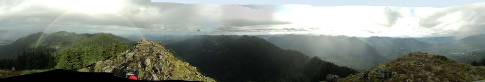
20151225 10.6mi, 960m | Snoqualmie Point, Grand Prospect, East Peak approach |
Snowshoeing required. Great mounds of fluffy snow still remain. Waist deep in places before snowshoes. Knee deep in places despite snowshoes.
No one had passed Grand Prospect in quite some time.
WTA Trip Report
|
20151218 6.2mi, 700m | Dirty Harry's Balcony, Peak approach |
Snowshoes! For the first time since 2014-04-19!
The snow was so fluffy that I used boots until getting to the balcony turnoff. After that, it was consolidated enough (in places) that snowshoes helped, so I had those on until I turned around near 3300ft. Even at that elevation, I was dropping 9--12" with each snowshoed step, getting tired, and had arrived at a spot where the trail was again a stream plus lots of trees. The next reasonable waypoint would have been the Commonwealth Peak (?) trail turnoff, and it probably would have taken another 30min to get there. I could actually have continued to trudge and possibly make the summit, but I would not have been able to get back to the parking lot until 4PM, and I didn't want to do that.
There was no one else hiking today, but two people were in the parking lot claiming they were going to do it. They were there messing around in and outside their car for the 15--20min I spent getting cleaned up, but never started their hike. I have no idea what they were planning.
The drive in was fun. Trucks were solid on I90 starting around MP33, chaining up for the pass, and traffic was stopping because of it. Slush was on the truck lane starting around MP36. I had it in 4wd to make Exit 38, and had to do some strange manuevering to get around the trucks parked there. Traction was good enough on the exit that I had to really cram the brakes to slide near the stop sign. The road, however, had not been plowed and traction was pretty bad. I decided to forego my stop at Olallie State Park (for the restroom) because the snow there was deep and had not been plowed, and I was worried I'd never get out. Some moron in a light, small truck came up behind me (within one car length), so I finally drove over into the snow to let him pass, and he went sliding up the road at 30mph. He was parked off to the side later; I guess I don't know what trail that is, possibly FS9030. There were two snow plows operating specifically for the fire safety/training facility. Apparently they or a county truck had gotten part of the highway interchange. The actual county truck showed up while I was still getting ready to start hiking. No one plowed me in, fortunately.
Rain was supposed to be gone by 7AM. Naup, it was wet snow and rain mixed in the parking lot and I had to completely replan the clothing. It basically rained the entire time except for about 30--45minutes throughout the morning. It was snowing otherwise (at various elevations), and still going when I returned to the parking lot. I cannot imagine what it was like getting over the pass. I saw the I90 traffic at a few places and it was crawling, a few trucks and cars at a time.
20151218_GPS.DirtyHarrys WTA Trip Report
|
20151212 9.1mi, 1472m | Mt Si, Blowdown Mountain |
Snowing!
2015 oops: I'm 185ft away from 250mi distance this year, and 600ft ascent away from 100,000ft ascending.
High winds today, 30kt gusts. Icing/flurries started at Mt Si, and continued to the Blowdown turnoff. I added the goretex jacket shortly thereafter as the snow was not letting up. About 4-8" of powder on blowdown, which was sufficient to pack on the back of my boots and calves. Lots of tongue scooping on the way down. Some snow stayed atop my pack until I reached the parking lot. Slippery descending Blowdown. Wind arrived on the return approach to Mt Si. Windy on the downslope side of Si until basically the boulder garden. More slipping on the north side descent of the boulder loop than at the top. Packed snow on the rocks approaching Mt Si made for a slippery descent. Lots of people up there at that time. No one else on Blowdown, and no other tracks on Blowdown.
WTA Trip Report
|
20151205 8.5mi, 1365m | Zig Zag Trail, etc. |
Fuzzy mountain goats!
Snowing!
High wind warnings today. 30kt gusts. Presumably 0.5" of rain between 1000 and 1300. Happily above 2000ft it was snow. Snow on the ground, 1-3". Some minor drifting near the top. I was not able to find any reasonable trail south from the truck today. Some WTA reports suggest there is a boot path, but with the ESE winds, I didn't want to be up on that ridge anyway.
WTA Trip Report
|
20151114 9.4mi, 834m | Talapus, Olallie, Pratt Lakes |
Snowing, raining, puddle jumping. The forecast was for 1--3" storm total precipitation in the mountains. The wind forecast was, fortunately, not excessive, so I deemed it reasonable to make an attempt. It ended up being a reasonable hike, and I discovered a bypass route to avoid the cut from the Olallie trail over to the Granite trail. Information forthcoming on the differences in those routes.
WTA Trip Report
|
20151027 7.4mi, 1080m | Bathtub Lakes, Pinnacle Lake, Bear Lake |
I did not eat half as much food as I should have for this trail. Had I been eating more frequently, I may have been able to make Pilchuck.
This is pretty much Class 2 the entire way. The trail to Pinnacle lake is replete with roots and mudholes, so the going is somewhat slow. I made around 2mph at the beginning, but arrival at the lake was the end of that. There is decidedly no trail around the lake. It took me nearly half an hour to make any progress because there was no clear direction of travel; having a boat would have been easiest :P The initial crossing is into bushes and overgrowth, with some manuevers on moss-covered rocks next to the outflow/creek. Continuing around the south shore, there is a ten foot section on leaf-covered rock that is directly above the lake; conveniently, it would only be a few feet to fall, but if the leafless shrubs aren't strong enough to hold some weight, down you'll go into five feet or more of water. Next there is some scrambling. I'll have to check GPS, but I'd estimate skirting the shore took at least thirty minutes.
The initial rise up the gulch is through the creek. All the indications online of yellow markers and a big "Iodine Gulch" paint on a rock are incorrect: All that stuff is at bathtub lakes and only at the top of the gulch. The main ascent is entirely up to you. Sometimes the shore is best, but, generally, I stuck to the stream or the rocks on the way up. At one point I had a class 3 climb down some big rock and a log (yes, I mean lowering myself on my arms and with only a single foot contact); I didn't see the spot on the way back. Ascending the gulch also benefits from some back and forth, crossing the creek to the easier side at times.
Bathtub Lakes are spread out quite a bit. I'm certain I hit them all, but they are about 3/4mi and there's some ascending/descending to consider. Traveling eastward is definitely more difficult/confusing, but it's fairly obvious when you've lost the markers. It's kinda sad to see so many markers up here, actually, but it is what it is. The lakes are nice to look at; I'm guessing they have nothing on the enchantments.
Sad that I didn't make it to Pilchuck. I really want to know where the ascending connector trail is located, how it is entered from the west, and how difficult it is to get to the lakees from the Pilchuck side. I know it would mean reascending, but I think that avoiding Iodine Gulch and the mess of a lake would be a better approach on these. Given the time that had elapsed, my energy levels, and the remaining estimated mile to get to Pilchuck (plus the amount in ascent), I deemed it unwise to continue past the last bathtub. I imagine it would have added another three hours, and while you "had time" it would have meant getting back shortly after sunset, which seemed unwise given the roots and mud. Had it been a weekend, I would have felt it more likely to get a ride down from Pilchuck and at least to the Bear Lake forest service road. That would have been a walk on gravel, mostly uphill, for about four or five miles. So another two hours if it was even possible. Dropping a mountain bike at Pilchuck TH might be a possibility, but two cars would be best.
WTA Trip Report
|
20151017 8.2mi, 1175m | Granite Mountain &c |
Another weekend of forecast solid rain drizzle showers with... nothing. Checking the Friday 5pm models showed rain passing through the region in a very narrow band starting between noon and 2pm. The trajectory suggested it was going to pass to the north a bit, however, so I packed the jacket. That was the right decision because it didn't even make it into the 40s overnight in the mountains. It was very warm for the entirety of the hike, which slowed me down a tad.
Spent some time searching for a trail to Denny Lake. I suspect it was a bit further up the bowl than I had anticipated, and I'm fairly certain I was heading into the wrong bowl anyway. Somehow I ended up on the south side of the saddle from Denny. I'll need to check the GPX route against the map. Yes, I had a map with me, but it turns out I wasn't in the mood to go traipsing around for very long.
(In hindsight, I suspect I was actually on the correct trail.)
Hello Jesse and doggee. Thanks for chatting with me for the last mile on the way out.
WTA Trip Report
|
20151010 4.6mi, 425m | Bridal Veil Falls, Lake Serene (attempt) |
This was a bust. :{ More later.
This was a planned rain hike, but the rain stalled overnight and started up in the morning. Rain was very heavy at time. :D
Bridal Veil Falls. One word: Stairs. Ugh, there were stairs. And they were filled with water. Water puddle stairs. These were the 4x4 erosion bars, in a square, with nothing but dirt in the middle. Slippery water puddle stairs. I prefer trails to stairs.
Some notable up and down on this hike and, with the varied size rock chunks on the old road, I don't categorize this as an 'easy' hike. Lots of wet leaves to trip over, lots of places where the trail is washed out. Lots of stream crossings. Lots of pools of water to fall into. Etcetera.
Trail was nothing but a pool of water at the first main waterfall after the bridal junction. Given the downpours, the wind, and the water coming off the falls, I saw no way to cross without falling in (or worse). I checked downstream, but the only viable approach would have been to proceed downstream until a crossing was found, then bushwhack back to the main trail. I had no GPS track, so no notion of where the trail was to the west of the creek, there was significant washout underbrush and footing would have been bad, and there was no reason to proceed in those conditions.
This makes me very sad. (I was hoping to get in some rain hike elevation at least to view out across the valley.)
WTA Trip Report
|
20150929 4.05mi, 340m | Cedar Butte |
The same day as Chirico. :]
There was a lady here hiking the John Wayne trail (that's the old railroad grade, 15ft wide, gravel) with bear bells. Really?
WTA Trip Report
|
20150929 3.75mi, 540m | Chirico Trail, Poo Poo Point |
I decided to give this trail a try on my day off (Tuesday). There's a spot 10min below Poo Poo Point where one can clearly see Rainier.
This trail is a solid wall of women hiking uphill at 11am on a Tuesday.
WTA Trip Report
|
20150926 11.75mi, 1300m | Snow Lake, Gem Lake, Wright Mt, Unnamed Peak B |
No easy path found from the unnamed peak back into the bowl descending to the trail. Perhaps ascending the bowl would reveal the easiest approach. Had to drop back to the campsites and lake. It was fast enough. Ascending from the campsites instead of traversing from Wright would be easier.
Very fast group of guys here coming back from Gem. Presumably they were pausing at Snow when I passed, then trailing me up to the saddle. They almost caught me on that ascent, but I stopped to let them pass. Alas, after that, the traffic was so solid, it probably took ten extra minutes to get back to the parking lot. Benefit was that the group of guys was breaking apart the crowds. Alas, I couldn't get any of them to talk much with me. They were probably a bit on the young side (college aged?).
WTA Trip Report
|
20150919 9.0mi, 1250m | Church Mountain |
Brian and I decided on a hike away to the north. It rained continuously, profusely, so he wasn't terribly happy with the picture taking opportunities. Obviously we were not able to proceed past the first summit as there is no clear trail to the true summit.
Fortunately I had checked the map beforehand and was able to direct us to a nearby waterfall on the drive out, and it stopped raining for a while, so he was happy to get some pictures there.
WTA Trip Report
|
20150905 8.0mi, 1200m | Mason Lake, Bandera |
Found a backcountry trail to Mason Lake.
Approach on the true summit, but visibility was poor and it was, ultimately, not clear how to proceed.
WTA Trip Report
|
20150828 12mi, 1165m | Rattlesnake Lake to Grand Prospect |
After weeks of dehydrating, hot weather, it seemed better to start with something "flat". As a Friday off work, it also provided an opportunity to visit the Cedar River Watershed Education Center, where one can buy fluffy things... and learn about our (lack of) water, of course!
No one above third ledge. Absolutely zero.
WTA Trip Report
|
20150808 12mi, 1725m | Kaleetan Peak |
It seems the summer weather is awful for hiking in many different ways:
Cramped thighs, rolled ankles, twisted knees, out of water, sunburnt.
Solid Class 2 from the lake up the ridge, down the other side, and up the other ridge. Class 3 is only the final, short segment, and easy by comparison.
Two guys here caught up with me on approach to the Pass. They were moving very fast. I was way too warm, so I couldn't open any distance on them. Nevertheless, I got to the base of Kaleetan first because they went the wrong direction. We were on the summit together; only room for three people anyway; and when they descended they were gone. I was very slow this entire trip.
WTA Trip Report
|
20150801 5.75mi, 700m | Boulder Garden, Little Si |
After three more weeks of 90F weather, I needed something easy with an option for extension.
I was ascending at least 20% slower. It would have taken at least 2:15 to reach the top of Mt Si. Given the increased heat on that slope, the lack of wind, and likely increased exhaustion, I imagine it would have taken closer to 2.5hr.
Passed a couple of dumb kids, 20min from the parking lot, who had a raging fire going. In a burn ban. With no water. They had apparently spent the night in hammocks, until they got too cold and decided to build a fire.
WTA Trip Report
|
20150711 11.75mi, 1700m | Mt Catherine, Tinkham Peak, Abiel Peak, Silver Peak |
After three weeks of 90F weather, it seemed appropriate to attack Snoqualmie Pass, if nothing else to have the train tunnel as a backup plan. The plan was to visit Catherine (for the first time) and then proceed via the PCT to Tinkham. The remaining portion of the hike was considered "possible but not necessary". The weather and energy permitted, so four summits were visited. The achievement is slightly cheap given the proximity of some of the peaks. By comparison, quadrupling Pratt through Putrid would be 17.4mi and 2750m of ascent.
The summit of Catherine appeared sooner than expected, giving a climbing rate around 700m/hr. The early morning was actually slightly warmer; with everything covered by clouds, visibility of the surroundings was better in the 3000-4000ft elevation band. The descent was uneventful and rather quick. I would recommend Mt Catherine as a short jaunt before other hikes in the surrounding area; if one intends to save Catherine for the end of another hike, it will probably feel annoyingly steep.
After descending, I opted to return to the Jeep, which was enroute to the PCT, and refill the platy, hoping that would be sufficient hydration for the remainder of the hike and avoiding the extra weight of another bottle. The southward jaunt on the PCT was typically lengthy, though it was a nice morning for a walk. The clouds cleared a bit, permitting views of the north faces of Tinkham, but condensation started around the time of reaching the saddle.
A group of three to four hikers was descending from the direction of Silver, though I was on the ridge before they passed the saddle, so they probably didn't see me. Despite the increasing precipitaiton, I worked upward through the forest in shorts and a tshirt, and only added the hat and jacket before the final climb up the rocks. There was a good deal of moisture updraft visible, but it was warm enough to stand on the eastern arm and eat. The descent took just as long given the poor footing in the forest.
The rise from the Silver Peak trail toward Abiel was enough to deenergize me, enough so that I was concerned about making the remaining ascents. Indeed, with the rain continuing, I was more concerned about footing and grip on Abiel; while the final ascent on Tinkham requires some caution, there are very few spots where hands are required for more than stabilization. My memory of Abiel, on the other hand, was that several spots required reaching and there was, in general, more open rock to ascend. Despite the talus slopes and the rain, however, both the ascent and descent seemed safe. There were a few places where good foot placement was helpful, but grip with the gloves never faltered and the only real footing problems were on dirt-covered rocks or loose soil. I recall only one rock on an open slope that was a bit slick from fungus.
By the time I had reached the summit of Abiel, my hamstrings and calves were starting to get a bit tight. I did a few stretches on Abiel after eating --- there was lots of eating on this trip, both to slow myself down, namely to catch my breath (as I'm way behind on cardio given the recent crappy weather), and to aim for some reasonable caloric intake (getting enough food has always been a problem) --- which seemed to help the legs through until I had finished the peaks and was on the PCT again.
Having saved Silver for last, I was able to mostly shut down my brain and just follow the people in front of me, which felt a bit safer as I was winding down on energy (or so I thought). People appeared behind me as soon as I descended from Abiel onto the PCT, but they did not catch me, though they got very close, on the way to the summit. They were, in fact, the second group I had seen all day --- lies, they were the third, as I had seen two women starting Catherine as I was returning --- which was to be the exception to volume of people, as the trail was rather occupied after that point. I passed a couple ascending the south face of Silver, but otherwise mostly paced myself sufficient to pass no others. In total, I probably saw forty people after Abiel.
Indeed, take a look at the ascent/descent times:
| Ascent Time | Descent Time | Descent/Ascent | Ascent rate | Descent rate |
| Catherine | 41min up | 27min down | .659 | 550m/hr | 840m/hr |
| Tinkham | 37min up | 32min down | .865 | 320m/hr | 350m/hr |
| Abiel | 22min up | 20min down | .909 | 340m/hr | 350m/hr |
| Silver | 31min up | 24min down | .774 | 421m/hr | 520m/hr |
| TH to Saddle | 58min up | 55min down | |
Note the relative ease with which Catherine was descended compared to Tinkham and Abiel. Even the descent of Silver was fairly direct, despite being deenergized at the end of the trip. In contrast, Red Mountain took 51min to ascend (from the lake), but the descent took 72min!
WTA Trip Report
|
20150613 17.0mi, 1530m | Kendall Peak, Kendall Katwalk, Alaska Mountain |
Third trip with Brian E.
Commonwealth Basin trail, PCT, Kendall Peak, Kendall Katwalk, PCT to rige of Alaska Mountain, with some scrambling on Alaska before returning via the same route.
This was, as is obvious from the numbers, mostly a distance hike. The Commonwealth and PCT trail sections are rather straightforward. Somehow on the approach I failed to notice when we hit the PCT; a few minutes followed where I was certain we were going the correct direction, but was a bit confused with surroundings. Eventually it became clear that I was in a location never before visited, and the PCT was the only choice. Likewise the trail started to match online pictures.
The ascent to Kendall Peak followed the descriptions online (namely the stump). That section led to a bit of huffpuffing, but it's so short that one can reach the summit in five minutes. Footing is slightly questionable in places due to dirt-over-rock and pebble collapses. The views from the top are pretty good. I was a bit scared of the east face with its quick dropoff... Brian was standing six inches away with his back to it.
After the Katwalk, the trail descends to some lakes. I had expected a bypass trail around the south of Alaska, but that is the current route taken by the PCT. Arriving at the east of Alaska we started to look for an ascent route but found none.
Near the top, we discussed the PCT with a light hiker, who was heading north east for an unspecified number of miles (probably at least another ten more). He was offended that I was using kilometers for distance, claiming that I was cheating by making the number look bigger (than the equivalent mileage). I failed to point out that, using meters for ascent, I was likewise "underreporting elevation", and that by almost double the factor.
We attempted some scrambling on the south face of Alaska, still looking for an ascent, but reached a spot that required ropes. Online reports (read later) suggest the long approach from the west, through shrubs and brush, might be the easiest. We were not in the mood to deal with that.
The return trip was uneventful, but much more populated. A good many were quite trudgy, whereas others looked like they belong. One guy in a team was all impressed by his friend's map folding. I guess he didn't see my map.
WTA Trip Report
|
20150530 7.8mi, 1000m | Red Mountain, Red Lake, Commonwealth Basin, PCT |
Having heard about this mountain from a hiker on Guye Peak, it seemed an appropriate early summer to give it a try.
The route to Red Moutain requires some attention, and the route up Red Mountain is confusing. There is one turn that is utterly invisible and, often, the easiest trail is the one that looks the narrowest. While Class 2 and Class 3 climbing were required on the ascent, due in part to the route chosen, I was able find the easier/actual trail for the descent, which required few downward stretches.
The Red Mountain ascent was a bit scary. I became worried how I was going to manage the descent, and had to stop several times to assess and mentally adjust to the situation. At times my body started to enter fear mode and my legs started to become weak. With wobbly legs, only a bit of food and water was sufficient to regain my composure.
The conditions were excellent (clear, dry, and warm), and I was the first ascender for the day. I decided that others would likely be following me up the trail. Trip reports had noted that the best trail was hard to find, and it seemed like continuing upward might be the best way to find the easiest route; indeed, descending the way I had come would have been more difficult. Near the final ascent, I was able to find the 'real' trail, which I followed on the way down.
I had the summit (all several square yards of it) to myself, arranged some miniature meditation to slow my racing heart, and reset for the descent. After making good progress for a while, I gained some more optimism, passed a couple of guys and a dog, and made good time for the remainder of the hill. I maintained a fairly calm demeanor for most of the descent.
I paused at the lake, thought about heading to Lundin (but skipped it), and listened to some people that were up on the saddle.
There is nothing intrinsically terrible about Red Mountain, but it does present the appearance or actuality of exposure at various places. Falling would result in long slides down the slopes, but probably nothing too terribly tragic beyond a bunch of scraped body parts and bruises. I took no pictures while on the moutain, deciding instead to concentrate on the climb. Pictures from the lake reveal the general slope of the mountain and how one might slide.
I returned via the PCT just to get that route on the GPS. I was surprisingly fast, even running uphill in places.
WTA Trip Report
|
20150509 14.4mi, 1300m | Hall Pt, Hall Peak, Mt Washington |
My second jaunt with Brian E., who has had some chance to practice and is still working on breaking in his boots. He was very happy with the views on this hike, though there may have been a few too many trees. I don't recall hearing any particular complaints. There were a few observations after descending to the railroad grade that it had been a long day, and that his energy was gone. I responded by noting that I wasn't able to go any faster myself, my feet being rather shot from the mileage and elevation.
This was a beautiful day for a hike. While there were some clouds, it was clear enough for most of the mountains to be in view. Shots southbound from the forest service road were great, and Rainier was well visible near the Washington summit. From Hall Peak, we were able to discuss how far was had gone, given that the earlier part of our hike was in view.
I was happy to have attended this loop again, and to find that Hall Peak offered some good views as I had remembered.
While it was considerable work to reach those areas, the rewards of solitude and reasonable backcountry views are worth it; I hope both Brian's share that opinion. :P
Indeed, the first person we saw was sitting on a rock near the Washington summit. We spoke only a moment before our final ascent, pleased to find it empty and responsive to pictures, but also that we were able to leave shortly after a dozen people arrived. Views near "Mt Washington summit south" are better, most days.
WTA Trip Report
|
20150424 8.1mi, 1325m | Mailbox Peak (Old and New Trail) |
Up the old trail, down the new trail.
There was some snow on this route, and it was very notable at the top. Fortunately, it was fresh enough to provide a good gripping surface, and very little sliding took place. Given the steepness of the old trail, I decided to give the new trail a try on the descent. Indeed, it is considerably more shallow, but very very long in comparison (fetch numbers please). I felt like I was hiking the old Mt Si trail at times, though it was considerably wider. Otherwise it felt like sections of Rattlesnake, but the variety in feeling was likely due to the length. Indeed, by the time I reached the eighty-seventh switchback, I was wondering if it would ever end.
WTA Trip Report
|
20150418 ~12mi, ~850m | North Fork Sauk River |
Introducing Brian! No, not me, but Brian E. This was his second hike (ever, since adulthood, this year, since he "started hiking"?), and the first joint jaunt.
Brian chose the location. It was an acceptable trail but there were a number of rises and falls over various small hills. The total ascent is nothing akin to the initial elevation subtracted from the final elevation.
The weather was acceptable, the trail suitably dry, but it took a bit of driving to get here. There were still 'car prowl' signs at the TH despite this being so far off the road. There were only a few people on the trail, though we passed quite a few on our return journey.
Our plan was to turn around at the lower shelter (Makinaw?) but we were going strong and did not notice it when we passed. Fortunately, after having made it 100m up the hill, we decided to break for food and a checking of the map, and decided we were done for the day. On the return, the shelter appeared.
Alas, the return trip was during weather that ruined the GPS signal, so the second half of the track from the trip is very noisy. Ascent and position are only approximate.
WTA Trip Report
|
20150411 10.2mi, 1320m | Dirty Harry's Peak, Balcony, Connector to P3 Trail |
It started snowing two minutes after my arrival at the peak, so I didn't stay long. After returning to the balcony trail, I decided to follow the blocked connector for a while and ended up on the P3 trail. There are several talus/slope crossings, but it is a nice hike in general. There are a few spots where one might slip in the mud or snow, given the right conditions. It's not clear to me when/how the connector might be most useful. Presumably one would not park at Ira Springs TH just to visit the Balcony (different parking passes). Likewise, one would not hassle with the Dirty H trail given the Ira TH and the (presumed) approach from exit 42.
WTA Trip Report
|
20150328 9.9mi, 480m | East Tiger Mountain: East Tiger 7300, Sleepy Swamp, Totally Hard |
Last week being a steep hike, and the first hike on a Sunday in half of forever, I decided to attempt another first in a long time: Another hike only one week later. The last hike having long-lasting effects, suggesting general issues with stretching and being in shape, it seemed only too appropriate to choose an easy location for a hike one week later. After checking various trail maps and online suggestions, I found an interesting little trail hidden on the northeast slopes of Tigger: The Sleepy Swamp trail.
Most trails in this region are aimed at mountain bikers, given that the primary access is via state park gravel roads. As such, the bulk of the distance in this hike was road walking to and from the various forest trails. Based on the few bikers I saw, I suspect most park at the East Tigger TH on Hwy 18, bike in the direction of the summit, then descend on Rd 5500 to reach these trails. Some may choosen the Northeast Forest Trail, but that would make these smaller trails mostly uphill, which is likely not desirable when on a bike.
The Sleepy Swamp trail was a reasonable hiking trail, but it does connect to the middle of nowhere. Most of the foliage is rather green and bright, but there are lots of fallen logs and underbrush off in the distance. The trail itself starts farther up the road than expected from the map, and doesn't follow the expected track. There are some minor bumps and slight hills (we're talking 6--18" here) along this trail, but it is fairly wide in most places.
The uphill end of the Sleepy Swamp trail presents two choices at a rather large bridge. The Totally Hard trail heads toward Rd5500 and was something of a mudslide/puddle. I saw two bikers coming down this trail, squeeking up a storm with their brakes.
The Preston RR trail was signed as closed for renovation.
WTA Trip Report
|
20150328 1mi | East Tiger Mountain: Raging River |
The intent was to start at the Raging River trailhead and head south to East Tiger 7300 (road). Unfortunately, the creek crossing was questionable and led into a steep incline of underbrush, mostly thorns. While I could have added spikes to cross the one reasonable log in the creek, it was partly submerged and surrounded by deep pools on the far side. This crossing would be reasonable in the absence of possible rain throughout the day, and when the water is generally lower. Unfortunately, that suggests summer, when everything is likely to be coated with insects. It was, therefore, only appropriate to return to the Jeep and drive to the next accessible trailhead.
WTA Trip Report
|
20150321 7.9mi, 1250m | Mt Teneriffe |
Lack of energy. Out of shape. Difficult trudging. Sad that the road is shut down for maintenance (I prefer that route during snowshoe returns).
WTA Trip Report
|
20150222 13.9mi, 1780m | Mason Lake, Pratt Mountain, Mount Defiance |
The initial plan was to triple Pratt, Defiance, and Bandera. Past Mason Lake, however, there was some snow, with about 3-6" of fresh snow on Pratt; it was likely overnight precipitation as there were no tracks approaching Pratt from the west, nor any tracks at the top.
The Pratt ascent took 50% longer than 'usual', I'd say, as I was overly cautious about footing, which was minimal or lacking. Interestingly enough, Microspikes were sufficient for traction on most of the boulds, as the snow was either fairly compact, or the fluffy snow packed well. Alas, anything over a 45-degree slope on a rock was too slippery. The descent was, neverthless, fairly direct.
It is not clear which route to Pratt is shorter or shallower, particularly given the newly-discovered shortcut to Mason Lake. The Talapus approach is likely to be much longer in winter, particularly if the upper road is closed. The path around Mason might be difficult if the snow is too deep and soft, but the shortcut avoids the normal avalance conditions approaching the Mason saddle (though there were a few steep spots along the backcountry route as weel).
The approach to Defiance was not a record-setting endeavour. Had I been repeatedly passed on the hill, I likely would have lost motivation or aborted. From the trail juntion to the base of Defiance itself, I saw only two downhill groups and no others. Just as I was adding food, water, and a hat, two women arrived; letting them go first was proper, as they were a bit faster than me.
After reaching the summit, a good score people arrived in the next 15&endash;20 minutes, including some college kids, a handful of couples, a couple of cute guys, and no others. Conditions were better on Defiance than in the woods, which were getting slushy from the melting/falling tree snow.
With less snow, I may have made an attempt on Bandera, but it seemed a bad choice for the day. Someone at the Bandera junction was describing nearly 18" of snow at the summit, suggesting it may have been a more difficult approach. It's such a short distance to be a minor disappointment, but, with the snow, it likely would have added two hours to the day.
This was my time truding through the bowl north of Mason, past Rainbow Lake. The made for some slow going as well. I had on gaiters and spikes for the return journey, which improved the spped a bit. The distance of that transit may be notably more than estimated from the map, though I'll have to compare to determine what variation might exist.
This was a rare day where I went through nearly 2L of water (probably 1.5&endash;1.75L). If a triple summit is intended, extra water will be needed.
WTA Trip Report
|
20150207 13.8mi, 1552m | Zig Zag Trail to Hall Pk |
As it had been raining and was supposed to mist and rain throughout the day, there were a few spots where flowing water on the trail had me a bit concerned about impassability in the afternoon. The descending trail from the four-way intersection passed the usual waterfalls without incident, but the first stream crossing was notably swelled and took a bit of work. After ascending the slight uphill, there is another water crossing, which was considerably more muddy. The westward, uphill trail was mostly a flowing stream. After that trail turns south, it takes a bit of route finding to get up the hill to the saddle.
Downpours were scheduled for the day, but the morning was mostly just a good deal of mist; I stayed mostly dry in shorts, tshirt, and a rain jacket until the summit near the dromedary part of Hall Peak. As my arms had started to get cold, I stopped to add the lightweight thermal shirt, at which point the mist started to become light rain. Making it out to the end of the 'peak', I discovered that it was a bit too windy to sit down and eat, so I returned to a slightly sheltered area for a few minutes and added some energy.
Around 1100, the rain started in rather heavy; the forecast had been for 1" of rain between ten and one. Having to cross on the south side of the ridge for about ten minutes, I was pummeled with 30kt winds and huge drops of rain, which kept me soaking wet through the remainder of the hike. I may have been a bit better adding the Goretex pants when I had stopped to eat, but oh whell. In any case, by the time I had a descended a few miles, the water had made it onto my socks and down into my boots.
This was a lengthy route, but I think it might make a wonderful loop, starting from Olallie State Park, possibly visiting Zig Zag peak (such as it is), looping around to Hall Peak (such as it is), ascending Mt Washington, and returning on the new Mt Washington trail. I still need to check the total distance to determine how much time would be required for such a route. Sadly, Raven's Roost would miss out on a visit with that loop, as would Hall Point and the Great Wall. Change Peak would still be only a short distance.
WTA Trip Report
|
20150117 8.9mi, 1440m | Blowdown Mt, Mt Si |
The Friday afternoon forecast for this area suggested downpours were developing starting between 1100 and 1400, but by the afternoon the forecast for rain had moved back to 1900. There were a good number coming up the hill to Mt Si on my descent, which seemed a bit strange given that it was supposed to be raining.
Despite the lower foot traffic, there were no people past the Mt Si upper overlook. The trail actually continues to the base of the haystack, and then turns east on a marked trail to the ridge trail. During the winter, this trail is typically not visible, and I have never seen it there before. Typically in winter, there is sufficient snow that a direct snow-shoe route is better.
WTA Trip Report
|
2014 | | Hiking log from 2014
|
2013 and earlier | | Hiking log from 2013 and earlier
|
|