|
Hiking Log
Hiking Locations
Data Analyses
Pictures
Recent Changes
|
2017 | |
Up to current log.
|
| |
2016 Update
- Year-to-date mileage: 302mi, average 8.0mi/hike.
- Year-to-date ascent: 109 930ft, average 2893ft/hike.
|
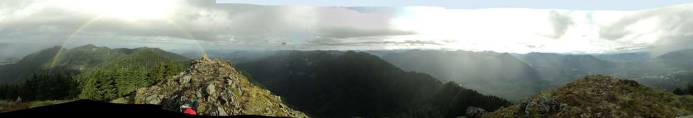
20161231 8.3mi, 620m | Twin Falls, Ragnar |
I was clearly aiming for the 300th mile here and wasn't in the mood to do anything too silly. There was considerable new powder even on Mt Wa new trail, so I was concerned about being able to make Change Peak and opted for Ragnar instead.
Spikes were sufficient. While I suspected trails above Ragnar, I was not able to find anything considerable.
WTA Trip Report
pikae pictures
|
20161224 9.0mi, 1000m | Olallie Lake, Pratt/Granite Saddle |
Snowshoeing from the Granite TH to the Olallie junction, then onward toward Pratt saddle. Tracks ascended eastward before the Snowy Wren spot and went up to the ridge overlooking Upper Tuscohatchie (though I'll have to check the track to ensure that was the portion of the saddle we were on). After descending, we decided to check the GPS and head toward the Snowy Wren spot, but turned around there. It seemed reasonable to drop to Olallie for pictures, and we snowshoed our own trail eastward back to the main trail, then decided to continue upward onto the hill and parallel the main trail for a while southbound.
Brian E joined.
WTA Trip Report
pikae pictures
|
20161214 8.8mi, 1300m | Snoqualmie Point, Grand Prospect |
Snowshoes on one half mile past Stan's Overlook, but spikes were sufficient before that. Very faint trail past the first mile beyond Stan's, with considerable drifting in places (6--18"). Weather was 25--35F with 30kt steady winds aloft and 20kt gusts at the surface, sufficient to wipe out portions of my track by the time I had returned. There was no reasonable track approaching Prospect, and nothing whatsoever past that point. I continued one quarter mile, perhaps a bit more, past Prospect and found that they have clear-cut along the road leading up to some towers, which otherwise have never been visible from the trail. From that point it was possible to see Rainier as well as the tower at East Peak.
While the temperature was okay today, the area was one big windstorm. Often aloft, when the wind managed to drop low sustained or in gusts, things got cold in a hurry. Of particular note, my leather gloves are starting to fail at these temperatures; after stopping to take pictures of Rainier I was unable to warm them back up, even after five minutes, so I had to switch to the 'ski' gloves. My legs started to get cold on the way down, and my toes during the last 2--3mi, as I was only wearing light thermals and goretex on the bottom, plus the gaiters while snowshoeing. Fortunately I had medium thermal layering on the top, so I kept my core temperature.
WTA Trip Report
pikae pictures
|
20161203 8.4mi, 1200m | Zig Zag, Fuzzy Goat Mountain Road |
Snow, snowing, snowshoeing, oh my! Indeed, a mini snow rescue was required here... when Spike fell underneath the truck (at the summit) and had to be dug out.
WTA Trip Report
pikae pictures
|
20161124 12.4mi, 1490m | Tiger Mountain |
#OptOutside
Tradition Plateau (main parking), Tiger Mountain Trail, K3 Trail, WT2 trail, WT2, old WT2 summit trail, Tiger Mountain Trail, junction with One View Trail, junction with Hidden Forest Trail, Wally's Glen, Lone Rock, 15-mile railroad grade, junction with Tiger Mountain Road, Paw Print Connector, Boot Path Trail, WT1, Preston Trail, West Tiger Railroad Grade, Tiger Mountain Trail, WT1, Section Line trail, Nook trail.
Rain hike. Rained most of the the trip (as was expected). Sadly it did not cool down as much as anticipated overnight, so I was overdressed and too warm for most of the trek. Despite being tired and behind on stretching, I maintained above 2mph for the journey.
WTA Trip Report
|
20161119 11.7mi, 1520m | Dixie Peak, Mount Teneriffe |
Estimated 5mi+ in the snow. Slow going overall, particularly with the route finding on Dixie. The trail disappeared into the trees after a snow-covered rise, so I turned back. How close to the summit I was, I do not know (but I know now that the trail did continue on the other side of the rocks, kinda a climb down).
WTA Trip Report
pikae pictures
|
20161113 5.2mi, 630m | Little Si |
After roughly 650 miles, the light hiking booties are almost dead. I decided I would try to switch back to my heavier Asolos (Powermatic), so this hike was primarily to determine if I could even walk in those boots, if they would rip my feet open, and so forth.
Rain was to arrive ~1000, so I also wanted to keep this short. It started sprinkling near the end.
WTA Trip Report
pikae pictures
|
20161108 8.3mi, 1220m | Granite Mountain |
This was a clear day nestled in an autumn that has been rather wet all around. As such, it seemed appropriate to take a day off from work and visit a mountain. Indeed the morning temperature was a balmy 47--50F, quickly rising to the high 50Fs and lower 60Fs as we raised the sun. The summit was in steady winds to 20mph at 9am, and was still holding fairly cool in the lower 50Fs.
WTA Trip Report
pikae pictures
|
20161106 8.5mi, 900m | Rattlesnake Ledge to East Peak |
Just a quick jaunt in the mist. Trees down across portions of the upper trail.
WTA Trip Report
pikae pictures
|
20161022 17.5mi, 1540m | Zig Zag trail, Hall Creek Road, Hall Peak, Mt Washington, Change Peak |
WTA Trip Report
pikae pictures
|
20161011 11mi, 1710m | Mount Defiance, Bandera Mt |
WTA Trip Report
pikae pictures
|
20161008 7.9mi, 750m | Snoqualmie Point to Grand Prospect |
Just a quick exercise jaunt today as it's supposed to be a rainy weekend. Given the minor amount of drizzle in the forecast, and the retained heat (high 50Fs), it seemed best to pick something close to towne that afforded a short roundtrip time but still provided some exercise.
Average speeds: Ascent 3.03mph (504m/hr), Descent 3.57mph (610m/hr).
WTA Trip Report
pikae pictures
|
20161001 10.4mi, 1250m | McClellan Butte |
Initial numbers suggested that I ascended 14% faster today than the 2014 November hike, roughly 21min faster overall getting to the summit. The final human-sized cheese grater on McClellan is not the best terrain over which to provide a comparison, so I'll collect the ascent times to the bottom of the human grater from my past hikes; all start from the lower parking lot and ascend the John Wayne trail route (as opposed to the northwestern "McClellan trail" loop on the old road):
| Ascent Time | Descent Time | Descent/Ascent | Ascent rate | Descent rate |
| 20120909 | 2hr24.88min | na | na | 489m/hr | na |
| 20131005 | 2hr55.54min | 2.048hr | .70 | 390m/hr | 558m/hr |
| 20141101 | 2hr25.96min | 1.654hr | .68 | 471m/hr | 692m/hr |
| 20161001 | 2hr10.13min | 1.754hr | .81 | 519m/hr | 642m/hr |
WTA Trip Report
pikae pictures
|
20160910 6.7mi, 1060m | Red Mountain |
This was less difficult than my first ascent of Red. While we still missed the trail turnoff across the chute, there was no particularly difficult climbing.
Brian joined.
WTA Trip Report
pikae pictures
|
20160904–05 17.1mi, 1475m | Talapus, Olallie, Pratt Lake, Little Tuscohatchie, Melakwa Lake |
First overnight trip (in decades?) with the new tent and gear. The backpack managed most of the gear, but is definitely not big enough.
I made really good time Sunday morning, arriving at Tuscohatchie shortly after 9am. A few were still packing up but offered me their spot, leaving their tents behind as they left for their day hike (Windy Lake?). I set up and took a nap for 90min+, then got up and attacked Melakwa in the early afternoon.
WTA Trip Report
pikae pictures
|
20160802 11.2mi, 954m | Kendall Katwalk |
Long story on this one, and a long day of hiking as well.
Having concluded the exercise hike to Gem, I decided I'd stop by PCT trailhead and meet Brian E. He had spent the night at one of the lakes past the Katwalk, and it was early enough in the morning when I finished Gem for me to meet him as he hiked back. Indeed, his car was still in the parking lot.
Given that the drizzle was fairly constant, I took the full PCT ascent trail which is safer and less slippery than the Commonwealth Trail in these conditions. I had also sent him one or two messages via SMS to let him know that I was there. Knowing that he prefers to sleep in, I estimated meeting him somewhere near the Katwalk, perhaps a bit on the ascending side.
Continuing to ascend, it became more probable that we had passed, even though the Commonwealth/PCT separation is only about 45min worth of hiking. Nevertheless, I reached the Katwalk without having seen him. Wind was a steady 20mph wall of fog and drizzle, and everyone was hiding in the lee of the Katwalk. I chatted for a few minutes and left.
Indeed, Brian had already gone, at least his car had, and I confirmed later that he had arisen much earlier than expected.
WTA Trip Report
|
20160802 9.9mi, 998m | Gem Lake, Snow Lake |
Quick jaunt to Gem Lake, and while there was no considerable rain, it was drizzly and cool most of the time.
WTA Trip Report
|
2016, July | |
Hot. Awful icky weather.
|
20160711 5.6mi, 895m | Js Landing, approach to Hall Pk, Hall Pt |
Very sad, this word "approach", but I was not able to make the ascent to "Hall Peak" via this route today. The wet weekend meant that rocks and grasses were still damp. I'm not rightly certain where "J's Landing" is located, but I took that trail (for the first time), crossed over the old FS road, and then proceeded up the ridge (officially a draw). At this point, it can only be called a bootpath, though there are some more established segments. The bootpath becomes high class 2, then a goatpath, meaning class 2 with some dropoffs, then eventually a goat trail, meaning class 3 with dropoffs. I turned around at a spot that was high class 3 and looked a bit like a miniature McClellan Cheese/Human Grater, with a 100ft drop on the downside. Low clouds and fog obscured the view making it impossible to estimate distance to the target other than by dead reckoning.
This route demands some attention. The west faces are mostly dropoffs (several hundred feet into the trees), though the east side slopes down to the old roads. Unfortunately those roads are overgrown and do not ascend around to the target. At today's turnaround spot, I descended east very briefly to search for a route under the class 3, but it appeared that any lower trail would have hit a cliff. A quick check suggested another 600ft ascent and 0.6km from this point to reach "Hall Peak", which is close to my estimates while on the trail. Unfortunately, that could have well been another two hours of climbing, depending on conditions, and getting back down that route could have proved troublesome. There was also no easy way to see around to the next movement past the class 3 because of the drizzle and fog; if it was all easy meadow climbing past that point, oh whell. The next time I'm at "Hall Peak", I'll have to search for the descent path to see how close it comes to that mark from the south.
This is definitely a nice little trail, and acceptable in reasonably dry conditions if one takes their time. In fact, it was quite a good deal of fun in places --- those scared of heights should turn around after getting out of the trees. I'm rather sad that I wasn't able to punch through.
Attention on the trail should be to the route and options on the draw. There are a few places where a lower bypass trail is more appropriate than passing over rocks. If you have to turn around, you'll want to know where to reconnect to those bypass trails.
WTA Trip Report
|
20160625 12.8mi, 2470m | Mailbox Peak, approach to Dirtybox Peak, Mt Si |
I lost over four pounds today.
Double/trip summit, from two different trailheads. Approach to Dirtybox was difficult because of rain and clouds, and I eventually turned back hoping to meet S Kubacki on the Mailbox summit. Indeed I found him there --- fortunately it had stopped raining --- and we descended together, him showing me the shortcut trail down the spur. Afterwards I felt well enough to join him on Mt Si.
WTA Trip Report
WTA Trip Report
|
20160617 5.1mi, 180m | Oak Openings, Toledo, OH |
Ridge Trail, Evergreen Lake Trail. During a visit to Toledo.
Sheesh this place is flat.
|
20160612 6.7mi, 800m | Tigger |
High Point Trail, Tiger Mountain Trail, WT2, Tiger Mountain Trail, K3 Trail.
The intent was for a quick exercise jaunt up the K3 trail to WT2, with a possible extended return route. Alas, some of the signs are less than accurate in this area, so I ended up east of the intended trail, so the ascent took extra time. I was hoping on 2hr round trip, but it ended up being three. Another aspect of the curious endeavour was that I took an additional 10lb of water weight with me.
Due to the delay in getting to WT2, I decided against any further stumblings around, and returned by way of the K3 trail. I have been at the upper end of K3 once, but never at the lower, and there are no signs on the High Point nor TMT approaches that identify the route to the start of K3. I had checked the map beforehand, but the online map is out of date and does not reflect some of the rerouting that has happened on the TMT due to bridge issues. On a previous trip, I took the old route and crossed the site of the old bridge (including the landslide area); this time, I opted to follow the TMT reroute across the new bridge, which also added more mileage.
The morning stayed fairly fresh and cool, so having an extra hour of exercise was not that bad. I saw no one anywhere on the trail... except in the last five minutes when I passed a couple and a solo coming up the High Point trail.
WTA Trip Report
|
20160611 8.6mi, 1190m | Dirty Harry's Peak & Balcony |
Compared to the rounds of 90F weather that we've had, the last few days have been bearable. Thursday night saw a great deal of rain, bordering on thunderstorms, that continued through parts of Friday. Some slush remained on the trees and shrubs near the top of Dirty Harry's Peak, and the first round of rain passed through early, between 6am and 10am. Near the end of the hike, most of the precipitation was at slightly higher elevations (above 2000ft), and was probably falling from the higher atmospheric layer that was hovering around 32F.
Those conditions meant that I got completely soaked. My leather hiking gloves were so saturated I was stopping to drain them; eventually it was difficult to keep my forearms warm, so I had to swap the gloves for my backup runners mittens. The Goretex jacket didn't fare much better, as rubbing up against trail-encroaching foliage was enough to keep cooling down any warmth that had built up. I didn't bother to put on rain pants or gaiters either, so my body was wet from the waist down, and the plants were wetting my socks and saturating my boots.
Needless to say, I didn't bother to attempt "Commonwealth Peak" today, because the bouldering involved likely would have been dangerous. The clouds were also very thick at that elevation, so visibility was poor. It may have been possible to attempt the "Webb Peak trail", but I decided to get back down the hill and out of the rain.
I took the climber's trail to the balcony. Sadly, this may also be the last time I take that route for some time. It seems DNR+WTA have posted trail closures for the final section leading to the balcony, and are planning to turn it into the main trail, rerouting the bulk of the traffic off the existing Dirty Harry's trail, which is the old logging road. The rocky, stumbly, practically-a-river mess has been flattened quite a great deal, as they've already moved up a small digger; it was sitting near the balcony connector trail. Whether or not this trail closure is annoying, I don't quite know...
The climber's trail, or "Birdhouse trail" can be hard to navigate in places, as there are a number of side trails to bouldering spots. It generally is a "nicer" trail, in that it's mostly a proper forest trail, and has some areas of "boulder staircases/paths". It's steeper in places and the footing is a bit questionable, particularly on a muddy day like today. The route certainly goes over several small hills, so some of the distance is spent losing altitude that you've already gained. Today's data suggest that this route, compared to the old road trail, is: 100m shorter distance overall, 160m shorter map-distance (two-dimensional), 110m greater ascent.
WTA Trip Report
|
20160513 4.5mi, 485m | Rattlesnake Ledge |
Parents' visit to Seattle included a jaunt up to the ledge, in 80F weather.
WTA Trip Report
|
20160507 5.5mi, 1000m | Putrid Pete's Peak |
Took S Kubacki to a new peak.
WTA Trip Report
|
20160430 7.2mi, 1200m | Hall Point, Hall Creek Trail, "Macchu Picchu Trail" |
Having been ill for the past five weeks, I decided to start with something simple. My plan was to ascend to Hall Pt, then return to Hall Creek and visiting the (lower) falls. Having coughed excessively for a few minutes atop Hall Pt, I felt well enough by the time I got to the falls to continue along the Hall Creek trail. I had previously walked that way only far enough to get an initial track, but decided I'd continue along it until I was tired, figuring that it continued until the upper falls.
Indeed, the Hall Creek trail continues a great distance. After crossing the creek twice, it appears as though some areas of the trail are still under construction. There are many cut trees strewn about, and branches are over various parts of the trail. Eventually the trail reaches a signed turn-off for the "Macchu Picchu trail", but shortly thereafter I reached a creek crossing that I felt was impassable today. I made several attempts but footing was not possible; it will be necessary to roll some boulders into the creek, at least to get minimal footing on something that isn't covered with water mold and slime. Apparently that trail is very near the lower Zig Zag road, but it's not guaranteed that the creek trail connects with the road whatsoever.
Returning from the creek, I decided to obtain a track on the "Macchu Picchu trail", which I enclose in quotes only because I doubt I had magically been transported 5200mi south. Indeed, this trail ascends to the middle section of an old forest service road, which is currently well overgrown. Travelling southeast on that road (current estimate 1mi) will lead to a junction with the upward section of the Zig Zag road. The westward direction should lead around the east side of the Hall Peak ridge. Apparently there is now a boot path leading down from Hall Peak, across "Easter Landing", and heading directly down to "J's Landing", for which there is apparently a trail directly down to the Hall Pt / Change Creek trail. It may be necessary to attempt the loop at some point. Presumably the boot path is still under trail construction in places.
WTA Trip Report
|
20160330 5.1mi, 400m | Glen Canyon Park, Mt Davidson |
San Francisco.
|
20160328 4.2mi, 475m | Lands End Trail, Eagle Point |
San Francisco.
|
20160325 8mi, 1025m | Putrid Pete's (approach), Ira Spring Trail |
Snow! On the ground and in the air. Alas no snowshoeing.
Hiked to ~3800ft where the trail crosses a small avalanche chute. Checking a bit to the north, the trail sits between two chutes at that point. The map and satellite suggest that continuing north to the 4200ft level and cutting east to the draw may be possible, but I had no GPS track on hand and was not willing to cross the chute given unknown conditions at higher elevations, coupled with a moderate+considerable avalanche forecast.
There is a wide area of avalanche damage near the western-most arm of the trail at lower elevations (~3000ft). While this does not appear to have knocked down any trees, it's clear that it carried blowdowns and underbrush from the upper portion of the chute.
There are many large blowdowns across the trail, some of which require alternate routing to bypass. Trees and branches are down starting at lower elevations, before the junction to Dirty Harry's Balcony.
With overnight snow, route finding skills are necessary above 3000ft. Previous experience with the trail is recommended. (This was the first time I commented that marking tape would have been useful, in order to find my way back, as it was still snowing throughout the morning.) You must be able to recognize the trail under detritus, small branches, and through tree limbs, and that underneath several inches of snow.
For extra exercise, I went toward Mason to ~3500ft and cleared some of the branches from the trail, and uncovered a few saplings that were being crushed by fallen branches. The snow was set in interesting shelves at that level, firm, but collapsing in places. Overnight and morning temperatures were considerably higher than modeled, what seemed closer to 40F than 30F. Daytime rain and solar heating were softening the area quite a bit.
WTA Trip Report
|
20160305 14.0mi, 1300m | McDonald Mountain |
I finally found a reasonable path that avoids the logging detritis. More information forthcoming.
Lots of bootpath and bike trails on the lower section, which appear to avoid the numerous switchbacks made by the road. I took the road during ascent, but there were multiple appearances of trails on the upper section so it was difficult to determine which might be a valid shortcut trail on the way day. As such, I stuck to the road on the way down.
Spent about 20min bumbling around in the logging area. I had hoped to find a route through just before the downed trees, but there is so much underbrush that the road is invisible. Moreover, my memory indicated that I would have had to travel east along the logging line quite a ways to get near the road, and I didn't want to have to go through 1/4mi of wet underbrush. As such, I turned around there. On the way back, however, I headed north off the trail through a sparse part of the forest and ended up only about 75ft from the road. In particular, it seemed to be at the junction of two roads, and I certainly came back that way and found a route through that was only about 50ft of shuffling through the branches. This route is much preferred, though I can't speak to it in the summer. It's past the first tree pile (I tried there as well) heading downhill slightly, probably about 60% of the way to where the old road starts ascending again toward the logging. At that point, where it ascends, the underbrush turns into a bunch of reeds and impassable scrub, so you'll know if you've gone too far.
WTA Trip Report
|
20160226 5.7mi, 1300m | Mailbox Peak |
Old trail up, old trail down.
Ran into Steve Kubacki as he was ascending the boulders and rounding the final treed corner. He was deep into meditation with headphones --- and, perhaps, stoned --- and sweating like a mule, but we stopped and chatted for a bit.
There were quite a few people around, in fact, and lots of the guys were chatty or downright flirting. One guy in a group of two at the summit was all smiley with me, but I played a little bit hard to get and he responded with sparring. For example, he asked if I would start doing mountain running and I said that my body would probably fall apart, to which he responded "You make it sound like you're an old man". Things like that. Maybe he was just overexcited at having made the ascent. I don't understand.
Descending I crossed paths with this kinda cute guy in a group of three (two men, one woman). I of course got out of the way, smiled and said hello. After he passed he stood there talking to me, even to the point that his friends were standing there waiting for a couple minutes. He just kept talking to me; he was definitely flirting with me. About two minutes in I noticed he was wearing a ring, so I wrapped up that conversation. I don't understand.
WTA Trip Report
|
20160213 11.4mi, 1170m | Tigger |
DOT, Preston trail, Bootleg trail, Paw Print, Tiger Mountain Trail, Lone Rock, WT2.5, K3.
All new trails... (meaning I've never been on them before).
"Lone Rock" seemed an appropriate place to visit the day before Valentine's Day.
WTA Trip Report
|
20160126 9.3mi, 1060m | Tig(g)er: Nook, Section Line, WT3, WT2, Seattle View Trail, RR Grade Trail, Poo Poo Point, Poo Top Trail, Bus Trail |
Having been ill Thursday through Sunday, I skipped my day-off-Friday hike. Indeed I90 was shut down on Friday due to a snow slide accident and cleanup, starting at MP34!
I was still under capacity today and out of breath. At times, I wondered if I would have a heart attack heading up the trail.
They've moved the cable line trail. I arrived to find it all fenced off, but the gate was open so I went to the parking lot at took the nook-section line approach. Skipped WT1 as I was slow, dehydrated, out of breath, and so forth.
WTA Trip Report
|
20160112 5.5mi, 600m | Wallace Falls |
After Saturday's ankle-mourning trail, I decided it would be nice to stretch my legs a bit. With a forecast of rain, Wallace Falls seemed like a nice choice, particularly as I had never been there before.
Made the Upper Falls, but the upper trail was under construction so I turned back. Brief extension as I looped the mini-falls interpretive trail on the return, haha.
WTA Trip Report
|
20160109 10.5mi, 1350m | Kamikaze Falls, Mt Teneriffe, Teneriffe Road |
The ascent took considerable time because the trail had been fouled that morning. A group of five guys started early in the morning, carrying basically no gear whatsoever, and ran to the top, punching holes in the entire snowshoe trail. The trail surface was still visible where they had not destroyed it, and it was solid for snowshoes. I was able to stand, with snowshoes, on the snowshoe trail even where it was only a few inches wide. Unfortunately, the majority of the trail above the falls had been decimated, so the entire ascent was a terrible mess of ankle-destroying torture. It was all I could do to not yell at the fools on their way down. Not only had they demonstrated a complete lack of etiquette, they were not prepared for any contingency; I wished for a snowstorm to trap them (no food, no traction, a few bottles of water).
On the descent, I passed a father/son pair approaching the north Teneriffe Road saddle. They lacked snowshoes --- again, having destroyed the road trail --- but were otherwise prepared.
Further down the road, I met an ascending team of four, two young women, two young men (college age or younger). At 2500ft, at 1330, on their way up. They appeared to be moving ~1mph. When asked, they said they had been hiking for two hours, which would have been 1.5mph. At that rate, they would have needed 2.33hr more to reach the summit; given slowing with conditions at the top, it's unlikely they arrived at the summit before 1600. They would not have made it out before dark in any case. I saw very little gear; one guy was carrying an ice axe, at least one woman had gaiters and was carrying a huge camera around her neck. I don't know how much food/water they had. She said, "He doesn't have the best boots" about the guy that wasn't carrying an ice axe; he didn't have spikes on his feet. Didn't see any poles either. I assume they turned around after getting pictures from the road; at least, I saw no stories in the news later.
Further down the road, young couple, they had come from the Mt Si parking lot, said they had been hiking about an hour. Probably met them around 1700ft, which gave them about 4.6mi to go, and 3000ft of ascent. Even at a solid 2mph they would not have made it before 1600, but they seem better equipped.
People need to learn to share the trails. Skiers don't like their trails fouled, so snowshoe off to the side. Snowshoers don't like their trails fouled, so chimney off to the side. If you glissade, do it somewhere else so the hikers can descend normally. Here's another report --- different wta hiker --- complaining of idiot lack of etiquette: http://www.wta.org/go-hiking/trip-reports/trip_report.2016-02-02.0478121222
WTA Trip Report
|
2015 | | Hiking log from 2015
|
2014 | | Hiking log from 2014
|
2013 and earlier | | Hiking log from 2013 and earlier
|
|