|
Hiking Log
Hiking Locations
Data Analyses
Pictures
Recent Changes
|
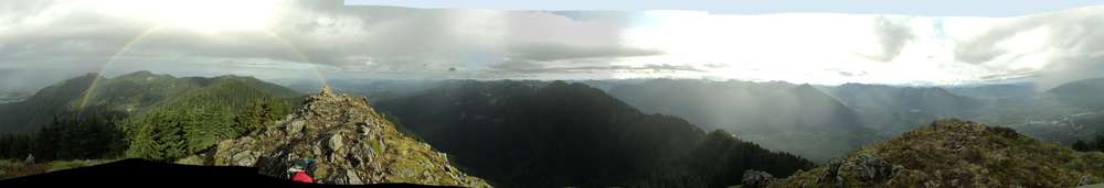
20251017 11.8mi 1050m | Rattlesnake Mountain, Grand Prospect, East Peak, Turkey Spot |
...
|
20251004 15.3mi 775m | Annette Lake, Snoqualmie Train Tunnel |
...
|
20250920 10.5mi 1245m | Mt Defiance, Mason Lake |
Well, it's still the middle of summer. 60F in towne this morning, with a few cooler spots on the drive reading around 45F, but the base of the ridge was probably close to 55F. It was near 80F toward the end of the hike, though being in the trees helped. Still difficult to stay hydrated.
Lots of frustrations, in fact. It was cool enough but just on the warm side. The creek trail is still signed (department of agriculture, closed to all use) so I had to go the long way, extra distance, extra elevation, and that trail is like blacktop (hardness). Started 20min late, which meant more sun, but I believe I escaped with near zero sunburn despite not wearing any sunblock, since I had on the hooded shirt; maybe a slight burn on the legs while on the summit. Chatting with people on the trail also added 15min, plus the 45min for the longer route. I don't know if 1.5hr would have mattered in the end, but for some reason they decided to work on I90 today, so it took over 1.5hr to get home (from exit 45). How a single lane closure heading into Issaquah causes a 25min delay with all three lanes moving 3mph, I'll never understand.
Moving on to more exciting things, no pika this morning, just birds and a squirrel or two. Pika were audible, but not visible. Saw something like an osprey at one point.
Handful of cars in the parking lot when I started. Turns out one did the full loop up Putrid, then Defiance, and started around 4am; how I beat them to Defiance I don't know, but I suspect the goat path on the ridge is part of it. Absent the creek trail, the PPP-Defiance route is actually shorter, but I have no idea about those ridge conditions. I only saw one tent at Mason, but there was at least one car still recognizable in the lot from the morning, so some may have gone to Island/Rainbow. Oh yes, and one solo hiker descending Defiance said he spent the night at Mason.
Hike was the usual, at least recently. I kinda burnt myself out getting to the lake, so when I started up the Defiance trail I had to start pacing. I was slightly below 2mph average when I reached the summit. Still need to check the overall numbers. Hard to stay hydrated, but I did get extra water on the return. I figure I had 1.5L on the trail, and almost depleted the main pouch. Given these temperatures, probably need to double that.
|
20250831 12.8mi 1070m | Kendall Katwalk, Ridge Lake |
Sadly we're still having heat waves. This was only a slight reprieve with the base temperature hovering around 60F and no cool air until hitting the upper boulder field. Even that only lasted a few minutes, so most of this hike was 60--75F with very high humidity. I managed over 2mph on the ascent and for the entire trip, but it ended up being rather painful. I couldn't stay hydrated with the heat+humidity, but couldn't drink anymore water without feeling "sloshy".
Started with a headlamp, yay!, only needed for 30--40min but it's a good sign of better days to come. Fairly steady pace and reached the junction with the PCT in the expected time. Most of this approach is fairly easy, always surprised that it's less ascent than Snow+Gem, but the large switchbacks get quite annoying, particularly on the descent. The final, northern arm to the Katwalk is also always 5--10min more than expected, but I arrived and it was actually clear, not humid, and not too overheated at the Katwalk itself. Perfect conditions lasted for a few minutes only today, I'd guess. Had the place entirely to myself, and, for that matter, when I came back later it was also empty.
Despite the non-popularity for the day, the parking lot was half full when I started. Presumably all overnighters, including two sleeping bags near the picnic tables at the entrance, I saw two descending early that were likely overnighters, but they were rather far up the trail, way up the long southern switchback. Multiple tents starting on that switchback, and a couple north of the southernmost point, but no one was up and about. First large group was descending the uppermost cliffs near the northwest point, and otherwise a few random solo hikers. Presumably all were at Ridge/Gravel for the long weekend. After taking a few pictures, I decided to continue to Ridge to fetch some water, worried that I'd run out in the heat.
Ridge still held several groups, including two tents on the south side of the lake still set up in the morning. Water was on the shore only, a bit difficult to fill the pouch (this is where a large nalgene would help), but I managed to get 1.5L that aided the descent. The climb back up from Ridge started slow, calves and quads were already crampy and sore, and the right foot specifically was trying to become annoyed. I seem to recall at least half a dozen passed me, closer to the talus/boulder fields east of the Katwalk, so presumably more were spending Sunday night. Two trail runners as well, who I expected were going to Alaska, but they never passed me on the return so who knows.
Half the usual crowds ascending below the Katwalk, but honestly I didn't see the usual crowds or types of groups expected. I suppose all of them got here earlier in the year.
Descent was mostly uneventful, but I needed poles maybe 10min after the southernmost switchback, to start taking some of the pressure off my right foot. Made it the rest of the way with that setup, so I'm around 10mi still before needing to change insoles, at least with these elevated temperatures and humidities. Below that point there were very few people, in fact. Crossing the commonwealth stream still requires rock hopping at this time of year, and it was actually cooler down in that forest for a few minutes.
I saw at least six pika, but they were quite mobile and I couldn't catch many/any on camera. Hoping there's at least one picture that isn't blurry.
|
20250816 10.7mi 1030m | Snow Lake, Gem Lake |
Pika pika pika! The pika were quite happy with the weather. I suspect they hid overnight with the 3in of rain starting the previous evening, and needed to stretch their legs. The continuing morning clouds and drizzle probably provided sufficient cover that the pikae felt safer being out and about; less likely to be spotted by a hawk. Perhaps they simply felt it was still dawn. I spotted at least ten separate pikae, heard at least double that amount (but saw no motion), had the camera out for four of them, caught two on camera, but one of the pictures was too blurry. One was below the trail on the left, ran around, stuck its head out below a rock and glared out me, then disappeared before I could get the camera.
Friday was a day off, but with summer allergies, lingering dehydration and muscle cramping, and just general depression, I decided I would use Friday to recover and sleep. The Friday rain arrived around noon, with the second, major round starting in the early evening and continuing all night. I suspect nearly 3in, but the only difference between Friday and Saturday morning was probably the water/mud on the trail. Both mornings were still overcast, cloudy, drizzly. Yay.
I arrived 45min before sunrise, which was a bit early. Cars already in the parking lot suggested overnighters, but presumably most of them failed to check the weather forecast. Tent count at Snow and Gem suggested only four main groups, though there were perhaps twice as many cars in the lot. While I was preparing, there seemed to be three other arrivals, but they didn't seem keen on hiking, just rambled around the parking lot reading signs and sitting in their cars. None of them caught up with me, and I didn't really see anyone on the trail resembling them. Of the overnight groups I spoke to one; a handful were out of the tent when I passed, and I caught up with them during my descent. It was two brothers who had visited before, but this time they invited their families; haha, poor guys said it was an interesting night with all the rain. I got the impression they didn't exactly stay dry, but at least their tent was on a high spot.
I started without headlamp, perhaps 15min before sunrise. Very light drizzle in sparse waves, mostly for the first 20min then holding off until reaching elevation up around Gem. Sadly it was 55F at the start, which was something of an impediment. Stream crossings reflected some of the overnight rain, but the trail generally wasn't very muddy. Of considerable note was the rain water coming down the trail to the ridge; the upper section was a 1.5" stream, which usually only happens mid-Spring. The stream crossing at Snow was fine. The wettest part was between the east Snow overlook and the tree bridge crossing; those sections were larger, deeper puddles in places. The trail to Gem was wet in some places, some flowing water in the usual places. Only the misdirection, off-trail routes were truly wet; at one point I ended up completely dunking, and getting my arms soaked from the brush, and then found it wasn't the trail at all.
I was eventually passed by a trail runner a bit under 1mi from Gem, having seen no one else on-trail (and only the single overnight group active, though I heard voices from a second site). I didn't see him at Gem (figured I would have seen the bright colors across the lake based on timing), nor did he pass me on my way back, so he either went to Wildcats or Wright or both. No one passed me on the return either, so while I was being more methodical --- six weeks since my last hike?! :( --- and not worrying about setting records, I seemed to still be in the fastest of the fast group.
My timing was perfect. At Gem I stopped to take pictures. Clouds were spotty so I could see Wright mountain, could see into the Snow and surrounding valleys. I decided I was close enough and walked around the lake to take pictures from the opposite shore, and that helped solidify my decision: No, getting up Wright mountain would have not been fun. First it requires going through lots of underbrush, much of it the one-foot-height stuff that would mean completely wet feet, but of great concern I don't really remember the upper ascent trail. Being a goat path, I was worried about slippery places on the wet rocks, and decided I could turn back. I'm glad I walked around, however, because that's where I found the patient pika that only twitched its nose while I got a 3d shot!
After starting my official descent from Gem, I started to encounter people (before getting to the first boulder bowl, in fact). Within five minutes, visibility dropped from 20mi to 1mi or less, and glancing back I saw that everything was covered; mountains gone, drizzle started, heavy fog, and it continued all the way back to Snow. Probably 20--30 people heading up to Gem, at least four with overnight packs, and they probably got no pictures. :D Well I was silently laughing anyway.
Snow Lake was grand central station. Over 100 people, some in the lake, but very few past the east overlook. Drizzle was still in the area, but it was getting up to 60F with some sun breaks. Wind had been 5mph most of the day, with a few 15kt gusts at elevation. I passed a couple groups ascending to the ridge, but mostly kept a steady pace. Gave right-of-way to most of the uphills to the ridge, but fortunately had the majority of that descent to myself. Below the junction there were quite a few more groups, another hundred heading toward the lake. I did some slower running in the last mile.
|
20250704 1.7mi 135m | Swan Lake |
Rock Rabbit Lakes, checking after the fact, according to global satellite imagery should be accessible, but I was not able to find the old road. It's likely I was a bit too far up the S-curve of the road at the wrong pile of rocks, and missed the entrance to the old road earlier along the trail. Oh well, should have marked it on my GPS beforehand. Also, ONX shows the "main" road as decommissioned/closed after the parking/camp area, and though I did walk up that road a bit later in the day, I should have noted that it went for several miles into the hills and may have provided some good views.
Swan Lake is actually a nice spot. There was a fire pit there with some cut wood, 6" stuff at least. Several people passed camp midday, presumably having walked up from the junction with the main FS road, but it didn't seem like anyone stayed overnight.
The swan lake camp was very nice. Considerably less buggy than the previous night, but the mosquitos definitely knew I was there. I did some walking around while reading to keep them off, eventually put on some DEET lotion that stopped them from biting.
This connector road off the main FS road (1/10 difficulty) is itself fairly narrow. Though the tracks are cut for main 4WD access, it was getting fairly narrow in places. There are two primary areas where 4L or 4H-with-speed-bump is needed, and several washed out areas where a disconnected sway bar helps. Driving up to that main camp is really nice, however. 3/10 difficulty I'd guess, and it helps to be aired down, tires might go out on a few sharp rocks otherwise. I'm impressed no one else appeared, though there was one vehicle that spent the night down the road, maybe halfway up.
Day two of a 2dy+2night trip, the offshot road was narrow but a nice drive. I had actually stopped 100m downhill from the parking/camp area because I didn't know how much farther I had to drive, it was possible to turn around at that point, there was a fire ring there suggesting others had given up, and I felt like I had done enough gnarly driving at that point. I walked up the road, found the camp, and decided to go back and get the jeep.
Honestly the main FS road from Gold Creek all the way to this point, or the Snooze junction, was in really good shape. Below the snooze junction to the north things got much worse, more potholes, more washboards. Guess where I saw the most weekend camping warriors? That's right, every available spot on box canyon creek was taken when I visited Friday morning, but there were almost a dozen spots along gale creek road that were taken as well. These might be great places to visit in autumn. Honestly surprised that so many people would know these are here, especially since a few places had six vehicles, suggesting some rather large groups. There was a nice valley spot slightly downhill from the Swan junction (I don't recall if it was below snooze junction), but it was also very exposed so probably hot in the sun.
Overall a nice trip. I could have hiked more the second day, and actually hoped for a bit more involved 4wd work, but oh well. As far as FS road driving I did a lot, probably four hours total, with a good hour overall of narrow/4L stuff. The mine creek drive claims solid 3/10 and certainly takes more time. Perhaps the snooze route here would provide that level of difficulty, and I decided to skip microwave hill, figuring it was full of people/overnighters. Still, I might go back and give it a look, sadly there's just not a lot of hiking around this area except Lilian and Rachel lakes. Maybe Rachel+Rampart lakes, possibly Rampart Ridge, but it would be a long day.
|
20250703 9.9mi 1270m | Lake Lilian, Lake Laura, Twin Lakes, Mount Margaret |
This trail reminded me much more of North Cascades; I wasn't expecting this type of location along I90 and within an hour of Seattle. During the hike I was reminded of many different area trails, though perhaps I was just delirious: Granite, Pratt Lake, Pratt Mt, Tinkham Pk, Lake Serene, the Pear--Valhalla route, Mt Catherine, Thompson Lk, and so forth. Overall the geography, land cover, and trail conditions where highly varied, from old logging roads, to well developed pine forests, midrange ridges, talus and boulder fields, waterfalls, etc.
The beginning of the trail is slightly deceptive compared to the map, with most of the elevation gain at the start. Ascent rates slowly taper off on approach to the ridge, but the hiker should not be deceived at this point, imagining that it's only another 45--60min to the lake. The ridge run is straightforward though a bit narrow, but it's followed by a steep downhill and you realize that re-ascending will be steeper than the first part of the trail. Eventually the bottom is reached, arriving at Twin Lakes; this seems a nice area to spend a night, and there are some clear spots, though no one was to be found this Thursday. Deceptively the bottom has not been reached and down you go. The junction with the southwest trail is farther along than hoped, but eventually there is clear progress. Many online reviews say "You'll be surprised when the lake (Lilian) appears!". No, not exactly. I would say, "Since the lake has been 'surely only 25 minutes away' for the last hour, you will find it exactly where you expected it".
Likewise the descent to Lake Laura reminds you of future climbing on the return. You spot the lake from above and it feels like it must be 500ft down or more, but descend you do. Here there is one troublesome spot for navigation, but it you search around and push through the lake appears. Honestly if there was an uptrail to some of the falls this would be a more-visited area; there may be one near the top but I decided not to bother with that offshot trail. There's a single camp area but it was mostly a creek when I went through. Camping up on the plateau in the middle of the lake might be neat. Otherwise, up the hill you go, tromp tromp, and then up the hill to Twin Lakes, then up the hill to the ridge. It was getting warmer and I knew it would take a while, so I stopped to sip water frequently. Oh yes, that muddy stream crossing was the worst spot, coupled with a big snow slide that I went around. (Last available water on the return is from Twin Lakes, or Lake Margaret if you go that way).
The hike was what I wanted and needed. Working on increasing my endurance (mental as well as physical), hoping for longer times on the trail, this was the right amount. I didn't set a speed record here because I was trying to pace myself, and keep the knees and feet happy --- almost needed to change insoles, but I made it --- so I tried to stop and take pictures where appropriate. On the return from the lakes, I convinced myself, as planned, to ascend Mt Margaret. This trail was like Tinkham in places, rather steep but at least a bit muddy, so less likely to slide. There was one 50ft section near the top that was dry sliding dirt, so poles helped. The summit was more exposed than expected and gave some fairly good views. I could not convinced myself to also descend to Lake Margaret, and one pair indicated there still seemed to be some snow/snow-bridges on that trail (but I don't think they went that direction in fact).
Fortunately the weather was behaving. Low 50s when I started, it warmed up slightly on the initial ascent, mostly on old road and then exposed dirt trails. Entering the lower forest after 30min was most excellent and really demonstrated why we need green trees: It was almost raining under the pine trees because they had gathered up so much moisture from the overnight clouds. My timing and choices were also good: Had I done the summit in the morning I would have seen nothing, as the clouds really didn't disperse until I had descended past Twin Lakes. But the talus/boulder slope things were bright, and by Lilian the sky was mostly clear. Good pictures then, at subsequent lakes, and Rainier was out by the time I made the summit.
Perhaps "as usual", the descent took longer than hoped, haha. The lower trail seemed longer on the descent, particularly after exiting the nice green forest. The road itself went on forever, for, ever.
Day one of a 2dy+2night trip. The main FS road accessing Lilian TH from the west is very easy, any car can make it, a few potholes and washboards. After my hike I continued up the FS road northeast toward the Microwave Hill area, but proceeded north on "Gale Creek road" toward Snooze Peak. I stopped at an offshot arm, old road, but sadly it was entirely impassable, and the main stream crossed the road almost directly at the junction; given the 3ft dropoff in the road at that point, it doesn't seem likely than anyone has been that way in a while (perhaps a snowmobile). There were many other road arms along that route that appeared open, so perhaps I'm stupid for stopping where I did, but it was available, there was a fire ring 150ft in, and I had my privacy... except for the silly person driving in at 1130pm with their headlights on, haha. Lots of bugs though, being close to a stream, and the entire area was like an overgrown jungle, so I really didn't get any chance to sit outside and read for more than 20min.
|
20250628 8.7mi 630m | Talapus, Olallie, Pratt approach |
Very nice weather today, 52F at the trailhead at sunrise, overnight light rain, cloudy and foggy, with a forecast of 65F and clearing throughout the morning. Trees were dripping, so it was humid, but only light rained once. It must have rained some overnight, however, because some spots were muddy.
No one at Talapus early in the morning, and none overnight. Some fisherfolk at Olallie and four tents, but no one on the trails. Based on cars in the parking lot, some may have been at Pratt Lake. I saw a few people ascending the Granite/Pratt trail, very few between Olallie and Talapus, but it was a madhouse below Talapus.
Things did not go well, generally, however, as I was unable to stabilize the lower GI despite pit stops at the trailhead and 35min later at Talapus. I continued to the ridge cataloguing all the side effects, dehydration, muscle cramping, water sloshing, energy loss, lack of thirst or hunger, foot/nerve pain. Initial views at the Olallie overlook were a solid wall of fog, but having pushed myself past Talapus, past the Olallie day area, past the ascent from the lake, I decided to continue to the ridge saddle. My goal was Pratt Mountain, but with the fog and overnight rain, I decided that ascent would be no fun. Talked myself into starting down the Pratt trail, but descending things were still rumbling and the trail became muddy. After 5min I turned back, and that was the right choice. Despite views opening at the overlook, I continued to have energy dropouts, rumbling, basically the entire way home.
Oh. Whell. Did not improve my goal-number for the year; will try later.
|
20250614 8.9mi 1325m | Mailbox Peak |
...
|
20250607 12.9mi 1050m | Snow Lake (approach), Kendall Peak (approach), Commonwealth Basin, PCT |
Well this was successful but disappointing. As background, I only have a Northwest Forest Pass right now and had hoped to go to Wright Mountain, trying to be out on the trails for nearly 6hr before the outdoors become an 85F desert.
Unfortunately, I set up having read no trip reports nor having spikes. I made the saddle above Snow Lake quickly enough, though a bit sluggish, but found that it was solid snow down to the lake. Fetching my poles I decided it was too steep to descend very far at all and decided I'd trun back instead of slipping and getting injured. Spikes required, and it's probably good I didn't have them because everything may had been slush by late morning.
Hiking back I saw a small amount of traffic, not much for a sunny Saturday honestly, even though it was 9am. I decided to hop in the Jeep and drive the 6min to the PCT trailhead, and went up Commonwealth Basin. Ground snow within the first half mile, and trail snow within the first mile. The telephone pole/tree bridge is half broken now, but passable, with full snow on the trail after that. Reaching the next stream crossing I decided I didn't want to get my feet completely wet just to find the other side was worse or, worse yet, solid snow up to the PCT. I had thought to loop back on the PCT, but if the shaded boulder field and forest was all snow, that loop could have taken hours upon hours. Again, then, turn around.
On the walk back, though some rather deep mud in one spot, I said to myself that I could proceed up the PCT from the early junction, and turn around whenever. I was surprised to find no snow, one small water crossing and then a 25ft+ section in a waterfall. I ended up passing the Commonwealth junction but snow appeared within 0.25mi. Around 0.7mi past that, starting up the switchbacks, was the start of the snow slides. I watched a group and a pair barely make it across, lots of scrabbling against the uphill side for balance, narrow/questionable foot placement, and decided I was done with that as well. :]
A little bit under 6hr, but I survived some 70F hiking (the last 1.5hr anyway).
|
20250531 | Lower and Upper Mine Creek |
Offroad trip and overnight.
...
|
20250524 12.0mi 1400m | Thompson Lake |
...
|
20250510 9.4mi 1040m | Lake Serene, Bridal Veil Falls, Memorial trail |
...
|
20250430–0502 11mi 850m | Colockum: West Bar, Cape Horn, Horse Canyon north, Horse/Brewton butte |
Approached Cape Horn from the southeast corner this time, searching for a route but eventually taking the old road. Despite an estimated 4mi route, reaching the actual summit is much closer to 6mi one way. It may be possible to cut off 1.5mi by taking the first spur up then cross country, but rocks may make it difficult. With high temperatures and no shade, the ascent takes considerable time.
Likewise the ascent up to the ridge between Horse and Brewton gulches was quite the crawl, a combination of the heat and cross country trekking. Moreso the heat because once on the ridge I was able to recover to typical speeds, but up a steep hill in the heat was rough. The later descent ended up being worse, down some talus slopes, small enough to slide in places, though a few spots had cobbles or small boulders that were a bit better.
Unfortunately I had to change my plans after Wednesday. Tekison Creek was flowing freely over Little Brushy road and there appeared to be mud before the bridge; being alone I did not want to get stuck, so I was not able to try out Sumac Spring this year. As such I went to Stray Gulch knowing that there would be a little bit of shade. That afternoon I checked the maps and decided I could do the loop onto the ridge and, as I was hiking that morning, gauged which draw to ascend based on the heat and hiking speed. That was the right choice because my arms were shot by the time I managed to descend.
After cleaning up I decided to get the tough part of the drive over with and returned across Brewton road and spent Thursday afternoon at the Tarpiscan upper camp. Happily there was still cool water in which to dunk some beverages, and still plenty of shade at that camp. A couple of snakes around that area, however, so watch out.
The plan was to hike east from the Tarpiscan/North Fork junction on Friday, or possibly drive a ways down that road, then hike to the Spanish Fort for some pictures and return. Unfortunately I was unable to get much sleep that evening and decided the even-higher temperatures for the day weren't going to be safe for hiking, especially since my arms were shot (think of poles as the "backup plan" when the legs and feet are done) and my legs were quite crampy.
Nevertheless, the trip was also about having an opportunity for some fun driving, and I was fairly happy with that. While I didn't drive on any new roads as such, it's a nice place for some mostly-safer 4L work. No mud puddles this year and no need for lockers (though perhaps the stream crossing would have been possible with them). The north entrance to Colockum road is actually much nicer and easier now; the old "gatekeeper" seems to have been blasted or something, because there's no 8ft rock to get up at the beginning. There are a few random gnarly areas, but the worse is still the stretch from Brushy Rd down into the valley. There's a hole on Brewton Rd, but eastbound was 4H 1st gear most of the way; only coming back west, which is uphill much of the way (500ft/2mi), needed 4L (2nd gear mostly, took my time). Road conditions looked mostly clear and less snow visible than previous years, so it may be possible to get up to 4500ft right now without issue. Had I spent the night at Sumac Spring, I was considering driving up Brushy to see when the snow started.
Zero people, zero cars. Nothing and nobody. There was one car camping within 500yd of the entrance, and I believe they were still there when I left, a hunter perhaps. Another hunter was starting when I departed, also close to the entrance. No evidence of anyone else anywhere.
For numbers, Horse/Brewton overland up the gulch was 2mph, ridge ascent was barely 1mph, overland on the ridge was 2.5mph, descent on the talus and rocky grass slope was 0.5mph(!). By comparison, uphill on Cape Horn was 2--3mph despite the heat, and downhill averaged closer to 3mph. Cape Horn maximum ascent was only 230m/mi, H/B ridge was 340m/mi up but the descent route was 500m/mi. Overall then, I guess I'd blame the speed on the heat, mostly, a bit on the long drive/exhaustion before the hike.
For driving numbers, from Wenatchee Costco to Yolo, into the park, and back to the pavement, was basically one-quarter of a tank, roughly 6gal (call it 8gal total to get back to the Malaga gas station). I dumped in my 5gal fuel canister right before getting back to the pavement. Going up to Sumac Spring probably would have used another 3gal (the initial climb up, then it's flat). Pure 4L climbing in 2nd runs around 5mpg, but most of the 4H uphills were 10mpg just like the highway, and properly coasting during the rolling sections saved a lot of fuel. Still, it should be possible to make Colockum pass direct, or even around Brushy, if traversing from north to south.
One amazing part of the experience in this area is "distance". Hikng in the cascades often means being in trees, or on a summit knowing that the surrounding areas are "far away" (since you can't walk directly to them). Here however there is no judging distance; everything is "just another 5mi" away on foot, and the general absence of trees makes it very hard to judge distance. It could be interesting to see what Naneum is like later in the year.
Happy with the trip despite changed plans. Some hiking, some dealing with/surviving hiking in the heat, some relaxation, some fun driving; no mistakes, rollovers, accidents, injuries.
|
20250419 14.0mi 1200m | Rattlesnake Mountain |
Snoqualmie Point, Stan's Overlook, Grand Prospect, Middle Tiger, Turkey Spot, Northwest Summit (Raging Tiger, Pacific Climbing Trail, Ferdinand the Bull).
...
|
20250405 9.4mi 1000m | Cougar Mountain |
Gobu cliffs trail, Wilderness Peak, Shy Bear trail, Quarry trail, Coal Creek Falls, Far Country Falls, Indian trail, Far Country trail, Deceiver trail, Doughty Falls, Long View Peak, Whittaker trail |
...
|
20250322 5.5mi 360m | East Keechelus (Thetis Creek) |
Zero people, zero snowmobiles. One set of week-old boot tracks abandoned approximately 0.2mi after leaving the main road.
Ascent on the main road was easy-medium, and I ascended in boots for the first 45min before needing snowshoes. Passing the junction with the main road heading up the ridge, the trail was unused. Other than the boot tracks, there was no evidence of snowmobiles heading west on this road this year. While the first hundred yards was straightforward, things became quite deep afterwards, and it's clear why the booted gave up. I was therefore breaking trail in knee deep snow (wearing snowshoes!), at times over the tops of the gaiters (so at least 18in). Surface was clearly layered from past snow events, so I would drop through the recent powder (8--10in), then push down the top layer (4--6in), and then if I stopped I would often fall through another layer (6--8in). Total 18--24in depending on drifting, etc.
Performance wise, what does this require? As quick numbers, my average was 1.5mph ascending in boots and snowshoes (2mph is preferred but oh well). For the knee-deep snowshoeing, I dropped to 0.9mph. The return to the junction was 1.25mph. One thing numbers don't accurately report: Junction to turnaround was only 70m of elevation gained, 85m of ascent, but if each snowshoe-shortened stride was 5ft, there were 1900 steps each representing an additional 18in of vertical change, roughly equivalent to 2900ft of ascent. That would be 950m/hr; I cannot ascend that quickly in general, typically topping out around 750m/hr in perfect conditions, and obviously pushing down through snow takes different but less muscular effort than a dirt hill, but it seems reasonable to conclude that the energy requirements for snowshoeing are effectively 20--50% less than climbing a hill of "equivalent ascent".
It would have been quite useful to have a buddy or two helping to break trail, because that may have permitted reaching the target. As is, I turned around at an appropriate time, in this case around 1hr of deep snowshoeing. More would have caused hernia, strained knees, nerve damaged feet, etc. Given the remaining 2km estimated to the target summit, I suspected it would have taken another 2hr to reach the summit; numbers seem to agree, 1.4hr minimum plus slowing down plus ascent.
Driving over the pass was fun again this morning. Road surface was equally bad, but this time a combination of snow and slush and bare pavement, but there were a few spots with poor visibility and of course people driving too quickly. 25--35mph with cruise control was mostly comfortable.
...
|
20250315 6.9mi 485m | Kachess (Gale Creek upper area) |
...
Zero people, zero snowmobiles. I saw no footprints during the descent, not even on the main road (around 11am). The first three snowmobiles and first three people appeared when I was roughly 15min from the parking lot.
Driving over the pass was fun this morning. 20mph maximum speed due to visibility with heavy snow. Road surface was packed snow and not slippery, but 20--30mph with cruise control seemed to be a comfortable speed.
|
20250222 5.6mi 270m | Kachess (Gale Creek area) |
Because of the weather this was planned to be a bit shorter than usual. There was a lot of lingering rain, sprinkling when I started, but I did manage to fit in between downpours. Overcast, cloudy, and some dripping during most of the jaunt.
I had hoped to check both arms of this trail, but stayed on the lower segment. The old road eventually ran out at an impassable creek, which I navigated around. Afterwards there was considerable overgrowth, trees in the "road", but I continued to an overlook of Gale Creek. This upper area was actually very nice, trees spaced apart, it would have been possible to snowshoe around on that portion of the hill for a while, but with the estimated arrival of the next downpour (2in of rain) I headed back toward the pass and went to visit a friend.
Nearly four miles of snowshoeing, though, starting from the old road. The snopark surface was solid enough for boots, but it was waist deep heading up the old road. Snow was rather soft, between yogurt and powdered sugar depending on location, cover, and how much water it had accumulated. Trees were bombing throughout the morning due to the high air temperatures. Sadly, the forecast high temperatures and rain in the next week may wash away most of the good snow. I did head off trail once for the fun of it, but the route is mostly direct so there are few places where it would save much time. I didn't have the old forest service map transferred onto my handheld GPS, so the connector to the upper trail was not clear; I don't even remember seeing it, just the lower/early junction, which is not the intended route. I don't know if I'll make it back this year to check the upper trail (unless it's in the Jeep after the snow melts).
Zero people, zero snowmobiles. The road appeared untouched, though there may have been some snowmobiles through two weeks earlier. While I descending I heard some, but they were going up the groomed area, as were the handful of people I saw midday, probably going to the state park area.
|
20250201 6.7mi 575m | East Keechelus Ridge |
Zero people today, and zero snowmobiles. Even as I descended I kept hearing them and thinking they appear soon, but naup they never did. There were some tracks much lower, but those were probably residents out running errands.
...
|
20250119 12.25mi 890m | Keechelus Ridge, Microwave Hill |
With lows below 20F for several days, it seemed an ideal time to try Microwave Hill. Getting up here never seems to be particularly easy, but with a frozen surface things go much faster. Fortunately conditions were favorable on the groomed road, though starting at 12F I almost had to put on my facemask. Things warmed up 5--10F once getting under the cover of the trees, and the ridge seemed to be warmer than the lower areas near the highway.
The northward ascent road was... a mess, like always. Only one set of snowshoe tracks, perhaps from earlier in the week, but those had frozen over so it was possible to continue with just spikes. After roughly 50min I checked my GPS and was moving nearly 2.5mph and expected to reach the upper hill in record time, closer to 2hr than the expected 3hr.
Roops, ten minutes later the snowshoer had given up and turned around. Surface was frozen, but only about 0.5in, and everything beneath that was still powder. There was no consolidation able to support boots, though I did try for a while. Between there and the middle ridge road, it was a mess: A combination of what appeared to be one snowmobile track, but very old, perhaps two weeks, that was also not consolidated; and what may have been a set of uphill ski tracks, that unfortunately wouldn't support boots and wasn't wide enough for snowshoes. Shortly after the track ended, it seemed time for snowshoes. The trip that would have taken 2.25hr... I suddenly had to add another hour onto the estimate, which wasn't very happy. (Took 3hr5min)
Things became quite difficult past that point. Given the conditions, it was necessary to wiggle all over the trail for footing and for efficiency. Overall snow is not very deep at this point, so there were still exposed areas of running water and gravel to get over. In a few places it was easier to go through the woods than dealing with the 3--5ft mini-hills/divots in the snow. Every three steps was a different problem, and honestly I probably only got 200yd of "good comfortable snowshoeing" during the 2mi to the upper junction. Past boot-only tracks had destroyed the trail probably two weeks prior, so most of the trouble was surviving the ankle destruction.
Overall I wasn't drinking enough water. There was no wind, so fortunately easy to stay warm, but I did stop for a few minutes and consider going back. Given that I was unlikely to return to this hill this year, and that I was less than an hour from the middle groomed road (and probably 1.5--2hr back to the parking lot at that point), it seemed safer to continue, the upper area being more likely to have snowmobilers. In the past the middle road has also been fully groomed, so that seemed a backup plan to getting back to the main road. (It registers as more distance on maps, there's no clear parking area, and usually it's full of snowmobiles and not the nicest place to snowshoe/walk).
With more breaks, pacing, and some glances at the GPS, I was able to will myself to the upper junction. Like all of the cascade false summits, there were a few spots that looked like the last leg, but of course there was still miles to go. :] Fortunately the middle and upper road was groomed, so I was able to continue just with boots, which was much easier on the feet. I managed to recover a bit of a good mood before the last switchback.
It is possible I was one of three people on Microwave Hill that day. Two snowmobiles arrived seconds after me, and we saw no one else during the time we were standing around talking and eating. Thank you Stacy and Jerry for keeping me company and telling me about your adventures, and checking one last time to make sure I was going to make it (and wanting to know my vehicle so you could check on your way out). Thank you also to the one family in their big 6-seater snowhouse/crawler for stopping on the way down to make sure I was okay.
My options were to return the way I had come, deal with all the holes in the surface and probably break an ankle, or attempt the middle road. Despite being the longer route, it seemed the safer alternative, that it would only require boots, that there would be no obstacles to get over/around, and as a backup plan more likely to have people. GPS unfortunately wanted me to go back the way I came, since that was the shorter route, so I really had no estimate beyond 2--3hr in my head.
Distances are thus: 5.44mi from the south parking spot west and up the ridge on the old road then to Microwave. 5.70mi from Microwave back on the middle road, east to Kachess Lake Road. 1.1mi along Kachess road back to the south parking spot. Overall then an additional 1.4mi compared to the ascent, but it only took 2.3hr and I suspect the ridge descent would have taken as much or more.
As an additional note, there are some really good views from the middle road. There is also logging down by Kachess Lk Rd, and I saw one car parked there in a circled out area. There is also a trail on the east side of Kachess rd starting from that area, which seems fairly flat and might be a good place to take beginners.
Parking was a nightmare. Reports online note that land/cabin owners park at the NF road junction, but I've never seen it this bad. Complaining a bit, about half were using up extra space because their trailers weren't parked up/in the unplowed/snowbank areas. One truck was spread across the front of the entire area, with an enormous trailer on one side (again about 10ft away from the snowbank behind it), and the truck, which must have been 25ft long, not pulled forward on the other side. As pictures show, I parked in front of that truck, up on a mound of snow built up by the plows. It was not easy. I had pulled into the flat area to look for a spot, and was barely able to back out. I looked on both sides, but short of moving their trailers it wasn't possible. In the end I spent 20min or so with the Jeep flattening down the snow mounds to park far enough off the road to avoid a ticket/collision. It was fairly fluffy so I also had to avoid getting stuck, and steering was a problem because the snow wasn't consolidating. In the end I used 4wd low and front+rear lockers to be able to manuever. Everything seemed solid, though, because at the end of the day it was still there and I was able to get out without issue.
Myself, I figured there would be no one parked in that area. At 15F conditions aren't great for snowmobiles since the surface is too hard, but chatting with one of them after I got back, it seems they were all out there with visitors for the MLK weekend. So then, don't try parking at this area on a Sunday, and definitely not on a long weekend.
|
| |
In the past fifteen years of hiking...
2024 is currently in second place for distance! (320mi)
2024 is currently in third place for ascent! (33519m)
|
20241229 7.2mi 340m | Gold Creek |
Yay snow! Yay snowing!
...
Oddly enough, checking past trips I've never gone beyond this point on the trail. There are only two such trips in the past where I've made it this far north, and I had to check my notes for the 2013 trip to remember those details. Having never been here in summer, I don't know where the trail officially goes (but I was mostly on it according to the topographic).
...
|
20241225 9.2mi 290m | Kachess Lake |
Yay snow! Yay snowing!
I set out 'early' because I have to work tomorrow, and the Winter Storm Warning started around 10am. The original forecast had heavy snow arriving overnight, but it has shifted back 12hr so I really couldn't time my snowshoeing with the winter storm. As such, it seemed best to hold to the early schedule, get a little bit of snow, and get home. My timing was nearly impeccable. Some flurries shortly after 10am and light snowing as I was cleanng up in the parking lot, but the drive over the pass was easy because it was still 28--30F, 55mph, medium snowing, but very little accumulation.
...
|
20241221 8.8mi 680m | Kendall Peak Lakes |
Yay snow! Yay snowing!
I set out 'early' because weather models showed precipitation arriving around 10am, mostly as rain, though some snow was expected north of the highway. Overnight lows in Seattle were 50F, with 60F in North Bend(!) primarily because of strong southern winds, nearly 40mph in places on the morning drive. Rain has been the story here for the past several days, heavy rain at times, and much has disappeared from the highway cameras. Fortunately surface snow is holding on the trails, though some slushy even in the early morning. This trail seemed like the right combination of using my Snopark pass and gaining enough elevation to (hopefully) find some good snowshoeing.
My timing was nearly impeccable. I arrived at the overlook with a view of Alpental, but the strong winds routinely carried low-lying fog up over the spot and I lost views for a few minutes. I couldn't take pikae pictures at this spot because their santa hats kept blowing them over (fortunately away from the ledge, but still). Likewise at the upper overlook I was able to get a few pictures, but the clouds were definitely accumulating by that time. Snowing started within 5min of starting my descent, so I was able to stop and take a few more pictures before leaving the upper ridge.
...
|
20241215 3.9mi 565m | Chirico Trail, Poo Poo Point |
Just some quick ascent to move into third place ascent for the year.
|
20241210 7.0mi 690m | Annette Lake |
Decided to make a (slightly early) use of my Snopark Pass and start with something relatively easy. Max snow depth 6--9in in drifted areas and on hills, but the trail was mostly just packed snow or ice after the first mile. Forthcoming weather will change this, with considerable additional snow in the next few evenings. Hopefully people wear snowshoes instead of destroying the trail.
This trail always feels longer than it is; not sure why.
Odd weather pattern, with Issaquah and North Bend forecast for 30F lows, Snoqualmie Pass forecast for 23F lows, and the same along the higway, but a full band between North Bend and the Pass was forecast to have lows in the high 30s. Indeed, it was near 35F leaving Seattle, 32F in Issaquah, and the temperature climbed in the North Bend area. By Olallie it was 38F, but the roads around Olallie SP were themselves covered with frost and I was able to fire traction control in 2nd gear. Likewise the road to Annette TH was frozen, but no slippage; parking lot was furrowed ice so I went into 4wd and drove a couple circles (mostly sweeping the headlights around to check things); even used 4L to back up (to avoid stalling out, because the reverse gear is a bit high).
Parking area had the same wind as the highway, 20kt gusts, but that dropped to 10kt after 10min of hiking and was almost entirely gone by the John Wayne trail. Temperatures did hold around the mid-to-low 30s (not 40s) for most of the ascent, and the warmest spot was at the highest elevage reached before dropping into the lake valley. There the temperature dove 15F in a few hundred yards, and it was barely 30F at the lake. Fortunately zero wind at the lake.
...
|
20241130 11.5mi 1020m | Snoqualmie Point, Grand Prospect, East Peak, Turkey Spot |
Turkey Spot was the target, for second Thanksgiving Day outing. Talked the hiking buddy into braving this area again; the last time we were here it was 20kt gusts and whiteout conditions. :]
Turkey Spot was the primary reason for coming here, but hiked Snoqualmie Point to East Peak first, then dropped back 1km and made turkey, stuffing, pot pie, spiked hot chocolate. Snow above Prospect is easy in boots. A few blowdowns in the last km to peak. The last ten minutes to peak was icy but was able to descend without slipping. Good views of the base of Rainier from the turkey spot, but the top was in the clouds.
|
20241128 6.3mi 470m | Talapus, Olallie |
Thanksgiving Day outing, to go up in the snow and make some turkey and stuffing.
Thanksgiving Feast hike. Started later than hoped but still needed the headlamp for an hour. The granite (tusk) ridge blocks the sun at the Olallie day use area until an hour after sunrise. Temperature in the bowl held around 27F. Snowy wrens wanted the pikae, the stuffing, and the tasty beverages.
Key points: Road clear to TH, no snow/ice (bathroom closed for winter). Talapus can be done with boots, ground still thawed to 1mi, frozen spots start 1.5mi, slippery just before the talapus day use spot. Spikes added after that, solid packed snow and ice to olallie. 4-8in dry snow at Olallie. (More precipitation arrives Wednesday)
|
20241123 9.9mi 940m | Squak Mountain |
Margaret's Way, Debbie's View, West Peak, Bullitt fireplace, Central Peak, (Griz/Central peak trail), Bullitt fireplace trail.
Windstorms throughout the area Tuesday left many without power for days and resulted in quite a few blowdowns, though somewhat randomly arranged across the area. On Squak, the west approach trails were completely clear, with blowdowns only appearing at the west exposed area of Debbie's View, where some hopping was needed, including one 2--3ft truck that needed a few bounds to get over. Moving east was more difficult. The West peak trail was passable, though at least two places required crawling through trees; in some places the already-slippery roots of this route were so covered by branches that footing was very questionable. Bullitt fireplace trail was blocked approximately 150ft downhill, and this required crawling through a tree for 25ft. West of the fireplace was much worse. The trail to central peak required three maneuvers, including routing around in one place and finding a way back to the trail. Note that the saddle of the central peak trail was wiped --- I thought they had been logging --- with major trees on the north side uprooted (though they fell northward, suggesting a major south-wind downdraft). Griz was blocked at the upper end by a 200ft/50ft-wide tree that seemed impassable; given the ridges skirted by that trail, I turned around instead of attempting a 500ft bypass. The central peak trail was worse than expected --- I had hoped downhill would be better, but nope --- and after crawling in/amongst/around several collections, I got to an area that was impassable. The first was too brushy to get through, but the trail was on a hill that would have required 200ft up/downslope followed by a large traverse, perhaps 0.25mi or more. I could see another large downed tree through the limbs, and perhaps others, suggesting the next section would have taken several hours and a slippery walk off trail in the marshy hill. I met two others later who indicated they had also abandoned that trail (somewhere from the north side).
Weather was quite beautiful today; avoided all rain. 39--49F, dark when it should have been dark, and sunny later in the morning. A few spots with a little bit of mud, but nothing crazy. No snow on the ground.
|
20241116 6.7mi 630m | Snow Lake |
Plan was to visit Gem. Sadly the trail at Snow past the river crossing was a complete mess; presumably from a few individuals who had been on the trail earlier in the week. Past the overlook area there was only a single track of prints, boots only, which meant all the snow had frozen. Ankles, feet, destroyed; based on footing, bridge crossings, etcetera, speed dropped to perhaps 0.5mph. What is needed is some snowshoers (or a freaking elephant) to come through and smash down the trail, or perhaps another four feet of snow and some non-terrible hikers.
Overnight lows were in the low 20s, so choices were limited. It was either this or Annette, so I chose Snow for the elevation. North Bend area was also low 30s overnight, and though it came up to 40F midday, it still seemed better to bite the proverbial ice cube and see how I managed with 20F this year. Honestly, things went rather well. I was only wearing the thin cotton gloves --- my usual leather gloves would not have worked --- but my hands stayed warm except when I was putting on my spikes. Thicker thermal layers top and bottom, but still just outer shorts and tshirt. The Goretex Hoka boots and larger gaiters were enough to keep the feet and legs dry; didn't need jacket or pants, as the snow was only 6--12in deep at most. Light balaclava was enough for the ears. Fortunately there was almost no wind, though the humidity was near 100% which made it a bit chilly.
I saw a headlamp starting when I arrived in the parking lot; sat for a few minutes and looked at weather/radar, put up the windshield wipers to prevent freezing (for 15yr I drove a vehicle where that was impossible, so I almost never think of this) probably took 15min more to get ready. Despite their 20min headstart, I'd say it was 20--30min before I caught up with someone, which like the movies turned out to be two people, no wait there are three... actually it was five. Another 15min and I passed a couple. No one else seen, and no additional new footprints, all the way to Snow, the overlook, the trail toward Gem, the way back, on the shores of snow, etc., until I was five minutes on the way back out of the bowl. I ran across the couple perhaps three-fourths of the way up the bowl (so they were a good hour behind me at that point). Oddly, the group of five, who were all carrying snowshoes, I never saw again. Given that all vehicles were still in the lot when I returned, I can only guess they took the Source Lake trail and played in the snow on that slope.
People appeared like flies after starting my ascent. I'd say near ten before I made the ridge, near ten more before the Source Lake junction. After that, perhaps more than fifty before the parking lot. Honestly I was a bit surprised. Several were hiking with small dogs (poor things). Many were not prepared.
I put on spikes 150ft below the ridge (on the initial ascent) because there was a solid sheet of ice. The stairs afterwards were also solid blocks of ice. Most of that ascent was snow, however, which made climbing much easier, but I had intended to put on the spikes before descending the ridge in any case (downhill is more difficult). Fortunately it was snow down into the bowl so footing was good enough. Spikes were helpful jumping the rocks across the stream. It was possible to make it with just poles, and I saw many people that were moving slowly. When I started the lower section was much more icy, so perhaps the 10am crowd was more surefooted about their goals because the lower trail had mostly turned dry except for some watery areas. Nevertheless, people ascending in tennis shoes... yeah they weren't really prepared. The winter storm warning loomed, but I don't think the rain started until after 1pm, and the snow probably didn't become heavy until 2 or 3 based on the Pass cameras.
|
20241110 6.5mi 650m | Cougar Mt, Gobu cliffs trail, Wilderness Peak, Shy Bear trail, Deceiver trail, Doughty Falls, Long View Peak, Whittaker trail |
...
|
20241106 8.3mi 870m | Rattlesnake Ledge, East Peak |
Finally getting around to taking some vacation days I skipped in July/August. I figured I'd try a Wednesday (ultimately having to drive to work both the day before and after, Tue/Thu, is really not going to be relaxing).
Now at 5th place for distance expecting to make 4th. Still at 5th place ascent, 4th place is possible.
...
|
20241102 10.6mi 1200m | Change Peak, Mount Washington |
Now at 6th place for distance, and 5th place for annual ascent, over the last fifteen years of hiking. Weather will be the deciding factor of making it to fourth place for ascent, but extrapolation says you'll make it.
...
|
20241022 8.1mi 1180m | Granite Mountain |
Overnight snow visible starting in the meadow, trace amounts, though nothing slippery on the trail until the lower boulder tracks. Spotty until the middle stream leading to the bowl, but no ice in that section. The bowl had up to 1in of overnight snow, fairly good grip, but slightly compressed and slidey in a few spots. Some icing in the upper streams, particularly in the shady spots. Above the bowl had better traction up to the summit.
Overnight lows in the parking lot seemed to be 41F. A few spots during the starting ascent had dips into the high 30s, but wind was low on the upper ridge leading to the meadow. As I arrived there shortly after sunrise, it held in the lower 40Fs. A few spots in the bowl seemed a bit more chilly, but it was 45F in the summit sun (sometimes obscured by fog or cloud). Atypical stillness on the summit, which usually has 20mph winds at least, so it was pleasant to hang around and take pictures. (I put on my puffy jacket on arrival in any case, just to be safe.)
Thin long sleeve under upper probably got a bit damp in the morning, but didn't seem to be an issue for warmth. Gloves got a bit wet a few times from dew; I was a bit worried on reaching the meadow, but they stayed warm. Wore my blalalclava from the parking lot, with the top open, headlamp atop, to keep the ears warm, and had no issues. Headlamp swapped for sunglasses at The Tree. Other than the puffy at the summit and the goretex mittens, so I could use my hands on the descent, I didn't really need much of any cold weather gear. Puffy and goretex mittens stayed on until a spot on the mid-trail, after I had overheated a bit, but shrug.
One car in the lot when I started, had at least a 20--30min head start, and I passed a pair around the 50min-hiking mark. Based on later footprints, they seemed to make it almost to the point where the main trail is signed and turns northeast toward the bowl, before descending. I passed them again ten or fifteen minutes into the woods. Zero others until I was below the meadow, off the ridge, and back in the woods. After that, roughly twenty total going various directions, some up the Pratt/Olallie trail.
|
20241019 5.1mi 605m | Little Si, Boulder Garden loop |
Just a short jaunt.
Forecast was for considerable rain excepting the Seattle rain shadow. Dissipation occured nearly 5hr earlier than forecast (3am instead of 8am) so there was no precipitation except a few drips, not even any drizzle. Wind was still gusting to 20mph a few times, particularly at the top. Forecast lows were 50F but it never made it below 61F. :[
Some discussions about doing a trail run this morning, but as it wasn't raining it probably wouldn't have been as fun, particularly at this temperature. Recent cardio seems to be helping but the legs are a bit behind. We'll see how the next climbing hike goes.
|
20241005 7.4mi 1030m | McClellan Butte |
Started from the upper road.
|
20241001 6.5mi 915m | Tiger Mountain |
Nook, Section Line, WT3, TMT, WT1, WT2, WT3, Section Line, Nook.
Just a mid-week exercise jaunt. Parking area was cooler than most of the ascent, which was closer to 60F. Starting at the WT3 summit it was 20kt winds. An hour after sunset it was still in the 60s in the shade, but closer to 70F otherwise.
|
20240927 8.7mi 1195m | Dirty Harry's Peak, Balcony |
Target was McClellan, but the rain that was to dissipate before 5am was still going at 6am, me being lazy and showing up a bit late. After a stop at Olallie State Park, though radar showed very little and rapid refresh showed nothing, it was fairly clear that the drizzle would continue for another hour at least and had being going steady throughout the morning. It seemed best, therefore, to avoid the Human Cheese Grater while wet, and I redirected to Dirty Harry's.
Not only was it drizzly, it was light raining and I decided it best to put on the jacket and goretex mittens (they keep my leather hiking gloves from turning into an immovable glob) in the parking lot. I didn't pay particular attention but it did stop raining in the first hour, but above the balcony there was more overgrowth encroaching on the trail and the jacket was helpful. The first of the two worst sections was after the first switchback past the stream crossing, specifically the section leading up to the upperhill-old-road junction. Sadly the second was the final climb to the summit plateau, 0.25mi at least. That meant being wet and cold at the summit, not that there was anything to see in the clouds.
It was the correct choice, however, because a few pictures taken on the descent showed only a few areas where the sun had broken through. McClellan was still only partially visible, the summit block completely in the clouds. It even rained a bit while I was cleaning up in the parking lot.
Healthwise, this trail is tricksey because I did the first section at 3mph, but that just means heading into the major ascent after already using up a bunch of energy. I had to pace myself some during the middle ascent, mostly to try to keep my heart rate down (my diaphragm hurt, possibly from leaning over too much; honestly there's less padding there than a few months ago). During the final climb to the summit I had to drop to a 75% duty cycle. Legs also kinda gave up on the descent; quads were done before I got back to the lower climbing area.
Zero people... which is not too surprising on a Friday.
|
20240922 6.3mi 880m | ZigZag trail |
A bit of exercise an elevation to get closer to the annual goal. I didn't want to overdo it today, having been out of town all week, but I also didn't want to convince myself to do Wilderness Peak twice (since I know I'd give up and head for the doughnut shoppe). This being more representative of the types of hikes I foresee for October, it seemed a better choice.
Zero people. Morning temperatures were improved, around 50F depending on the hillside, very little wind. At 5F cooler it would have been a perfect day to go to Granite, but I didn't think I was stretched enough to do that.
|
20240914 11.6mi 995m | Snoqualmie Point, Grand Prospect, East Peak |
As expected the lows of 53F were never reached, 59F, and still 95% humidity. Things were unfortunate below 3000ft, as on Tuesday, but not nearly as oppressive until the last bit of the descent. Precipitation was mostly as infrequent mist, some very light drizzle, low lying fog in places, and dripping from the trees with the wind. Despite the gusts and precipitation, it wasn't really cold except for a few spots, and the gruond was still dry in some places with sufficient tree cover. The florping sun appeared through the trees for a few minutes after 9am.
One had started before me, presumably with a headlamp as well, or they were sleeping in their truck, though I was 35min from the summit when a scowling downhill woman went past. I didn't see anyone else until after descending past Prospect for ten minutes, and then there was a steady collection for the next ten minutes, suggesting everyone started between 0730 and 0800. A handful of runners, one mixed group, but otherwise a bunch of women in tights. :P
Performance here was much better than Tuesday, perhaps suggesting I need more leg exercise. Ascent was smooth and above 2mph until 0.5mi before Prospect, and then I started having some power falloffs. Things got better again 0.5mi above Prospect because it dropped to the low 50s and was more foggy/drizzly, but I still had to stop a few times to let my legs catch up; I think I didn't drink enough water Friday.
|
20240910 6.3mi, 1060m | Mt Si |
Summer, thanks, now go away. There's no reason for it to be 65F with 95% humidity below 3000ft in the middle of September. If this weather doesn't switch into autumn, I'm never going to reach my ascent goal this year.
One morning runner came through with a headlamp while I was putting on my booties, and otherwise I saw zero people for almost three hours. I was expecting to get passed at several points, because I never recovered from the energy drain during the first hour, but no one appeared. I had the entire summit area to myself for fifteen minutes, seemingly, and it was empty enough that even the squirrels were out on the rocks. I had descended past the junction with the main trail for 15min perhaps before encountering a slow-going uphill hiker, and another ten minutes later, but then it was again quiet until the Little Si trail.
It's nearly impossible to quantify the impact of temperature and humidity on performance. The best evidence I can provide is pointing out that it even slowed me down on the descent! After dropping back down below the cloud layer, though it was a bit delayed because I was descending, by the time I reached the brief flat area, junction with the old road, that is above the last descent to the boulder garden trail, I could feel it and had to start taking breaks again. One wonders if it was allergenic or just the heat. This story basically matches my 20230930 ascent of Mt Si, similar temperature troubles, similar ascent time, and considerably slower than almost all other hikes up these trails.
|
20240902 5.5mi, 700m | Mt Pilchuck |
So. Many. Stairs.
While I appreciate that they've fixed the road, no 4wd or sway bar disconnects needed, they've sadly installed an extra half mile of stairs in the first part of the trail. Erosion can certainly be a problem, but if I wanted stairs I'd do the Columbia Tower challenge.
Needless to say the first mile was the most difficult. Of course it gets steeper at the end, and I'm always surprised by just how much trail there is after getting onto the draw, and I did pace myself for the last half kilometer to slow down my heart rate a bit, but on reflection the first part of the trail is actually worse. This may actually prevent me from visiting Pilchuck again except on special occassions (so I suppose they've achieved their goal of reducing trail impacts). Meanwhile they've been shutting down trail access left and right, blocking off areas that were perfectly acceptable to hikers that have been opened to mountain bikers who are leaving garbage, and labeling some trails online as "illegal" just because they themselves were contracted to do the construction (even when those trails have been there for 20yr+).
After the stairs, that is just past the head-injury tree they've not yet removed, the trail goes back to its normal form. Once in the clear, there are a few slippery boulders, some patches with mud or standing water, and don't get your hopes up until after the third boulder slope going up the ridge.
Legs were fine 98% of the way, just a few random points of power falloffs. No issues on the descent, though I could have been a bit faster toward the end but was discussing trails with an older hiker and his son for the last 20min.
The morning crowd averaged 20 years of age at most; reports were that they had arrived on the summit very early and made a great deal of noise, awaking those who had spent the night (of which the older hiker+son were two). I saw them all during their descent, approximately a score (possibly high schoolers, but not Scouts), plus a handful of chaperone adults(?), and they were still making noise to be heard a mile away. Otherwise of those who had started earlier, one family, and two women with a dog (that was perched on a boulder at the summit growling at people, but otherwise seemed fine), and a few other teams.
Having slowed down my heart a bit during the final switchbacks, I found the older hiker+son at the summit saddle and, based on their staring and discussion, surmised they were trying to find the trail to Bathtub. We discussed possible routes, steepness, safety, but did come to the conclusion that it was likely an easier approach from the other side. A two-car thru hike would likely be best, but the route finding to Pilchuck might present some issuse.
Clouds were hanging somewhere around 3500ft, so fortunately some peakies were visible in the distance. With all the people around, Spike and Kage hid from the camera.
I had meant to do this hike Saturday but got less than an hour of sleep and, when checking the surface conditions, found it to be well above 60F even at 3am, and decided to stay home instead. I couldn't sleep last night either, even after mental prep, centering, breathing exercises, and preparatory reading (and yawning). Finally after midnight I chugged a double Godfather and slept well from 1230 to 0330. :/ (Seriously I don't drink much these days)
Honestly very close to my fastest ascent time for Pilchuck, approximately 95min. (Why do I always think this trail is "about an hour"?). Measuring of impacts of things like those stairs is very difficult...
Oh yes, temperature... not ideal. It was no less than 58F in the surrounding area that morning, and slightly warmer at elevation, maybe as high as 64F on the descent. The clouds were holding in the heat and humidity, so not ideal when behind on cardio. One or two drips from the sky (and I do mean less than six individual drips) and one round of rolilng thunder around 9am, but that seemed a bit north. Driving back toward Everett there were a few minutes with low windshield wipers, but nothing considerable.
|
20240820 3.9mi 540m | Chirico Trail, Poo Poo Point |
One of my random Tuesdays off, so I decided I needed to work on my 2024 ascent goal. Current plans are a steep hike once a month, then a couple shorter things for exercise or a medium, depending on conditions, health, vacation days, and so forth.
Weather modeling and forecasts were off. The 20% chance of rain, 0.07in between 6am and noon, and thunderstorms arriving after noon, were realized as light rain then rain on the drive out of town, mildly heavy rain whilst in the parking lot getting ready (but no point in waiting since radar showed a solid band coming up from the south), holding steady at medium drizzle, and only opening back to light rain two hours later. I foolishly added a jacket in the parking lot, foolish because it was nearly 65F and I ended up taking it off 10min later, but also because in the trees there was very little precipitation and it was more comfortable being cool and a bit damp. Trees were protective most of the way, so I suspect it was mostly drizzle while I was hiking. Views on top were scattered, but at least not really raining at that time, and the descent was uninteresting except the last ten minutes when it started raining again.
I think I saw more people per hour today than my nine hours on Friday. :P There were only two cars when I started, 15min after sunrise, and one person was dropped off (presumably to be collected elsewhere/later, since they went beyond the point).
(I'm going to need a few big trips --- fingers crossed for excellent weather in September and October --- to reach my ascent goal: I only have to do this trail another eighteen times! Or Mailbox eight times... so yeah my pattern of every-other-week hiking will be augmented with a few shorter, "exercise hikes".
|
20240816 11.9mi 1790m | Silver Peak, Abiel Peak, Tinkham Peak, Mount Catherine |
Silver was much easier than I had remembered. I can't explain this except perhaps that, last time, when Silver was "much harder" than I remembered, was completely open hence easier to see the trail looming ahead and the cliffs/dropoffs below. Perhaps all mental impacts, and this ascent with its poor visibility helped you focus on the immediate problems of climbing and descending. I still had to boost myself in a few places. Abiel was, honestly, worse than I remembered; all the climbing spots were still there, and twice as many counting the ones I had forgotten. Getting down Abiel was easier than I remembered, probably because the mosture on the surface prevented dirt sliding. Tinkham was initially easier to ascend, but then it got progressively worse. Tinkham is still not as treacherous as Abiel, nor is it more "technical" (less likely to need rappelling ropes and if you fall you'll sustain fewer major injuries), but it's much more "challenging" (many difficult places to get up/down). For example, Tinkham has several spots with zero handholds, and it's so steep that you can't lower yourself with your arms. I had to get out my poles, finally, for the Tinkham descent, and was employing "descending foot-stop stairs" (jam the pole into the ground and use it as a descending step by placing your foot above it) to avoid sliding down the dirt. The final upper climb on Tinkham is still technical, but other than a couple of transitions (one I almost didn't make back today) at least that climbing is isolated. Despite the wet surface in places, I only encountered two slippery rocks on Silver, maybe a few to Abiel, and none really on Tinkham.
The weather was, true to form for the first nice day we've had in a couple of months, something of a mess. While I did not pay much attention to the model details, I expected most of the clouds to bake off with the sun, even though the days was expected to vary 50F–65F. Sadly, for the sake of pictures, any fog and cloud in the I90 valley simply lifted and settled over the crest. I believe I saw from afar that Silver and even Tinkham may have gotten a few brief moments with views later in the day (4pm) but I basically had 0.5mi visibility on all summits. Truly the clouds were primarily at elevation; things were clear down at the level of the PCT, and likewise everything was clear and open when I ascended Catherine until the last 100m, which was again in the clouds. Initial forecasts called for afternoon thunderstorms with lightning, but fortunately that moved to later in the weekend.
It had clearly dewed heavily overnight. Some areas of topsoil dust had turned to damp/mud, but other than the persistent puddles there wasn't much proper mud and most of the muddy places sitll have their summer dryness. Rocks were damp in places, but not enough to make things treacherous. I got absolutely soaked navigating from Silver to Abiel because of the small plants in the meadows. I never really dried off until Tinkham perhaps. Put on my jacket at the bottom of silver because there was a 5&ndash15mph wind coming from the northeast; fortunately it was blocked 75% of the ascent, and mostly blocked on Abiel (south-side approach) and Tinkham (in the woods), but I kept the jacket on until returning to the PCT (where it was 10F warmer).
Because of the expected length of the hike, I did a water drop. Carried up two pouches with 1L+ extra water and stashed them in a plastic bag (with a "will pickup today's day" sign). I thought about tying them to a tree trunk, but in the end just wrapped the rope around it all and chucked it on the ground. Stashed it before going up Silver, then picked it up and moved it off to the Abiel trail, and again carried it to the Tinkham trail. It was a nifty approach because getting up the peaks with a extra total 4–5lbs would have sent me packing much earlier. I did have an unopened cliff bar in the bags, but noticed zero evidence of animals snorfling around, so this might be a good device for in-and-back hikes in the future. Moreover, while I did refill my platy in the parking lot before Catherine, on the trail I was mostly chugging directly... and actually chugging. I'm seriously considering taking my second pouch with just plain water in the future, because I felt like I was drinking more than the Nuun.
Navigation isn't required on these routes, but most take the meadow from Silver up toward Abiel. I'm going to advise against that (and in my WTA post) based on conditions. If ascending through the menu and turning west, one will eventually reach the trail (which, to the east, has turned south for a while, but eventual jogs north and can be met at the far west of the meadow plateau), but it is near that junction that one can most easily get off trail. The most common error is proceeding west and north from that point and descending 100m to a dead end, instead of turning sharp south to descend to the trail. Today, I shall admit, I got it all wrong. Having collected my water in the Silver meadow, I took a more southerly course intending to reach the east end of the Abiel trail to stash my water. Instead I ended up on the "south silver" knoll and couldn't reach the trail at all, having to return north then west through the meadow plateau, and even then had to climb straight down at one point. On the return I followed the trail precisely, and descended back to the lower Silver trail (instead of the meadow) and it was much easier. Therefore, even with the added 25m of ascent, the main Silver/Abiel junction is the easiest route, slightly longer if coming from Silver, but honestly probably faster, and much dryer.
Other than Spike and Kage, I saw two pikae today, but both were too impatient for pictures. One was a perfect sihlouette in the fog on Silver. The other was in the boulders on the PCT (one of the usual spots).
This was a very long day and I certainly didn't set any records. The ascent to the Silver meadow took a bit longer because I was carrying close to 20lb (somehow). Silver took the expected amount of time, though probably 5min more than usual with the wet conditions. Getting to the Abiel trail added at least 15min, though the Abiel ascent was likely close to average. Tinkham was very slow, included route finding time on the summit, and the descent was "impossible" (and I didn't want to take the long route east and around the lake, which would have added 3mi and there was nothing to see up in the clouds anyway). My left knee hurt starting a couple days earlier, and was twinging on some of the descents. Oddly some joints were in pain the morning of, even driving, though I felt hydrated (maybe the change in weather? gasp). Despite stretching, feet were not particularly happy. I managed the Jeep-to-Jeep portion on a single set of insoles with only some metatarsal pain starting on the last 1.5mi of the PCT.
Climbing ascending went very well. Legs felt very good even going up Catherine (no knee pain, no muscle energy falloff, no boosting needed, and I went up all but Catherine without poles). The primary limit was cardio (and nose not yet cleared from the summer); most of my stops were catching my breath, drinking, eating.
Road conditions were worse than remembered, with deeper potholes, the same washboards. The slot around the sharp corner has deepened and widened as well, and the road above it is now more open and getting worse; I had to "crawl" through one spot. That said, a car can get up here if it takes its time. I saw one car when I arrived (overnighters), maybe two other cars when I returned, one large sprinter van (kinda ridiculous actually, but I didn't check the tires), and otherwise it was proper SUVs and trucks.
|
20240803 5.4mi 20m | Tunnel |
(Taiwan team is visiting offices this week so I took them to somewhere 'unique'.)
...
|
20240803 5.0mi 775m | Tiger |
Cable Line, WT3, Tiger Mountain Trail, WT2, K3 Trail, Tiger Mountain Trail, Cable Line.
...
|
20240720 5.4mi 20m | Tunnel |
...
|
20240720 3.1mi 485m | Hall Point |
...
|
20240622 10.5mi 850m | Talapus, Olallie, Pratt Lake |
Forecast high heat today, 85F, but slightly cooler in the mountains (50--75F). It was warmer in the morning that I had hoped, low 60Fs, but clouds stuck around for quite a while which made most of the hike passable. The sun hit the Pratt valley anvil (rock slope) minutes after I arrived on the descent, so getting back out of that bowl was the usual practice of slow, steady, plodding up the hill trying to balance breathing, foot placement, and ignoring the heat and sun.
Traffic was notable from the start, a good two dozen starting from the parking area, or passed on the trail to Talapus. From there to Olallie was markedly reduced, one ascending at nearly the same pace, a couple descending from their overnights, and half a dozen at Olallie itself.
Feet started to become a problem around the north slope of Olallie. Left was tweaking on that steep bootpath uphill, suggesting either outside-ankle tendonitis or some skeletal alignment/nerve pinching issue. At one point during the following several hours, the Morton's toe made an appearance. Right metatarsals were very unhappy on the bootpath as well, at least one stab of pain, but I decided to continue to at least the saddle. I likely should have turned back but decided that it wasn't very far to Pratt and worth a visit, since I'm unlikely to be back this year. In point of fact, it took 30--40min to reach the southern slopes of Pratt Lake and, by that point, it was getting a bit boring. :[ It's only 200m of descent, ideally would only take 20--30min, but I was being more methodical to protect the feet. I changed insoles at the saddle for the descent, which helped the toes but not the heels.
Passed once, by a runner north on the Pratt trail --- after that who knows, I didn't see them again --- otherwise only two ascending from their overnight, a group of three leaving their overnight that I only saw at a distance, and one other. On my ascent there were half a dozen heading toward Pratt, but very little traffic between the saddle and the main part of Olallie. Between Olallie and the trailhead was madness, unsurprisingly, with some very large groups (beyond twelve).
|
20240608 6.9mi 940m | Bandera Mt |
...
|
20240526 11.6mi 1030m | Snoqualmie Point, Grand Prospect, East Peak |
The days of beautiful rain to soak up are dwindling. Forecast for Saturday and Sunday was morning rain, but Monday Memorial Day and timing made it easier to visit trees on Sunday this weekend. While the rain was not as prolific as suggested by the higher resolution models, it certainly wasn't hot and sunny.
Some scattered drizzle on the drive in, but often little enough that evaporation was better than windshield wipers. Happily the gate was open so parking was easy, but there was no rain to speak of when I started. The forecast suggested precipitation starting at 5am and continuing until 2pm, with the slightly-heavier stuff around 10am. There was some sporadic drizzle during the first hour but it didn't start raining lightly until 0730 or 0800. At that point I had raised the southern-exposed ridge approaching the Turkey Spot, and at that point I had to zip up the side vents on my jacket and kept my hood up, both to block the wind and rain, and keep in some heat.
Twas a "near run thing", then, above Grand Prospect. The 0.25mi on either side of the Turkey Spot was the most aggressive area for getting wet. On the west side, the southern exposure produced quite the gauntlet, both in and back. On the east side, the post-logging area has a number of small pines and ferns encroaching upon the trail at the right height to get everything wet below the belt. In some places I elevated my gloves to try to keep them a bit more dry. Otherwise, being in shorts, non-waterproof gaiters, non-waterproof booties, all of that got wet, though my feet stayed relatively dry. Fortunately I had worn long sleeves so the upper body stayed relatively dry as well, inside the jacket, and it really only felt humid/damp at one point around my neck. I was paying close attention to my gloves, not covered by goretex, and temperature, but I never ended up needing a hat, mittens, nor my rain pants.
While the hike started a bit warm, near 50F at the surface, long sleeve shirt and unnecessary jacket, the temperature became acceptable half-way from Overlook to Prospect (probably mid to low 40s). Above Prospect it became "chilly", but even during the descent it was never "cold" and was generally quite relieving, soothing, comfortable, ... exactly what I had hoped. (These summer people can try to "soak up the sun" all they want, but this type of weather is still the only good soaking.)
As last weekend, the place was empty. Zero people above Prospect (none from the Ledge side at Peak). Only seven people above Overlook, two single runners, and some pairs. Below that there were perhaps forty, at least two large groups, very few solo hikers, a few solo runners. Statistically, I'd say 90% on the trail were women over age 55. rofl. Lots of bikers in the parking lot, but I saw no mud, lots of milling around, and some people just getting started around 1000; perhaps they were waiting for the rain to stop (it cleared out around 1200 probably).
|
20240518 10.6mi 1175m | Change Peak, Mt Washington |
Great Wall Trail, Change Peak, Mt Washington.
Scattered rain forecast for northern King county and along I2, increasing to afternoon showers and possible thunderstorms. Models along I90 showed little to no rain until the afternoon, possibly with drizzle starting around 10am.
That forecast may have been sufficient to keep the weekend warriors snug in their beds, awaking only for their 1pm "brunches", because the trails and indeed the ridges and mountains were... empty. I was by no means early, no headlamp required, but was still first in the parking lot. Also, despite having routed first to Change Peak, but all reports I was the first on Mt Washington as well. No evidence of morning hikers until 20min descent below the summit, and then only small, scattered groups. Indeed I wondered after the first 10min of descent if I was in the twilight zone or dead, given the absence of the usual crowds. Even by the time of reaching the John Wayne trail, I estimate fewer than 40 people in total.
My legs were outrunning my cardio, so I had to take more frequent breaks on the initial ascent, but held at 2mph and 550m/hr+. Right foot has been hurting a bit after running Monday night, and the main metatarsal had some weird, very sharp pain starting when I first got up. It fired a few times up the hill but toned down a bit and didn't recur until the last mile of the descent, then being the more typical dull pain.
...
|
20240507 3.9mi 530m | Poo Poo Point |
Chirico Trail
Just a day-off exercise hike. I wanted to see how my feet would do carrying more weight, so I ended up with a 22lb pack. Uphill was certainly more difficult than Mailbox and even Cable Line (with the leg issues that day), but I still managed close to 2mph on the ascent. Something like Kendall Katwalk or, gasp, the 18mi to the lake, seems nearly impossible in hindsight. :P
Fortunately the morning was still "spring", 42F, cloudy, and a bit drippy, though the rain had already moved away to the east for the most part. There were a few sections of cloud on the drive, and in fact one very large (though white) clump of cloud hanging directly over Poo Poo Point. :] Conditions were acceptable on the ascent, good enough footing, and the trail was mostly empty.
...
|
20240504 7.2mi 1060m | Tiger Mountain |
Cable Line, WT3, Tiger Mountain Trail, WT1, Preston Trail, Tiger Mountain Trail, K3 Trail, Tiger Mountain Trail, Cable Line.
...
|
20240426 8.85mi 810m | McDonald Mountain |
It seems our early summer weather has gone elsewhere and the PNW now has drizzle in the forecast for a while. This ruled out Bandera or Mt Washington, and I decided against doing Cable Line in a downpour --- which it didn't --- so it seemed like a good time to try a rain hike at McDonald.
Overall it was boring-to-kinda-frustrating, to be honest. Fortunately, being a Friday, I had zero others to worry about, so my mumblings went unheard. First, Taylor Mountain was gated, so no bathroom break. Second, there was a tonne of traffic --- Google choose south tiger road, claiming it was 5min faster, but I couldn't really tell and, with the light rain, some of the corners were slow going --- so the drive required lots of energy and attention. Likewise being before sunrise, there were lots of headlights, many pointing the wrong way, and there are a good number of overlifted PAB trucks around these parts, so there was way too much headlight light behind me as well.
Fortunately I had the small parking area to myself and there were no vandals about, but starting after sunrise makes the first part of this trail more boring. Things were... moist, not really wet, but there was clear flow from the recent rains and some areas of mud, enough to be coated by the time I returned. Only a few spots with overgrowth, and two fallen small trees/branches to consider, but mostly straightforward.
The first open area, with views to the north, was unusually calm but populated by a large number of small black slugs. They hadn't moved much when I came back through.
The way was always up and up, and honestly I felt much slower than two weeks ago. Numbers suggest, however, a lowest average speed of 2.5mph, with an overall average of 2.75mph, so I was going faster than Rattlesnake. The two are very similar, though Rattlesnake has an initial flat segment; McDonald is less total ascent and just slightly longer, so it's nice to see a related increase in speed.
The upper ridge trail is rapidly becoming destroyed, almost certainly from mountain bikers. While I stayed off the lower mountain bike trails, there are now more and they seem to have taken the upper ridge trail and extended it to a full descent to the junction above the blue gate. I did not descend this new trail fully and chose to reascend to the road junction --- for future reference, leave the ridge trail before it turns west, and instead head due east onto the road, otherwise there's an added ascent and distance, reversed-course, to get back to the road, and it's longer than just taking the road from the tower.
I had worn my long sleeve shirt hoping to stay relatively comfortable despite a small bit of dripping, but when I arrived it was still raining and decided it best to add my jacket. I quickly started opening all the zippers to try to get sufficient airflow, but after 30min I had fully opened the jacket and basically tucked the sides back, up and out of the hip belt, and just hanging behind the shoulder straps. That let me put up the hood a few times when drizzle passed over, but otherwise it was almost 60F and too warm for a jacket... but I was to dumm and stubborn to bother taking it off at that point. I did reposition things properly before the radio tower.
Sadly no good place for pikae pictures today. Spike and Kage stayed dry and warm throughout the hike.
|
20240413 8.2mi 850m | Rattlesnake Ledge, East Peak |
After the steep training hike, I wanted distance/flat. I started a bit later than planned and didn't need the headlamp :[ so there were already a number of groups on the trail :[ but I was able to pass a dozen and get on the hidden ascent without being seen. I had to count paces on that section, because I seemed to be overdriving a bit, but maintained 2.2mph+ to the first ledge (which I didn't visit) and the third ledge (which I did visit) and onward to East Peak.
As per the usual, crowds mostly disappeared after the first ledge. One group of six, loud highschoolers was descending from the 3rd ledge, one abandoned hiker was sitting at the third ledge, and above that only two small groups descending. We had the 'summit' to ourselves long enough for pictures and a break, and only a handful were met between there and the final section above third ledge. I did pass one descending group that had aborted; not sure why.
Below first ledge was again a nightmare of people. Sadly I think one member of a large group saw me enter the hidden trail, but really there was no choice with that many people. In fact I saw no one on that trail either ascending or descending, and was able to exit onto the main trail without being seen. (Those trails can't support a large amount of traffic, nor really even groups above two or three, so I don't like people to see where they are when possible.) It was still the right choice because descending the main would have added close to 45min of getting around groups.
Back on the main trail became an exercise in standing or running, mostly to give right of way to ascenders and use that opportunity to get around downward groups. Fortunately no one bothered me while I was cleaning up.
No rain, slightly more chilly atop than expected, but 2.4mph average made me fairly happy. Legs were fine, just hit some limits on cardiovascular and breathing endurance.
|
20240330 5.8mi 1280m | Mailbox old trail |
Brian had never been to Mailbox Peak and I have wanted to get back to practice for some steeper hikes, so I decided to take him up the old trail (and the hidden trail). The ascent was, unsurprisingly, challenging. Unfortunately trip reports were woefully inaccurate and there was snow starting just below the junction and all the way to the summit, so the final ascent and descent was much more of a mess. (Neither of us carried spikes, to save weight, and poles are not really helpful in these conditions.)
On arrival the outer parking lot(s) were entirely full, but there were still places available in the main lot; there was a line for the toilets. A large number of groups seemed to be heading in the direction of the new trail, and there were a good number of dogs as well (poor things). We passed one group of three+dog on the gravel road heading to the old trail, and passed two near the base of the main ascent. After that it was difficult to keep count; we did get passed by half a dozen, probably, at various points, and we certainly passed some groups who were standing, some who had split from their slower members, etc.
The hidden trail was difficult to find, as always, which is good. One group of trail runners descended when we were perhaps halfway up, and otherwise we saw no one. Rejoining the upper trail the crowds became thicker, and again we were mostly passing people. Ice started slightly before the junction, and snow was solid at the boulders, where I finally got out my poles. The lack of spikes was a major impediment; slipped on the way up, fell down on the descent. The summit was not ideal for taking pictures; starting 90min earlier preferred.
|
20240324 6.4mi 300m | Soaring Eagle Park |
Double D, Sleigh Ride, Northwest Passage, South Trail, Princess Trail, connector (roops), Downhill Loop, Babe's Way, Devil's Slide, Lightning Trail, Terror Trail, Iron Gate Trail, Do Loop, Horse Trail, Katie Lane, Sleigh Ride.
Temperatures were forecast for low 40s to high 40s, with rain tapering to drizzle and disappearing sometime after 9am. Given the weather models a steeper trail didn't seem to appealing, particularly with potential lingering snow in the area and the high likelihood of rain in the PNW during spring. As such, I chose to stretch my legs and worry about climbing some other day.
There were actually two deer on Sleigh Ride which appeared to be four strange reflectors of light off in the distance but were, surprise, two sets of eyes approximately ten meters away. Fortunately they were mostly not scared of me because they just stared endlessly as I went past, after apologizing and hoping I hadn't blinded them. Much later, after getting beyond Northwest Passage past the golf course, there was an incredibly loud snuffling thing in the forest that was most likely a bull deer; I was still using the headlamp at the time and basically hid behind a tree until it was done, then moved past quickly; it was doubtless at least 40ft into the woods and was never visible.
Having gone counterclockwise, options for extension were fairly limited. I felt generally unwell the first hour, and it wasn't really until the last 30min that I decided I could have added more, but by that point I was in the northeast corner of the park with no great options. I added a bit by cutting back through some of the center trails.
Precipitation was mostly evident on the drive in; it was constant overcast throughout the morning, enough so to avoid sunburn, and slightly warmer than forecast. Shorts and the long sleeve shirt were sufficient. Running provided a bit of cardiovascular exercise, but most of the 3mph hiking was "easy".
|
20240309 7.9mi 815m | Pratt trail to Olallie |
With the recent (slightly unexpected) snow, Brian and I thought to get in one more small snowshoeing trip. No snopark passes this year because it's been El Nino summer most of the time, so we chose a place that only needed a forest pass.
Well, we got a lot of exercise carrying our snowshoes, but we didn't bother putting them one because footing was good enough in most places, and even going down the hill toward the lake in the "deep snow" it wasn't even knee deep and was soft enough just in boots. The most treacherous part was going around the northwest corner of the lake because the trail is embedded in the hill directly above the lake, so it was slow going to avoid falling in.
I wasn't planning any hiking this weekend, so at least this gave me a little exercise. Thank you hiking buddy for getting me outside.
|
20240301 9.5mi 950m | Cougar Mt, Gobu cliffs trail, Wilderness Peak, Shy Bear trail, Quarry trail, Coal Creek Falls, Far Country Falls, Indian trail, Far Country trail, Far Country viewpoint, Deceiver trail, Doughty Falls, Long View Peak, Whittaker trail |
Lots of equipment issues on this hike. Despite being ill for several weeks, my body was the least malfunctioning piece of equipment on this hike. As such,...
I hiked nearly ten miles with the new(ish) Hoka boots without having to change out the insoles. The final descent was a bit rough but some forced body twisting changed the angle enough to move the pressure off the damaged foot nerves, and I was able to get from the upper junction to the parking lot in the time I set as a mini-goal.
Late start on this hike so I didn't need my headlamp, and this was my first time up the trails in the light. Two started five minutes before me but I quickly passed them and had the trails to myself for the few couple hours. The junction signs are accurate as to direction, though I don't necessarily trust their distances. I decided I was close enough to Coal Creek Falls that I could at least deviate in that direction and could turn back if my feet started to act up.
Coal Creek falls was empty for the first ten minutes, but a pair arrived just as I was getting ready to take a Spike and Kage picture (which I skipped out of embarrassment). After that I saw other hikes, mostly in groups, approximately every ten or fifteen minutes. (Sorta lost count of the total, maybe thirty?)
Reaching the western-most point of my trek, I was not surprised to find that I had no climbing energy. It took a while to get back to a reasonable climbing speed and, according to the graphs, it's basically the same climb up from the western point as it is from parking. Nevertheless I managed to hold near 2mph and, since I was checking GPS time every now and then, managed to descend the last bit fast enough to get back before noon. (I didn't bother with GPS navigation to see if it agreed with my estimated travel times or not.)
So then, Cougar Mountain does have enough loops to permit hikes of 2mi length, or 4mi, 8mi, 10mi, most probably. Entrances require some initial ascent in most cases, but things are relatively (compared to crest trails) flat, 100m/km probably.
|
20240206 6.85mi 380m | Tolt MacDonald |
Feet are still unhappy from running two Mondays, so I decided to visit a new "flat" spot. There is one primary plateau to climb but otherwise things are flat. Amusingly this is still more elevation than the trails I've visited in Ohio (and indeed represents 80%+ of the total elevation change in the entire state of Ohio).
While there were some cars in the parking area, I saw no one on trail until the far northwest corner, ultimately the farthest from the trailhead; it's possible they were camping/overnighters and had set out for a morning walk. I saw a handful of others after starting my descent, perhaps a total of six that I passed the entire morning.
The lower trail was no longer flooded, so the loop was possible. I spotted several of the orienteering markers (4,5,9,18,21) but mostly the course looked like a running course, since the area doesn't really offer any overland travel; a compass probably isn't needed at all for the course.
Driving was something of a pain. I started out shortly after 6am and hit the commuter traffic; people were driving like maniacs, had lots of difficulty picking a speed, and were blocking lanes. After passing through Redmond the traffic was very slow, possibly because of the drizzle, but going 40mph in a 55mph seemed excessively cautious. The route from Seattle has lots of left hand turns :P so there was a lot of waiting, and lots of big trucks blinding from behind.
|
20240203 6.5mi 1105m | Old Mt Si trail |
Time to get in some elevation.
Sadly I went running the past two Mondays, which seems to have aggravated the metatarsalgia, so I had to be very cautious with footing, stride, and speed on this hike. I have been stretching, but it's clearly not enough to counter the running impacts, so I'll need to figure out a different programme there. I had one or two spots on the descent where I needed to stop and wiggle my foot a bit, but otherwise managed without poles.
Very few people on the trail early in the morning, less than half a dozen around the summit area. The old trail had about 40 I passed during the descent, but 20 or 25 of those were in two large groups (please don't do that, it destroys trails). No one was moving very quickly, and to be honest and prejudicial there weren't that many people that appeared to be in "great shape" (whatever that means). Not sure where the olympic athletes were this weekend.
|
20240120 7.1mi 700m | Lord Hill |
New entrance path, Beaver Lake trail (southwest), Start-Up, The Sink, White Ox, West View Loop, Devil's Butte Loop, West View Loop, West View Cutoff, Ridgeside, Meet Cutter, Main Trail 3, River Trail Cutoff, River Trail, Snohomish River, Riverview, Beaver Lodge Pond, Midway, Rock Candy Lookout, Midway, Hidden Pond, Footpath 2.
The weekend forecast: Rain! Snoqualmie Pass was also supposed to be rain, not snow, with temperatures rising near 40F at the pass, and 50F+ elsewhere. I decided I wanted to try out the new backpack and focus a bit more on cardio, ultimately getting ready to start going running again in the next few weeks when summer arrives. :D
Well, it didn't rain. The rain delayed by 16hr (and this from the 48hr forecast; they've been getting things wrong lately), but I only had enough inspiration to plan one of these options and didn't feel it necessary to consider the steep options. My first choice was actually Taylor Mountain, which boasts 30 miles of trails, but then I found that most of the outer trails are closed for the season or closed for forest recovery, meaning that every reasonable loop route dumped you in the middle of nowhere with no exit. Lord Hill was the second choice, and though various maps marked some trails as closed, it seemed there were enough alternative routes.
I've never been here before. Quick summary, this is more hilly than Soaring Eagle, ranging from 0ft (zero) elevation at Snohomish River, up to 210ft elevation on Devil's Butte. Soaring Eagle trails are generally wider and more maintained; Lord Hill hiker-only trails had considerable detritus and some downed trees (but of course the latter is more a property of recent windy weather). Lord Hill trails are not generally marked, though most can probably figure it out with their phone gps. The park mark is very confusing, with different colors for all combinations of hiker/biking/horse trails, but unless it's a summer Saturday it likely doesn't matter too much.
By 1030 the parking lot was overfull(*), but I only saw the three early bikers, one pair at the lookout, followed by a group of kids, one pair near Hidden Lake, and of course a few people getting started near the lot. A number of people on foot were milling around between 1030 and when I departed, suggesting many were on foot.
When I arrived ~40min before sunrise, the first hill on the road up from the main road was frozen, traction control fired, and even at reduced power there was a bit of sliding in 2wd. There is a very large hill ~0.5mi before the park, which I decided to go up in 4wd to avoid sliding into someone's yard; it was a bit more clear, but still looked frozen in places. The park entrance is also up a smallish hill, and the main road was frozen but spotty, and the main parking area was a sheet of ice. The road to the horse parking seemed more drivable, if only because the surface snow wasn't packed to ice. (*) Even the later cars were clearly not willing to use the horse and secondary lots, probably because even the main lot and road were frozen and they were scared of getting stuck in the horse lot.
The main trail was solid ice when I started, so after 0.2mi I stopped to put on spikes (and the bikers caught up with me). I wore spikes for the remainder of the morning, though trails were a bit better "higher up" where it was warmer. Devil's Butte (but not the lower trails by that lake), most of the river trail, were clear of ice and starting to get a bit muddy in places. Even the midway trail, though, had spots with ice and stream crossings with ice covered rocks. Most of the area northwest of the lookout seemed okay, except for places with natural surface water. The hill to the lookout icy, as were some marshy areas north of hidden lake.
This seems a reasonable place to visit in winter since it is likely always open. Driving is a bit of a challenge depending on the route, and coming home through Woodinville is very slow; even stopping for fuel at Costco adds ten minutes of bottleneck traffic. There's not much to see here, other than lakes and fuzzy trees and the river, but it's a bit less boring than (my distant recollection of) Wallace Falls.
|
20240113 6.9mi 200m | Ice Caves |
Snow. Snowshoeing. Yayz.
...
|
| |
2023 final report: 236 miles hiked, 22 080 feet ascent. 31 total hikes, 2 overnights.
|
20231231 8.2mi 1040m | Tiger Mountain |
Nook, Section Line, WT3, Tiger Mountain Trail, new erratic, road connector, WT1, Poo Top Trail (new route), Preston Trail, Tiger Mountain Trail.
Honestly after fourteen years of hiking, I simply wanted to get my annual distance up to 5th place. :]
...
|
20231225 9.9mi 550m | Soaring Eagle Park, Beaver Lake Preserve, Hazel Wolf Preserve |
Double D, Sleigh Ride (N), Do Loop, Bear Way, Lightning Trail, Devil's Slide, Blue Jay Way, Princess Trail (South Trail?), connector to Beaver Lake trails, Beaver Lake parking, Beaver Lake loop (6/5/4/3), connector to Hazel Wolf, Ann's Walkway (marsh loop), connector to Beaver Lake, Beaver Lake loop (3/2/1), connector to Soaring Eagle, South Trail, Northwest Passage, Downhill Loop, Bone Trail, Horse Trail (S), Katie Lane, Sleigh Ride, Double D. I crossed the Pipeline Trail four times but never walked with it.
Details coming soon....
|
20231223 9.95mi 980m | Rattlesnake Ledge, East Peak, Turkey Spot |
...
|
20231209 7.4mi 1000m | Dirty Harrys Peak approach, Balcony |
Winter storm warning starting at 10am, so I started before sunrise ~0640 in hopes of making the "gallery" area before sunrise. I was much slower than hoped, but still averaged over 2mph in getting to the balcony junction. Minor snow was visible on ground near 2400ft, which was frozen soon thereafter, with 1in or less on the ground at the balcony. After that point things became more complicated.
Whereas snow held below 2in for a while, after the stream crossing near the gallery ~3200ft it was 4--6in deep and slippery. Unfortunately the surface was new powdery snow, with a solidified layer underneath, so the spikes didn't seem useful since the upper snow would have balled up quite quickly. By 3400ft snow was roughly 6in solid and the slope of the hill required some kickstepping.
Around 3900ft drifts on the switchbaks were thigh deep or greater, I had been kickstepping for over a mile, there was ~700ft remaining and probably 60--90min. I had set an initial time of consideration of 0900, the 2hr20min mark roughly, but hiked a ways past that. 0930 was my second mark, which would have been nearly 3hr hiking with a 1.5hr fastest return, and put me well into the first hour of rain and snow.
I had purposefully decided to avoid taking my snowshoes, because I didn't want to carry the weight, knowing I'd have enough trouble being out of practice. Upon reaching the 3ft deep snow I decided I didn't want to destroy the trail for everyone else, at which point I stopped to take pictures and turn back.
Only after 15--20min of descent did I encounter someone else. They had roughly 1000ft of ascent remaining and may have reached the summit by 1030--1100, but they also had a dog with them who may have decided to abort before the summit. The 12/04 trip report suggested the person turned back when they fell in waist-deep snow, and though they estimated 500ft below the summit it's hard to say from their story. I know that the next switchback has previously been unclimbable, so that may have been their place of abort.
I stopped by the balcony on the way back to observe the conditions. The trail was a bit frozen so using the trees as handholds was helpful, though not absolutely necessary since I never slid. A pair on the balcony was the only others I saw above the junction, though they indicated passing several of groups who were descending.
During the descent there were six or eight others that were ascending, and I asked each where they were going and if they knew about the weather forecast. Most were only going to the balcony and knew it was supposed to rain later. One solo hiker, well prepared, was going to the summit (no way he made it before 1200, 1230 or 1300 is more likely based on his speed) but he was quite convinced that the weather storm warning had been canceled. Moreover, he had "been doing this for" (decades, who knows, I wasn't paying attention) and was convinced he was fine. I was moving downhill and that point and simply said "I just have been checking to make sure people are aware of the weather". (I thought about this while hiking; communicating "I'm just relaying information... so you can make an informed decision" is too complicated; no wonder some people never bother; "let them die").
One couple was more appreciative. They were wearing only sweatshirts, didn't appear to have rain gear, but actually asked "Why is everyone carrying so much gear?". I let them know that the balcony was achievable, but they might get some rain later, because it was supposed to start between 10 and 11.
The final encounter was a younger, rather tall guy, just getting started. When he heard my explanation he decided to go get his snowshoes. Sorry dude if you didn't need them; anything is possible, of course, and getting to the top of a mountain neck-deep in snow can be done just with kickstepping, but it ruins the trail for everyone (which is why he got his snowshoes, thank you kind sir), and is also not comfortable or safe at all.
So there it is, maybe three people made it to the summit Saturday. Probably only one person had snowshoes and was capable of ascending without needing scuba gear. Maybe the second guy powered through and made it.
Myself, I made the "man's choice", adhered to my schedule given the available data, avoided injury, and didn't get stuck in a bad situation.
As an aside, I was hiking without my jacket until reaching ~3400ft, at which point the 30mph winds were enough to start up the (snow-based) tree bombs (no branches thankfully), and I was getting covered in snow. That was relentless above that point, and also part of my considerations. Fortunately it was warmer ~40F at lower elevations, but it was ~25F at elevation. Perhaps I've been on Dirty Harry's Peak twice when you can see more than 50ft. :D
Returning to the parking lot I could see that upper elevations were entirely covered, so the high winds and moisture were doubtless present. Other ranges were visibly covered above 3000ft, so while there was no precipitation at parking lot levels, it was fairly clear that high elevations were accumulating.
I had wished the first guy-with-dog a good trip, good luck, and hope that the rain arrived 30min later than forecast. Rain appeared on my windshield less than five minutes after getting on the highway, and it rained all the way home.
|
20231110 10.25mi 1020m | Margaret's Way, Debbie's View, West Peak trail, Bullitt Fireplace, Central Peak, C1 Central Peak trail, East Side trail, West Access trail, new Chybinksi trail |
Originally planned as an overnight, hiking buddy canceled and I felt uncomfortable driving up the planned 4wd roads without a backup vehicle, particularly as overnight rain was to start around 10pm and not conclude until noon Saturday, which would have made the descent drive rather interesting. As I was fully dressed and sitting for my final pre-drive reading and meditation, I sat for a few more minutes and devised an alternate plan hoping to approximate the exercise portion of the original plan. The original full loop likely would have been 5.9mi 520m. Instead I decided that...
Margaret's Way trail permitted me to start hiking early enough, since it was already after sunrise when I passed through my front door. Traffic was something of tragedy; while there was no active rain, people were driving 45mph in places, for no apparent reason. Fortunately the trailhead only held two vehicles on arrival, plus one Friday morning tradesperson sitting in their work van presumably eating breakfast.
A fourth arrived just as I was finalizing preparedness and we started up the trail somewhat simultaneously. I had some difficulty maintaining my lead, but after the first viewpoint I was able to open the distance a bit and didn't see them again until Debbie's View. They indicated stopping at the first viewpoint, but said they skipped the second (larger) overlook, so it's possible that I did eventually outrun them a bit. Their arrival was only 10--15% slower, however, so they were fairly quick despite indications that they just moved here and have only hiked a couple times. My initial ascent of Margaret's to Debbie's averaged 2.7mph.
Two groups were descending on my way up — if memory serves five women in total — though an older trail runner appeared shortly after I arrived at Debbies. I saw zero people after leaving Debbie's during the north eastern loop, heard no one, until I was back on Margaret's Way for the return.
All trails were in good condition. Mud was minimal on Margaret's Way, mostly around the boardwalk area; there was one mud puddle heading toward Central Peak. Small stream crossings were easily hoppable. The most treacherous areas were those covered with a full blanket of large leaves, which will doubtless become ice slides once they freeze.
Weather was rather windy. Morning forecast rain exceeded actual rain; there were only a few small periods of light drizzle or dripping, though it did start very light rain shortly after 11am for ten minutes. I was hiking in shorts and a tshirt, light thermal upper and lower, and at roughly 40F things were mostly okay. I didn't bother to put on a jacket because there wasn't enough rain and the trees offered some protections.
Feet mostly survived, though the right foot was becoming quite troubled on the descent. I stopped at the larger viewpoint but decided against changing insoles, since that would have taken seven minutes or more (gaiters and such), and managed to control my foot rotation for the remainder of the journey to avoid anything too critical.
|
20231028 10.9mi 1185m | Change Peak, Mt Washington |
Early season winter storm for a couple days meant overnight frost warnings this weekend and the associated interesting morning driving. Fortunately there were only a few spots with some minor wheel sleep, but most highway traffic was moving steadily. Other than areas of frost on the trail, no ground snow had been retained below 3200ft, and that only in shaded areas. Ground snow increased to 1--2in by 3700ft, at the junction with the re/newed bike/lake road, but held at 2in on the Great Wall Trail. Ascent to Change Peak had several areas, mostly near the top, with 3in of snow, the most encountered on the trip. Mt Washington itself had only 2in in places, except perhaps a few patches on the boulder field.
I was surprised my ascent to the OWL held at 2mph. I was distracted thinking about vehicle batteries, which have been acting up similar to the January issues --- not written about in this blarg, but both the main and ESS were replaced at that time --- so it didn't feel like it took much time to reach the OWL, though I was paying attention to see how long it took my body to "warm up". Let us say that's mostly being out of shape --- but, old --- but it's hovering around 30--45min. I did have a severe power falloff at one point later in the trip (hmmm, don't remember), but otherwise things were fairly smooth. With the snow, careful footing atop Change, and caution descending from Washington, I averaged 2mph before starting the ascent to Change Peak, but only 1.8mph average by the time I made Mt Washington. Picked up some speed on the descent, but only enough to be at precisely 2.003mph :D overall average when returning to the parking lot. (That includes all breaks)
The Change Peak trail was as I remember it, though some backtracking was needed with the snow. Ascent from the great wall junction only took 21min. For future reference, there are two marked trails around the boulders, one that presumably ascends directly and another that drops down a bit to the east. The proper trail follows the eastern trail and then ascends up the east face of the boulder pile. Well, my tracks are there until the snow melts. :]
There were tracks on the great wall trail prior to the bike/lake road junction. Ascending through the forest (the "old great wall access trail") provides several good views of the Mt Si range. At the point it steeply rises to meet the old road, there are areas of overgrowth and trail impingement until reaching the bike/lake road junction. The trail no longer connects directly to the northern road; proceed up and around to the west to meet the new bike/lake road, and there is a connector that proceeds east to the old northern road. From there it's only a few hundred meters to the great wall trail and junction with the road to Change Lake. Previous tracks proceeded west on the bike road, but there were some older tracks on the great wall trail.
Change Peak still affords views to the east, Hall Point ridge, Zig Zag ridge, and other areas along the highway. Honestly my timing was backwards since the sun was just above the camera, so perhaps this is a better second destination after Mt Washington. Honestly though I don't know if I could convince myself to do it after Mt Wa, when it's so tempting to just go home.
Energy was depleted by the time I reached the southern base of Mt Wa but, as per usual, I trudged up the south face. No one was on the main trail, surprisingly, though I did encounter one very quiet person on the summit. While taking pictures from the southeastern viewpoint, one other solo hiker appeared. Traffic was very light on descent until reaching the boulder field, and remained relatively light to the pond. Being after 11am, this surprised me a bit --- sunrise 0745 --- but there were several larger groups between the pond and the stream crossing. Honestly traffic was likewise light below the great wall junction. The crowd ascending in the cold/morning also seemed heavily male. One hiker much later indicated a group of three women had returned from the summit quite early, and two women were ascending toward the pond that seemed prepared for the summit, but above the pond I only encountered four solo male hikers and two groups of two men.
In the parking lot I spent some time doing a "trail fix"/workaround on the batteries (and the trip home reinforced my suspicions). I even talked myself out of ordering a bunch of restaurant food later that evening. So... success?
|
20231014 8.1mi 730m | Snoqualmie Point to Grand Prospect |
Rain/exercise hike. Rain was supposed to arrive dovernight and dissipate around 11am, but the front was so scattered that we drove through some light rain but had nothing at the trailhead. Heavy drizzle fell perhaps for 5min at one point, but it was warm enough and dry enough to hike just in shorts and a tshirt.
Third hike with new booties, though I wore my old gaiters this time to keep my socks dry. Had it been raining, my right foot likely would have gotten wet because the right gaiter certainly has a large hole in it.
|
20231008 11.55mi 970m | Kendall Katwalk |
Commonwealth basin ascent to the Katwalk, with descent via PCT full route for the extra mileage. Speed was faster than anticipated though I was very tired (woke up at 2am), so it took about an hour to start feeling good about the world. :P Having a slight change of plans in the morning, I arrived in the lot, half a dozen vehicles for overnighters, around 0610, with sunrise slated for 0720. As per my usual "perfect timing", I sat there for a few minutes yawning wondering if I should wait for sunrise, but decided to go ahead and use the headlamp if only for half an hour.
Commonwealth trail had a few puddles and the underbrush was wet with overnight dew, though nothing got notably wet. Having not been on this trail in some time, six years(?), there were several spots I didn't remember, but I made it to the PCT junction without feeling too awful so I continued. Shortly thereafter I was able to remove the headlamp. The pair that started 15min before me was never seen until I was descending, so I ended up getting ahead of them via Commonwealth, and eventually 45--60min ahead of them overall (my initial dark-morning guess was that it was two college kids, but I think it was a father young teenage son pair).
Overnight lows never reached the 40s, though I did see 48F at one point while driving up the pass. Parking lot was close to 50F, but the woods were considerably warmer, probably high 50s. Slight difficulty breathing as a result. Commonwealth is generally steeper (158m/km) than the PCT (112m/km), so after the first 30min things got "easier".
Two independent trail runners passed me descending, but I encountered no others until reaching the southwest edge of the saddle prior to (~5min before) the Katwalk. That was a group of Boy Scouts who had spent the night at the lake and were on their way home (~0830). I had the Katwalk entirely to myself, slightly windy with some gusts, and my heart was still busy catching up so I stayed close to the safe edge as much as possible. :] Spike and Kage also stayed far from the edge, fearing that a gust might send them down the 500ft unretrievable dropoff.
The first I saw others was the uppermost narrow rock walkway above the Kendall Peak junction; had to stop to let people by because of the narrow trail, and it was there I thought of what to do in an earthquake --- run, I suppose, to avoid getting crushed by falling rock. Fortunately there was no earthquake, though a magnitude 4.3 did occur on the northern Olympic Peninsula at 19:30 later that day and was felt in Seattle (I was in bed).
Continuing my descent, I'd say there were eight total above the final switchbacks, and then it was quiet again for a while, though eventually I'd estimate 80--100 were on ascent and the parking lot was certainly full at 11:30 on a Sunday. The Scouts had a 30min headstart on me, so I didn't see the first of them for a while. I stopped at the ridge saddle campsite to check my feet, new boots squishy my right little toe I guess, and eat, adding to the delay of catching the Scouts. Two father/son pairs were moving more cautiously and slowly than the rest, but those were practically cub scouts and they told me their troop, from Seattle, had chosen this as their first overnight! Okay, so for a 12yo this is quite a lot; no wonder they were flattened. I didn't catch all of them until the parking lot, in fact, but the rear was still a good hour behind at that point.
New boots and my feet held together. I chose the PCT for the return route to get more distance and... sheesh it's a long way: Estimated an extra 0.92mi, but there's also ascent on the return. My feet were done with roughly 400m remaining so I had to do some interesting sideways walking to prevent explosion.
Temperature oddity held on the return trip: 72F in the parking lot, 76F between Granite and Olallie, dropping to 68F at Exit 34.
|
20230930 6.68mi 1155m | Old Mt Si trail |
I chose the shortest possible route on the ascent, which of course meant higher than usual average steepness, so I wasn't quite warmed up before the climbing started. Temperatures were, like two weekends ago, nearly 10F hotter than forecast at the surface; 30min into the hike, my external thermometer registered 52F and the forecast was for 41F. Having worn a long-sleeve shirt, being that Seattle only recently fell below 70F and we're still acclimated to summer weather, I was overheated for most of the first hour.
After reaching the uphill junction in the boulder garden and ascending to the next plateau, there was a large crash as a tree/stump fell less than 500m away. I heard no secondary indicators but interpreted it as a bear playing with a tree and promptly started clapping, whistling, and dumped a bunch of adrenaline moving twice as fast toward the next climb. It was becoming dawn at that point so I was able to glance behind me, though it's not clear that anything hunting me would come up the hiking trail. The next rise was the rough 100ft climb next to the rooted trees, but at least that gave me an advantage of height so I was able to feel comfortable that the tree killer wouldn't get me quickly. lol. Unfortuante side effect, I had to start pace counting for the next half hour to deal with the adrenaline drop.
Pacing was required for the bulk of the remainder of the hike, and though I adopted a more steady, slower pace, I had basically exhausted my cardio and pulmonary systems before reaching the junction with the main trail. I'd estimate 10--15% slower than ideal, similar to Cable Line, but let's see: Average to the viewpoint was 499m/hr and 1.4mph, versus 2018 when it was 560m/hr, or 2019 via the new trail at 650m/hr. There is often debate about which approach is steeper or more direct, the old or new trails, and which variant: Mt Si new/main trail 6.24km 995m ascent. Mt Si new trail with shortcuts 5.04km 999m ascent. (With GPS accuracy that's not bad since the ascents should be exactly equal). Old trail southern boulder loop 4.91km 1027m ascent. Old trail northern boulder loop (today's hike) 4.68km 1037m ascent (with the newer higher accuracy gps). The average ascent slopes are (per 1000m): 159, 198, 209, and 222.
I had considered Granite but haven't been stretching enough. My legs did well throughout the hike, but I haven't been getting enough cardio and it shows. With my current performance, Granite might take 3.4hr to ascend (versus the 2.3hr from 2021), but that's just an estimate so it's hard to say. I can say that current performance is notably better than August, and marginally better than July. IE, Summer Sucks.
...
|
20230915 5.1mi 795m | Tiger Mountain |
Cable Line, WT3, WT2, K3, Tiger Mountain Trail, Cable Line
...
|
20230902 7.3mi, 985m | Silver Peak, Abiel Peak |
Pikae!
Temperature was unfortunately higher than predicted. Though I had sufficient water, I was unable to stay hydrated or achieve a viable pace. Even the descent was tiring. The valley was initially quite warm, near 70F, and held in some overnight humidity. The base of Silver's summit block was the first hint of a breeze, which increased (unsurprisingly) with elevation. Summit wind was mostly light with some gusts, but the sun was very strong. By contrast, Abiel offered only one gust of wind and was otherwise baking near 80F. Note that the forecast approaching noon was for 74F. Anaximander noticed as well, indicating near 87F when I started the return, but dropping to the high 70s after some driving. Air temperature was well below non-shade temperature.
The road and mountain(s) were empty for most of my trip. I ascended Silver, ate and took pictures, descended, and proceeded toward Abiel without evidence of anyone else. Of course Abiel was empty, nor did I see anyone until I returned to the Abiel trail junction. There a solo plus dog was approaching Silver's base to ascend, and two (plus two stragglers?) had just reached the valley below Silver and were stopping for a break in the shade. Descending to the PCT I encountered no one. One hiker heading for the lake was hiding in the PCT shade. The PCT say quite a few groups heading southward (for the day), probably going to the lake based on gear.
I was slow, but numbers show I wasn't as slow as I was expecting. Hiking experience paid off, though I do question the sanity of going to Abiel. :D The last 250ft were rather annoying, and both Silver and Abiel were more technical than I remembered. Even Silver had half a dozen places where I needed to lift myself (I was expecting maybe one). Abiel had half a dozen as well (I was remembering one), including some places where I had to ascend/shuffle on my knees.
Pikae were plentiful, surprising really given that it was well past sunrise, and sunny, and hot. I was within 25ft of one on Silver, but it had moved before the camera was ready. Likewise on the talus passing around the southeast of Silver, I glimpsed one moving down through the rocks, but it never stuck its head up. Squeeking continued while I visited Silver. One was in the sub-summit talus slope of Abiel, but unseen. I saw a rather large peek carrying grasses from the PCT; though I stood with my camera at the ready for several minutes, never reappeared.
Return to the vehicle was... not a complete tragedy. Water by that point was making me sick, and food wasn't helping much either. I had hoped to enjoi the forest service road a bit and get Anaximander some exercise, but I nearly had a heat exhaustion mental breakdown just cleaning up — I was aware and patient enough to help a group that seemed lost — so I only changed by shoes and shirt and decided I'd manage on the seat cover, as long as there was AC blowing. Patient driving, sometimes just engine braking in 1st, was the nature of the return but, after getting past the lower trailhead, I was able to use cruise control at 20mph for the rest of the FS road. Lazy, eh? 8] I stopped in the shade of an FS intersection to have my protein powder, but decided I didn't even need to reinflate the tires, just drove home, no stopping for gas. Happily I had a thermos of water that was still cool, but even after minimal gear cleanup and the shower at home, when I got in bed with the AC maxxed I noticed my head was still baking. Not sunburnt, but completely flattened. Recovery took 24--36hr; rehydration took at least 36hr. 8|
|
20230818 6.4mi, 560m | Snow Lake |
Relatively-new coworker has started some hiking since moving to Seattle and has been sharing stories of Cougar, Squak, and Tiger mountains. With temperatures near 80F or above for the entire week, but having Friday off, the topic came up at lunch Thursday and I suggested Snow Lake as a relatively straightforward hike, likely a bit longer than their previous hikes, but generally considered beginner level. My willpower to go, despite it being 50F--75F at the Pass, was in question.
We started a bit later, 08:45, so it was a bit warm on the final ascent to the ridge, since the trail was in the sun. The parking lot was quite full, there were a good number with overloaded, overnight packs, but foot traffic only became a problem on the descent. We didn't get passed.
|
20230805 10.2mi est, 220m est | Annette Lake TH, Snoqualmie Train Tunnel |
GPS had some early issues and was somehow operating in demo mode, so early data is not accurate. Distance as much as 10.4m and 400m ascent.
True to the witchcraft skills of Brian Squared, we saw clouds on the drive over, but it wasn't until we parked that there was ANY evidence of rain drops. Dripping started while we were preparing, medium dripping while we were ascending the Annette trail to the John Wayne trail, and we were damp from drizzle by the time we reached the west end of the tunnel. It was also raining at the east end of the tunnel, though 25m farther east the rain stopped. rofl; the rain was only in the 5mi east-west window where we were hiking.
...
|
20230708 9.6mi 400m | Otter Falls |
Talked the hiking buddy into a relatively flat hike, because otherwise I may not go hiking again until September. Haha, July is my worst month so I'm trying to... try.
The trail is straightforward, uneventful, and very wide. Lots of visitors ascending as we were on our way back, some of whom were a bit lost and seemed to have chosen a trailhead without any knowledge of the area, including that provided by the map at the beginning of the trail.
The falls were merely a trickle at this point, but quite interesting geological formation nonetheless.
Temperature fortunately stayed below 70F, though it was to get to 80F later in the day. Moving fast enough to be sweating though, so still a bit warm. It was good weather to sit in the shade and drink. :P
|
20230701 8.7mi 1200m | Mt Defiance, Mason Lake |
Hoping to do something steep, but wanting to use my Northwest Forest Pass :P I ended up making an attempt (successful!) on Defiance. Believe it or not, I haven't been to Defiance since October of 2016, and on that day I doubled with Bandera, which was not possible today.
There were nearly twenty cars in the lot when I arrived just before sunrise, but only one person moving around (cooking their breakfast), suggesting all had spent the night. No one arrived while I was preparing, so it was definitely the witching hour.
Surface temperatures were on the warm side, though humidity was not too bad, and this didn't much improve until getting to the lake. The lake was acceptable and seemed like a reasonable spot for the overnighters; the available spots were all taken, with some tents only a foot from the trail, including a pair that were lying in sleeping bags with their heads right next to the trail (no tent).
To reduce distance a bit, I took the creek trail, which seemed to be in better shape than a couple years ago; it's possible that overall traffic has reduced since the 2020/21 mess. The initial climb verified that it was going to be a long day, and there were a few more "zones" along the creek than I remembered. I did not set any records getting to Mason Lake, but at least I felt like I could keep going.
No one else was on the trail past the lake, so I had every opportunity to stop and take breathers. After ascending the draw, before the upper meadow slope, I had to stop and stretch a bit as my left calf had been trying to cramp. Passing around the mountain on the flat meadow trail, I actually checked GPS and began to get worried that I had missed the ascent trail, but indeed it was still there all the way to the west before the thru trail drops into the trees. The final ascent was slow, of course, and I really had no power left and couldn't find a good pace, but I made it and had the summit to myself the entire time.
Bugs were almost non-existent on the summit during the twenty minutes I took pictures and stretched; perhaps the light wind was bothering them. Temperature was acceptable, though hotter in the sun, but there was a grove of trees just below the summit that was very comfortable. Several minutes into my descent I encountered my first group, and there were a dozen above me by the time I made the draw trail in the woods. Traffic was comparably light back to the Mason junction, maybe only five people. One runner passed me coming down from the summit, but I was concentrating on not slipping in the dirt-covered-rocks, and protecting my feet.
At Mason I stopped to change insoles, as my feet had hurt most of the trip; clearly not stretching enough. The lake, by that point, was swamped (with people), though most were just sitting around. One large group was blocking the trail near the entrance/mouth, but otherwise it was easy going. I managed to slip onto the creek trail unseen between two groups, and decided I'd rather return that way than the main trail. The main trail would have required that initial uphill, then been several miles of hard surfaces, rock, gravel, and that very steep downhill forever... and way too many people. The creek trail was overall much softer, I only saw three groups ascending, though one was very large.
Temperature rose as I descended, though I managed to keep a reasonable temperature throughout, and likewise made the main trail unseen. Somehow I also managed to get cleaned up without anyone asking for my parking spot. Though there were three spots in the lot when I left, 100 cars were parked down the road.
|
20230617 6.25mi 900m | ZigZag |
Rain was moving out between 2am and 5am, but in fact it really didn't. Grizzle off and on throughout the morning, with a solid fog and cloud bank above 2500ft where it was more likely to sprinkle. No jacket needed as such because rubbing up against plants and the wet grasses transferred more water than the drizzle. Visibility was below 0.5mi most of the time. Approaching high 40Fs near the top, but the breeze was below 10mph and not really chilly.
Two real pikae!
This was a 'training' 'steep' hike. This route is steeper than the Mt Si new trail (300m/mi versus 260m/mi), and steeper than the Mt Si Old Trail for the first 2.3mi (though it averages 330m/mi by the end). Approximately 100m less overall, of course, and a mile shorter than Mt Si's new trail.
All the trees were up, though the road was getting grown in places near the end. Otherwise no major footing/path issues, though the lower section is getting narrow in places. A bit slippery going downhill in the rain on that terrain.
|
20230603 11.7mi 1190m | Hall Point, Change Creek, Great Wall Trail, Mt Washington |
First true sun hike for the year, requiring application of sun goop in the parking lot, which I departed before any other cars had arrived even though it had already been daylight for half an hour. Moving was a notable challenge in the heat and part of my reflections were how difficult it would have been had I not been running recently. Fortunately most of the morning hike was in the shade of the forest, as is much of the descent on the new trail, with only the middle 90min being truly exposed.
Several trees now grace the trail above the John Wayne Trail, including at least one that's easier to pass with a long go-around. The trail from the first overlook/ridge to Ravens Roost is uneventful and in relatively good shape despite increased traffic in recent years. A small downed tree on the rise to Hall Point makes one area of the descent difficult.
The section south of Hall Point felt different, less-well-trodden, with more trail detris though not yet fully encroached. Tree growth on the FS sections before Change Lake suggest that this route will be much more challenging in the summer months in three to five years, as there may be too many small trees in the way. While snow adorns the entire south road around Change Lake, the path through the forest is clear, though basic route finding skills are necessary in a couple places. The final ascent out of the forest is complicated by a soft, dusty trail.
The ascent from the lake-forest junction, to the Great Wall Trail (proper) is much less treacherous than it was before they constructed the bike trail. Zero visitors today, other than me, and though I took refuge in the shade of the few large trees along the route, I must admit that the sun wasn't too powerful. It is a long trudge, however.
Always calculating, I had concluded that taking the Great Wall trail around to Mt Washington would add almost 2hr to my trip, compared to a direct descent back to the main trail. Of course, one of my goals for the day was to get some good pika pictures and I felt it appropriate to ascend the first 20ft to check out the views, at which point I realized I could continue given the available sunlight for the day, food, water, insoles, poles, and so forth. Clearly it was not a day to also ascend Change Peak, that would have hurt too much, but the weather was nice enough and there were no bugs (at the time).
Note: On arriving at the south FS junction of the Great Wall trail, I encountered large concrete blocks designating the south FS road as (newly) off limits. This is a great tragedy, because it means there is no longer a route up Hall Point ridge that permits looping back via Mt Washington or the Great Wall trail. This effectively makes Hall Mountain unreachable, because it means both ascending and descending the ridge, and that's a very complicated approach and likely too scary a descent. While it seems unlikely they installed blocks below Hall Mountain, if they put up signs it could means a 6hr hike where you're cut off from the views in the last half mile.
Note two: There is a relatively flat area north of the road, west of the great wall trail south junction, where I decided to stop and take a break. Unfortunately, it is the home of every mosquito for 10mi, and afterwards they seemed to follow me for at least two hours.
I continued to Mt Washington, and found, surprisingly, there weren't additional signs on the FS road that passes around the south of the summit. Getting up the draw took a bit of time, as I was mostly tired and out of energy, but I did manage to have a few minutes to myself at the summit before twenty people showed up. A few conversations later and I was on my descent, which was the usual fracas of dealing with traffic. The middle, larger stream crossing was okay, and the only section of snow was between there and the great wall trail junction. The lower section of the new trail is, as always, endless. Hoping to save my feet I was going rather slowly and deliberately, and did manage the entire trip without changing insoles.
The John Wayne Trail was host to many bicyclists, and was much warmer since some of it was in the sun. There were several climbers, not quite at capacity, and one area signed as off limits to climbing (though I've never ever seen anyone climbing there, nor any holds). Everything below the bridge was a mess of confusion, people not knowing what they were doing or where they were going. I had helped several groups at the summit, sharing hiking info and such, but no one in the parking lot sought my advice, though I overheard conversations between groups trying to figure out where they were and where they were going.
While it was not the hottest day on record, it was a day deserving of AC on the drive home.
|
20230519–20 5.8mi est, 500m est | Talapus, Olallie |
Well this was decidedly interesting. Hiking buddy and I left Seattle around 5pm and slowly made our way out of town; I was impressed by how bad traffic was, but Brian was expecting it and was more comfortable driving in it. Arriving at the trailhead around 1830, it was still relatively warm and sunny, giving us ample time to reach the lake. Despite the heat, we were able to spot the old trail junctions in several places (I'm usually passing them in the dark), found one tent already set up at Talapus, but were the only ones at Olallie.
Snow started in the bowl of Olallie, but we made it to the lake with 30min of remaining sun, plus 45min of dusk. The snow was rather fluffy, being the end of the sun-heating for the day, so we abandoned our idea of hiking around to the north campsite and instead bounded across the mouth of the lake (still covered with a thick snow bridge) and ascended the knoll south of the lake. The spot I remember from some years ago was likely further south, and perhaps a bit west, but we were able to find an area that was relatively open, flat enough for my tent, and with trees appropriate for Brian's hammock.
Unfortunately, I had packed for the forecast 55--65F overnight. Models showed temperature holding steady above 70F until 11pm, and not getting to "maybe 60F" until 2am. At our location, however, my tent held at approximately 25F for the seven hours I was willing to stay in there; ultimately, I should have left at 11pm when I woke up, and hiked down to a spot that was warmer. Not to provide too many scary details, let me just say that I spent half the night in a seated position to minimize area of contact and, while lying full on the sleeping pad (again, my lightweight R3.4 pad), I had to change sides every 30min because the downward side would go numb. After 3am, I started adding chocolate chips to try to maintain body heat.
Around 4am, at the first hint of lighting, I finally got up and started to pack quitely. Brian eventually woke up, however, but was still willing to pack up and leave. It seems I was not the only one that didn't sleep well (though he stayed warm). We descended fairly smoothly and within 15min found ourselves in a... 55F forest. Fifteen minutes later it was well in the 60s, and the sun had only been up for half an hour. Indeed, I should have hiked down at 11pm.
|
20230506 8.25mi 870m | Rattlesnake Ledge, East Peak |
Still some snow and ice at the top, but melting fast. It was still cool and a bit drizzly this morning, but more people showed up later in the morning. Saw only four people above the first ledge, and only two people above the third ledge.
|
20230420–22 9.6mi+ 575m+ | Baker Lake, Noisy Creek |
Overnight at Noisy Creek. 18hr of rain. 18hr spent lying in the tent. :P
|
20230401 5mi 250m | Kecheelus Ridge |
Yay new snow! Yay snowing! (Nay everything else, haha).
Snow started Thursday with much more Friday and overnight. By Friday evening at 10pm, chains were required over the Pass, but it wasn't crazy enough to hold until morning, mostly because it was warm and wet enough to keep the highway relatively clear. There were some "sots of slush and ice" reported, but mostly those were in the unused lanes west of the crest. Descending the east side of the crest was much more complicated, as there was a body of traffic lined up behind a plow dumping (sand perhaps) and the truck in the right lane wasn't passing. Unfortunately everyone got stuck, sometimes going only 25mph, particularly after the truck turned off. Traffic behind us was also going much faster, so it became a mess for ten minutes as people tried to figure out how to drive.
Arriving at the highway exit, the overpass was mostly covered and Lake Kachess Road had at least 6in of overnight snow. Fun driving in 4wd at 25mph, ultimately. The parking area has not yet melted, still being elevated at least a foot above the road bed. Given some wheel ruts and divots, I dropped to 4L to manuever when parking. Two vehicles had been parked at least overnight and showed nearly a foot of accumulated powder.
Snow on the un/groomed road was 4in of powder minimum. There were no tracks nor snowmobiles. Arriving at the junction I was happy to find that the first stream crossing was completely covered; yay! No wading through a river. Unfortunately, another 300m up the road I find the true stream... there was no choice but to run across it. I had carried my snowshoes to that point, and fortunately didn't slip, but put them on shortly thereafter.
Heading up the road introduced the same problem as the last time I was here: The main road turns west, but that's not the road that connects with the middle road, according to the map. I had to backtrack a ways to find it and, as I started to remember, it's a mess: Significant (slowly) sliding snow and drifting. Not a single section was flat, just up and down and up and down and up.
Conditions were actually quite awful. There appeared to be three primary snow layers: The lowest layer was fully consolidated and/or frozen, and in some exposed places was just dirt. Presumably this layer fell in January. The second layer was mostly consolidated and offered some grip, but was still compressible in places. The upper layer was from the past couple of days and mostly fluffy. Unfortunately overnight snow was also very wet, which had a miserable effect. Even binding the snowshoes, sometimes I'd trigger a (very tiny) mini wet-slab avalanche (I mean just myself sliding out, nothing crazy). Poles didn't help, and with the endless mounds, this meant very very slow going. I eventually turned back to the main road, figuring I'd go up that old trail a ways since conditions were much better. Unfortunately there was a section with multiple downed trees. As I balanced and searched for sections of snow that wouldn't collapse under me, hoping to find a route both over and under, I realized it still would not suffice: I needed to move, not snail along.
Heading back down the road I picked up some speed and continued happily until again meeting the stream. As planned, I stayed north of the stream and proceeded through the woods and made my own trail. After roughly a mile I was able to meet the main road again without ever having to cross the stream.
Given that my distance (and calorie deficit) was less than desirable, I turned west and followed the main road to the Price Creek crossing for a few more pictures. On the way a snow vehicle running tracks passed me headed east. Fortunately they did not appear to have run into any of the parked cars when I got back.
On the walk back it started snowing. Major snowfall the last 10min, and some good Jeep pictures (I hope). Checking the radar I was able to take my time and delay departure by a few minutes, so I didn't have too much precipitation to contend with going back over the pass.
|
20230318 9.5mi 740m | Kendall Lakes |
I remembered that I hadn't yet been to Kendall Lakes and, still being scared to drive all the way to Blewett Pass, decided I would give this a try instead. Given all the noon-time traffic on the return drive --- it took over 90min and there were accidents both on I5 and the 520 bridge --- this was probably a good choice. I had also hoped to go a bit faster on this trip, given the online descriptions, but though I was going above 2mph for the first two hours, I only averaged 2mph overall and didn't pick up speed until the last 90min.
A nice little place, honestly with less traffic than expected. Perhaps people were otherwise occupied but there were only 20 vehicles when I got back, which matched the roughly 10 or so groups I remember on the descent.
This was a day where the body needed to warm up a bit first, so I was pacing and counting along the initial uphills on the road. Once inclined, the ascent is fairly constant at 9.5%, 312m/hr, 500ft/mi. Fortunately only spikes were required most of the way up and, since I started with my headlamp, things were mostly frozen until getting near the lower lake. After putting on snowshoes I opted for what appeared to be the safest route, which stuck to the shore on the northeast side of the lake (which did appear on the GPS map). There wasn't much to see at the upper lake except a route leading outbound to the north; it may have traversed to the viewpoint corner, but I doubt it considering the steepness of that edge. It seems possible to get to the PCT from these lakes, at least in winter, and I did see one set of skis heading uphill, but it's nearly 1000ft so I skipped it. The return was less safe because the main track seemed to go over the lake; the true trail was 50m west but wasn't worth it, so I opted for adventure and went over the lake like all the other crazies.
I had things to myself at the lakes, at the viewpoint, and met a solo hiker who had overnighted at the lakes (I didn't see them, good job), but they were moving slowly and they lost site of me on the descent. Reaching the primary junction I visited the other viewpoint, not as great, mostly just a view of Alpental. Descent was uneventful and I eventually removed my snowshoes.
Not a place I'd go often. Gold Creek is very flat by comparison, though it does afford more excitement if you proceed past Heli's Pond. Still, that boulder field has been somewhat unsafe the last few times I've been there, so perhaps this is a better choice. There are some clear turnoffs and FS roads here, at Kendall Lakes, but very few of them had any tracks, so it would take some work.
|
20230304 6.8mi 1065m | Tiger Mountain: Nook, Section Line, WT3, WT2, WT3 main trail, Talus rocks trail |
Wow. Knowing the weather was rough near the pass on Friday, with overnight snow accumulation and such, (and for a medical-related reason), I opted to skip driving over to Blewett Pass this weekend. The Saturday morning forecast was mostly dry, with perhaps one small cell passing over Seattle, but otherwise rain was staying to the west and temperatures were warming rapidly after sunrise. Wanting to stretch my legs, I decided I'd give Tigger a try, hoping to do the loop via WT2-K3-TMT. I therefore wore my thin thermals, summer booties and gaiters, and even my leather gloves. I did take my synthetic puffy jacket (and the usual items, hat, balalalclaclava, eVent mittens, sunglasses,...). Also, being the PNW, always have a rain coat.
The forecast was wrong, particularly at elevation where it was very wrong. Snow was on the ground starting with the Nook-Section Line junction, and it was slippery enough just past the junction that I stopped to add the spikes. Overnight snow was evident even here (20mi east of Seattle), with 1--4in accumulation before reaching the WT3 summit. The medical issues tweaked a couple times, but otherwise I had really good speed... until after putting on the spikes and then I couldn't get back in the groove for some reason. Meeting the upper trail I went up to the summit wearing my late-spring garb and...
30--50mph winds and blowing (surface) snow, though there were some pauses and visibility was 10--50mi and I was able to get some pictures. I put on my rain coat at the summit, but dropped back down behind the trees to add the puffy, covers for my gloves, the balalalclaclava. Twas at that point that I realized I had not packed my goretex pants, expected perhaps a foot of snow in places and knowing I could get across the top in 30--45min; no big deal.
I decided to give it a try. Getting down from WT3 was a challenge. The old trail is now visible but was heavily drifted so footing wasn't great, and the wind was enough to almost knock me over. On reaching the lower plateau it seemed as though there were some small trail flags, so I followed those and found they went up in the direction of the old trail, over the rise, past a pocket of trees that has not been removed (near the old building foundation, probably). Then back down onto the road. There was a set of tracks, possibly 1hr old, that were invisible in places because of drifting, but things were relatively clear until the TMT junction. After getting to the final corner toward the main road...
The wind set in to 40mph constant with gusts to 50mph+ and it seemed to start snowing. It turns out that breathing airborn snow doesn't work. :] I had to walk with my eyes shut at times because my corneas were getting abraded. 8[ When I made it to WT2 I decided to put on my sunglasses (which helped avoid the usual kind of snow blindness) but had to decide on the next move. I was familiar with the trail descending north from WT2, down to the TMT, then K3; these were places I had been before... when there were trees. With the mountain razed, however, there were no good landmarks, the descent would be steep and presumably over logging debris, i.e., falling through unmarked pockets, and I'd need to contend with a blizzard. Of course I carry a GPS that's easily accessible and has these trails marked, but I figured it could take an hour just to find the K3 trail.
Turn around and go home! Following the trail back to WT3 was hard enough, and I couldn't even get up WT3 without my poles because of the new drifts. Fortunately the wind had dropped a bit (maybe 35mph haha) so I was mostly able to see, but visibility was 100ft at best. A team of two was actually heading up the road and we chatted a bit; I suspect they also turned back, but who knows.
Descent was via WT3. My plan of descending via K3 would have been steep, but I didn't want to revisit Section Line because I knew it was still slippery, and I wasn't planning on breaking trail on the WT railroad grade, so I took the easy path down. Adds a bunch of distance, but at least I was able to jog a bit. Cut over to the talus rocks and descending via the Nook, stopping underneath a bridge on the main gravel trail at the bottom to wash off my spikes.
"A good day". 8]
|
20230218 5.4mi 630m | Cougar Mt, Longview Peak, Doughty Falls, Wilderness Peak |
So I went here instead since I wanted some exercise. Went in the "reverse direction". There were a few moments of snow flurries and/or ice and, happily, it didn't get much above 40F.
|
20230218 0mi 0m | Cougar Mt: Sky Country trail, Antiaircraft Peak |
Gate closed. :[ Backup parking also gated and closed. :[
I would characterize these trails as "family trails" targeting the "Seattle brunch" crowd; you know, people that struggle in to the parking lot around 11:30am and get in their 45min walk and a picture before heading home for happy hour.
|
20230211 7.0mi 655m | East Keechelus Ridge |
Checking the map I discovered another road, NF4936, that proceeds from the south end of the Kachess snopark westward toward the north side of Keechelus ridge and the point north of Microwave Hill. My plan was to proceed to the farthest northwest point near Thetis Creek, underneath "Point 4xxx", and see about ascending to the pond or Baker Lake. Snowmobile tracks suggested travel Friday or earlier, but turcks in the lot suggested possible overnighters. Tracks diverged off the FS road after several miles to a higher road not marked on calptopo/google (though it is shown on the forest service map).
Being rather tired anyway I followed the snowmobile tracks, because they were mostly frozen overnight and provided good traction without snowshoes. I was eventually passed by a group of snowmobilers (never seen again). Reaching another branching point I saw fresh tracks west and down, but decided to continue on the upward road to see where it went. A single snowmobile caught up with me and, while waiting for their group, described what was ahead; good timing, so I continued on and they passed me again a few minutes later. The upper southbound road reaches a subpeak around 4000ft, has a few nice open bowls for snowmobiles to play in, and some good open views southeast to northnorthwest.
The westward connection eventually reachs a (different) pond below "Point 4618", which is the peak north of Microwave Hill. This might be a faster route to reach Microwave Hill if one is willing to ascend offtrail to the ridge. It's still an additional 2km from there to Microwave Hill, however, so it might still come in at 3hr.
On the summit another snowmobiler mentioned a hiking trail downward to the north, but things looked too steep and topography on the ascent suggested potential valleys to get through, so I stuck to the road. I was able to find several places to cut some large road switchbacks, but the lowest of them ended at a 30ft cliff so I had to re-ascend to the road.
Note: The main road to the northwest Thetis Creek crossing is below a different ridge; it's 1mi +1000ft from the road to that ridge; the "established" road (4948-133?) from that ridge leaves to the west to the main northwestern road (4948) which goes miles around to the west/south to get to Microwave Hill. (So I'm happy I didn't go that way.)
Note: The lower section of 4936 is private property on both sides (marked/signed). It's easier/safer to walk on the road to start on 4936. I had considered parking to the north, heading north on the popular trail across the creek and ascending through the woods, but that likely would have taken an hour; there are some steep spots in the woods near the creek, so it may not be possible.
Note: The first horseshoe switchback on 4936 cannot be cut as there are cliffs along the west edge of the road on the lower part. The next three switchbacks in that group can be cut, though on ascent it probably won't save much time.
|
20230128 5.0mi, 170m | Gold Creek Pond, Heli's Pond |
Boots only at the start; the main groomed road and primary trails are well trodded at this point and quite flat. Temperatures will be dropping into the 20s and keeping things well frozen. After reaching the point of the trail that started into the woods, I put on snowshoes, and would have needed them had I continued on that route. Instead, I returned to the eastward road and approached the base of the ridge. There were no recent tracks, only drifts, so 6--12in of softness on top and real snowshoeing for 30min. Snowshoes were mostly not needed on the way back or around the pond, but some others were wearing them and they did seem soft enough on the feet.
Large crowds were certainly arriving, and closer to 10am there were quite a few carrying skis, so they were probably planning to go at least to the boulders.
|
20230121 10.7mi, 860m | Keechelus Ridge, Microwave Hill |
More fluffy surface powder than expected. The week was mostly free of precipitation, but it appears not much consolidation has taken place. Knee deep in places, with a top layer of dry/light powder 6--18in, and a lower layer 6--12in thick of consolidated snow or ice. Perhaps erroneously we opted to ascend without snowshoes, nor did they seem particularly useful on the descent. Spikes were sufficient for fotting in the icy areas, but wading through snow in places meant lower average speeds (1.5mph instead of 2.1mph on my last trip). Total ascent time was therefore 3.6hr; with most energy reserves already drained, it wasn't really possible to "run" on the descent, which took 2.4hr.
...
|
20230114 4.8mi, 515m | Rattlesnake Ledge |
Just a quick little morning jaunt at the start of the long weekend. Way too many people; I probably saw 200--250 heading up by 08:40 (sunrise is at 07:40), and nearly 50 had gone up with headlamps. One group of ten didn't like the busyness of the ledge and went to the second ledge. After taking pictures of the lake, I passed them on my way to the third ledge, which remained empty until two guys came up a couple minutes after I left.
|
20230107 10.2mi, 450m | Kachess Lake |
Rcent light rain with temperatures near freezing meant that the groomed trail was fairly consolidated. I carried my snowshoes in hand for a while; there were a few spots where I sank an inch but otherwise the graded surface was fine with just boots. Even off trail in Kachess SP a bit I didn't need the snowshoes; I finally put them on the backpack near the lake. (Sad to think I could have done the entire trip with my summer footwear; perhaps I should have stashed the snowshoes somewhere and picked them up on the way back haha; but I don't do that because you never know what emergency might arise, or if you'll have to return via a different route.)
Other than a smell of octane leaving Kachess SP, there was no evidence of snowmobiles in the morning. Even that single puff was difficult to verify, because the only snowmobiles tracks on the road had been there from the start, but I don't know what else would have produced the octane cloud; perhaps some natural process.
Finally around 10:30 a group of snowmobiles caught me after the ascending switchbacks. That was likely mile six for me, counting the goings-around in Kachess SP, and there had been no other tracks visible. The road had been groomed maybe Thursday or Friday, with one or two footprints and snowmobile tracks since that time, but above Kachess there were no recent footprints.
It may be that the snowmobile gang broke my spirit a bit. I reached a spot to take a picture of the north side of the mountain (more in a moment) and checked the GPS. Based on some mental arithmetic, it seemed safer to return: I had hoped to be leaving around noon, to avoid the afternoon rain, and started having some GI issues around 10am and didn't really want to deal with them.
Twas the correct choice. Based on the map, it was almost a mile to the junction with the next road. I estimated perhaps four hours total to do a full loop, going down the main central FS road instead of returning. Sheesh, it's a good thing I didn't try: The next junction was actually to a mountain called Snooze, not Microwave Hill. It would have been another 12mi to do the full loop, which is 16mi total. With a mile of that being on the pavement at the end, I definitely would have had no feet remaining, and it likely would have taken another 8hr with a return at 7pm, IE slightly after dark.
Aside to that observation, I started my day at dusk and, because of the nice white snow, didn't actually need my headlamp for the hike. It was in Jeep.
In summary, we need another three feet of snow this week. This main road is actually at 4000ft, and the snow level is to drop to 2500ft, so we might get lucky. Nice snowshoeing, I used my Snopark Pass, but I need to get in some more trips while I have the chance.
|
| |
2022 final report: 230 miles hiked, 23 740 feet ascent. 34 total hikes, 3 overnights.
|
20221224 12.1mi, 1365m | Tiger Mountain Trail, Lingering Trail, Dwight's Way, Preston Trail, Bootpath trail, Paw Print approach, WT1 approach |
Hiking requires difficult decisions at times. In this case, I choose to turn around way off on an overgrown, snow-covered trail that I thought was heading toward the Paw Print "rest area". (Good choice since, in fact, it was not a trail at all as far as I can tell from past hikes.) I went back to a known good spot and ascended via another trail (but when I found the Paw Print sign I decided against continuing in that direction, expecting it might take 4-6hr to get back to the trailhead). Alas, as conditions worsened on the way to the summit, I estimated that it could take considerable time to go from there to the third summit, and again turned around. Had to recover my entire trail to get out of there.
...
|
20221217 10.5mi, 975m | Snoqualmie Point, Grand Prospect, East Peak approach |
No active snowing this week, but Brian was willing to try a hike that involved a bit of distance and carrying snowshoes. We could have used snowshoes 0.5mi past Stan's Overlook, but unfortunately people have been past there with boots so the trail is a bit of a mess. That pattern continued to Prospect and a bit beyond, becoming a notable issue just past Prospect where the snow started to become deeper, with 1ft+ drifting in places.
One solo hiker was descending, and a pair with dog had continued to an intersection with the road before turning back; none were wearing snowshoes, though the pair was carrying some basic tubular snowshoes. Brian and I followed the earlier prints onto the road and eventually back to a junction with the trail. The next section of the trail was fun, but with sidehill work we eventually returned to the road when meeting it again. Following that toward the "turkey spot" (see 20191130), we did eventually encounter a large group going from the lake all the way over the mountain; they were also destroying the trail. (Overnight temperatures this week will be in the teens, daytime temperatures in the 20s, so every 12"+ hole they've left will turn into an ankle-destroying divot and remain that way for the entire season.)
Stopped at Grand Prospect on the return to add dry clothes and make some hot chocolate. Brian was going "have just a sip" until finding that it was scotch and peppermint double chocolate :]
Shortly after Prospect the trail opens to the south, because of logging a few years ago, so the temperature dropped notably. The (sidehilling part of the) trail was a bit more protected, but rejoining the upper road gave us constant 15mph winds with 25m gusts, and very little visibility. Had the snow not been consolidated and frozen, it would have been whiteout conditions. Back at Prospect the single large mug of hot chocolate was our limit because it started snowing! Some continued flurries on the remainder of the return trip, and a minor bit of wet sleet in the parking lot, but didn't get that wet.
|
20221213 11.4mi, 1090m | Margaret's Way, Debbie's View, Perimeter Loop, Bullitt Gorge, Bullitt Fireplace, Central Peak, Summit Trail, Phil's Creek, East Side Trail, West Access Trail, Old Chybinksi (unmaintained) |
Needed to stretch my legs. Sadly the (5mo new) GPS wouldn't start in the parking lot and searching online suggested plugging it into a battery pack, but I didn't have that USB cable with me. I left the batteries out, apparently for nearly 50min, and it started after that. I was able to reconstruct the up-trail based on the down-trail and an estimate of when I started (which I forgot to check on the phone, derp).
Ultimately this round trip took less time than expected, but it still took quite a bit of time. :] I was able to follow the planned route without much difficulty, though there was a bit of ice coming down the road from the summit, and the Summit Trail was icy (and steep in places) down to Phil's Creek Trail. No spikes needed, however, and I didn't fall down.
After the initial ascent I was fairly slow and had to resort to pacing myself on the remaining uphill. There was no one around to see the snail's pace.
As I wanted to get in enough mileage, I was checking GPS near the West Access trail and ended up at the old junction for the old Chybinksi trail. Figuring that segment would intersect with the new Chybinksi trail, I hopped over and under the few blocking trees and ascended, but never found the new trail. 8] There were segments that were rather slow going, with downed trees aplenty, a stream crossing, and some brush to get through. More snow on this section as well, since the trail isn't as wide as the newer trails, hence less sunlight and more retained snow. Very quiet on this section; birds seemed to be hanging around the peopled trails. Tracks in the snow suggested one human and a dog, but in some sections of snow there were no tracks, so unclear. Also there were a few downed trees to get through where it's unclear how a domesticated dog would manage.
Anyway, getting closer to the annual goal for mileage. For once I hope the clear weather holds.
|
20221204 7.0mi, 780m | Annette Lake |
No trail, snow from 12" in the woods, to 18" in open areas, to 3' in drifts. Having only been here once in the snow, I had to check the trail location a couple times (somehow managed to turn off the GPS in that process, probably because I was wearing bigger gloves). I managed nearly 1mph for the first two hours breaking trail, but expected I'd turn back at the 3hr mark since I had not started until sunrise. Forecast was for high winds, and I preferred to find a location in the woods out of the wind to use my stove.
After approximately 2hr I was finally caught, and the morning groups started to arrive. The first pair had one who "was talked into it" and really not able to keep up; the other broke trail for a while, which helped me start some recovery. The second pair was a bit younger, and their lead was able to manage the trail for half an hour before running out of energy. The third covered the next 20min, before the last pair arrived... and that guy was in a hurry or something, but even he had slowed down on the last 25min downhill. The first pair had given up, and one additional solo hiker strolled up, but we formed a tight knit little group of eight people convinced they could make the lake. We traded off snowshoeing lead duties a few times. There was some small talk, but people kept to their talk mostly to their partners. Strange.
I honestly don't know if I would have made it. I had plenty of food and would have stopped to eat and probably kept going. The day had plenty of hours of sunlight, no forecast precipitation, and I felt healthy enough and was able to maintain my 1mph, so it would have only taken 4hr to get to the lake.
As expected, wind at the lake was 20kt with gusts above that, likely no more than 20F, with wind chill near 0F. No one in the group stayed for more than five minutes, and I was going to set up my stove but really couldn't find a spot out of the wind. As others started up the trail, I decided it best to follow, intending to stop somewhere higher up. While others left before me, I passed the lead group on the way down, but sadly...
Arg, WEAR SNOWSHOES on showshoe trails. Though shalt not wear boots on a snowshoe trail, especially when all the snow is new. Simple physics, people: Wearing boots on a new surface is going to punch in a bunch of holes, and then it's going to freeze overnight and ruin the trail for everyone else for the entire season. Don't be jerks, sheesh. It irks me; we spent hours and a ton of effort making a nice flat trail (and it was still soft enough to sink down while wearing snowshoes); I want a nice calm descent after all that work, not some jumping-between-rocks-and-spikes mess.
So yeah, I had to slow down considerably because the new trail divots were twisting my ankles and putting a lot of pressure on my toes and that was pushing my metatarsalgia close to the line of nerve impingement. I still held behind the lead group (I comment on this because I'm surprised I still had energy), but turned off at the John Wayne trail for lunch.
One person cross country skiing on that trail, and lots of people going up the lake trail, some with dogs, and way too many who were totally unprepared. I finally had my 11/23 Thanksgiving food, turkey and mashed potatoes, and some spiked hot chocolate. The wind had started to pick up, however, and with the higher temperatures the trees were dumping huge swathes of snow, so I was getting wet and cold and decided to skip the second hot chocolate. Hands were getting quite cold.
Remaining descent was uneventful. (New) GPS threw a battery alarm near the parking lot; I should have turned it off while eating.
Twenty cars in the parking lot. Some kids on sleds on whatever hills were available. One couple was carrying around a small tree (cutting is legal here?). Fortunately warm enough to clean up without freezing, so I took my time. There was still slush for the first 10mi on the highway, so I kept to the 55mph dynamic posted speed limit. Drive home was something of a mess after that; people were driving like morons.
Completely wiped out the remainder of the afternoon and evening (I skipped my first sleep since I wasn't all cleaned up until 1630). Sunday morning things seem okay, though I doubt I could go hiking today, haha.
|
20221123 2.1mi, 450m | Random |
Snoqualmie Pass closed (at exit 34!) early last evening so I decided to cancel my plans for Annette Lake, nor could I reach my backup plan of Talapus+Olallie. I decided against risking the highway still being closed by morning, so somewhat randomly I chose another location that would provide a reasonable spot for a small turkey lunch together with some hot beverages.
Indeed not, the universe decided that my usual preparatory eating habits were counter to pre-turkey-day hiking. After 45min the situation had not improved much, and as I was traipsing around in the ferns and underbrush looking for a spot to attempt relief, I decided the entire thing was stupid (as in "lacking good intelligence") and turned around and went home, which was the right choice since I was in pain throughout the day. Checking the numbers, the spot I had reached took 55% longer than in April, and reaching even the first viewpoint would have taken 40min longer than usual. I concentrated on descending the steep slope without injury, and took no pictures.
|
20221112 11.4mi, 1400m | Blowdown Mt approach, Mt Si |
Encountered more snow than expected on Blowdown, up to 2ft deep in places and mostly very powdery. The primary mess was the lack of a snow-covered surface, and the underbrush has grown up quite a bit on the trail. I proceeded past the end of the tracks a quarter mile or more, but it had taken considerable time to get to that point and the up trail to the corner and viewpoint was likely another 45min away, so I also gave up and turned back. The trail at present requires snowshoes, if only for the stability, waterproof pants, and gaiters. Somehow with just gaiters, I was able to keep my feet mostly warm despite only wearing my non-waterproof trail runners and a single pair of socks. 8|
Tonnes of people atop Mt Si, mostly at the first overlook, with perhaps two dozen past that point. Only two people were on the back/east side. Getting down was slow going because of the crowds, and I stopped to answer questions one group had about remaining distance to the top, and also stopped to help a person who couldn't see well enough (in the forest shadow) to figure out which direction to put on the spikes.
Once I got onto the talus loop trail, again no one, except three rather aged hikers in a group slowly enjoying the day. A few people were coming up Teneriffe road even at 1pm, but I suppose they weren't planning on going very far since that parking lot definitely closes at 5pm. It was certainly closed at 6am when I went past. I was the only vehicle parked at the old trail entrance. Note: The sign on entrance board clearly states, from the KC Sheriff, that parking IS ALLOWED, but that busses must not be blocked on weekdays.
... (more observations later, perhaps)
|
20221101 4.3mi, 475m | Cougar Mountain |
The upper trails have been completely changed. Unsure if I missed a turnoff in the dark, but there's definitely no connection from the 'summit' to "Sky Pass"; one must return toward the Gobu Cliffs trail and then along a new descent trail roughly 0.5mi to reach the four-way junction. Given that mess, I opted not to attempt the Sky Ridge trail as I was worried that the 2mi loop past the falls had also been somehow modified, and that trail goes several miles before joining the main trail to the west.
|
20221022 8.2mi, 760m | Snoqualmie Point, Grand Prospect |
Yay Rain!
|
20221015–16 5.3mi, 485m | Thorp Lake |
It's rained once since June, basically, but the east side of the pass was considerably cooler and clear this weekend than the Puget Sound area, which was 80F and smokey. Brian wanted to go somewhere to put up a tent, having not done so for months, and located this place. A bit dry and dusty in places, but otherwise quiet overnight, light wind, no condensation, maybe 65F high Saturday, light wind, and perhaps 50F minimum overnight.
|
20220930 7.4mi, 1125m | McClellan Butte |
Drove the forest service road to the upper area. Other than a bit of mess at the beginning, it was actually a nice little road. I returned from the hike rather later than expected, so I didn't check any of the branches.
...
|
20220918 5.7mi, 735m | Mt Pilchuck |
The road to Mt Pilchuck is a tragedy; less than 5mph in places. Holes the size of volvos. I disconnected my sway bar it was so bad.
...
|
20220905 10.3mi, 1350m | Pratt Mountain, Mason Lake, Island lk, Rainbow lk |
...
|
20220819 1.9mi, 65m | Oxbow Loop |
Being on the return drive, only ten minutes from Steggy parking, I decided I could stop and stretch my legs for another half hour at the Oxbow loop. In short, I should have gone down the middle fork river trail instead, as the scenery would likely have been better. Moreover, Oxbow was loaded with mosquitos and hot, so I had to move very quickly, stopping only once or twice for a picture, and flailing my arms around wildly for 30min either rubbing mosquitos off my arms or head, or trying to keep them away. It was not peaceful.
|
20220819 2.5mi, 425m | Stegosaurus Butte |
Being in the middle of a heat wave, I really didn't want to attempt anything too crazy; climbing up thousands of feet for hours on end only to be greeted by sun and 85F heat bands didn't sound fun at all. Having never been to Steggy, I decided to give it a try.
I arrived early enough for a headlamp hike, hoping that the darkness would help me feel "cooler". Of course it was 71F during the drive, but fortunately I knew it was dropping a few degrees until 7am (how ridiculous is that) so I shored up my willpower and told myself I could manage. No bugs in the parking lot while I put on my magical sunblock (more on this in a tad), fired up the old and new GPS, and started on the main trail, only to be greeted ten feet later by...
A Bear!... sign. Apparently they've shut down all dispersed camping for 5mi+ on the road leading to this area because of black bear issues, doubtless because of people leaving around garbage and such. By extension, they have a sign right at the trail head, black bear (plural) in the area as of two weeks ago. This reminded me that the last WTA post from July included a picture of bear droppings, and here I am on a trail I don't know hiking in the dark. Oh joy.
Shrug, given the Summer SAD I might as well go get chomped, so across the bridge and up the trail I went. Of course with the river right there for half a mile, there's no way to hear anything, but oh well. I had set my shiny new GPS with a proximity alert for the junction with the unsigned Steggy trail and, happily enough, it chirped less than a minute before I got there (and I wasn't even thinking about it, so it worked!). Kinda strange settings on the device though, because the alert is set in miles and not meters, but I was able to set it to 0.03mi (~50m) which is good enough. I looked for a sign and didn't see one, but the location seemed correct and up I went, the proximity alarm noting a minute later that I was moving away from the target.
The trail is comfortable most of the way, though steep, but I didn't really find it to match the WTA descriptions, which describe it as flattening off then being steeper at the end. Rather, it felt much steeper at the beginning, and the area where it does eventually flatten off is very short and the route is not clear. Likewise their description mentions a trail to the "true summit", but it's within sight of the trail at that spot and, more to the point, it's about 20ft away from the trail. Indeed, checking GPS data afterwards, initial steepness is 295m/km (1562ft/mi) initially over 285m (931ft) ascent, followed by the small saddle, then the summit ascent of 186m/km (980ft/mi) for 50m (163ft).
I generally took my time on the ascent. It was hot, uncomfortably so, and I was wearing a headlamp which felt like an impediment. I stopped regularly to catch my breath and sip some water, but was also going slowly to watch my footing. Meanwhile I was clapping and whistling and wasting energy scaring away all the invisible black bear. Counting time to take pictures and roam around at a spot before the saddle, it only took 50min to ascend (fairly slow, shrug, 1.4mph, 400m/hr average, but over 500m/hr before I stopped to take pictures, which is not bad considering the heat). I did spend a lot of time near, then past the summit roaming around. I had also slowed my initial ascent a bit because I didn't want to arrive too much before sunrise; the trail description noted dropoffs/cliffs at spots, and I didn't want to get to close to those in the dark.
The sumit appeared eventually, perhaps 10min later than I had planned, and sadly a bit after sunrise (making pictures more difficult), however, I was aided by the clouds! Recall that I put on sunblock in the parking lot; well, the magic again worked: 25min up the butte it started to rain! HAHA. 85F weather all week, 75F at 11pm, 71F on the drive over, maybe a low of 67F halfway up the side of a minimountain, and we'll probably set an alltime record for hottest month by heating-degree-days... and I get rained on. If it cooled down anything, it was only by 1F, and (now that I think about it) there was no clear moisture on the trail on the descent, so it was nothing more than some heavy dripping or very very light raindrops. Ultimately it made "hot and humid" into "hot and more humid".
The descent was, unsurprisingly, worse than the ascent. "Downhill is harder" applied and there were a few places needing strange manueueuvers. I stopped to take pictures of the river and then was back with Anaximander. One additional car had arrived at the parking lot (though I heard other motors while descending).
People seen: Zero. Bears seen: Zero. Birds heard: Half a dozen. Unknown ground creatures: Two in the shrubberies, maybe ground birds, but one might have been a snek.
|
20220806 4.0mi, 460m | Little Si |
First outing with the new handheld GPS. Given the heat warnings starting midday, I decided on just a short exercise jaunt. There's also a major festival/event today resulting in I90 closures, so I didn't want to stay east too long.
|
20220724 8.66mi, 905m | Granite Lakes |
Disappointing day. Things were running smoothly despite the morning humidity and warmth, but around 75min up the valley the lower GI went into overdrive and I wasn't able to get things to quiet down. My plans of going to Thompson Lake were therefore abandoned, though I did make it to the lower lakes. As I could barely move uphill without pain, however, I decided it best to go home, thereby avoiding the impending 85F weather.
|
20220703 8.25mi, 1175m | Dirty Harry's Peak |
Rain was forecast for the long wekend only on Sunday, so I made appropriate preparations only to discover that, by midday Saturday, the rain had shifted away to the north and was, at best, spotty. I slept in a bit but nevertheless decided I'd best go visit the trees. There was some heavy mist in spots on the drive to the trail. Then, surprisingly...
Rain started while I was putting on my boots, rather heavy drops albeit falling somewhat intermittently. My wizard's method of inducing rain again being successful, I grabbed my jacket and made it about ten minutes before the rain had stopped and the jacket was merely causing overheating. At that early point in the morning, I had the approach and mountain, darkness and relative dryness, to myself. Indeed, it took almost two hours after sunrise before things brightened up very much; it felt like dawn darkness because of the heavy clouds. I ascended in shorts and a tshirt, the ambient temperature slowly dropping from 60F to 47F, until I was within ten minutes of the summit. It had been raining atop in the clouds for fifteen minutes before I finally put on my jacket, hoping to time things to avoid being too cold on the summit.
No particular wind, but it was still closer to 40F on the summit. Spike and Kage didn't want to appear for a picture, so I decided to drop back to dryness. On the descent I stopped a few times to bask in the 53F coolness, hoping that it might help me survive the coming summer onslaught.
I stopped to change insoles at the balcony junction, and had fortunately retained the jacket. The fog layer was up to around 3200ft, so below it was still subdued and dripping here or there. Rain started ten or fifteen minutes later, and during the last thirty minutes of the hike. Where I had been relatively clean before, the backs of my legs got quite messy from the puddles on the final legs of the journey.
The wettest parts of the trip were right at the beginning, because of the overgrown path getting from parking back to the road, and near the summit, because the trees close to the trail were depositing water on anything they touched. The final 15min of the day were also quite wet.
Basically empty of people. I encountered one solo hiker ascending just past the balcony junction; they appeared prepared for the summit but may have turned back at the gallery due to the arriving rain. Groups were just starting as I was returning, so I did pass a dozen or so people in total within 30min of the parking lot; it's likely most went to the balcony.
|
20220625 6.5mi, 1070m | Zig Zag |
80F temperatures expected today, so I choose a north forest approach and western ridge to hide from the sun. Still some cool winds aloft, 50F above 4000ft, but the air temperature increased rapidly below that. The lower forest was 60–65F initially, around 50% humidity, enough that sweat wasn't drying. Wind didn't start on the ascent until nearly 3000ft, but had lowered somewhat on the way back. The Great Ignitor was out in full force but I stayed in partial shade 90% of the trip.
|
20220611 5.75mi, 500m | Talapus, Olallie |
...
|
20220529 3.5mi, 275m | Carkeek park |
Eddie McAbee entrance, Pipers Creek trail, South Ridge trail, South Bluff trail, beach, North Bluff trail, North Meadow, Grand Fir trail, North Traverse.
Slight morning drizzle, otherwise just out trying to stretch the legs.
|
20220527 5.9mi, 1070m | Mt Si old trail |
Morning drizzle dissipated rapidly after I started; I removed my jacket after 15min to avoid overheating and just put up with terminal drips from the trees. Warm at the surface but 40F and blowy at the first overlook, which was refreshing.
...
|
20220514 4.0mi, 115m | Soaring Eagle Regional Park |
I've been waiting for a nice rainy weekend to give this place a try. While there is some overall elevation change, things are relatively flat, a few small 10ft hills in places. I opted to go without any gear, so this ended up being 70% trail running, just to see if I could do it. A friend was interested in walking the main gravel trail; we checked in once as I was crossing that trail, but otherwise kept the morning relatively short, 45–60min.
|
20220504 9.9mi, 515m | Colockum: Little Brushy |
...
|
20220503 2.0mi, 200m | Colockum: Horse Canyon |
...
|
20220503 3.9mi, 210m | Colockum: Cape Horn |
...
|
20220423 10.15mi, 1300m | Tigger |
Cable Line, WT3, WT2, WT1, Poo Top trail, Tiger Mountain Trail, Lone Rock, Paw Print (no longer exists), 15mi Railroad Grade, Bootleg trail, Preston trail, Dwight's Way, High Point Trail.
Tigger summits have been razed to the dirt. :{ Despite being a "state forest", suddenly everything around the summits is "private land", and not just the radio towers and roads but a huge swath in all directions. Therefore, starting in July the upper mountain was closed for logging activities. (See my previous reports.) Those activities have concluded, based on reports online.
I decided I needed a bit of elevation for exercise, but reports for Mt Si suggested snow above the 3/4 point and I was hoping to stretch my legs a bit. Even for the two days I was thinking of Mt Si, my mind kept popping back to Tigger and that is where I ended up.
While I didn't break an ascent record for Cable Line, I did arrive at the bare boulders with reasonable energy levels and, having successfully paced myself, not so exhausted that I wasn't ready to face the next 40 minutes of variable high winds and cold. Temperatures near the highway were perhaps 43–46F, but with the early sunrise it seemed like temperatures held in the 40s for most of the ascent. While the summits weren't clouded in, the clouds blocked the sun until 10am perhaps, and without the protection of the trees the route from WT3—WT1 was hovering around 30F wind chill at times. Fortunately I had worn my (only) long sleeved shirt in anticipation of the morning cold, and in fact never changed it even later in the morning. (Had I still been there at 3pm, perhaps it would have been tshirt weather.)
The mountain was, half-surprisingly, empty. I was the first to park at Cable Line, though I was soon joined by two people who's only purpose seemed to be giving their dogs a chance to litter the edge of the parking lot. I saw no one until a runner approached as I was ascending WT1, though they didn't quite catch me and seemed to disappear near the radio buildings. I saw them later as I left the Hidden Forest junction, and they were also descending the Poo Top trail, so I suspect they stopped at the tower for a while.
(That's a "very bad" move since the gates are historically closed for NIER, and there are specific zones with occupational exposure limits; as there was no clear bypass trail amidst the logging detritis, I followed the trip reporter's and proceeded through the opened gates, read the signs, and moved directly from one side to the other. Granted, exposure limits should be at least 30min.)
I passed one runner westbound on TMT, and two more on 15mi RR grade, and two approached from the south near the Preston upper trail junction. Otherwise there were two or three more before I reached the High Point trail.
Having not been in the northeast section (of West Tiger, haha) for a while, I did spend a few minutes at the junctions considering options. I knew I didn't want the Boot* trail back up to WT1, but the Preston trail confused me for a moment, though I correctly surmised that would be a lot of pointless ascent back to a point with bridge outages and extra miles of bypasses. I was still a bit worried about descending too far northeast and ending up at the Preston trailhead, mainly because there was more descent than I expected before getting to the junction back to Dwight's Way.
The road near cable line was quite full on the walk back; fortunately no one bugged me while I was leaving. But indeed this was the first time in a long time that I just changed into shoes, had some protein powder, put down the Jeep seat towel, and drove home without changing my clothes. Because...
The first three hours were punctuated by lower GI troubles, which should not have happened since I planned ahead. That perhaps is a cause for some of the slowness on ascent, spending energy and concentration on squeezing. Things never really cleared up, and I was very disappointed to find that the Paw Print rest area has been torn down, but things subsided enough in the last hour that I decided I could make it home directly and didn't need to run over to the Tradition trailhead.
|
20220409 5.7mi, 300m | Gold Creek snow park |
I had hoped to continue beyond the boulder field today, but while I was stopped looking at route options and coming up with a plan, they started setting off avalanche charges somewhere. While it wasn't taking place on the ridge above me, it was loud enough that it registered as slight vibration ("in my body"?). Coupled with the weather, I turned back. (I've subsequently found no reports of avalanche control at Alpental or I90/wsdot, nor was it clear enough to see any of the effects, but it went on for ~45min and sounded like it was coming from the ridge to the west, then echoing off the nearby ridge to the east. The only thing that makes sense is Alpental, south side ski area, which was SW of my location, but would have still had to make it over the south part of an intervening ridge.)
There was No One Here today. Three cars were parked overnight (residents), with tracks showing one person walked out with boots after I hiked in. Their car was replaced by a pair of hikers who started ~15min before I returned. There were no other cars parked, though there were half a dozen by the highway cloverleaf (1mi away from the TH). Unclear where they went (though a few were just standing there taking pictures) (the trail up Kendall ridge?).
...
|
20220326 11.9mi, 440m | Kachess snow park, Rachel Lake TH |
...
|
20220319 8.9mi, 940m | Rattlesnake Ledge and East Peak |
Morning headlamp hike in the rain. There was supposed to be a pause followed by a bunch of snow, but I guess it all moved away to the north. :{ At least there were some flurries when I was at the summit. :}
Good solitude. I saw only a single group at third ledge, and no one above the second ledge the rest of the day.
|
20220305 5.4mi, 705m | Cougar Mountain |
A quick jaunt, mostly breaking in the new pair of boots I purchased a few months ago, hoping that I'll be able to wear these in the spring mud instead of the mountaineering boots. Conclusion: They're comfortable enough if they aren't tied very tightly. :/ But they're very scoopy and I had to dump grit out of them halfway through. As is, without gaiters they probably won't work with Pass-levels of goop.
|
20220212 10.7mi, 940m | Keechelus Ridge, Microwave Hill |
Third time's a charm! I finally made it. In 2019 I spent a good deal of time exploring the western side of the ridge, the various NF road offshoots; it's a great place for solitude as no one goes there by foot nor on snowmobile. I did see some tracks heading that way when I passed today, so it's possible someone has bought land up there. Last weekend, I attempted the lower trail crossing to the groomed road and found it impassable, or at least unsafe, and likewise explored that part of the ridge; again, great solitude, but not good for getting to the summit.
Today was successful for three reasons: First, conditions early in the morning permitted ascent with only spikes. Snowshoes would have made for a nicer descent below the midway point, but by then I didn't want to waste time putting on snowshoes. Second, I forced myself to check GPS at every intersection, of which there are nearly twenty; sometimes I even checked a few minutes later to make sure I hadn't been tricked. Third, the last section leading to the hill from the groomed central road is also groomed, so it was an "easy stroll" (compared to the forest road).
There was... No One Around, interestingly enough. I caught site of a mountain biker (with snow tires?), downhill a bit from the summit, but otherwise there were no people nor snowmobiles. Being on the summit from 9am for about 30min, one would expect the early crowd to have arrived, but naup. Also, it took 20min to get up the last section of groomed road, and at least 10min to descend, so that's a full hour that I had to myself in the "busy" area.
The only people I saw other than the biker: One solo hiker was ascending the forest trail in snowshoes; I thought I had heard them, but didn't encounter them on the trail for several minutes, so I don't know if they were screaming or talking on their phone or what. They were standing at an intersection looking at their phone when I spotted them, about 1400ft and 2.5mi from the summit. The second person was a snowmobiler sitting on the lower road, just past the first creek (where I hiked last weekend); they had an overheating issue and later returned to the NF parking spots because they couldn't keep it running.
Feet were torn to shreds, and within the first 30min I'd say. Tape had blood soaked into it when I got home, and I felt both heals/ankles itching shortly after starting (at least during the lower portions of the ascent, but I don't honestly remember if they hurt on the road). The metatarsal pain was fairly constant as well, which on the left felt like socks bunching up. Since I didn't want to poke holes in the groomed roads I wasn't using poles.
This is a nice place, but in my current physical shape it takes some concentration and perseverance. Snowmobiles often cut routes through the forest, so it's easy to decide to explore those or decide that a common snowmobile route "must go to the summit", when in fact they've just made a big triangle to have fun and you end up half a mile up the road. On a day like today it was peaceful and quiet; some highway and truck noise, but no whiny snowmobiles trying to bump into me.
WTA Trip Report
|
20220206 5.5mi, 530m | Keechelus Ridge |
Well this was something of a bust, at least in terms of getting to the tower. Having walked for 15min or so, I arrived at a point that seemed like the turn and was near the creek. It was vaguely recognizable, but with the deep snow it was hard to tell. After searching around I finally found a method to cross the creek. As I continued up the road it became clear that I wasn't in the expected place; however, as I was on a lower trail that connected to the middle groomed road, I decided to continue. I had plans to return via this route, so getting to the groomed road and ascending that route would have been fine.
Well, following the road for a while I checked my GPS and found... I was no longer in the expected place. As there was no one about, no snowmobile noise, and a mostly nice FS road for snowshoeing, I decided I'd keep going. Much of the area seemed familiar so I held out hopes of actually being in the right place and getting somewhere that would connect with the road.
Naups. Reaching the end of the road I found myself a good 1--2mi from the groomed road. Based on the topology, I expected an overland descent and ascent (maybe 2000ft) to reach the road, and given that the route would require staying between two streams it could have terminated at an unsafe cliff. Around I turned.
After reaching the junction with the lower trail, I searched around for evidence of the route they intended me to follow. Heading east 100m and then checking that it was too my south, I was eventually able to find a flat spot that seemed like an old road. Upward and onward.
Until I hit a snow melt and slide area. The old road was gone, things were steep on all sides. My plan of reaching the groomed road and doing a return loop were no more. I had to go all the way back, cross the silly stream again.
Don't be fooled; I knew where I was; I knew my options and escape routes. Sadly I didn't know all the various roads in this section nor if they would connect, so I took my chances. What I got was
A rather nice day of solitude and plenty of snowshoeing exercise. I had planned on five or six hours and got four, and this was a Sunday with limited recovery options before Monday work, so I decided to head home.
WTA Trip Report
|
20220122 6.4mi, 450m | Gold Creek snopark |
...
WTA Trip Report
|
20220104 6.5mi, 330m | Kachess Lake snopark |
...
WTA Trip Report
|
| |
2021 final report: 248 miles hiked, 29 700 feet ascent. 36 total hikes, 4 overnights.
|
20211227 3.3mi, 240m | Snoqualmie Point |
Trail became encroached by saplings/trees/shrubs after the first hill, near the stream. I shook off some of the snow but reached a point where it would have been necessary to remove the pack and crawl under (on hands and knees), nor was it clear how open the trail would be past that point. At that point I was hiking without a jacket or waterproof pants, and had already dumped some snow from the trees all over, brushed it off, but realized I'd be getting rather cold soon if I stood around trying to formulate a plan. Instead I turned around.
I considered trying the bike trails, hoping that they would be wider, more-recently build, have fewer overhangs, etc. Instead of chose the road, which while obviously longer was likely at least a hike (instead of a snow caving trip). Other than one major collection of tree limbs (see picture), it was much nicer, except that the snow depth was near on 2ft. I added snowshoes, which unfortunately slowed my speed enough to be rather boring. I forced myself to continue with some pacing, but after ascending a bit and taking some pictures, I decided to head back on one of the downward bike trails. The bike trails were indeed much nicer and I only encountered one low tree. Otherwise, with only 4--9" of snow on the ground on the bike trails, they seem the best choice for hiking at this time. The snow is too powdery and deep otherwise and needs to consolidate a bit.
|
20211220 7.1mi, 740m | Annette Lake (approach) |
Blessed are the snowshoers, for their sprained ankles groom our trails.
In other words, please remember your trail etiquette: If the snow is more than 4" deep, you shouldn't be walking through it in boots. It will freeze overnight and people will have to hike on nasty sharp pointy rocks for the rest of the season. Wear snowshoes.
First to reach the highest point, but no one has reported getting to the lake recently. I turned around at the fourth avalanche chute. A group I passed on the way down suggested that was the last, and posted a trip report for the day saying they also turned around, but the map shows there was one more crossing.
Snow! Snowshoes! and rain and sleet, but at least it wasn't particularly cold. Leather hiking gloves worked well (inside the goretex mittens) until the last bit of the descent when I stopped to take pictures. They were warm enough during the remainder of the downhill and the little loop trail. Definitely got cold cleaning the snow off the Jeep and getting things put away.
Fun driving. It was snowing in North Bend between mp27 and mp29, but the air temperature didn't drop below 33F until mp32. It was snowing when I stopped to get fuel (mp34). There was 2" of snow on the ground at exit 38, and I was able to fire the anti-locks on the exit ramp without much pressure. A group was parked near the John Wayne TH entrance dinking around with chains, I guess. Bathroom still accessible at Olallie SP. Past mp38 it was 30mph, with mixed slush turning to snow. Several silly cars were riding my tail in the right lane, so I had to get in the center before they'd pass. In 4wd I could exceed 40mph, but held to 35mph and had no issues. Lots of trucks on the side of the road chaining up, and things dropped to 15--20mph single lane near exit 47. The exit overpass has a single clear lane, over the bridge and back on the highway. :P I checked the north side but ultimately decided to back southward south of the interchange, down Asahel/Tinkham road, toward the bridge. Dropping into 4L I parked far to the right (east) near the pylons. Others parked in front of me later in the day but didn't get as far right.
Trail is not as flat as WTA suggests. There are uphill switchback sections coincident with the map, but most of the other sections are steadily uphill. In summer, this would likely be an 80min hike one way, instead of the 2h15min I spent going the first 3.2mi. I averaged 1.5mph which, honestly, is not that bad considering this is the first trip with snowshoes in a long time, and considering that I wore very light weight boots for most hikes this year.
|
20211212 8.6mi, 900m | Squak Mt |
Lots of snow and rain over the past week, with troublesome road conditions approaching the pass. Snow is still of questionable depth so it might not yet have accumulated to the best snowshoeing depth. Getting a vaccine a few days ago meant Saturday was not the best choice, but Sunday granted a reprieve in the weather (just a chance of slight drizzle and pockets of scattered rain throughout the day) that a short jaunt seemed a good idea.
|
20211127 3.7mi, 520m | Cougar Mt |
Just a quick jaunt to start breaking in the boots for the season. Sadly my SD card was still at home because I had been downloading the previous hikes' pictures, so I wasn't able to take the planned Pika picture at the brunch spot. (It was going to be captioned, "Spike and Kage are currently on a clear liquid diet for brunch")
Straightforward; a few minutes of mist, maybe one minute of drizzle. No one caught me, but a tonne were ascending the long route and the lot was full when I got back at 9am, with more cars arriving by the minute. I have no idea why there would be so much traffic here on a rainy weekend. Perhaps people feel guilty about all the stuffing they ate?
|
20211124 8.8mi, 1200m | Mt Washington |
Thin snow started on the trail above the stream crossing just past the Great Wall trail junction. The bowl above that had 3--4" of snow before the next stream crossing, but things were easy to the lake. Footprints ended at the northeast corner of the lake at the junction with the old FS road and the main lake trail. The main trail around the lake was a mess and a considerable delay: While I had put on gaiters at the lake, the trail around the lake still had a good deal of foliage and the trail was blocked in multiple places by shrubs, saplings, and trees weighted down with snow. I spent a lot of time wiggling the trees to get the snow off, but eventually had to stop and put on my jacket because I couldn't keep brushing the snow off me as well as the trees.
By the boulder field snow was 12" in places. Wearing my trail runners (for what we'll call "the great 2021 trail runners experiment") it was clear there was a mile more snow than expected at this point, but I kept knocking the snow off my feet when stopping to keep my feet warm. I was mostly exhausted on reaching the Mount Washington east junction, but managed to keep going with lots of rest stops. I was still the first to ascend for the day, got some good pictures around the summit despite the clouds, and decide it best to return via the same route. I had considered going back the more gentle Great Wall trail but figured my feet might get cold.
I finally encountered a pair ascending the section above the boulder field, near the north switchback. They were very appreciative of finding a clear path, though admitted they still had some trees sharing snow when rounding the lake, and noted that they may have turned around at the boulders if I hadn't found a route through.
I added spikes at the summit and opted for the poles as well. The snow was dry enough that the spikes worked without balling, which probably would have hurt my feet in the trail runners. The poles were, as usual, a pain, particularly in the deeper snow. It wasn't until I got below the lake that I was able to adopt some reasonable cadence and, of course, the one time I fell down on the trail it was because of a pole. I was also having difficulty getting the poles under my hands, and in the deeper snow I had to switch to a palm-inward grip to lift the poles. I looked at cane-style pole handles but a single pole of that type is around $100; I don't use them often enough to warrant that price.
Snow and ice were considerably reduced below the lake, with most places melted out just above the stream crossing. I stopped to clean up everything at the OWL spot, had some food, took a few afternoon pictures. I encountered two more groups (one pair, one solo) for a total of 5ppl/3grp for the entire day.
The parking lot was more full, maybe 20 cars, suggesting that people may have been there biking along the John Wayne trail or somesuch.
|
20211120 9mi, 890m | McDonald Mountain |
A rare weekend without rain, though it wasn't really "sunny" until the last ten minutes. :] Started an hour before dawn so there were still some spots with fog, but otherwise no precipitation. There was a very light dusting of snow right at the radio tower and some lingering on the trees, but otherwise the ground was bare. Not much standing water on the trail at this point, and the lower streams were running low to medium, so there didn't seem to be any major flooding from the recent twenty days of rain.
Maybe 37F at the top, so enough to cause evaporative cooling of the hands on the descent. Otherwise things were very very calm. Exhaled breath was following me up the trail before sunrise, so there were a few places where I had to breathe out the side of my mouth to avoid my headlamp getting stuck in a constant cloud. I would stop to take a drink of water and it would all slowly move past me at 1mph. :D
|
20211030 10.4mi, 1400m | Mt Teneriffe |
Despite a solid week of rain with some likely records Thursday and Friday, the trail was not very muddy or went. Some of the lower streams on Teneriffe Road were a bit high and required jumping, but in general nothing like would be expected after this much rain. Meanwhile there was no snow until the upper meadow, and snow near the summit was only trace amounts (under 1") and crusty. The summit block was frozen, but the moisture was in the rock channels; the upper surfaces of exposed rocks were mostly dry.
Weatherwise things were weird. Forecast lows were 39 or 40F, but when I parked it was 29F! I stuck with the long sleeve hiking shirt and shorts, because it was only 30--40% RH and winds were low. My headlamp managed to stay in place on top of a balaclava that I had doubled to cover my ears, but I had left the top open just a tad to radiate some heat. The summit was actually warmer since it had been in the sun for a couple hours (and is rock); even with the 20mph gusts, things weren't much below 'chilly at times'. The ground below the summit was frozen, however, and I needed spikes to descend the needle-covered-frozen-dirt to the north because the poles were insufficient. Ground was not deeply frozen, however, because the poles punctured in lots of places. Descent from the summit to the road saddle was the coldest part, because the wind was 15--30mph from the east over the ridge. Fortunately the temperate came up 1C every 200m so it was a comfortable 40 or 45F at the road saddle, at which point I decided to continue without adding more clothes.
Hiking traffic was very light. One pair was descending in the dark, presumably having turned around at the falls 30min before me. One solo hiker caught up with me about 45min before reaching the summit. There was one pair near the summit when I arrived, but it looked like they had ascended from the north and may have been bypassing the summit (based on the lack of footprints). Heading north toward the road, I encountered one solo hiker a couple minutes up from the saddle. On the road descent before the Mt Si junction, only a couple people, though perhaps a dozen upward to twenty between there and the Kamikaze Falls junction. The main parking lot, which wasn't open when I started, was less than half full at 1330.
Speed was not the best, but certainly not the worst for this route. Over a 2hr45min trek, it's difficult to expect anything like consistency, particularly with highly variable conditions about 1000m elevation. My ascent was, surprisingly, only about 15min slower than my best ever time (which was the year before PCT and again a couple months before PCT), but this is still faster the a handful of slower times. This required a good deal of concentration and paying attention to the old broken body parts. I'm also still doing "paced hiking" — where I count 20 ascent steps then stop for 10 equivalent steps of time for a 67% duty cycle, or count 30 ascent steps then stop for 10 steps for a 75% duty cycle; it's never exact because with the steepness of this trail finding even small flat spots on which to stop can be tough; in any case — there's quite frequent stopping for 10sec, maybe to sip some water or glug some peanuts and chocolate. General lack of stretching and such will likely be revealed Sunday or Monday. :]
|
20211016 9.7mi, 1090m | Tiger Mountain |
Chirico trail, Poo Poo Point, West Tiger RR Grade, Section Line, and backtrack.
Primary concern here was that various trails have changed, been closed, added, and signs generally only indicated the nearest changes. My plan was to take the WT RR trail north to the little-used Seattle View trail, ascend to WT3 and WT2, then take the Tiger Mountain Trail southward, back to the One View trail. Unfortunately I found Seattle View marked as closed for logging and, with no additional information continued the extra distance north. Section Line upper trail was also, unfortunately, signed and include a map suggesting all upper trails were closed.
Weyerhauser has basically been brought in to shut down the mountain, and trees on the WT3 summit are about twenty feet apart. When it reopens it's going to be... bare, and probably even more popular since the views will be more open. I must assume they have also extended the road, particularly from WT2 to WT3, and many of the upper trails, bootleg, connectors, even the TMT, have probably been utterly destroyed.
This will not be a good location for winter hiking (say during I90 avalanches) because there won't be much to do except the full 15mi loop around the bottom. :[
|
20211002 8.15mi, 1300m | Granite Mountain |
Weather is finally improving. It was still a bit warm and, at times, slightly humid, but it was cool enough in the darkness of the morning to hike comfortably and relatively efficiently in shorts and a tshirt, and the wind was calm enough that the summit wasn't completely frozen. There were some areas with frost below the summit, but it was mostly isoalted to shallow standing water the drainage in the northside bowl and needle ice on mud. Temperatures increased rapidly during the descent, but once in the trees it was just barely cool enough to hike in a long sleeve shirt, which I put on at the summit as a dry layer and to protect from the sun.
Morning traffic was minimal but still slightly surprising: There were two groups of two that had ascended before me, which I crossed near the mud stream and at the bottom of the final summit climb. I had the summit to myself for at least fifteen minutes, perhaps nearly half an hour, before one solo hiker appeared then disappeared to the north side of the summit block.
After I started my descent, however, solitude was canceled. I had encountered a dozen by the time I made it to the bowl, one score or more by the time I made it to the mud stream, three score by the top of the meadows, well, at least three score by the time I got to the bottom of the meadows. I'd give it four score but the time I made it back to the main avalanche chute, and close to six or seven score by the time I reached the parking lot. Likely two hundred people in all, with probably only the first dozen starting before sunrise proper, though the groups arriving around 9am had likely started at dawn and didn't need headlamps.
Myself I was slightly late getting started and would have preferred setting out at 0545 to get in more darkness. There was sufficient sunlight in the upper main avalanche chute, though I had my headlamp on for a few minutes back in the woods after that. The headlamp was no longer needed in the section below the meadows, as there was enough incident sunlight and once out of the thick woods the exposure is primarily southward.
|
20210918 11.7mi, 1000m | Snoqualmie Point, Grand Prospect, East Peak |
Yay rain! Well a few morning sprinkles and a bit of drizzle for the first hour. A nice cloudy day, however, with temperatures starting in the low 50s and holding below 60F for most of the journey.
|
20210831 6.15mi, 790m | Silver Peak |
...
|
20210822 7.00mi, 800m | Cougar Mountain |
Jim Whittaker Wilderness Peak, Gombu wilderness cliffs trail, Cougar Mt / Wilderness Pk, Shy Bear trail, (Top?) overlook, Deceiver Trail, Doughtey Falls, Long View Peak, Whittaker wilderness pk trail
Hoping that I recently got over summer SAD, I spent a great deal of time thinking about initial hiking options. Silver Peak was calling but seemed rather far, particularly as the overnight lows aren't much below 60F; they were supposed to be near 40F but when I checked Snoqualmie Pass was still at 54F this morning. Meanwhile, we've had 80F+ weather and, (happiness but) unsurprising, it was maybe supposed to rain today, and moreso past North Bend. Given that I didn't foresee driving around the FS roads all day today, especially with the weekend traffic getting in the way, I set my sights closer to towne.
This seemed a reasonable choice, having only been here once. Less popular that Cable Line, to avoid the crowds; much closer than Little Si; more routing options than Poo Poo Point. Having only been here once in the winter snow and drizzle, this seemed an appropriate target.
I started nearly an hour before sunrise but there were definitely animal noises in all of the shrubbery and underbrush. I took to clapping my hands fairly early in the initial ascent, but there were still a few beasties close to the trail before sunrise, and during the hike as well. I caught sight of one 1.5"-long mouse/mole/something shortly after the summit. At least one thing squeeked/shrieked at me in the underbrush as I was heading toward the falls near the end. I got some pictures of a woodpecker a mere 15ft off the ground; I walked past without it caring much.
Otherwise uneventful and a good choice. I saw one group of three, who complained (jokingly) that I hadn't cleared all the cobwebs for them. I failed to mention that I had scared off the cougars and owls for the day. Within two minutes of the parking lot, I saw one group with one lady I heard coughing a few minutes away; needless to say I held my breath, since it sounded decidedly... coronaviral. They had one dog off leash as well; fortunately it was more behaved than the owners. While cleaning up in the parking lot, one older gentlemen pulled in, locked the car, read the sign, and started up the trail with no equipment. (It's 1.5hr minimum and probably 3hr if you're trying to conserve water by walking slowly.)
Ascent was fast enough, despite all the spare flab these days, but it was definitely warm in the morning. Anaximander said 61F on arrival; I doubt it was much below 57F and definitely warmed up a bit during the first hour. There were a few spots of 5kt winds, but it wasn't steady.
Dawn crept in about ten minutes before the summit — my summit picture and GPS check was around 06:05, and I just checked sunrise was at 06:15, so this matches — and sunrise looked like it would brighten things up a bit; however, even fifteen minutes after sunrise there were places I still turned my headlamp back on. I wouldn't call this "deep woods", but it started to get a bit darker as the clouds appeared, so I kept my headlamp on until I got to the overlook. I had no map of the entire area, except the one stored in my head, so I was basically winging it on the trails, which are signed at most junctions. (The overlook isn't named on the map, but since) The overlook was another 0.6mi past the junction where I planned to return, I decided to give it a shot since I probably won't be here again for a while. Indeed, it has more of a view than Long View Peak, and what I suspect is South Beacon Hill is visible.
The falls were, disappointingly, not flowing any water whatsover, despite there still being a bit of runoff lower on the trail.
|
20210723 12.7mi, 1290m | Fortune Pond |
...
|
20210720 6.95mi, 1020m | Bandera |
A slightly late start, but it is difficult to get to a location an hour out of town for a headlamp hike when sunrise is at 0530; while I had the headlamp ready, I didn't need it today; oh whell, but it is difficult getting up at 2am when work is running meetings until 2:30pm.
There were four cars in the parking lot —there were none at Olallie— but I got the impression that two of them may have been there overnight. The forest service road in is graveled until the above-road-level gravel pit and I encountered two dump trucks: One on the drive in was backing just before the first pothole field, as if they had taken a wrong turn and forgotten to go up the hill. The other was on the drive out, in about the same place. There are now there fields of potholes, the first still immediately after that gravel pit. They are only getting worse due to 2020 traffic, but Anaximander's suspension is much much nicer here than Chirpy's was. :}
The trails were also suffering greatly from 2020 weekend warrior traffic: Multiple bags of dog deposits along the main trail. The trail to PPP was widened (entrance was the shape of a V instead of a nice narrow path, but seriously who is entering or leaving that trail from the uphill side?). The stream route does have a few trees over it but they are generally pointless because the trail is a solid foot wide and very clear. That approach has been rather fragile historically, so I can only imagine that it's ruined entirely now, particularly if people have been taking kids and dogs up there.
I did see the shortcut trail on the eastern switchback of the main trail. It terminates on the upper end in one of the treed sections between boulder sections. On the lower end it is well before the eastern switchbacks, suggesting that the elevation gain is considerable. At both ends it is still very well covered and there are some trees, hanging branches, that would make entrance somewhat difficult. It's unclear if the center section is more open or requires a machete. It may be possible in autumn.
Traffic was light, as expected, for a Tuesday morning. I only saw one pair descending (destination unknown) and the one person who got to the parking lot just as I started passed me and wasn't seen again (probably went to the lake). There were zero people above the lake-Bandera junction, and lots of people were heading toward the lake when I descended.
Bugs were prevalent at and past the junction, where I stopped to fetch the juice. I added more at the summit, but it seemed to be helping a bit because I only had a few dozen mosquitos on me during the ascent/descent. In the wooded sections they were missing, probably because it was close to 60F in the shade. I suspect most of them were still asleep, waiting for the lunchtime hour when it was 80F+ on that southern exposure.
Honestly most of the hike up was "easy", but the lower GI hit about 5min before the junction so the first third of the summit ascent was slow. I managed to recover a bit in the center section, but the upper third took a bit of time because I haven't been up there without snow in years :D so I had to pause often to find a good route through the boulders.
I couldn't convince myself to do Bandera East nor Defiance. I changed insoles just below the junction on the descent (surprisingly without audience) but the feet were mostly done when I got back to the parking lot. Some arch or front-heel pain on the right in the last mile, but I'm trying to avoid putting in the heel lifts. Fortunately no pain leftover from the Thursday-through-Sunday issues, but that right fibular reticulum still hurts a bit.
|
20210703 9.8mi, 1200m | Hall Point, Hall Point Ridge, Easter Island, Great Wall Trail, Change Lake |
Rather warm day and a very humid initial descent with low hanging clouds and fog at least as high as Hall Point (perhaps 500--1000ft higher). I visited the class 3 offshoot before Hall Point and took some pictures of... I90 obscured by fog, as well as some quick pictures from Hall Point itself, where the John Wayne trail wasn't even visible. Some way beyond Js Landing I finally got above the fog layer.
There were two pikae this morning! :] The first was atop a rock on the small boulder pile 200m past Hall Point. It was content to sit and squeek while I took zoomed pictures --- sadly no telephoto lens, but that would need a tripod too so who knows --- but ran off when I blew my nose. The second was at Js landing, disappeared when I got closer than perhaps 30ft, but reappeared while I was taking Spike and Kage pictures. This was perhaps 7am, so they were up kinda late in the morning. For the first, I'm not quite sure where its burrow would be; perhaps farther down the slope, below the trail. At Js Landing there's much more room to hide.
The ridge was much longer than I had remembered, and there's a good mile of very-high Class 2 scrambling and Class 3 shuffling. The large boulder that had shifted position on my last visit was gone, suggesting that someone else released it at some point. As expected things were rather slow going in this section, with at least three places with potential bypass trails not really panning out. In summary, always stay on the highest knife edge of the ridge. The only exception is when first meeting the road, where one travels down the road a ways before it switches back then upward onto the gravel/rock pile to re-attain the ridge.
Fortunately my only companion in the morning was the sun, which didn't really become a problem until the final ascent up to Hall Peak. I had planned to make the shady spot on that road then sit down to rest my feet but, unfortunately, that's where the mosquitos started. Indeed the mosquitos were a solid, thick annoyance from that point around until the northern upper portion of the Great Wall trail. Just south of the Great Wall junction with the southern road was the coolest spot of the day, and coupled with adrenaline, hunger, sunburn, day blindness, and swarming mosquito bites, I was kinda going into shock; I quick grabbed the bug juice and then stumbled onto the great wall trail and spent five minutes running the stuff around my neck, ears, arms. It really didn't help, of course, though it may have helped get rid of them later, but it was impossible to stop anywhere for more than five seconds. Perhaps halfway north I was able to stop next to a pine tree, with a bit of shade, and was able to change the left insole while the mosquitos mostly attacked my backpack; at some point I fetched the poles to start removing some of the load on the feet, then was eventually able to stop for the right insole.
After five hours and eight miles, I had planned to sit overlooking the creek to get in a final break, but of course there were people on the bench. I stopped at the first pika boulder pile to add on the footpads and change into a comfortable shirt for the descent. That couple+dog, plus a pair at the Hall Point junction, were the only people I saw between Js Landing and John Wayne in the afternoon. During my morning ascent I had encountered one descending trail running at Raven's Roost. On the upper trail, I was convinced there were people following me toward Hall Peak as three times I heard a voice talking loudly; looking back I saw no one (general visibility for 2mi at that point, haha, but the trail is obviously obscured at points), but neither did I want to wait for them once I got to the road. On the southern road I thought I heard car tires coming but indeed it was a mountain bike, and I saw another dozen bikers on the Great Wall trail itself. No bikers on the lower great wall toward change lake, put there were some obvious ramps as well as some tire tracks. The lake bypass trail is marked, and the southern around-the-lake road was so overgrown on the east side that I doubt it would have been navigable without the machete (which I took a small one with me but didn't use despite things being a bit... fully grown in places).
Feet mostly survived, but trail runners aren't the best choice for this route. They truly only work on city or state park type trails and have issues with: Rocks larger than pebbles, side hilling, steep ascents, climbing requiring toe-in. The cushion is most excellent, of course, and they do have considerable grip on rock, but they are not-just-annoying-but-very-bad in some of those general cascade situations. While I've had them on ice and been city running in puddles, I'm not sure how they'd hold up with stream crossings and mud; I suspect having them be wet will be worse than the always-claimed-instant-drying from foamers online, and will actually be worse than the boots. On the other hand, I do wonder if I can switch back to Asolos, but I doubt they'll have enough cushion.
|
20210619 5.4mi, 1300m | Mailbox Peak |
The last truly steep hike I did was... last year sometime. As I've mostly been running, I was expecting this to be quite troubling. This route is 392m/km at the steepest; by comparison, Tigger is 400m less ascent overall and only 300m/km on Cable Line. Zigzag clocks a mere 295m/km, and Dirty Harrys Peak only 235m/km but obviously much more total distance/elevation.
Being thus concerned, I mostly paced myself so I wouldn't feel completely awful when I got to the top. This meant frequent 10sec breaks to see if I could hear anything past the blood beating in my ears and the trees bending away from the strength of my exhalations. There were a few spots where I was admittedly counting, so many paces ascending followed by so many pace-equivalent-seconds standing, which is a sorely effective method to keep things running in the LT region instead of the heart-bursting 180bpm region. Depending on terrain, high stepping, balancing, and so forth, anything from 70% to 85% duty cycle was manageable. No poles on the ascent; I still find they slow me down quite a bit on the way up, but I did use them on the way down to take some of the pressure off my feet.
Traffic was excessive. I arrived in the external parking lot around 0530, about 30min after sunrise, and there were already a dozen cars parked. Most seemed to be headed for the new trail, lots of joggers, and I neither passed nor saw anyone on the old trail during the initial part of the ascent. When I rejoined the old trail above the forest, I saw a couple people, then only three ascending the final section above me. I passed one couple and shared the summit with an older gentleman who had started shortly after me (and covered the ground of the new trail in the same time, 2hr roughly). After about four minutes it turned into grand central station, with a new couple arriving every minute, until there were almost twenty at the summit by the time I left after a 25min break.
I had to double check the GPS because at first glance it suggested I had reached the summit in 2hr15min, which seemed a bit fast given my condition. Checking numbers at home, I'm convinced I beat my personal record by 2.5min, having made the ascent in 2hr12min. Somehow.
The descent was uneventful but required focus to keep the feet happy. I changed insoles on the summit which seemed to help a bit, as I didn't need the foot pads during the descent (though I got close a few times). Descent time was around 1.8hr, so yeah it's fairly steep. I will say that the final lower sections were less depressing than usual on this trail. Normally it's terribly depressing just how much there is on the final section. Perhaps with all the people ascending (and thus having to wait), or because I had been pacing myself earlier and not feeling awful, or just general relaxed attitude, it wasn't really until the last section where I was happy to be finishing. Most certainly it was clear that I wasn't doing any more hiking for the day, but a great start to the "steep hiking season" in any case.
|
20210605 7.1mi, 990m | Zigzag |
First jaunt after vaccines, allergies, etc.
It was a very nice rainy day; well, light rain at times, but it was mostly raining above 2500ft elevation, go figure. Indeed on the descent the rain stopped below 3000ft. In fact, then, it likely wasn't raining; it was merely very saturated clouds blowing through at 30kt that only contained enough moisture to rain about 1000ft before evaporating. :D Compared to last week's 82F weather, this was a very nice reprieve. It was 42F and blowing on top.
Surprised to see one solo hiker near the top when I was descending, along with a group of three another half mile down the trail that had started shortly before me.
Took a slight detour down Hall Creek Road to check on the first waterfall.
|
20210508 5.1mi, 900m | Tigger |
Cable Line, WT3, WT2, K3, Tiger Mountain Trail, Cable Line.
New footwear is working well but I don't expect it to last long. I had to get the pliers out at home in order to extract a half-inch stick that had lodged sideways in the sole. At least there's plenty of cushion and the feet survived this round trip, but I'm still working on figuring out just how much distance, elevation, and weight I can manage with them.
|
20210418–0423 | Colockum Wildlife Area |
The trails. While there are no specific hiking trails in the wilderness area, there are a number of old roads that are off limits to motorized vehicles on which it is easy to hike or presumably ride horses. We followed a number of the old roads to get started on our hikes, but there were many places where the roads were way too thin to be easily navigable. A good deal of bushwhacking was required in some of the places specifically as we increased our elevation and got up into the tree line. Fortunately in most cases there are also roads at higher elevations which we were able to eventually find and use for our hiking routes.
Most of our hiking started from the end of roads in some of the valleys, at which point the motorized section ended and the old road began. We therefore went alongside a number of streams and continued up those valleys until reaching the upper hills. Most of the descents were across the ridges, because it was easy to hike overland with the views we had. Despite having several good maps and a couple of accurate compasses, there wasn't really much use for accurate navigation because it was easy to follow ridgelines or stay along lines of elevation to reach our destinations. Some of our descents were a little bit steep and places, but poles and taking our time definitely helped.
Some of our routes seemed to follow the game trails, but there were also clear hiking trails on some of the ridges. Specifically a few routes went directly to the top of the ridge line, and those seem to be the ones where there was a clear dirt path.
The roads. Most of the driving was on old dirt roads, but because the wildlife area covers a region from the Columbia River all the way up to Colockum pass at 5200 ft (and even higher), many of the roads are rocky. The primary route starts from Colockum pass road at the north, and we found that the road was really rough immediately after the paved road ended. In particular I could have used my disconnected sway bar in the first 500 yards, because there was a very eroded spot which required bumping up onto a rock. Nevertheless it was doable with just two wheel drive and a little bit of momentum, but I did wait for Brian to make it up because his vehicle had less clearance. It was necessary to place the wheels in the right location to avoid balance and bottoming out issues.
A number of full-size pickup trucks were camping at locations within the first mile, but we saw no vehicles on the drive-in except for one additional lone truck returning about a half a mile later. The first portion of Colockum pass road is mostly drivable for all vehicles except for some locations with Eastern Washington mud, which Brian drove through and I did not, assuming that the vehicles take their time to avoid bottoming out.
The final hill ascending into the wildlife region is rather rough, because it is rather rocky and has some divots making it slow going. I believe I used four-wheel drive to get up that hill, but it's not really necessary if one can maintain slow momentum in first gear. During the descent I had it in four-wheel drive low in order to control the speed, and I had the sway bar disconnected which made the descent very smooth compared to the drive up. The Rubicon is very good in four-wheel drive low because it basically entirely controls the speed of the descent and ensures that maximum traction is retained.
After entering the wilderness area however, the roads start to become much more rocky, and slow going coupled with good use of four-wheel drive really becomes beneficial. We did remove air from tires shortly after getting on Colockum road, but I air down even further as we got into the wildlife region because of the size of the rocks on the road. There was nothing specifically requiring four-wheel drive low, or rear lockers, but there were places where the control of four wheel drive low was particularly beneficial. In the Rubicon for example four-wheel drive low works well in second, third, and fourth gear, but I never really had it in first year because that is a very slow crawl (<1mph).
Of the roads that are open to motorized travel there are several spots that are rather sketchy in terms of stability, sliding, and driving alongside drop-offs. Those are also unfortunately the places where the roads are the roughest, probably because of exposure.
The backpacking. Because this is a desert, one primary concern was staying close to water both while hiking and while preparing for overnights. Our first overnight trip, which we started on Sunday immediately after getting there, was troubled by access to water. We had been hiking up a valley alongside a creek and intended to go up to the saddle toward the other valley, but as we started to ascend it became clear that the stream was going to be very far away. By the time we reached the upper saddle we had spent a half an hour getting up the slope, because there were no trails at all, so it was clear that if we had stayed at that location access to water would have been very difficult for the evening. After briefly consulting with the maps, we decided it would be best to continue along the road in hopes that there would be water where it crossed the stream in the next valley. Fortunately we did find it and the water was still flowing at that location and we were able to sit in the shade for a while and recuperate.
Brian noticed that I had accumulated a great deal of salt on my head at that point, which is not something that happens while I'm hiking in most cases. The temperature of the day had no doubt led to some considerable electrolyte depletion, because I had to sit at that stream and recover, both food and water, for a considerable amount of time before I was ready to move on. Afterwards however we were able to continue up the road, which ascended the next ridge, in search of a place to set up our tents. Finding anyplace flat was a challenge, though we did manage to find something relatively soft despite a slight angle. Being "desert highlands", everything was rocky even when covered with foliage. Our Sunday evening site was doubtless very near (or on) a game trail, and the elk we saw two ridges over had made it to one-ridge-over by morning, but fortunately didn't run us over during the night.
Routes on maps suggested a rather lengthy return via the road in the next valley to the north, but I had planned on an overland returned route based on printed topographic maps, and had my good compass with me to practice some overland navigation. As initial views were fairly open from that location, it was straightforward to descend the ridge-spur line to the correct point. Descent was a bit challenging due to grass-covered rocks at the angle of repose, but things were dry and we encountered no difficult stream crossings.
The second overnight we spent with the vehicles, ergo a much flatter spot, but then we drove one valley south for the third day and hiked up the draw to find a spot for an overnight. That bushwhacking was "more open" in a sense, but mostly crossing back and forth over the main stream. My feet eventually became a bit unhappy with force*distance so I found a relatively flat spot that was 100m from stream access, which permitted sitting in the shade near the cool, flowing water. For more exercise that evening we bolted up the nearest ridge to take some pictures.
Day four we drove south to the next main junction, at the southeast end of Cape Horn, but the road out to West Bar was still closed for the winter. As there was no shade at that spot whatsoever, we opted to drive back partway and stay at one of the campsites we had seen near the road on the drive in. While we didn't go back as far as the pickup-truck-tent site, we did stop at another creek.
Thursday we did a day hike up that valley, but unfortunately we found that the road/trail crossed a junction of two streams that were still flowing heavily, being at a lower elevation. Instead we doubled back up a ridge, which was honestly more bushwhacking than the previous two valleys.
On that hike we passed a rather largish campsite on an unmarked road and decided to stay there Thursday night. Friday morning, as we had already driven back half way, we fortunately only had very basic driving to consider, no steep cliff dropoffs or any 4L as such, though it was helpful coming down the first section of Colockum Pass Road. Airing up tires took a while, but then we were on our way to town for breakfast and vehicle washing stations.
|
20210410 7.9mi, 840m | Snoqualmie Point, Grand Prospect |
Very fast for reasons...
...
|
20210327 12.4mi, 1525m | Thompson Point |
...
|
20210323 4.1mi, 585m | Little Si |
Just a midweek jaunt. Had I not gotten out of bed and gone hiking, I wouldn't have done anything at all today. :D
...
|
20210313 11.8mi, 1280m | Teneriffe Road |
Being generally out of shape, I was not in much mood to attempt another steep snowshoe hike today. I decided that something flat would be better for cardio overall, so I planned to either go to Gold Creek for snowshoeing or Teneriffe to suffer the long road. Given the population explosion, I opted out of Gold Creek and figured I could start early enough at the old Teneriffe trail to avoid the crowds. Mostly successful, and more successful than I had actually planned. I was considering heading toward Blowdown, or perhaps Mt Si, but much depended on the conditions of the trail, any snow or ice, and my general health.
I arrived to find the old parking area empty around 5:30am, and parked in my "usual" spot despite having a slightly longer Jeep. Temperature was perhaps 45F, I'd say a full 15F above what was forecast for the morning. Nevertheless, I stuck with the light thermal upper that I had planned for the 35F weather, but stuck with shorts.
The morning headlamp hike was uneventful but sadly short, with dawn appearing rather early. Time passes quickly when hiking with a headlamp; it certainly took much longer to pass all those features on the return, which is the one thing I still dislike about this trail: The initial road can be nice for dog walkers, but it's truly a pain to have that extra 20 – 30min when trying to get back at the end of the day. At least the new bridges are holding up well.
Having passed the trail for Kamikaze Falls, deciding that indeed I didn't want to go to Mt Teneriffe, I reached the point of ascent on the road fairly quickly and started up. From that point, the hike became rather modular and I had to make a number of stops and adjustments. When moving, I reverted to my old trick of forced breaks and rather closely monitoring speed, energy, heart rate, breathing, and so forth, to target a good average rate of ascent. In the first hour I was approaching 500m/hr, at which point I had to stop for a bit to address an issue; were it not for that 10min break, I likely would have maintained above 500m/hr for the overall ascent, which is good considering that the first mile only gains 100m.
Snow started at 2500ft, with solid snow starting just above 2700ft, at which point I stopped again to add the spikes. This area, up to 3200ft, was becoming quite slushy in the high-50Fs weather of the day when I was descending. The trail continued and was packed solid to the junction with Mt Si, at which point I decided to continue up the road. Around 4000ft I got another "break" as I found that one of the larger streams had cut a 15ft wall in the snow. Natural melting (or bad hiking) had left the wall rather smooth, so I almost turned around, but decided to spend some time kicking steps. At that point I had planned to get some pictures to the north at the saddle, which was only 10min away, so it seemed worth it.
At the saddle, views were clear to the north for several hundred miles, and I went toward Dixie Peak to get more pictures. The flat trail terminated at the saddle, with only footprints heading toward Teneriffe. I had been pondering making a run on Teneriffe but decided it would be at least an hour to ascend; moreover, I didn't want to have to pass seven thousand people descending that route, nor did I want to overstress the knees/quads, and I had reasons to prefer the familiarity and safety of my ascent route, so I decided it would be best to return the way I came.
Descent was uneventful and empty. One group of three was plodding past at 0.5mph at the open area on Teneriffe Road above the Mt Si junction. I passed two ultralighters/joggers below the junction. Otherwise things were sparse until I got below 3000ft, at which point it became a circus. I counted 30 people, averaging two per group, between the upper saddle and the talus loop junction. There were a good number of solo hikers, but also several large groups of 6-to-8 people (spreading germs amongst themselves I suppose).
The descent required continued modularity. Though I was able to keep the spikes in place until 2700ft, I noticed much higher up that I was going to need to adjust the socks and retie the boots. With about a mile to go on the final, flat road, I had to stop and add a pad to the left foot, which wouldn't have made it otherwise.
|
20210227 4.8mi, 640m | Change Peak approach |
Universe was misaligned: Very little sleep, in pain, almost stayed in bed, raining on the drive over, I90 "closed at MP34", primary inaccessible (mp38), secondary inaccessible (mp34 was completely blocked by cars and trucks), got stuck for 40min waiting for the pass to open (mp52) before they'd let traffic advance beyond mp34. There was no snow on the road up to MP38 but the surface was wet since no traffic had been over it. Raining or snowing lightly. Exit 38 was not plowed, perhaps 2" of overnight snow, no slipping whatsoever up to the trailhead.
Zero energy. Roughly 2" of fresh powder in the parking lot, rising to 4" in the first 500ft of ascent. Gaiters on at 1800ft elevation, so it was 9" average depth at that point, rising toward the OWL. I put on my snowshoes at the OWL spot, 2800ft elevation, because it was clear that the under layer was not very dense. The trail approaching the stream crossing hit a spot that was hip deep at least and mostly powder, but I turned off trail toward Change Peak. Later, the mountaineers group was ascending without snowshoes, messing up the trail. I do have to wonder how long they waited given the conditions, particularly since they had been in my footprints then snowshoe track the entire time.
Having broken trail the entire way I had no energy. The early trail was slippery but too much surface powder for spikes, and not enough to warrant snowshoes. When I put on the gaiters (35min) I got out the poles which helped a little. I only had energy for about 15min of the trip and ultimately decided I would turn around at the OWL. As the mountaineers had not yet appeared, I continued to the Change Peak trail and thought about going up to the upper OWL for more pictures, but decided against it (poor Spike and Kage).
Descending I passed an unsurprising tonne of people, most of them ill equipped. Pictures will show that the surface weather was 32F and clear, but the layer above 3500ft was solid cloud/precipitation and likely very unpleasant, which also factored into my decision. I estimated at the speed of the day that another 2hr would have been needed to reach Change Peak, assuming stable conditions, so at least another 3.5hr round trip. Given the lack of energy I wasn't willing to push that much. Turning around was the right decision... except for all the traffic gumming up the highways on the way home... and the fuel pump in North Bend that started spraying fuel everywhere (which got on my gloves but I'm hoping didn't transfer from there into the leather passenger seat).
I should have stayed in bed.
|
20210220 8.6mi, 850m | McDonald Mountain |
I was the only person to reach the summit (well the radio tower) today. The early morning hiker was departing just as I arrived, having aborted before the 2mi mark. An arriving runner gave up at the 2mi mark; I passed them as they were descending. A couple with two dogs started shortly after me; as I stopped to add gaiters they caught up with me and we got to chatting. Eventually we reached the knee deep snow and shared breaking trail, but they aborted before the borrow pit. I added snowshoes at that point and had fresh snow to myself for the remaining 1.5mi.
A group of three arrived at the borrow pit as I was descending. The middle member of the group took one look and observed, "This is as far as we go without snowshoes; that's a smart man". I passed two other solo hikers while descending, but neither had sufficient gear. Of course anything is possible.
...
|
20210206 8.7mi, 1370m | Dirty Harry's Peak |
The weather forecast, noticing that two Brians would be in proximity on the trail, again managed to move the majority of the rain from Thursday all the way back to Saturday morning. Despite the expectation for downpours throughout the entire trip, we suffered only a few short sprinkles at the beginning, and a bit of ice blowing in the wind near the summit. Other than mud, we stayed surprisingly dry, and the humidity and resulting chill was much greater at lower elevations. Presumably the weather moved slightly east, toward the crest, before deciding to precipitate.
On ascent we passed several groups then extended past the balcony beyond the others. After another 500ft of ascent it was clear that a morning set of footprints had ascended in front of us, but we did not encounter them on their descent until the last 15min.
Indeed our arrival at 7:35am was marred by a nearly-full parking lot. A particularly large group was mostly hanging out in the parking lot, perhaps 15--20 people. While we passed them in the morning, it was still on the dark side of dawn in those trees but they looked a bit on the young side. Indeed on the descent I checked with one of the adults and it was a Boy Scout troop, presumably doing weekends in preparation for Philmont.
While we did not set any particular speed records --- I was the slowest here, though I must say there were a few times the other Brian looked to be getting a bit surprised that we weren't there yet --- we made it to the summit, enjoyed a break at the top without freezing, generally stayed warm throughout the journey, and weren't really sore the following days.
|
20210129 10.2mi, 1000m | Squak Mountain |
Last few hikes with "free parking", as I'm planning to go get the new license plates after today's hike and will thus be able to get my forest passes next week, at the start of February.
A bit warmer than expected today, closer to 40F in the morning than the expected 30F. While it was "mostly cloudy", there were a few moments where it was thinking about dripping. There was a bit of rain on the morning drive in (first use of the automatic high beams on NewJeep).
Unfortunately the gate was still closed at 5:30am, so I parked in the Cougar Mt (Wilderness Peak) parking lot and walked the three minutes along the road to get to Margaret's Way trailhead. By the time I started my hike the gate was open, but it wasn't worth it at the time to go back and muddy my driver's floorboard. In hindsight, perhaps I should have since that trailhead parking was only 30% full when I returned, but the Cougar trailhead was 120%+ with people sitting around waiting, people parked along the road, etc. On a Friday, they should have all clearly been out looking for a job or something. :]
My primary goal for this hike was distance/endurance. I made central peak a few minutes after sunrise — so the first 90min was in darkness — but had definitely run out of energy by the time I reached the lower portion of the Chybinski trail, which was the last planned uphill.
Feet mostly behaved by I stopped 1.5km from the end, at an overlook, to change out insoles. They didn't help for the next ten minutes but eventually things started to feel a bit better, so I didn't need the foot pads. Feet still hurt a bit the day after, however, so two-day trips might still be questionable without more stretching and practice.
|
20210116 8.5mi, 1200m | Tiger Mountain |
High school trail, Section line trail, WT3, WT2, WT1, Poo Top trail, One View trail, Poo Poo Point trail
NewJeep is still awaiting plates so I don't yet have any forest passes and decided to give this free-parking trailhead a try. Brian tagged along and provided a critical vehicle review of the shiny new vehicle.
Fortunately the cloud cover forecast surface-to-10kft was accurate and we were able to see all the way to Rainier from WT1.
People to excess, particularly on the final descent. It seems that people use that trailhead but park everywhere, along the road, someplace farther north, maybe even at the high school.
|
20210103 4.1mi, 540m | Cougar Mountain |
Jim Whittaker Wilderness Peak, Gombu wilderness cliffs trail, Cougar Mt / Wilderness Pk, Long View Peak, Whittaker wilderness pk trail
Having never been here and looking for a quick jaunt that fit between the overnight rain and the afternoon rain, and having no parking pass requirements at this lot, I decided to give it a try. This route permitted extension beyond the 4mi in reasonable increments (6mi+1hr, 8mi+2hr).
Unfortunately, the forecast models (only 6hr old) were drastically incorrect. Drizzle during the drive over and while parking. Though there was a very brief reprieve, it was also raining (rather hard) at times while I was adding boots and, ultimately, my rain coat.
A very nice headlamp hike for 60--90min. Some spots had less than 10m visibility given the lingering fog from the persistent drizzle. Above 1000ft there was snow on the ground (this is a mere 15mi from Seattle) and the temperature dropped notably. I visited and continued past the summit before consulting the map to determine next steps.
As the light was coming out, I opted to first visit Long View Peak, reasoning that I could continue around that loop in a clockwise direction (opposite the initially-planned route) if I wanted to add the 2mi/1hr extra. After some pictures, however, I realized it would be folly: The trail up had been very muddy and slushy in places, the temperature was still lower than expected, and the loop would have taken me through "Shy Bear Marsh". As most of the trail condition issues were above 1kft, it seemed likely that the next two miles would have been more mud-slushing around, finding routes, etc.
Instead, I decided to descend and get out of there. It was the right decision; though I had 20min of hiking mostly without rain, it started again in the parking lot and continued throughout the drive home. The entire rain band was well east of the expected area and Seattle was in the middle of it before 10am.
|
20210101 2.5mi, 125m | Terrace Park |
Still doing short drives in NewJeep. Decided to visit a previously-unknown city park. Gorge hike, creek, was off the main trail at the beginning and had to do some log hopping.
|
| |
2020 final report: 206 miles hiked, 23 220 feet ascent. 26 total hikes, 3 overnights.
|
20201225 7.6mi, 930m | Tiger Mountain |
Chirico trail, Poo Poo Point, Poo Top trail, Hidden Forest Trail, West Tiger road.
...
|
20201126–27 4.6mi, 670m | Huntoon Point, Artist Point |
...
|
20201121 9.15mi, 1040m | Squak Mt |
Margaret's Way, Debbie's View, Perimeter Loop, Bullitt gorge trail, Central peak, West Peak trail.
Chirpy currently lacks forest passes (long, sad story) so hiking choices are limited. Given general 2020 lack of being in shape for more aggressive hiking anyway, today seemed a good chance to go stretch my legs and not get rained on.
Way too many people started appearing out of the woods, so to speak. A group of runners had obviously come up behind me and arrived as I was leaving Debbie's view, but one person was there when I arrived and probably used a different approach. There was a group of two coming up the perimeter trail; who knows where they started. Between the trailhead and central summit, I saw a total of six people, and I had started as the first in the parking lot with a headlamp.
After the central summit, it was a zoo, and certainly returning via Margaret's Way was an exercise in breathing futility: Every 200m I had to try to get the face covered again, then my sunglasses would get fogged up. Some groups were as large as twenty people, so apparently they have yet to get the message of 2020. Admittedly most were wearing masks or balaclavas, but I saw several groups of separate families hiking in proximity. One group took me near 40 seconds to pass with all the kids and dogs; I was barely able to hold my breath that long.
Otherwise a nice day. Checking the map at the summit, I decided to head back because my legs had been getting slightly cramped. It was the correct choice because crossing over west peak took a bit of work; normally it would be cruise mode.
...
|
20201114 8.0mi, 780m | Snoqualmie Point, Grand Prospect |
Expected rainy day with sufficient snow at the pass to warrant potential highway avalanche concerns. Chirpy is in need of some routine maintenance before a trip of that duration, and Brian is working on getting new tires for the 4runner. We opted for something closer to towne in order to get back before the rain started again at 1pm.
...
|
20201024–25 10.4mi, 740m | Lower Quilcene River |
We were lucky with the 30F overnight temperature, versus the 15--20F forecast, perhaps because we were farther down the valley and close to the river. I took my older mummy bag (rating unknown) and was able to stay warm by wrapping the foot area in my puffy jacket. 5F lower would have started to become uncomfortable, and 15F lower would have been cold.
...
|
20201010 5.2mi, 720m | Tiger |
Nook, Section Line, WT3, WT2, K3, Tiger Mountain trail.
Very nice rain hike today, forecast for 0.25" during the 2--3hr window I was hiking, though I did start early enough to avoid the next deluge scheduled to start at 11am.
...
|
20200920–21 12.6mi, 1150m | Top Lake, PCT, Pear Lake |
Brian started PCT-K today (9/20), so I met him at Pear Lake. His distance 18.5mi, mine 6mi. :D With fires in Washington, access to the PCT via Suaittle River is closed, though a 15mi access is possible via North Fork Sauk. I had off Monday+Tuesday, weather was pure rain for Saturday, so I decided to join for a Sunday/Monday.
Sunday models showed rain dissipating by 5am. With sunrise at 0650, I targeted a 0330 departure for a Google-estimated 2.75 hour trip to the trailhead. I arrived at 0735; needless to say, Google was wrong, very. I had expected to be a little bit slower driving up an unfamiliar road slightly before dawn, but my hopes of starting at sunrise were not met. Part of the delay was my fault, having gone up the wrong forest service road at one point, but even losing an estimated twenty minutes on that misdirection, the trip still took an hour more than Google estimated. Moreover, this route is henceforth known as Washboard Way; there were places with a top speed approaching 8mph.
Fortunately I had decided to take my rain pants; initially I had planned to hike in shorts and tshirt, but trip reports suggested the first mile of the trail might be overgrown in places. Anticipating overnight rain and dew on those plants, it seemed reasonable to bring the pants just in case. During the drive over, however, it rained several times and was misting during the last 15min of my drive. Needless to say I wore the rain pants all of Sunday.
Target arrival was 1000 at the lake; I made generally good time starting around 8am and arriving shortly after 1030, faster than expected (average 2.5mph) with a 25lb pack. My primary concern was going slow enough to avoid significant impact to the feet. The warnings of over-growth were accurate: Sadly within the first 15min my right foot was getting wet, suggesting that the lower right rain pants were letting in water somehow; the left was unaffected. Light-to-heavy mist continued throughout the morning though a jacket was not needed. Views were significantly limited and I could only see vague shapes of the hills on the route, making it difficult to gauge progress.
The first climb appeared rapidly, so much so that I wasn't certain it was the expected initial climb of ~600ft after only 30min. Ascent rate was 1600ft/hr with the initial grade but dropped to 1400ft/hr over the first full hour due to the steep, switchbacked section. I'm definitely out of shape this year, so 25lb plus vertical plus these boots (particularly the right one being full of water) slows me down.
...
|
20200906 12.75mi, 1480m | Thompson Point |
Someone torn down the cabin. :(
...
|
20200825 8.3mi, 1200m | Dirty Harry's Peak |
...
|
20200808 10.8mi, 1550m | Silver Peak, Abiel Peak, Tinkham Peak, Mirror Lake |
80F weather in Puget Sound for three weeks was finally broken by a reprieve Thursday with some clouds and a few sprinkles. Saturday morning models showed a chance of rain over King County, dissipating eastward to North Bend. There was some predicted humidity approaching the pass, but all high resolution predictions had rain 20--30mi west of the pass (eg, not high enough to "make it over" the pass). True to 2020 Brian-Brian hikes, what actually happened was...
We got soaked. Rain, as light rain, probably for 2--3hr total during the hike. Complete saturation from the underbrush and trees on the goat path to Abiel. Picked up some more from the trees on the way to Tinkham. The sun never appeared, except for five minutes while we were in the parking lot cleaning up to go home, but there were no views beyond 0.5mi during the bulk of the hike (except for a glimpse of Point 4902 on the way back). It was even dropping very fine rain 5min before we got to the parking lot.
By all expectations, it should have been sunny to mostly cloudy, and 70F. Indeed, it was low-visibility hiking in the clouds at 50F for the entire journey. Fortunately we both took our jackets ("Cascades hiking, always take a raincoat") and wore them for all but the initial ascent on Silver Peak. That first hour was our driest of the day.
Conditions therefore slowed us down considerably, and work-from-home-out-of-shapedness slowed us down some more. Silver was straightforward, but Abiel and Tinkham require climbing, checking hand-holds in some places, and figuring out how to descend on slippy rocks and grasses and dirt. The last bit of Tinkham itself is 150ft of climbing, so we were taking our time.
Much fun was had by all, as evidenced by the 200 people we saw on their way to Mirror Lake around 3pm. Crazy people carrying sleeping bags in their arms (lucky them it actually wasn't raining at that precise moment, as I recall) were arriving in droves and filling up every square inch of the shore around the lake. Most were wearing cloth coverings of some sort, but the wind was 5--10mph and people were mostly keeping their distance as much as possible. I had stopped to adjust the metatarsal pad, and was fortunate to find a spot amongst the rocks out of the way.
And the forecast for Sunday and Monday? Sunny 75F and 85F.
|
20200718 7.5mi, 1000m | Hall Creek Jungle |
Hall Creek trail, Machu Picchu trail, Hall Creek Rd, Zig Zag trail.
...
|
20200629 13mi, 1325m | Teneriffe Road, Blowdown Mountain, Mt Si, Talus Loop |
...
|
20200621 7.9mi, 1250m | Granite Mountain |
Winter trail past the ridge, spikes and an ice axe. Very narrow in a few places; had to hop on the boulders a few times. A few groups had ice axes, spikes, and actual jackets. A number of groups were turning around, dressed only in summer clothes, wearing light hikers or trail runners. Lots of dogs, and tons of people on the descent.
...
|
20200606 18.5mi, 1060m | Pratt River |
...
|
20200523 7.5mi, 1170m | Bandera, Mason Lk |
Main Ira Spring trail, Bandera, Mason Lake, old Mason Lake trail.
...
|
20200516 11.1mi, 1100m | Tiger |
DOT, power line, Preston Trail, Hikers Hut, 15mi RR Grade, Tiger Mountain Trail, Lone Rock, WT2/3 saddle, TMT, Lingering Loop, power line
Forecast was for drizzle starting after noon, with rain arriving around 2pm. Instead, it was dripping on the drive in, cloudy all morning, with light drizzle for a few minutes every hour. It started light rain around 1045.
...
|
20200509 5.6mi, 975m | Hall Pt, approach to Hall Pk |
"Quick" jaunt up to Hall Pt, after which I had planned to go whichever direction seemed most appropriate to the conditions. Snow was visible on the northwest slope of Hall Pk, but it still seemed the best choice for focusing on elevation over distance. Continuing up the ridge I found my one animal for the day (a small snake in the sun), after which things quickly became class 2. There was still some snow along the old road, but none elsewhere. I turned around at a class 3 climb when a 1sqft rock I was hugging for an anchor decided to shift toward me one inch. Expecting to turn around at a higher elevation due to the snow, and knowing that there was still some climbing remaining, it seemed an appropriate time to descend. I wasn't setting any speed records this day either, and figured the peak was still an hour off.
The full loop to Mt Washington would have been more distance, obviously, but seemed questionable given the forecast 80F weather; the air was warm rather early in the morning, having dropped only to the low 60Fs at lower elevations. The only cool I found was in the shaded area on the west side of Hall Point. After descending from the Hall Pk trail, I continued south toward Change Creek and stopped at the benched-overlook, before heading back toward Hall Pt and the trailhead. I was sad to leave the cool, but wanted to get home early enough to avoid the in-town 85F weather. The descent was slowed by...
Tons of people. This being the first weekend of relaxed orders from the governor, coupled with a clear 80F day, it was obvious that people would be trying to "start their summers" in droves. This trail is clearly maintained --- by whom is not entirely clear --- but I have never seen more than one or two people on it. I consider it a hidden trail, and indeed a hidden gem, since it gives you Rattlesnake-Ledge-like distances and elevations plus reasonable "summit"/valley views in 45min. Moreover, it's not the easiest trail to find.
Today, however, I came up behind a group of three above Raven's Roost on the ascent, passed them, and I imagine they returned home before I descended. Afterwards I saw no one until I was heading back from the Change Creek overlook. From there it was a group every five minutes or more, two to three score people in total. Several told me that Dirty Harry's trailhead was overflowing. Others seem to acknowledge they were overflow hikers, but didn't say from where. When I drove to the highway, the John Wayne trailhead had cars down both sides of the road at least 0.25mi, which I've rarely seen even during past summers. I think it's fair to say that many weekend warriors were out simply as a gesture to their newly-recovered rights. I worry at how many Search and Rescue calls were made over the weekend, what with people being out of shape.
|
202004 Zero | covid19 |
Sadly they've opted to close everything, including the 100k acres I planned to visit. Apparently half a dozen people in an area 20mi by 20mi is not socially distant enough.
Monitoring the closures:
|
20200315 8.2mi, 815m | Snoqualmie Point, Grand Prospect |
...
|
20200228 10.2mi, 1050m | Tigger |
Traditional trailhead, Tiger Mountain Trail, full loop to WT3/2 saddle, TMT to the WT1/One View junction, One View trail to Poo Poo Point junction, Poo Poo Point (descent) trail, powerline trail, Bus trail.
Practice hike with near-overnight weight, to determine if the feet can survive overnight trips with the new boots. Happy to report that things were mostly okay, but I'm still a tad slow given the weight of these boots.
This was the Friday after oncall, so I started way too late and ended up getting stuck in traffic. There was a 6--8 car pileup on the I90 bridge, so it took 60min to get to the trailhead (versus the usual 25min).
pikae pictures
|
20200215 8.8mi, 850m | McDonald Mountain |
Yay snow and snowing.
Saturday was supposed to be constant rain, so it seemed time to pay a visit to this old location. An excellent rain and snow hike, though it was mostly heavy drizzle throughout. Snow started around 2100ft, past the last major junction but a bit before the gravel pit. It didn't snow much while I was there, mostly being the equivalent of drizzle. There was a single view from the radio tower into the valley below. Wind gusts picked up considerably on the trip back, so the saddle in the middle was up to its usual tricks of being a gauntlet. The wind was 20kt more just slightly around the southwest side of the draw, however, so I was spared most of it.
Two trail runners, one very early carrying very minimal gear, and one who passed me just before the gravel pit carrying nothing whatsoever. No other tracks above, but I did pass three groups and one solo hiker on my descent. Apparently someone has a gate key (perhaps accessing from the south), because there were four-wheeler tracks that turned around 500yd into the snow. Presubably the "off limits to civilian motor vehicles" doesn't apply to cheaters.
Speaking of which, they now have watershed No Trespassing signs everywhere. The old road I snowshoed 300ft down from the summit is signed in the middle; it never connected to the road on the east side, but was good snowshoeing and off the beaten path. They also have a sign on the upper road, east of the radio tower, but it seems to be mounted diagonally on the south side as if to indicate that the watershed is on the south hill. That would make the most sense, since at that point the road is north of the ridge. I didn't go very far to see if there were more signs (which was the right choice because the temperature dropped 10F and the descent was quite cold at the beginning due to the moisture). Given that road as the only access to the true summit, it seems like it would still be open, but it might help to check the property maps.
The bike trails seem more established at the point. I didn't see any hikers on them, nor did I ask anyone if they had stayed on the road during their ascent. Some of them look very steep and dangerous, would probably be really muddy and unsafe right now, and would be a good way to get run over in the summer.
All in all, a good choice. I carried spikes and snowshoes but didn't need them.
pikae pictures
|
20200202 7.1mi, 1060m | Tiger Mountain |
Cable Line, WT3, WT2, WT1, Preston Trail, Dwight's Way, High Point Trailhead.
Wanting to ascertain if I could handle consecutive hiking days, I joined Brian for some standard hiking (ie not shoeshowing) up Cable Line then around on Tigger. A few inches of accumulation near WT1, but less slippery than the mud that's formed from all the rain.
...
pikae pictures
|
20200201 4.0mi, 600m | Chirico trail, Poo Poo Point |
Just a quick morning jaunt to see if I've gotten over my cold enough so to go hiking. Mostly successful, though clearly a bit behind on my climbing endurance.
Windy and rainy. Started with a headlamp, though it wasn't strictly necessary; the trail was visible about 20min later. Constant rain, though the downpours had been isolated to the highway, and most of it was blowing into my face. Still some heacy drizzle at the summit, and 30kt winds in the open areas.
I passed a rather loud group in the first 5--10min, eventually lost them, but then the lead two caught up with me later. After letting them pass they seemed to be going very slow, because I was mostly able to stay on their tails. On average, though, they had caught up and were going just a tad faster, because I was stopping to drink water. Still, by the end, I was only about 50ft behind them. Makes no sense to me. It means there are a couple segments where I was going slower than "maximum" because I was stuck within their group.
Spike and Kage wanted to stay dry so they hid from the camera.
pikae pictures
|
20200111 7.9mi, 715m | Pratt snowshoe |
Granite TH, past Olallie junction, toward Pratt saddle.
Snowshoeing the entire way. 12--18" in the parking lot, 12" on the lower trail, 18" past Granite junction, 2--4" in places near and above Olallie junction. Significant tree bombing in the first two miles. Localized temperature depressions to 15--20F with increased wind.
Eventually it became very difficult to lead, breaking trail through knee-thigh deep fresh-but-wet powder. Alternating helped but we were both getting cold from stopping for breaks and decided it was time to stop for food, add dry clothes, then turn back.
Temperatures were generally higher than expected. Snow was rather wet from the start, so we were mostly soaked throughout the hike. I90 was closed off and on throughout the day, but fortunately only a few miles of driving in the snow to get to exit 47; lots of cars though, which was weird for 0730. Much of the snow on the highway had melted by the time we departed, but it was still slushy and hydroplaney in places.
pikae pictures
|
| |
2019 final report: 195 miles hiked, 66 100 feet ascent. 32 total hikes, 5 overnights. Rather light this year; not sure what happened.
|
20191130 12.0mi, 1200m | Snoqualmie Point, Grand Prospect, East Peak |
Happy Thanksgiving!
Overnight forecast was 20F, though it had risen to nearly 30F when I stopped to make my thanksgiving feast on the trail for breakfast. The parking lot was likely above 40F when I departed. The thermal layer was sufficient until I passed Grand Prospect, at which point the 20-30kt winds, which had been going throughout the hike, started to become a bit too much when coupled with the lower temperatures at elevation.
Some ice in places above Stan's Overlook, with 2--4" of snow on the ground above Grand Prospect. Nothing required poles or spikes.
pikae pictures
|
20191127 10.1mi, 900m | Squak Mt |
Margaret's Way, Debbie's View, West Peak, Summit, Old Griz Trail, East Side Trail, Bullitt Fireplace Trail.
Needing a little bit of exercise, I decided to stick closer to town where it was 35F instead of 20F overnight. Rain and snow was also forecast farther east, so this seemed like a good opportunity to get in some mileage on some relatively flat trails.
pikae pictures
|
20191123 13.3mi, 1475m | Snow Lake, Gem Lake, Lower Wildcat Lake |
Hoping to get in some more distance before the end of the year, I convinced Brian to return to Gem Lake. We were making fairly good time (despite me being out of shape, sigh), Gem lake appeared rather quickly, so we decided to give Lower Wildcat lake a go. Sadly, the 4pm rain arrived as fog and drizzle while we were eating lunch around 1130, so we started back up the hill. There were actually quite a few people at Gem, all things considered, and the usual collections of people wearing jeans, sneakers, with one bottle of water per group, five minutes up from the trailhead wondering "How long does it take to get to Snow?"... all of 90 minutes before the forecast downpours.
...
pikae pictures
|
20191102–03 10.0mi, 690m | Little Quilcene River |
...
pikae pictures
pikae pictures
|
20191027 10.4mi, 1460m | Tigger |
Nook, Section Line, WT3, WT2, WT1, Poo Top trail, Hidden Forest Trail, West Tiger Road 1000, Poo Poo Point, West Tiger RR Grade, Section Line, Nook.
Started with the headlamp. At the TMT/PooTop/HiddenForest junction I should have turned west, but misremebered having descended the Hidden Forest Trail previously. Past excursions led me east on the 15 Mile Railroad Grade, but I didn't want to reascend and continued south/downhill for an adventure. The signage of distances was almost certainly wrong, so it took some time to find the road. At that point I was mostly navigating by nose to find Poo Poo Point, as there were several turnoffs from the road toward logging areas. It was a clear day and worthy of a stroll down a road.
...
pikae pictures
|
20191006 10.6mi, 1130m | Pratt Mountain |
Mountains make happy eyes.
Having slept in a bit, I sat in the parking lot around 15min waiting for a bit more sunrise, not wanting to start with the headlamp just to take it off half an hour later.
...
pikae pictures
|
20190907 3.2mi, 560m | Hall Point |
Second breaking in of the new boots, slightly steeper trail this time. Second weekend in a row that it's been hot and humid in the hills, nearly 70F and 85% RH or more. After taking pictures at Hall Point, I decided it wasn't much worth it to continue up the ridge, particularly since visibility was under a mile.
pikae pictures
|
20190901 4.0mi, 500m | Little Si |
Breaking in new boots, so I chose something closer to town with some variations in steepness and terrain. Considerably more humid than expected and warmer as well, so I felt rather sluggish. I was lazy and didn't get up when I woke up, so I only got in about 30min of headlamp hiking this morning, starting a few minutes before 6AM. Second person on the summit, though quite a few started their way up after 7AM.
pikae pictures
|
20190824 3.7mi, 1035m | Snoqualmie Mountain |
Feeling that I deserved pizza, I set out to earn it. The last steep hike I did was two months ago, so I took my time and concentrated on avoiding injury and the various pains. Other than being tired, I seem to have done a fairly good job.
I'll need to compare with previous ascents, from several years ago, but in all this took about two hours to ascend. Descent took longer because I stopped to take pictures, retie my boots, etc. Primary limitation was wearing these very old glasses, as I'm currently not permitted to wear my contact lenses. As a result, I was having difficulty find places for my feet, as I had no real peripheral vision and couldn't see alternate routes. Given the dirt-covered rocks, boulder slopes, and dirt slides toward the bottoms of cliffs, I had to exercise more than the usual caution.
It was fortunately cool (enough) on the summit, but the morning started humid and wasn't much below 55F. The sun wasn't enough to bake off all the low clouds, but was enough to force me to stop only in the shade.
I stopped to take some pictures at the boulders on the descent, but decided I didn't want to deal with the route finding time required to get to Guye today. Also I was worried that my general comfort would have been ruined by attempting another ascent.
pikae pictures
|
20190803–04 12.0mi, 1430m | Snow Lake, Gem Lake, Wright Mountain |
Brian wanted to do an overnight to get more practice setting up his new hammock, so I suppressed my desire to restrict my outside activities to a day hike — the sun is out 120% and Puget Sound temperatures are in the 80s — and suggested this destination. Surprisingly, Brian had never been here. I did enforce a strict "very early start" rule, forcing him out of bed at 3:30am to reach the trailhead by 5:30. As Snow Lake is a popular summer trail with the weekend warriors, the parking lot fills rapidly after 7am and the trail is difficult to hike from the constant need to pass people.
Performance was not optimal on the ascent. We had both worked to reduce our pack weights considerably, around 25lb each, but the heat, humidity, and other concerns, meant our ascent was fairly slow around 1.75mph. We passed only one group, but a few day hiking groups caught up to us near Gem Lake. The slower pace, hence shorter stride, coupled with my choice to use trekking poles during the entire hike, may have helped my feet quite a bit; certainly carrying 23lb instead of 40lb makes a big difference.
As the last rain was to conclude late Friday evening, with no rain forecast until the following Friday, I got aggressive on removing unnecessary items from my pack. My goal was to fit everything in my day pack (36L) instead of having to carry the multiday pack (60L and two extra pounds), primarily because I hoped to hit several of the peaks surrounding Gem Lake. Though I have done day hikes around overnights in the past, with the multiday pack things are invariably slower and less comfortable; it does have a detachable minipack, but no hip belt makes that hard to carry the ten essentials and enough food/water for a several-hour hike. Happily, I was able to fit everything in my day pack by: Using a smaller ground cloth for my tent, omitting the rain fly entirely, not taking my hat, spare mittens, altimeter, cheese knife, any cooking gear, the spare 2L water bag (for filtered water), and several odds and ends. No book nor phone (which I rarely carry anyway), but I took my usual kit of paperwork (a couple pages of conifer tree identification, one or two pieces of paper, a chunk of pencil, a mini Tao Te Ching that I typeset, and my mini table of logarithms and trig functions).
Food was therefore primarily trail mix and granola bars, though I took some chicken/cheese/tortilla, last of some CheezIts, an apple, some slices of bell pepper and carrots, as well as a little bag of mixed nuts. It's quite amazing how little I eat on these trips; I should say, it's amazing that we're not hungry and in fact can't eat anymore than we do. For instance, I started on my chicken "wrap" after setting up my tent, but only took three(ish) bites; I attacked it in earnest on the summit of Wright Mountain, but half remained, which I finished for the evening meal. The apple was to be for the ascent but I didn't touch it, nor was I hungry when I awoke, so it was saved until we reached the last saddle above Snow, a mere 45min from the parking lot. I had one Clif Bar, some of the nuts, a few pieces of vegetables... and nothing else(?). That's for 7hr hiking during a 30hr hiking. Upon reflection, I think the heat is to blame for this as well.
Perhaps worse than the initial humidity was the steady swarming of mosquitos starting near Gem Lake. They. Were. Everywhere. Even atop Wright Mountain with a few small gusts of wind, the bugs were relentless, though they did come in waves. Bug repellent only helped a little bit, but that left my back as an apparently-popular target. It was nice enough later in the afternoon and early evening, being only 70F in the shade, but there were also some black ants about. Nevertheless, I was able to hide in the shade of Brian's tarp so we could chat a bit.
Pikae were not particularly loud Saturday morning, but started up throughout the day and apparently were becoming territorial with the increasing presence of people. I recall perhaps only a single call when going around Snow Lake. There were two within 200yd of our camp, high pitched and low pitched (older?), on a boulder slope that was only large enough to support two pika. I managed to see one of them moving and tracked it for a couple minutes, but didn't want to approach to get a picture (it would have been gone anyway, and encroaching in a low-human-traffic area isn't nice). All others, except Spike and Kage, were unseen. There were a couple atop Wright Mountain, and at one point I saw a furry mammal move from the rocks to some bushes, but couldn't tell if it was a pika or squirrel. More calls were heard hiking out Sunday, perhaps because they had all become pissed off at the loud humans. There was even one on the boulder slope near the Gem Lake toilet.
Though I started from the parking lot coated in SPF50 and stuck to the shade at camp where possible, the back and sides of my neck were burnt by the afternoon. I added more before the evening jaunt, but washed it off shortly thereafter when I was preparing to hide in my tent. My arms and head are slightly red, my legs nothing. I probably burnt a bit more on the trip back since I put on no sunblock.
We were fortunate that the sun went behind trees and hill earlier than sunset by a couple hours — I think even Brian had enough of the sun by that point — as it helped drop the temperature to 60F rather quickly. By sunset it had likely dropped to 55F, and was 50F at the onset of night around 11:30pm (there are a few hours of twilight after sunset). There seemed to be a period of quick condensation right after sunset; when I awoke around midnight the top of my sleeping bag was damp, as were the sides of the tent. I wiped off a bit of it to help with evaporation, but a small gasp of 3--5mph wind every five minutes helped things dry out by ~3am.
The sky was clear, of course, so the stars were quite visible. In mid-twilight, satellites could be seen as quick flashes in the west (as they reflected the sun at only one angle in their path across the sky). Satellites in the morning were seen as quick flashes in the east. There were several shooting stars during early night (Brian mentioned a meteor shower?). Some airplanes. A few patches of haze and high cloud. I was lazy and didn't even attempt to take a picture from within the tent; the bugs were still going and a night shot takes a steady surface or tripod, which I wasn't willing to carry.
Brian was able to witness my painful genius during our trip out Sunday: By getting started at 6:30am we were able to make it to the Snow Lake saddle before any crowds appeared. The final descent took an extra 15min, however, due to those just getting started, including one or two very large groups (too large for regulations) that were spread out in such a way that we got stuck. We got back by 9am and found lines at the bathrooms, carloads arriving 1/min, and groups of kids and dogs swarming around the day-use registration box. I didn't even bother with the bathroom but just flashed the world by quickly changing while hiding between two open cardoors, and had Brian drive over to the PCT trailhead for a quick restroom break.
All in all, a relatively nice hike. I feel we would have gone to other summits around Gem, just as a matter of course, had there been fewer bugs and less sun. Myself, I suspect I would have slept better 5--10F down, thus would still prefer overnights during days that hold to the 40--60F range. Autumn, please arrive quickly.
pikae pictures
pikae pictures
|
20190727 6.0mi, 850m | Mason Lake |
Approached via the hidden spur trail, which I shall not be planning on doing again. It shaves off 300m compared to the stream trail, but requires over 30min extra time as the last section is solid Class 3. I would also not recommend this route in winter as it would be unsafe in avalanche conditions.
...
pikae pictures
|
20190712 4.2mi, 415m | Fort Ebey SP, Kettles Trail System |
Water Line, Kettle's Trail, Cedar Grove, Powerline Trail, Kettle's Trail (N), (Roy Evans) to Madrona Hill, Confusion (N) across Whippersnapper, Alder Grove, Limbo, Flatback, Molly Drop, High Traverse (E), Hook, Hugh's Delight, Fisher Ridge, Spencer's, Spencer's Loop, Shepherd's Crook (or Princess Run?), Campground Trail.
Went with Jimbo and Tala (the dog).
...
pikae pictures
pikae pictures
pikae pictures
|
20190628 5.2mi, 1320m | Mailbox Peak |
Having the day off after oncall, I checked with Five Gallon Jug to see if he was planning a trip up Mailbox today, it being his routine Friday destination. Indeed he was, and I felt that would provide the type of exercise I had planned for my next hike: Steep, mostly, but not so much distance that I'd expect to hurt my feet. I had considered using this three day weekend for an overnight, but decided instead that I'd rather do something shorter so I could focus more on running in the coming weeks.
I ascended with 22lb, around 9lb of which was disposable water. I was mostly able to keep up, but suspect I was rather dehydrated based on my overall recovery time. My right foot hurt toward the end of the descent, but I was able to make it without changing insole arrangements (a second time, since I changed everything on the summit); unfortunately, that foot hurt for at least the next 36hr.
A nice day for a hike, though, given that it was mostly cloudy throughout the morning. Not the best pictures from the summit, therefore, as one could see only sections of the surrounding mountains. Others had the same destination in mind for the day, but most of them started much later. As we were on some of the hidden trails, we saw very few people overall.
pikae pictures
|
20190618 | Granite Mountain |
I planned to partake of the reprieve from the heat, go enjoy some boulders with Spike and Kage, and feel a bit of drizzle amidst the clouds. Unfortunately I discovered that someone had attempted to steal Chirpy, so I'm spending my day getting the ignition cylinder replaced (and hopefully nothing else needs repair) and following up with insurance/police/apartment managers.
|
20190601–02 13mi, 1120m | Ashland Lakes, Bare Mountain Ridge |
...
pikae pictures
pikae pictures
|
20190519 7.75mi, 1025m | Mt Si |
Someone online organized a group hike. I carried an extra 4L of water to slow myself down, and took my tree identification stuff for practice anticipating hiding out at the end of a large, chatty group. The group ended up quite small but I kept the 4L on the ascent for exercise, and was able to offer someone a refill before dumping it all out at the top. Other than the first 15min, the pace was fairly easy, but a bit of energy spent on talking, which I'm not used to doing, pointed out when I was out of breath. It was a bit humid, but fortunately not too hot.
pikae pictures
|
20190421–23 14mi, 680m | Columbia River, Dusty Lake, Ancient Lakes |
Three days and two nights in the desert turned out to be the right choice for a small vacation. Rain was prominent west of the Cascade crest, particularly on my drive home, so having one clear and one cloudy day near the Columbia River was well worth the drive.
Being in no particularly hurry, I completed my last few preparations and departed around 6:30am Sunday morning. My first failure was in choosing to start a new pair of contact lenses, which immediately led to irritation in my right eye. At my 50mi break, I removed it and tried some eye drops to no particular effect. I used newer fluid to try to flush out whatever debris was in there at the next rest area — roughly 50mi farther — but was again unable to fix the problem. Another 25mi along I took an exit to get fuel, but stopped first on the exit ramp and removed both contacts, driving the remainder with glasses. Apparently the damage had been done earlier, perhaps in the first half hour of wear, and whatever corneal scratching occurred led to swelling; even standard tears were hurting without the contact, so I was stuck driving with glasses... into the sun... in the middle of the desert.
Fortunately, the remainder of the drive was without incident. The wind was up, as usual in eastern Washington, as discovered by a few people stopping for fuel; apparently they felt 15--20mph gusts were "windy". The wind farm was running fairly nominal and the route was rather empty most of the way. Being a holiday weekend there were some state patrol out giving tickets. Most interesting are the stretches of highway that are blacktop versus concrete versus dead pavement. Seattle is, of course, pothole heaven; there are some nice segments of blacktop heading out of town. Past Ellensberg, there were segments that felt like the midwest with their two-lane endless pock-marked concrete slabs.
The parking lot, being a Sunday morning, was full of weekend warriors. Arriving around 10:30am, there were a number of groups leaving; surprisingly, I passed quite a few walking out at that time, suggesting they woke up at a reasonable time. (Ah, how people wake up with the sun when outdoors, whereas every other day they hit snooze and sleep in.) There were a few groups preparing horses as well as a few returning. At least one group of Boy Scouts was returning to the parking lot; I spoke briefly to one of the adults.
The Columbia River is accessible via a westward trail about a mile down the main trail (old dirt road). Having glanced at a map, I basically played Columbo (Christopher), pointed myself down a canyon, and kept going until I hit the river. I saw one set of footprints, so a trail runner may have passed that way in the past week, but otherwise there was no evidence of people. The first campsite was a bit small, but the second heading south was fairly large, had a good area in amongst the trees with a firepit and some seating, and was still close to the river. I had thought it might make a good Monday night sight, but, in hindsight, I suspect it would have been loaded with bugs that close to the river. There wasn't that much wind and the Columbia looked surprisingly calm. My feet behaving, however, I continued south then back up out of the canyons and onto the plateau, and followed my nose to the east.
My Sunday night campsite was at Dusty Lake, far to the north side against the cliffs, where a nice pile of rock provided some shade. Perhaps a half dozen campsites (marked only by fire rings) are on the northwest hill overlooking the lake, though I seem to recall previously seeing tents set up to the south. I heard two voices that may have been fishing, but there were no tents around. In review, I didn't even go walk to the south side of the lake or check out the south side of the valley; hmmm.
The afternoon sun was blazing hot, rising about 70F air temperature (yes, much less than possible), but 85--95F in the tent, even with the shade. Sadly the 15mph gusts were aloft, perhaps only 10--15ft, but enough that the tent wasn't cooling. I made one or two attempts at some sleep, but kept returning to my rock to read. In the shade, the wind was enough to create a chill at times, as the afternoon wore on, but a few moments in the sun was all that was needed to warm up. I found that my larger stuff sack made a great cushion for sitting and mostly kept track of time by checking the position of the sun and the number of pages I had read.
While setting up the tent and a few items in the afternoon, I saw bikers on the trail weaving through the "campsites". Perhaps a total of eight, but clearly not a popular area. Most were going at a measured pace (as opposed to tearing along at 20mph ripping up the trail). There were one or two small groups on the overlook cliffs, but otherwise no hikers. In the early evening, I believe I heard a solo hiker along the north shore talus and may have seen them on the rise northeast of the lake, but I couldn't see well with my glasses. There is no marked trail around either the north or south side of the lake, but that would be the most direct route to return to the central roadways and parking areas east of the lakes.
Coyotes started in with their howling Sunday night, presumably somewhere farther down the valley or to the south along the river. It was clearly an entire pack, so I shuffled the cheese knife a bit closer to my sleeping back. Sunday night the moon was 60% waxing gibbous, so the howling only lasted for a few minutes, and there was no evidence of the pack Monday night. Overnight temperatures into Monday morning managed to drop to 42F, but sleeping started as mostly naked and only minimally in the bag, ending with being zipped in the bag. I usually wear at least a light thermal layer to help with sweat absorption, but it wasn't much worse sans clothes.
Geese were actively migrating in the afternoon, flying overhead as I sat and read. In the three days, 80% of all flocking I saw was toward the southwest, which doesn't make much sense. Their migrations continued into the evening, perhaps one flyby every 20 or 30 minutes, and I could still hear them as I read in the tent with the headlamp. Sadly, the headlamp had turned itself on, presumably while the random bag of stuff was jammed into my backpack; when I went for my post-eating, early evening walk, I discovered that the headlamp wouldn't stay on for more than a few seconds (though it worked fine with the red bulb), so I had to replace the batteries, the first set having gone to waste.
...
Monday morning, ...
The one remaining car in the parking lot, ...
Others, ...
High water, ...
Breakfast, ...
It became difficult to find shade, ...
Late afternoon clouds brought increasing moisture, though fortunately only in the form of humidity. A dropping barometer brought puffier clouds that appeared to be dropping rain on the hills west of the Columbia. ...
A perfectly simple evening meal,
Overnight lows, ...
Three groups remained after my hike out, ...
Altogether it seems fitting that I achieved my forty standard Gregorian calendar years of age at... "Ancient Lakes".
pikae pictures
pikae pictures
pikae pictures
|
20190413 6.8mi, 1030m | Mt Si (new trail) |
Another gauging hike, for performance versus steepness. Initial forecast was mostly dry overnight with rain arriving around 11am, but by Friday night the model showed drizzle starting shortly after 9am. It was raining the last few miles of the drive to the trailhead, and for a few minutes while I prepared, but seemed to stop so I ascended without my jacket. There was some light drizzle of and on during the ascent, but not enough to get wet, and most of the trail was protected from the wind. Above 2900ft it was snowing, so I finally put on a jacket at the first overlook.
Laziness left me in bed an extra hour, but I hiked with my headlamp for nearly an hour. Other than one group descending 300ft below the overlook, I passed everyone else who was ascending. Best guess is that I was holding around 2.5mph, perhaps 100--105min ascent time; this is "normal", certainly not slow, but neither particularly fast.
While the parking lot was less than half full when I departed, I passed a good number of crowds on the way down. At least one group I passed on the ascent turned around before the overlook, and I saw a few groups that probably gave up once the real rain started.
93min up, 73min down.
pikae pictures
|
20190330 7.8mi, 830m | Snoqualmie Point, Grand Prospect |
Once-every-five-years sickness struck for most of March. This was a gauging hike.
This has mostly become a mountain biker parking lot. Instead of going to the miles of trails on East Tiger, it seems that 80% of the lot is bikers heading up the new trail system on Rattlesnake. Fortunately the trails are almost entirely separate so there has been minimal damage; I'd expect to see some erosion and mud developing this year at Stan's Overlook and the nearby trail crossing.
...
pikae pictures
|
20190302 11.8mi, 550m | Kachess Lk, NF4930, Box Canyon Creek |
My plan was to take the Kachess Lake Trail north past the lake to the Mineral Creek Trail, but I was not able to find a safe route across Box Canyon Creek. I checked along the creek from the mouth, near Kachess Campground, upstream for half a mile. Given the snow and ice covering rocks in places, it may have been possible to cross, but it was not clear where the trail was on the opposite shore. The actual trail seems to be one hundred feet up from the shore, and there were very few places to ascend after crossing the stream. Online reports mentioned an old bridge that had fallen down; I saw one edifice a ways upstream that suggested a possible bridge, but clearly that had been long washed away. There were two trees crossing the stream, at an uphill slant nearing 20--30deg, that held several feet of snow (and, probably, covered in ice).
After taking pictures of the lake I decided to head back to the (groomed) road. My secondary plan for the day was to head north on NF4930, which departs the main road and presumably connects to a trail crossing the stream. I saw no such trail, so I continued north on the road. Here there was a single ski track; that is, a track from a single set of skis. Given the morning temperatures, it's possible the track was made earlier in the day. Snowshoes being invariably wider than skis, I made my own trail many times to reduce ankle twisting.
I eventually found a spot to stop for breakfast, but decided it best to head home since I had already hiked 7mi, and expected to need several hours to return. Indeed, I started slow from eating too much, but the left hip flexor was unhappy so I was slow for most of the return.
While there were a handful of trucks (for snowmobiles) in the snopark when I arrived, as well as a couple guys decked out with climbing gear (such as helmets, possibly they skiied NF4930), and one late arriving sports car that flew in and was empty of its occupant moments later, as well as three or four dozen vehicles when I returned, despite all these things I saw no one at all for the entire hike. One person was just starting as I arrived, and I saw a couple throwing snowballs that was returning to their vehicle about 0.25mi in front of me. Otherwise, no evidence of anyone, and only a single audible cry from a snowmobile.
I took enough food for breakfast and lunch, and was prepared for 12mi with a few stops to warm up food and boozies, but decided that "breakfast" was excessive enough. Likewise I considered stopping again at the campground to make some boozy hot chocolate, but that would have left me sauced a mere 30min from the parking lot. Given that I was going to be tired enough driving home, I decided to save those calories for another day.
pikae pictures
|
20190217 4.9mi 450m | Rattlesnake Ledge |
Just a quick jaunt. The Rattlesnake parking lot was gated and unplowed. The overflow lot had at least 2ft of snow with several tire tracks, presumably from high clearance vehicles. I checked for a few minutes, but even with Chirpy in 4WD I was worried about sinking and ending up high centered. Instead I drove 300m away in the Cedar Butte / John Wayne / Iron Horse parking lot, which itself was a solid sheet of ice and mostly inaccessible except for a small area fitting 20--30 cars.
The hike was mostly uneventful. I ended up starting later than planned, so I only used my headlamp for 15min. I wore my spikes for the entire hike, which were not needed in some spots, but much more helpful than snowshoes. Instead of my usual shortcut route, I went around the long way and barely made it to the top before someone caught up with me. (They were carrying nothing but a camera, and indicated living close by, so they're probably practiced at the route.)
pikae pictures
|
20190209 5mi 160m | Seattle snowstorm |
The 2019 Seattle Snow Storm occurred in two parts over a two-week period. An initial round of snow appeared Sunday evening, February 3, leading to slippery conditions Monday morning. While some places within incorporated King County received a couple of inches, roads and bus service were fairly normal. The second round began Friday, February 8, at noon. By evening, most places had received a couple of inches, but areas east of Seattle were much worse. With more snow expected throughout Saturday, it became impractical to drive to Snoqualmie Pass --- more specifically, I didn't want to have to drive back into Seattle with chains on most of the way.
Instead I got up fairly early Saturday morning and enjoyed the snow in town. No snowshoes needed, of course, but variable from 3--9" within about a square mile of home. Some places had drifting approaching 12". Areas farther north or south got more, and with snow continuing through Sunday and Monday, records were broken. Indeed they called for rain starting Tuesday, but that was delayed and the high temperature line farther south than expected, so most areas got 4--12" more overnight Tuesday.
Needless to say, I worked from home several days starting Tuesday 2/5 (I had to go to work Monday, yay), and the beginning of the week of 2/11. As of Friday, 2/15, bus service has not been fully restored.
pikae pictures
pikae pictures
|
20190202 10.9mi 810m | Keechelus Ridge |
Snowshoeing.
...
pikae pictures
|
20190112 7.8mi 500m | Gold Creek |
Snowshoeing. I was the ~20th arrival for parking and started later than hoped. I passed several groups on the road before the turn to Gold Creek Lake, and saw no one during the rest of the outward journey. Tracks stopped at the first boulder slope past the river stop. As I am not familiar with the summer route, there were quite a few spots where I had to find my own route or stop to search for marking tape, which eventually disappeared.
Most of the east valley and hillside seems to be a flood plain. Because the snow was not particularly deep, there were spots clearly underrun with water, and some of the larger boulders were ten or twenty feet tall. If the actual summer route proceeded through the talus slopes, it was not clear from any of the snow-covered features, and not very safe in any case. Avalanche forecast called for loose wet conditions below the tree line based on recent wind loading, so I mostly stayed off the slopes and on spots where trees and bushes were growing. There were clearly a few spots that were stream crossings (streams underneath the snow).
I didn't fall through, but I decided to head back after reaching the third slope. It's possible that the trail turned downward to the river at this point. The map suggests an eventual river crossing, but I was not looking for a log or bridge at that point.
I returned to an earlier crossing and made lunch ~100ft above the river. It was, perhaps, nearly 40F, and my spot was mostly protected from the wind, so it was a nice stop to make half a meal and some boozy hot chocolate for Spike and Kage. Sadly, I had forgotten to bring a spoon, so eating was facilitated by dumping stuff from the rehydration bag. The boozy hot chocolate was certainly steep, peppermint schnapps and rum, impossible to breath in without coughing, but a nice way to spend a nice day. Feet got cold whilst milling around cooking, stamping them and squats helped a bit.
There may have been one set of sneaker tracks just past the river, but otherwise I saw no one until I made it back to the river. There were half a dozen near the river, and I passed another half dozen approaching on lightweight floppy ski things. After that I turned off the trail, far up the hill, 150m ascent, to get some more exercise. That route intersected an older FS road that I followed back until it met the road.
I have a seasonal Snopark pass so I should very much like to return here and see about proceeding beyond the boulders. Other options including heading uphill along some of the streams (there are one or two small lakes up there).
pikae pictures
|
2018 | | Hiking log from 2018
|
2017 | | Hiking log from 2017
|
2016 | | Hiking log from 2016
|
2015 | | Hiking log from 2015
|
2014 | | Hiking log from 2014
|
2013 and earlier | | Hiking log from 2013 and earlier
|
|